De Bonis - Input2012
1 like602 views

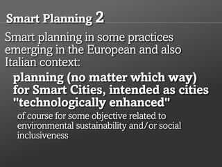
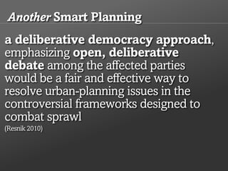
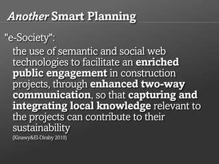
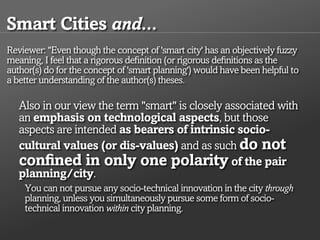
Luciano De Bonis on "Smart cities and planning. Towards a research framework"
1 of 11
Download to read offline

Ad
Recommended
Cingolani - input2012
Cingolani - input2012INPUT 2012
╠²
The document discusses participatory sensing and smart cities. It describes participatory sensing as an approach where individuals use mobile devices to collect and interpret data about their world. This helps people understand reality through data and change habits. The document advocates for creating communities before building projects. It presents DreamHamar as a network design process that engaged the public. It promotes participatory mapping, open networks, and community participation and sharing to build social cohesion in smart cities.Limonta - Input2012
Limonta - Input2012INPUT 2012
╠²
The document discusses the application of the Kernel Density Estimation (KDE) method in analyzing retail phenomena to support urban planning in Milan. It outlines the methodologies for evaluating retail dynamics, the phases of the analysis process, and how these insights can inform urban planning policies to enhance local shopping potential. Conclusions emphasize the importance of using KDE for objective assessments in retail strategy development and urban planning integration.Roccasalva & Spinelli - input2012
Roccasalva & Spinelli - input2012INPUT 2012
╠²
The document discusses the concept of 'smart cities' through the lens of the Turin renewal project, focusing on responsive parametric infrastructure and the importance of civic awareness and participation. It highlights various aspects such as economic factors, mobility, environmental considerations, and social cohesion, along with examples of e-participation initiatives and the role of citizens in shaping urban spaces. Key components for success include increasing public engagement, utilizing real-time data, and fostering a collaborative environment to transform Turin into a smarter city.Santana, De Mattos Freire, Saliba, Ferreira - input2012
Santana, De Mattos Freire, Saliba, Ferreira - input2012INPUT 2012
╠²
This document presents the results of a Neighborhood Impact Study (NIS) conducted for the installation of a new hospital in the Jardim Teres├│polis neighborhood of Betim, Brazil. The study used GIS tools and methodology to identify and analyze potential impacts on land use, population density, real estate values, and urban development. Key findings included pressures on infrastructure from increased density, potential changes in land use patterns, and both positive and negative socioeconomic impacts on the surrounding community from the new hospital. The NIS concluded that while conflicts may arise, the hospital could help renew the urban area and improve living conditions if managed properly through urban planning and property titling programs.Utah Code Camp 2014 - Learning from Data by Thomas Holloway
Utah Code Camp 2014 - Learning from Data by Thomas HollowayThomas Holloway
╠²
The document provides an overview of machine learning and artificial intelligence goals including deduction, reasoning, problem solving, knowledge representation, planning, learning, natural language processing, motion and manipulation, perception, social intelligence and creativity. It discusses different machine learning techniques like supervised learning, unsupervised learning, reinforcement learning and developmental learning. It also covers topics like linear regression, logistic regression, neural networks, overfitting, regularization and more.Pontrandolfi & Cartolano - Input 2012
Pontrandolfi & Cartolano - Input 2012INPUT 2012
╠²
The document discusses the importance of re-evaluating planning levels in the Val d'Agri region to promote effective local development policies and overcome traditional municipal boundaries. It highlights the need for integrated strategies that consider the unique geographic, social, and economic characteristics of the area, aiming to create sustainable development through collaborative projects. The research utilizes GIS technology to gather and analyze data for informed planning and to enhance local tourism initiatives, ultimately fostering regional identity and governance.Pensa, Masala, Marietta &Tabasso - Input2012
Pensa, Masala, Marietta &Tabasso - Input2012INPUT 2012
╠²
The document discusses 'Invito', an interactive visualization tool designed to support urban planning processes by facilitating data management and real-time visualization of decision impacts on urban form. Utilizing existing software like Rhinoceros and Grasshopper, the tool allows users to analyze various urban planning scenarios through participatory processes and mathematical functions. The tool's effectiveness has been demonstrated through pilot applications in cities like Turin and Asti, focusing on infrastructure impacts and land use management.Dinamica della localizzazione territoriale e della struttura socio-demografic...
Dinamica della localizzazione territoriale e della struttura socio-demografic...Istituto nazionale di statistica
╠²
Il documento analizza la dinamica della localizzazione territoriale e della struttura socio-demografica delle aree metropolitane in Italia tra il 1991 e il 2011. Si evidenziano le variazioni demografiche, la formazione e la morfologia delle aree metropolitane, nonch├® le strutture lavorative e la mobilit├Ā dei residenti. Infine, si forniscono conclusioni e nuove direzioni per la ricerca su questi temi.Corso Pereira & Rocha - Input2012
Corso Pereira & Rocha - Input2012INPUT 2012
╠²
The document discusses the relationship between spatial representations, urban planning, and digitization. It covers topics like urban models and their role in planning, the impact of new digital data and public participation, and how representations are shifting to incorporate virtual environments. Idealized urban models are giving way to more accurate digital representations incorporating data from sensors, satellites, and ubiquitous digital networks. This allows new forms of public participation in planning processes and more accurate analysis of social and physical urban environments.Idini - Input2012
Idini - Input2012INPUT 2012
╠²
The document outlines the 'Tamalaca TuttamialacittaŌĆÖ' project focused on participatory planning in Sassari, emphasizing urban rights and the quality of life for children in marginalized urban areas. The project aims to transform derelict spaces through children's input, fostering community engagement and collaborative design, exemplified by the successful 'Portacolori' initiative, which revitalized a school playground. Future efforts will extend beyond school boundaries to further integrate community and educational spaces.Bodano, Ingaramo & Sabatino - INPUT2012
Bodano, Ingaramo & Sabatino - INPUT2012INPUT 2012
╠²
The Urban Areas Competitiveness Report (RCau) aims to support the Jessica revolving funds in Italy by constructing a synthetic index to measure and compare the competitiveness of urban areas through various dimensions and indicators. The report highlights key factors affecting territorial competitiveness and presents findings from research conducted between 2009 and 2011. It concludes with observations on the reliability of the mathematical model and the usefulness of the information system for local stakeholders and policymakers.Abdelmalik - input2012
Abdelmalik - input2012INPUT 2012
╠²
The document presents guidelines for sustainable neighborhood development in Soba, Khartoum, utilizing Geographic Information System (GIS) technology and smart location principles. It discusses the urban expansion, environmental impacts, and planning challenges faced in the region, alongside methodological approaches such as Multi-Criteria Decision Making (MCDM) to assess zoning suitability. Key outcomes include identifying potential development sites, evaluating existing urban elements, and integrating sustainability criteria for future planning.Sini - input2012
Sini - input2012INPUT 2012
╠²
1) The document analyzes mobility patterns and preferences among different demographic segments in European cities. It identifies segments that are most receptive to various smart mobility policies.
2) It finds that female 15-24, female 25-39, and male 25-39 segments are most open to single ticketing, easy transfers between modes, and online ticket purchasing. Male 25-39 and male 55+ prefer new road charging schemes.
3) It maps these receptive segments across neighborhoods in Cagliari, Italy and recommends targeted mobility policies for different areas based on their demographic characteristics and densities.Jiang - INPUT2012
Jiang - INPUT2012INPUT 2012
╠²
This document proposes a quantitative approach to computing the image of a city. It begins by discussing how the image of a city is traditionally obtained through qualitative interviews. It then introduces concepts like legibility and imageability that contribute to a city's mental image. The core of the proposal is a multi-step process: 1) organizing city artifacts into layers, 2) ranking artifacts by size, 3) partitioning artifacts into "head" and "tail" groups using the mean size as the threshold, and 4) iteratively applying this partitioning until the distribution of large artifacts is no longer heavy-tailed. This process aims to capture the underlying "scaling pattern" common to cities where there are far more small artifacts than large ones. TheArdissono & Voghera - INPUT2012
Ardissono & Voghera - INPUT2012INPUT 2012
╠²
The document discusses the integration of ICT technologies and social networks in participatory decision-making for smart city governance, emphasizing the need for citizen involvement in urban planning processes. It highlights various examples where real-time data and user clustering can enhance participatory strategies, although existing efforts often fail to engage the general public effectively. The text outlines a structured approach to fostering citizen participation through communication, consultation, and empowerment while addressing privacy concerns in the management of user data.Maltinti, Melis and Annunziata - input2012
Maltinti, Melis and Annunziata - input2012INPUT 2012
╠²
This document presents a new methodology for assessing the vulnerability of road networks using GIS applications. It describes calculating a vulnerability index based on road design characteristics and identifying critical links. The methodology was applied to a road network in Ogliastra, Italy. Maps showed the most vulnerable central links that are on multiple shortest paths and critical for rescue services. Considering population in the exposure index showed more vulnerable municipalities in more populated areas. The methodology effectively evaluates vulnerability in low traffic, low population density areas and can help prioritize road improvements and emergency management.Fabbro & Dean - input2012
Fabbro & Dean - input2012INPUT 2012
╠²
The paper analyzes transport infrastructure planning in the Friuli Venezia Giulia region within the North Adriatic logistic system and argues for a radical restructuring of Italy's national logistics policies. It highlights the inadequacies of current planning frameworks, the stagnation of Italian ports, and the need for optimized existing infrastructures. The conclusions call for revisions to both national and regional plans, prioritizing 'European gateway ports' and ensuring an open market for competitive logistics management.Paolillo, Benedetti, Graj, Terlizzi & Bisceglie - input2012
Paolillo, Benedetti, Graj, Terlizzi & Bisceglie - input2012INPUT 2012
╠²
The document outlines strategic environmental evaluation scenarios for the Barzio territory government plan, focusing on landscape conservation and sustainable local development. It emphasizes the importance of protecting valuable landscapes, agricultural areas, and ecological networks while limiting urban growth to maintain the area's integrity. Various planning scenarios are assessed for their potential to address current environmental challenges and improve the quality of life in Barzio.Lombardini - input2012
Lombardini - input2012INPUT 2012
╠²
The document discusses urban planning and governance practices focusing on the relationship between land use and environmental assessment, utilizing the Sea of Genoa land use plan as a case study. It emphasizes the need for spatial knowledge representation to effectively manage and assess territorial transformations in urban settings. Additionally, it highlights the complexities of environmental contexts and the importance of creating a coherent framework for knowledge representation to analyze and utilize environmental data in planning processes.Isola & Pira - input2012
Isola & Pira - input2012INPUT 2012
╠²
This document discusses participation and consultation in strategic environmental assessments (SEAs) for land use plans. It analyzes the SEA process for city masterplans in several municipalities in Sardinia, Italy. Key points include:
- The SEA Directive and other agreements emphasize the importance of public participation early in the planning process. However, implementation of participation is inconsistent.
- Guidelines for Sardinian municipalities integrated the SEA process into land use planning, but public participation was limited to identification rather than involvement.
- Case studies showed participation mainly involved authorities, with limited public engagement until late in the planning process, contrary to best practices.
- Early and meaningful public participation is important for integrated decision-makingBesio - Input2012
Besio - Input2012INPUT 2012
╠²
This document discusses the strategic environmental assessment (SEA) conducted for the urban plan of the municipality of Genoa, Italy. It describes the SEA process, which included building environmental knowledge, assessing the plan's impacts, and developing tools like district cards and municipal cards. The goal of the SEA was to integrate environmental considerations into the urban plan to promote sustainability. It analyzed the plan's proposals for transport, urban transformations, and green spaces using geographical information systems. The assessment evaluated impacts on environmental factors and contexts to identify opportunities and critical issues.Sansoni & Valentini - input2012
Sansoni & Valentini - input2012INPUT 2012
╠²
This document presents a methodology for developing an expert system to assess the environmental sensitivity of energy systems and create sensitivity maps for the Emilia-Romagna region of Italy. The methodology involves identifying types of energy plants, sensitivity themes, interference rules between themes and plants, an interference matrix of themes and plant compatibility, researching and organizing sensitivity theme data, and creating overlay maps to identify environmentally sensitive and preferential areas for siting energy plants. The system is intended to support environmental impact assessments and strategic planning.Budthimedhee - Input2012
Budthimedhee - Input2012INPUT 2012
╠²
This document outlines a formative study on designing effective visualization interfaces for planning support systems. The study evaluated nine interface prototypes for a land use planning system called LEAM over three years. Key principles for effective interfaces were derived based on the evaluations. These principles include using appropriate graphic representations and layouts to direct user attention and maintain engagement. Effective graphic representations use proximity and a limited number of attributes to show relationships between different variables. Effective layouts group related drivers and impacts closely, align scales for comparison, and provide motivation and flexibility.Iannucci, Congedo & Munaf├▓ - input2012
Iannucci, Congedo & Munaf├▓ - input2012INPUT 2012
╠²
The document discusses the importance of monitoring land use and land cover changes for effective spatial planning, highlighting the need for data interoperability among various administrative levels. It analyzes the role of the INSPIRE directive and the Plan4All project in creating shared spatial data infrastructures to address challenges like urban sprawl. Furthermore, it emphasizes the necessity for standardized data models, metadata profiles, and collaboration to enhance data quality and accessibility for spatial planning.Campagna, Kudinov, Ivanov & Girsheva - input2012
Campagna, Kudinov, Ivanov & Girsheva - input2012INPUT 2012
╠²
The document announces the Seventh International Conference on Informatics and Urban and Regional Planning to be held in Cagliari, Italy from May 10-12, 2012. The conference will focus on planning support tools related to policy analysis, implementation, and evaluation. One session will discuss how volunteered geographic information (VGI) can help bridge the gap between geoinformatics and spatial planning towards geodesign.Deruyter - input2012
Deruyter - input2012INPUT 2012
╠²
The document discusses the significance of geographical information systems (GIS) and spatial data infrastructures (SDIs) in enhancing planning, particularly in Flanders, Belgium. It highlights the development and implementation of the INSPIRE directive in Europe, which aims to create a seamless European SDI and improve access to quality spatial data. The case studies show the increasing use of GIS in planning activities, the barriers faced, and the role of higher education in training skilled GIS professionals.Zeferino, Cunha and Antunes - input2012
Zeferino, Cunha and Antunes - input2012INPUT 2012
╠²
The document presents a robust model for regional wastewater system planning, addressing the challenge of inadequate sanitation faced by billions globally. It outlines a comprehensive approach to optimize wastewater management infrastructure, including treatment plants and pump stations, while ensuring cost-efficiency and environmental compliance. A robust optimization model is proposed to manage uncertainties in river flow and water quality, enhancing decision-making through a user-friendly software tool called OptWastewater.Virgilio - input2012
Virgilio - input2012INPUT 2012
╠²
This study outlines a methodological approach using artificial neural networks to enhance decision-making in planning eco-sustainable settlements, termed ecodistricts. By analyzing case studies from various European cities, the research aims to identify effective design strategies and structural characteristics necessary for successful urban planning. The findings emphasize the complexity of interactions within urban systems and the need for sophisticated analytical tools to aid policymakers and planners.More Related Content
More from INPUT 2012 (20)
Corso Pereira & Rocha - Input2012
Corso Pereira & Rocha - Input2012INPUT 2012
╠²
The document discusses the relationship between spatial representations, urban planning, and digitization. It covers topics like urban models and their role in planning, the impact of new digital data and public participation, and how representations are shifting to incorporate virtual environments. Idealized urban models are giving way to more accurate digital representations incorporating data from sensors, satellites, and ubiquitous digital networks. This allows new forms of public participation in planning processes and more accurate analysis of social and physical urban environments.Idini - Input2012
Idini - Input2012INPUT 2012
╠²
The document outlines the 'Tamalaca TuttamialacittaŌĆÖ' project focused on participatory planning in Sassari, emphasizing urban rights and the quality of life for children in marginalized urban areas. The project aims to transform derelict spaces through children's input, fostering community engagement and collaborative design, exemplified by the successful 'Portacolori' initiative, which revitalized a school playground. Future efforts will extend beyond school boundaries to further integrate community and educational spaces.Bodano, Ingaramo & Sabatino - INPUT2012
Bodano, Ingaramo & Sabatino - INPUT2012INPUT 2012
╠²
The Urban Areas Competitiveness Report (RCau) aims to support the Jessica revolving funds in Italy by constructing a synthetic index to measure and compare the competitiveness of urban areas through various dimensions and indicators. The report highlights key factors affecting territorial competitiveness and presents findings from research conducted between 2009 and 2011. It concludes with observations on the reliability of the mathematical model and the usefulness of the information system for local stakeholders and policymakers.Abdelmalik - input2012
Abdelmalik - input2012INPUT 2012
╠²
The document presents guidelines for sustainable neighborhood development in Soba, Khartoum, utilizing Geographic Information System (GIS) technology and smart location principles. It discusses the urban expansion, environmental impacts, and planning challenges faced in the region, alongside methodological approaches such as Multi-Criteria Decision Making (MCDM) to assess zoning suitability. Key outcomes include identifying potential development sites, evaluating existing urban elements, and integrating sustainability criteria for future planning.Sini - input2012
Sini - input2012INPUT 2012
╠²
1) The document analyzes mobility patterns and preferences among different demographic segments in European cities. It identifies segments that are most receptive to various smart mobility policies.
2) It finds that female 15-24, female 25-39, and male 25-39 segments are most open to single ticketing, easy transfers between modes, and online ticket purchasing. Male 25-39 and male 55+ prefer new road charging schemes.
3) It maps these receptive segments across neighborhoods in Cagliari, Italy and recommends targeted mobility policies for different areas based on their demographic characteristics and densities.Jiang - INPUT2012
Jiang - INPUT2012INPUT 2012
╠²
This document proposes a quantitative approach to computing the image of a city. It begins by discussing how the image of a city is traditionally obtained through qualitative interviews. It then introduces concepts like legibility and imageability that contribute to a city's mental image. The core of the proposal is a multi-step process: 1) organizing city artifacts into layers, 2) ranking artifacts by size, 3) partitioning artifacts into "head" and "tail" groups using the mean size as the threshold, and 4) iteratively applying this partitioning until the distribution of large artifacts is no longer heavy-tailed. This process aims to capture the underlying "scaling pattern" common to cities where there are far more small artifacts than large ones. TheArdissono & Voghera - INPUT2012
Ardissono & Voghera - INPUT2012INPUT 2012
╠²
The document discusses the integration of ICT technologies and social networks in participatory decision-making for smart city governance, emphasizing the need for citizen involvement in urban planning processes. It highlights various examples where real-time data and user clustering can enhance participatory strategies, although existing efforts often fail to engage the general public effectively. The text outlines a structured approach to fostering citizen participation through communication, consultation, and empowerment while addressing privacy concerns in the management of user data.Maltinti, Melis and Annunziata - input2012
Maltinti, Melis and Annunziata - input2012INPUT 2012
╠²
This document presents a new methodology for assessing the vulnerability of road networks using GIS applications. It describes calculating a vulnerability index based on road design characteristics and identifying critical links. The methodology was applied to a road network in Ogliastra, Italy. Maps showed the most vulnerable central links that are on multiple shortest paths and critical for rescue services. Considering population in the exposure index showed more vulnerable municipalities in more populated areas. The methodology effectively evaluates vulnerability in low traffic, low population density areas and can help prioritize road improvements and emergency management.Fabbro & Dean - input2012
Fabbro & Dean - input2012INPUT 2012
╠²
The paper analyzes transport infrastructure planning in the Friuli Venezia Giulia region within the North Adriatic logistic system and argues for a radical restructuring of Italy's national logistics policies. It highlights the inadequacies of current planning frameworks, the stagnation of Italian ports, and the need for optimized existing infrastructures. The conclusions call for revisions to both national and regional plans, prioritizing 'European gateway ports' and ensuring an open market for competitive logistics management.Paolillo, Benedetti, Graj, Terlizzi & Bisceglie - input2012
Paolillo, Benedetti, Graj, Terlizzi & Bisceglie - input2012INPUT 2012
╠²
The document outlines strategic environmental evaluation scenarios for the Barzio territory government plan, focusing on landscape conservation and sustainable local development. It emphasizes the importance of protecting valuable landscapes, agricultural areas, and ecological networks while limiting urban growth to maintain the area's integrity. Various planning scenarios are assessed for their potential to address current environmental challenges and improve the quality of life in Barzio.Lombardini - input2012
Lombardini - input2012INPUT 2012
╠²
The document discusses urban planning and governance practices focusing on the relationship between land use and environmental assessment, utilizing the Sea of Genoa land use plan as a case study. It emphasizes the need for spatial knowledge representation to effectively manage and assess territorial transformations in urban settings. Additionally, it highlights the complexities of environmental contexts and the importance of creating a coherent framework for knowledge representation to analyze and utilize environmental data in planning processes.Isola & Pira - input2012
Isola & Pira - input2012INPUT 2012
╠²
This document discusses participation and consultation in strategic environmental assessments (SEAs) for land use plans. It analyzes the SEA process for city masterplans in several municipalities in Sardinia, Italy. Key points include:
- The SEA Directive and other agreements emphasize the importance of public participation early in the planning process. However, implementation of participation is inconsistent.
- Guidelines for Sardinian municipalities integrated the SEA process into land use planning, but public participation was limited to identification rather than involvement.
- Case studies showed participation mainly involved authorities, with limited public engagement until late in the planning process, contrary to best practices.
- Early and meaningful public participation is important for integrated decision-makingBesio - Input2012
Besio - Input2012INPUT 2012
╠²
This document discusses the strategic environmental assessment (SEA) conducted for the urban plan of the municipality of Genoa, Italy. It describes the SEA process, which included building environmental knowledge, assessing the plan's impacts, and developing tools like district cards and municipal cards. The goal of the SEA was to integrate environmental considerations into the urban plan to promote sustainability. It analyzed the plan's proposals for transport, urban transformations, and green spaces using geographical information systems. The assessment evaluated impacts on environmental factors and contexts to identify opportunities and critical issues.Sansoni & Valentini - input2012
Sansoni & Valentini - input2012INPUT 2012
╠²
This document presents a methodology for developing an expert system to assess the environmental sensitivity of energy systems and create sensitivity maps for the Emilia-Romagna region of Italy. The methodology involves identifying types of energy plants, sensitivity themes, interference rules between themes and plants, an interference matrix of themes and plant compatibility, researching and organizing sensitivity theme data, and creating overlay maps to identify environmentally sensitive and preferential areas for siting energy plants. The system is intended to support environmental impact assessments and strategic planning.Budthimedhee - Input2012
Budthimedhee - Input2012INPUT 2012
╠²
This document outlines a formative study on designing effective visualization interfaces for planning support systems. The study evaluated nine interface prototypes for a land use planning system called LEAM over three years. Key principles for effective interfaces were derived based on the evaluations. These principles include using appropriate graphic representations and layouts to direct user attention and maintain engagement. Effective graphic representations use proximity and a limited number of attributes to show relationships between different variables. Effective layouts group related drivers and impacts closely, align scales for comparison, and provide motivation and flexibility.Iannucci, Congedo & Munaf├▓ - input2012
Iannucci, Congedo & Munaf├▓ - input2012INPUT 2012
╠²
The document discusses the importance of monitoring land use and land cover changes for effective spatial planning, highlighting the need for data interoperability among various administrative levels. It analyzes the role of the INSPIRE directive and the Plan4All project in creating shared spatial data infrastructures to address challenges like urban sprawl. Furthermore, it emphasizes the necessity for standardized data models, metadata profiles, and collaboration to enhance data quality and accessibility for spatial planning.Campagna, Kudinov, Ivanov & Girsheva - input2012
Campagna, Kudinov, Ivanov & Girsheva - input2012INPUT 2012
╠²
The document announces the Seventh International Conference on Informatics and Urban and Regional Planning to be held in Cagliari, Italy from May 10-12, 2012. The conference will focus on planning support tools related to policy analysis, implementation, and evaluation. One session will discuss how volunteered geographic information (VGI) can help bridge the gap between geoinformatics and spatial planning towards geodesign.Deruyter - input2012
Deruyter - input2012INPUT 2012
╠²
The document discusses the significance of geographical information systems (GIS) and spatial data infrastructures (SDIs) in enhancing planning, particularly in Flanders, Belgium. It highlights the development and implementation of the INSPIRE directive in Europe, which aims to create a seamless European SDI and improve access to quality spatial data. The case studies show the increasing use of GIS in planning activities, the barriers faced, and the role of higher education in training skilled GIS professionals.Zeferino, Cunha and Antunes - input2012
Zeferino, Cunha and Antunes - input2012INPUT 2012
╠²
The document presents a robust model for regional wastewater system planning, addressing the challenge of inadequate sanitation faced by billions globally. It outlines a comprehensive approach to optimize wastewater management infrastructure, including treatment plants and pump stations, while ensuring cost-efficiency and environmental compliance. A robust optimization model is proposed to manage uncertainties in river flow and water quality, enhancing decision-making through a user-friendly software tool called OptWastewater.Virgilio - input2012
Virgilio - input2012INPUT 2012
╠²
This study outlines a methodological approach using artificial neural networks to enhance decision-making in planning eco-sustainable settlements, termed ecodistricts. By analyzing case studies from various European cities, the research aims to identify effective design strategies and structural characteristics necessary for successful urban planning. The findings emphasize the complexity of interactions within urban systems and the need for sophisticated analytical tools to aid policymakers and planners.