Desktop Softwares for Unmanned Aerial Systems(UAS))
ŌĆóDownload as PPTX, PDFŌĆó
0 likesŌĆó100 views

The document compares various desktop software used for processing data from unmanned aerial vehicles (UAVs). It provides a table comparing the major features and functionality of Pix4Dmapper, Agisoft Metashape, WebODM, and QGIS. These include outputs generated, ease of use, cost, support and limitations. It also provides guidance on choosing the best software by defining needs, researching options, trying demonstrations, considering costs, and getting recommendations from experts. Selecting the right software depends on the required processing capabilities, accuracy, compatibility and other factors listed.


Desktop Softwares for Unmanned Aerial Systems(UAS))
- 1. DESKTOP SOFTWARE FOR UNMANNED AERIAL VEHICLE (UAV) BASED DATA PROCESSING Group Members: ’ü▒ Mahdy, Mostafa ’ü▒ Lateef, Lukumon Olaitan ’ü▒ Shahi, Kamal
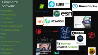
- 2. Commercial Software ’üČPix4Dmapper ’üČAgisoft Metashape ’üČDroneDeploy ’üČPrecisionHawk ’üČSimActive and Correlator3D ’üČTrimble Business Center ’üČESRI ’üČENVI ’üČBentley ContextCapture ’üČPhotomod UAS ’üČRealityCapture ’üČSURE aerial
- 4. Some Major UAV data Processing Software
- 5. ŌĆó Advanced processing algorithms: Pix4D uses advanced photogrammetry algorithms to create high-quality maps and models from drone imagery, including structure from motion (SfM) and dense image matching (DIM). ŌĆó Automatic processing: Once images are uploaded, Pix4D automatically processes them into maps and models, requiring little to no user input. ŌĆó Customizable settings: Users can adjust processing settings to achieve specific results, including adjusting the resolution of the output, selecting specific output formats, and choosing between different processing options.
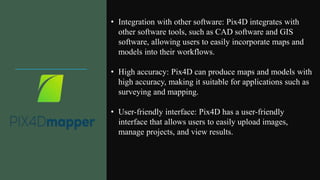
- 6. ŌĆó Integration with other software: Pix4D integrates with other software tools, such as CAD software and GIS software, allowing users to easily incorporate maps and models into their workflows. ŌĆó High accuracy: Pix4D can produce maps and models with high accuracy, making it suitable for applications such as surveying and mapping. ŌĆó User-friendly interface: Pix4D has a user-friendly interface that allows users to easily upload images, manage projects, and view results.
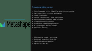
- 9. Professional Edition version ŌĆó Digital elevation model: DSM/DTM generation and editing. ŌĆó Georeferenced orthomosaic generation. ŌĆó LiDAR data support. ŌĆó Ground control points / scale bar support. ŌĆó Measurements: distances, areas, volumes. ŌĆó Stereoscopic measurements. ŌĆó Hierarchical tiled model generation. ŌĆó 4D modeling for dynamic scenes. ŌĆó Panorama stitching. ŌĆó Multispectral imagery processing. ŌĆó Automatic powerlines detection. ŌĆó Satellite imagery processing. ŌĆó Python and Java API.
- 10. Standard Edition version. ŌĆó Photogrammetric triangulation: Processing of various types of imagery from digital digital cameras. Auto-calibration for frame (incl. fisheye) cameras.. ŌĆó Dense point cloud generation: Elaborate model editing for accurate results. ŌĆó 3D model: generation and texturing: Various scenes: archaeological sites, artifacts, buildings, interiors, people, etc, Photorealistic textures: HDR and multifile support (incl. UDIM layout). ŌĆó Panorama stitching: 3D reconstruction for data captured from the same camera position ŌĆö camera station, provided that at least 2 camera stations are present.
- 11. Capabilities. ŌĆó Orth mosaics: Georeferenced, orthorectified maps. ŌĆó Dense point cloud generation: Elaborate model editing for accurate results. ŌĆó 3D model: Textured 3D models in .OBJ and OGC 3D Tiles format. ŌĆó Measurements: Make volume and area measurements with ease, track stockpiles. ŌĆó Elevation Models: Georeferenced digital elevation models (DSMs and DTMs). ŌĆó Plant Health: Easily compute NDVI, VARI, GNDVI and many other indexes. ŌĆó Ground Control Points: Create and use GCPs for additional accuracy. ŌĆó Contours: Preview and export elevation contours to AutoCAD, Shape File, Geo Package. ŌĆó Any Camera: From consumer phones to professional cameras (standard, fisheye, 360┬░), single or multi-camera. ŌĆó Any Format : JPGs and TIFFs (8bit and 16bit), with or without EXIFs. ŌĆó Any Orientation: Process aerial and ground images, captured nadir or oblique. ŌĆó Multispectral: Process multispectral images. ŌĆó Rolling Shutter: Correction support. ŌĆó Share Easily: share your maps and 3D models. ŌĆó Scale: Run multiple jobs in parallel and single jobs distributed on multiple machines.
- 12. QGIS (Quantum GIS) provides a wide range of tools and plugins such as Whitebox Tools, UAV Toolbox, Raster Terrian Analysis Toolbox that make it a powerful and flexible software for processing UAV data. ŌĆóImage viewing and management: ŌĆóUser-friendly interface for viewing and managing UAV images. ŌĆóSupports a wide range of image formats and allows you to load and visualize images as layers. ŌĆóGeoreferencing and image registration: ŌĆóSupports georeferencing, for assigning geographic coordinates to images and align them with other spatial data. ŌĆóImage processing and analysis: ŌĆóSuch as Image enhancement, filtering, classification, and feature extraction. ŌĆó3D modeling and visualization: ŌĆó Supports 3D visualization and modeling, which allows you to create 3D models and terrain surfaces from UAV images. ŌĆóUseful for visualizing and analyzing terrain features, such as elevation, slope, and aspect. ŌĆóIntegration with other GIS tools: ŌĆóEasily integrated with other GIS tools and data sources, such as GPS, remote sensing data, and web services. ŌĆóAllows you to combine UAV data with other spatial data and perform more complex analyses.
- 13. Agisoft MetaShape Pix4dMapper WebODM QGIS Features and functionality Image mosaic, orthomosaic generation, 3D modeling, NDVI analysis, panorama stitching, automatic powerlines detection. Measurements: distances, areas, volumes. Lidar Support. Image mosaic, orthomosaic generation, 3D modeling, and NDVI analysis. Measurements: distances, areas, volumes. Image stitching, orthomosaic generation, 3D modeling, Crop health. Measurements: distances, areas, volumes. Allows combination of UAV data with other spatial data and perform more complex analyses.ŌĆŗ User Interface User-friendly User-friendly User-friendly User-friendly Support and Documentation User manuals, video tutorials, and customer support. User manuals, video tutorials, community forum, and customer support. User manuals, Video tutorials, GitHub repo. And community forum. Online documentation, community forum, and developer support for users Input Support different cameras and image formats. Support different cameras and image formats. Support different cameras and image formats. Mostly support semi-processed data. Output Point cloud, Orth photo, DSM, contour, DTM, 3D 3D model, textured 3D meshes, thermal, and index map. Point cloud, Orth photo, DSM, contour, DTM, 3D meshes, thermal, index map, reflectance map. Detailed quality report. Point cloud, Orth photo, DSM, contour, DTM, 3D meshes, index maps. Free trial 30-day free Yes (15 days) Free and open source Free and open source Cost $ 3 499 / perpetual Ōé¼3,990 / perpetual (Ōé¼260/ month) Free and open source Free and open source 3D Model Textured 3D Textured 3D Textured 3D Limited capability for 3D drone modelling Hardware Requirements (Recommended) RAM: 16 - 32 GB CPU: 4 - 12 core Intel, AMD or Apple M1/M2 processor, 2.0+ GHz. 8 GB RAM, 15 GB SSD Free Space. GeForce GTX GPU and 2 GB RAM. 100 GB free disk space. 16 GB RAM. 64bit CPU. Limitations Detailed information about algorithms not available. Detailed information about algorithms not available. DoesnŌĆÖt support creation of 3D mesh from point clouds from third party. Small areal coverage for outputs, especially for the datasets that contain water bodies. Result available for a few days (14 days) Small areal coverage for outputs, especially for coastal datasets. Limited capability for 3D drone modelling Comparative Chart
- 15. General Note on Accuracy ’é¦Horizontal Accuracy (no GCP or RTK): Average displacement 1.86ŌĆō2.50m in the centre and 2.12ŌĆō4.13m at the edges. ’é¦Number of GCPs and their position/distribution, software parameter tunning affects the accuracy. ’é¦Recommended to use the same software when comparing multitemporal drone datasets. Which one to use?
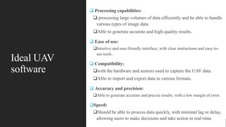
- 16. Ideal UAV software ’ü▒ Processing capabilities: ’ü▒ processing large volumes of data efficiently and be able to handle various types of image data. ’ü▒Able to generate accurate and high-quality results. ’ü▒ Ease of use: ’ü▒Intuitive and user-friendly interface, with clear instructions and easy-to- use tools . ’ü▒ Compatibility: ’ü▒with the hardware and sensors used to capture the UAV data. ’ü▒Able to import and export data in various formats. ’ü▒ Accuracy and precision: ’ü▒Able to generate accurate and precise results, with a low margin of error. ’ü▒Speed: ’ü▒Should be able to process data quickly, with minimal lag or delay, allowing users to make decisions and take action in real-time.
- 17. Ideal UAV software ’ü▒ Cost: ’ü▒Cost-effective, providing good value for money in terms of its features and capabilities. ’ü▒Customer support: ’ü▒Good customer support ’ü▒Clear documentation, tutorials, and responsive technical support. ’ü▒Security: ’ü▒Should be secure, with features that protect user data and prevent unauthorized access. ’ü▒Scalability: ’ü▒Should be scalable, able to handle larger volumes of data as needed ’ü▒Capable of growing with the needs of the user.
- 18. Choosing best software Define your needs: Define your needs and requirements. Types of data you need to process Level of accuracy and precision required Output formats you need. Research and compare: Reading reviews and customer feedback to get an idea of the software's strengths and weaknesses. Software with good reputation in the industry and is known for producing high-quality results. Containing most of previously mentioned characteristics Try before you buy: Many software vendors offer free trials or demos of their software. Take advantage of these offers to test the software and see if it meets your needs. Provides an opportunity to evaluate the ease of use and the processing capabilities of the software.
- 19. Choosing best software Consider the cost: Cost is an important factor , but it shouldn't be the only factor. Consider the value of the software in terms of its features and capabilities, and how it fits into your budget. Keep in mind that cheaper software may not always provide the level of accuracy and precision you need, so it's important to balance cost with functionality. Get support: good customer support, with clear documentation, tutorials, and responsive technical support. This will be important if you encounter any issues or have questions about the software. Ask for recommendations: From colleagues, industry experts, or other users in your network for recommendations. Can provide valuable insights on different products
- 20. References https://www.heliguy.com/blogs/posts/dronedeploy-versus-pix4d https://sourceforge.net/software/compare/DroneDeploy-vs-Pix4D/ Pix4DMapper: Pricing. https://www.pix4d.com/pricing/pix4dmapper/. Accessed 26 April 2023. Agisoft: Buy. https://www.agisoft.com/buy/online-store/. Accessed 26 April 2023. Pix4DMapper: Outputs. https://www.pix4d.com/product/pix4dmapper/outputs/. Accessed 26 April 2023. Opendronemap: WebODM: https://www.opendronemap.org/webodm/. Accessed 26 April 2023. Pell, T.; Li, J.Y.Q.; Joyce, K.E. Demystifying the Differences between Structure-from-Motion Software Packages for Pre- Processing Drone Data. Drones 2022, 6, 24. https://doi.org/10.3390/drones6010024 Kloc, B.; Mazur, A.; Szumi┼éo, M. Comparison of Free and Commercial Software in the Processing of Data Obtained fromNon- Metric Cameras. J. Ecol. Eng. 2021, 22, 213ŌĆō225. https://doi.org/10.12911/22998993/131074