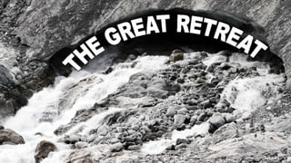
The great retreat
Download as PPTX, PDF1 like1,802 views

A description of the worldwide retreat of ice margins, using the Trient glacier in Switzerland as a case study.
1 of 23
Download to read offline


Recommended
NEARC GIS Educator's Day
NEARC GIS Educator's DaySeth Dixon
Ã˝
Notes from Seth Dixon's keynote address at NEARC's GIS Educator's Day delivered in Nashua, NH on Sept 29, 2013.Global Learning- What do you mean?
Global Learning- What do you mean?Silvia Rosenthal Tolisano
Ã˝
1. The document discusses the concept of globally connected learning, which involves more than just learning about other cultures and holidays.
2. It emphasizes the interconnectedness of the modern world and the need for students and teachers to be globally connected through collaborative tools and personal learning networks.
3. The document presents several frameworks for conceptualizing degrees of connectedness, from lurkers to confidants, and provides examples of how teaching and learning can transform through practices like bringing in experts, student blogging challenges, and global partnerships.Urbanisation
UrbanisationNoel Jenkins
Ã˝
Urbanisation refers to the increasing proportion of people living in cities and urban areas. It began rapidly in poor countries in the mid-20th century as people migrated from rural areas to cities at a rate of 20% per year, driven by difficult rural living conditions and the concentration of jobs and services in urban centers. In rich countries, urbanisation accelerated during the Industrial Revolution as new factory and shipyard jobs drew people to towns and cities, while mechanized farming led to rural job losses. More recently, urbanisation has slowed in rich nations and some have experienced counter-urbanization, though cities are now attracting residents back to redeveloped inner areas.2013 Global Hunger Index Launch
2013 Global Hunger Index LaunchInternational Food Policy Research Institute (IFPRI)
Ã˝
2013 Global Hunger Index Launch -- The Callenge of Hunger "Building Resilience to Achieve Food and Nutrition Security"
published by International Food Policy Research Insititute, Concern Worldwide and Welthungerhilfe. Building Your Own Town
Building Your Own TownOllie Bray
Ã˝
The PowerPoint presentation to support the lesson featured here: http://www.tes.co.uk/article.aspx?storycode=6005139STEAL THIS PRESENTATION! 
STEAL THIS PRESENTATION! Jesse Desjardins - @jessedee
Ã˝
This document is a presentation about designing effective PowerPoint slides. It provides tips over several slides on how to design slides with a killer title and opening slide, use of color schemes and images, getting the text right, using the principles of contrast, repetition, alignment and proximity (CRAP), incorporating video, sharing the presentation online, and recapping the key tips. The presentation emphasizes the importance of visual design over text-heavy slides and using techniques like strong images and video to engage the audience in a way words alone cannot. It provides examples throughout to illustrate its tips.
Dharavi Slum - Trabalho de ParesPedro Dami√£o
Ã˝
Dharavi é o maior bairro de lata da Ásia, localizado em Mumbai, Índia e abrigando mais de 600.000 habitantes. Embora situado próximo a grandes condutas de água, a população de Dharavi não tem acesso a ela. Muitos moradores de Dharavi dependem da reciclagem de lixo para sobreviver e gerar renda, trabalhando e vivendo em condições precárias em apenas 1 milha quadrada.
Crime no litoralPedro Dami√£o
Ã˝
Este documento descreve um jogo de investigação sobre o assassinato de José Rocha em Praia Serena. Há sete suspeitos, incluindo moradores cujas casas estão em risco devido à erosão costeira, um agricultor e uma ambientalista. Os jogadores devem analisar pistas, fotos e perfis dos suspeitos para determinar o motivo e o assassino dentro de 45 minutos.Geography of Mexico
Geography of MexicoSeth Dixon
Ã˝
The document discusses the culture and geography of Mexico. It covers topics such as Mexico's Catholic and soccer traditions, as well as the Day of the Dead. It also discusses Mexico City as the primate city with over 20 million people, facing issues of pollution and limited capacity due to its high altitude basin location. Additionally, it summarizes Mexico's role in the regional context of North America and Latin America, and border issues with the United States such as maquiladoras, narcotics, and migration patterns.RIGEA-Using AGOL
RIGEA-Using AGOLSeth Dixon
Ã˝
This document contains information about the Rhode Island Geography Education Alliance (RIGEA) and its director Seth Dixon. It includes RIGEA's website URL and several URLs linking to maps and apps created by RIGEA on ArcGIS Online to teach geography. It also provides Dixon's Twitter accounts and email for further contact.Welcome
WelcomeTabatha Miller
Ã˝
This document provides an overview and introduction to the PSY100 course. It summarizes the instructor's background and contact information. It outlines the course learning objectives, structure, assignments including homework, projects, assessments and grading criteria. It discusses the instructor and students' responsibilities and provides next steps for students to review the syllabus, take pre-tests and begin the first week's content.Psy 100 unit 2 week 3 ch 2
Psy 100 unit 2 week 3 ch 2Tabatha Miller
Ã˝
This document provides an overview of the material covered in Unit 2 of the Psychology 100 course. The unit focuses on the biological basis of behavior, including:
1) The structure and function of neurons, neurotransmitters, and the nervous system.
2) An introduction to psychobiology and neuroscience and their focus on the biological underpinnings of behavior and mental processes.
3) An overview of the central nervous system including the brain structures like the hindbrain, midbrain, cerebral cortex, and limbic system.
4) A discussion of tools used to study the brain such as imaging techniques.Choices Program-China 2014
Choices Program-China 2014Seth Dixon
Ã˝
Presentation given at Brown University for the Choice Program's workshop on understanding contemporary China through a geographic lens. Unit 4: Motivation and Emotion (Week 5)
Unit 4: Motivation and Emotion (Week 5)Tabatha Miller
Ã˝
This document discusses the key topics in motivation and emotion covered in Chapter 8, including several enduring issues and questions. It addresses whether motives and emotions are inborn or acquired, if they change over the lifespan, how individuals differ in their motivations and emotions, and how motives and emotions arise from and affect biological processes. Several theories of motivation are summarized, such as drive-reduction theory, arousal theory including the Yerkes-Dodson law, and Maslow's hierarchy of needs. Key motives like hunger, sex, aggression, achievement, and affiliation are explored. Theories of emotion like the James-Lange theory and Cannon-Bard theory are compared. Gender and cultural differences in emotion are also summarized.Cracking the Code: Enduring Issues in Social Studies
Cracking the Code: Enduring Issues in Social StudiesMeagen Farrell
Ã˝
Learn how to engage adult learners in The Great Conversation for success on high school equivalency tests, as well as real-life civics scenarios.2016 SEMAGNET 
2016 SEMAGNET Seth Dixon
Ã˝
This document discusses how teachers can help students understand the world through a geographic lens. It recommends that teachers provide geographic information, teach geographic concepts, use data, maps and geospatial technology, and ask questions that encourage spatial thinking. Developing geographic literacy allows students to see how the global and local are interconnected and how place still matters despite distance and time. Asking the right questions about images, landscapes and locations can reveal cultural and environmental insights.AP Human Geography: Unit 1 - Introduction to Geography: Guided Notes
AP Human Geography: Unit 1 - Introduction to Geography: Guided NotesDaniel Eiland
Ã˝
These are guided notes to go along with Mr. Eiland's AP Human Geography Unit 1 Powerpoint. You can find the Powerpoint at the following link: http://www.slideshare.net/deilands/ap-human-geography-unit-1Pscyhology 101: Chapter14
Pscyhology 101: Chapter14dborcoman
Ã˝
This chapter discusses psychological disorders. It begins by conceptualizing abnormality and how it has been defined, including statistical deviance, cultural norms, distress and dysfunction. It then discusses the medical model and problems with diagnostic labeling. The chapter outlines the DSM classification system and describes several common disorders like anxiety, mood, dissociative, somatoform, and personality disorders. It concludes by examining biological, genetic, cognitive and environmental factors that may contribute to psychological disorders.Cultural Landscape Polish Chicago
Cultural Landscape Polish ChicagoSeth Dixon
Ã˝
This document discusses the Polish cultural landscape of Chicago's Avondale neighborhood. It describes how Avondale was settled primarily by Polish immigrants in the early 20th century and became known as the "Polish Village" due to its Polish churches, businesses, and cultural institutions. While Polish influence is still evident via landmarks like St. Hyacinth Basilica, the neighborhood is becoming more diverse as younger generations move out and new immigrant groups like Latinos move in, representing the changing nature of Chicago's neighborhoods over time.NCGE Webinar: Teaching the Geography of Food
NCGE Webinar: Teaching the Geography of FoodSeth Dixon
Ã˝
The document discusses ways to teach the geography of food by exploring various topics such as cultural geography, political geography, environmental issues, and the global food system. It provides examples of lessons and resources that use maps, data, and questions to help students understand complex relationships between places and develop geographic literacy and spatial thinking skills. Some key approaches highlighted are examining how development levels influence food concerns, questioning the industrial food production system, and making the global food network more personal and relatable to students. The overall goal is for students to gain geographic context and insight into interconnected global issues related to food.Unit 3: Sensation and Perception
Unit 3: Sensation and PerceptionTabatha Miller
Ã˝
Central Penn College PSY100 FL13 Z1
Unit 3 for week 3
Sensation and Perception
Credit is given to authors of PSY100 textbook, Morris & Maisto (2013) as well as additional resources to include Durand & Barlow (2013). Much thanks to the publishers for shared images and slide design.
PLEASE NOTE: Please refer to weekly professor guide for list of videos required in addition to this PPT presentation.Urbanization and Race
Urbanization and RaceSeth Dixon
Ã˝
Suburbanization in the United States greatly accelerated after World War II due to several factors: (1) the Federal Highway Act of 1956 funded the construction of an extensive interstate highway system, increasing accessibility to suburban areas; (2) large-scale developers mass-produced affordable single-family homes on cheap land in the suburbs; and (3) social trends like the postwar baby boom and preference for the suburban lifestyle drove demand for suburban housing. Transportation infrastructure and housing policies were the primary drivers of suburban growth in this period.Primate cities in india
Primate cities in indiarajeshkplanner
Ã˝
India does not have a primate city. While Mumbai, Delhi, Kolkata, Chennai, and Bengaluru are the largest cities, none meet the threshold of being at least twice as large as the second largest city. Historically, colonial cities like Mumbai, Kolkata, Chennai, and Delhi grew to be major economic centers, but India's large size, federal system of government, and regional diversity have prevented extreme primacy of one city over others. Regionalism and lack of centralized infrastructure and resources have also contributed to the absence of a single primate city dominating India's urban hierarchy.Geography and the Common Core
Geography and the Common CoreSeth Dixon
Ã˝
Resources for link geography with the ELA common core standards. Presentation given by Seth Dixon at Bridgewater State University Nov. 2, 2013. Wiga 2015 Geography in the Age of Globalization
Wiga 2015 Geography in the Age of GlobalizationSeth Dixon
Ã˝
This document discusses the importance of geography education in an era of globalization. It argues that while globalization has made the world more interconnected, place still matters. It provides four recommendations for how competent geography teachers can help students understand our complex world: 1) by providing geographic information, 2) teaching geographic concepts, 3) using data, maps, and geospatial technology, and 4) asking questions that encourage spatial thinking in order to develop geographic literacy. The overarching message is that a spatial perspective is valuable for understanding global issues and students need diverse cultural understanding to interpret conflicts and changes around the world.Praxis Social Studies Exam: Geographic Content 
Praxis Social Studies Exam: Geographic Content Seth Dixon
Ã˝
The document provides information about the content areas covered on the Praxis Social Studies exam, with an emphasis on geographic content. It outlines 15 areas of geography that are assessed on the exam, including understanding map types and projections, spatial patterns, ecosystems, human-environment interactions, agriculture, development and more. Test questions are designed to evaluate a candidate's knowledge of these geographic concepts and their ability to apply spatial thinking skills. The exam aims to demonstrate a teacher's preparedness to understand and teach required social studies content across disciplines using geographic perspectives.NCGE 2015 Web Maps
NCGE 2015 Web MapsSeth Dixon
Ã˝
The Rhode Island Geography Education Alliance is requesting help to teach Advanced Placement Human Geography (APHG) using Geographic Information Systems (GIS). GIS and other geotechnologies are important fields for job growth, but more graduates with geographic science and geospatial skills are needed. The RIGEA website provides information on what GIS is, why it should be used in education, and examples of web maps that can be created and viewed using GIS in an interactive way online or on mobile devices.2014 geo fest dixon 3
2014 geo fest dixon 3Seth Dixon
Ã˝
This document discusses the importance of geography education. It notes that fewer than 10% of college students study abroad or geography. Studying geography can broaden perspectives on how other countries view the US. The document provides suggestions for good geography teaching, including:
1) Providing geographic information using data, maps and technology
2) Teaching geographic concepts
3) Using data, maps and geospatial technology
4) Asking questions that encourage spatial thinking to develop geographic literacy and understand our complex, interconnected world. Coronavirus m in focus
Coronavirus m in focusAlan Doherty
Ã˝
News ∫›∫›fl£s from December 2019 to April 2020. The story so far.Volcanoes
VolcanoesAlan Doherty
Ã˝
The document discusses the benefits of exercise for both physical and mental health. It notes that regular exercise can reduce the risk of diseases like heart disease and diabetes, improve mood, and reduce feelings of stress and anxiety. The document recommends that adults get at least 150 minutes of moderate exercise or 75 minutes of vigorous exercise per week to gain these benefits.More Related Content
Viewers also liked (20)
Geography of Mexico
Geography of MexicoSeth Dixon
Ã˝
The document discusses the culture and geography of Mexico. It covers topics such as Mexico's Catholic and soccer traditions, as well as the Day of the Dead. It also discusses Mexico City as the primate city with over 20 million people, facing issues of pollution and limited capacity due to its high altitude basin location. Additionally, it summarizes Mexico's role in the regional context of North America and Latin America, and border issues with the United States such as maquiladoras, narcotics, and migration patterns.RIGEA-Using AGOL
RIGEA-Using AGOLSeth Dixon
Ã˝
This document contains information about the Rhode Island Geography Education Alliance (RIGEA) and its director Seth Dixon. It includes RIGEA's website URL and several URLs linking to maps and apps created by RIGEA on ArcGIS Online to teach geography. It also provides Dixon's Twitter accounts and email for further contact.Welcome
WelcomeTabatha Miller
Ã˝
This document provides an overview and introduction to the PSY100 course. It summarizes the instructor's background and contact information. It outlines the course learning objectives, structure, assignments including homework, projects, assessments and grading criteria. It discusses the instructor and students' responsibilities and provides next steps for students to review the syllabus, take pre-tests and begin the first week's content.Psy 100 unit 2 week 3 ch 2
Psy 100 unit 2 week 3 ch 2Tabatha Miller
Ã˝
This document provides an overview of the material covered in Unit 2 of the Psychology 100 course. The unit focuses on the biological basis of behavior, including:
1) The structure and function of neurons, neurotransmitters, and the nervous system.
2) An introduction to psychobiology and neuroscience and their focus on the biological underpinnings of behavior and mental processes.
3) An overview of the central nervous system including the brain structures like the hindbrain, midbrain, cerebral cortex, and limbic system.
4) A discussion of tools used to study the brain such as imaging techniques.Choices Program-China 2014
Choices Program-China 2014Seth Dixon
Ã˝
Presentation given at Brown University for the Choice Program's workshop on understanding contemporary China through a geographic lens. Unit 4: Motivation and Emotion (Week 5)
Unit 4: Motivation and Emotion (Week 5)Tabatha Miller
Ã˝
This document discusses the key topics in motivation and emotion covered in Chapter 8, including several enduring issues and questions. It addresses whether motives and emotions are inborn or acquired, if they change over the lifespan, how individuals differ in their motivations and emotions, and how motives and emotions arise from and affect biological processes. Several theories of motivation are summarized, such as drive-reduction theory, arousal theory including the Yerkes-Dodson law, and Maslow's hierarchy of needs. Key motives like hunger, sex, aggression, achievement, and affiliation are explored. Theories of emotion like the James-Lange theory and Cannon-Bard theory are compared. Gender and cultural differences in emotion are also summarized.Cracking the Code: Enduring Issues in Social Studies
Cracking the Code: Enduring Issues in Social StudiesMeagen Farrell
Ã˝
Learn how to engage adult learners in The Great Conversation for success on high school equivalency tests, as well as real-life civics scenarios.2016 SEMAGNET
2016 SEMAGNET Seth Dixon
Ã˝
This document discusses how teachers can help students understand the world through a geographic lens. It recommends that teachers provide geographic information, teach geographic concepts, use data, maps and geospatial technology, and ask questions that encourage spatial thinking. Developing geographic literacy allows students to see how the global and local are interconnected and how place still matters despite distance and time. Asking the right questions about images, landscapes and locations can reveal cultural and environmental insights.AP Human Geography: Unit 1 - Introduction to Geography: Guided Notes
AP Human Geography: Unit 1 - Introduction to Geography: Guided NotesDaniel Eiland
Ã˝
These are guided notes to go along with Mr. Eiland's AP Human Geography Unit 1 Powerpoint. You can find the Powerpoint at the following link: http://www.slideshare.net/deilands/ap-human-geography-unit-1Pscyhology 101: Chapter14
Pscyhology 101: Chapter14dborcoman
Ã˝
This chapter discusses psychological disorders. It begins by conceptualizing abnormality and how it has been defined, including statistical deviance, cultural norms, distress and dysfunction. It then discusses the medical model and problems with diagnostic labeling. The chapter outlines the DSM classification system and describes several common disorders like anxiety, mood, dissociative, somatoform, and personality disorders. It concludes by examining biological, genetic, cognitive and environmental factors that may contribute to psychological disorders.Cultural Landscape Polish Chicago
Cultural Landscape Polish ChicagoSeth Dixon
Ã˝
This document discusses the Polish cultural landscape of Chicago's Avondale neighborhood. It describes how Avondale was settled primarily by Polish immigrants in the early 20th century and became known as the "Polish Village" due to its Polish churches, businesses, and cultural institutions. While Polish influence is still evident via landmarks like St. Hyacinth Basilica, the neighborhood is becoming more diverse as younger generations move out and new immigrant groups like Latinos move in, representing the changing nature of Chicago's neighborhoods over time.NCGE Webinar: Teaching the Geography of Food
NCGE Webinar: Teaching the Geography of FoodSeth Dixon
Ã˝
The document discusses ways to teach the geography of food by exploring various topics such as cultural geography, political geography, environmental issues, and the global food system. It provides examples of lessons and resources that use maps, data, and questions to help students understand complex relationships between places and develop geographic literacy and spatial thinking skills. Some key approaches highlighted are examining how development levels influence food concerns, questioning the industrial food production system, and making the global food network more personal and relatable to students. The overall goal is for students to gain geographic context and insight into interconnected global issues related to food.Unit 3: Sensation and Perception
Unit 3: Sensation and PerceptionTabatha Miller
Ã˝
Central Penn College PSY100 FL13 Z1
Unit 3 for week 3
Sensation and Perception
Credit is given to authors of PSY100 textbook, Morris & Maisto (2013) as well as additional resources to include Durand & Barlow (2013). Much thanks to the publishers for shared images and slide design.
PLEASE NOTE: Please refer to weekly professor guide for list of videos required in addition to this PPT presentation.Urbanization and Race
Urbanization and RaceSeth Dixon
Ã˝
Suburbanization in the United States greatly accelerated after World War II due to several factors: (1) the Federal Highway Act of 1956 funded the construction of an extensive interstate highway system, increasing accessibility to suburban areas; (2) large-scale developers mass-produced affordable single-family homes on cheap land in the suburbs; and (3) social trends like the postwar baby boom and preference for the suburban lifestyle drove demand for suburban housing. Transportation infrastructure and housing policies were the primary drivers of suburban growth in this period.Primate cities in india
Primate cities in indiarajeshkplanner
Ã˝
India does not have a primate city. While Mumbai, Delhi, Kolkata, Chennai, and Bengaluru are the largest cities, none meet the threshold of being at least twice as large as the second largest city. Historically, colonial cities like Mumbai, Kolkata, Chennai, and Delhi grew to be major economic centers, but India's large size, federal system of government, and regional diversity have prevented extreme primacy of one city over others. Regionalism and lack of centralized infrastructure and resources have also contributed to the absence of a single primate city dominating India's urban hierarchy.Geography and the Common Core
Geography and the Common CoreSeth Dixon
Ã˝
Resources for link geography with the ELA common core standards. Presentation given by Seth Dixon at Bridgewater State University Nov. 2, 2013. Wiga 2015 Geography in the Age of Globalization
Wiga 2015 Geography in the Age of GlobalizationSeth Dixon
Ã˝
This document discusses the importance of geography education in an era of globalization. It argues that while globalization has made the world more interconnected, place still matters. It provides four recommendations for how competent geography teachers can help students understand our complex world: 1) by providing geographic information, 2) teaching geographic concepts, 3) using data, maps, and geospatial technology, and 4) asking questions that encourage spatial thinking in order to develop geographic literacy. The overarching message is that a spatial perspective is valuable for understanding global issues and students need diverse cultural understanding to interpret conflicts and changes around the world.Praxis Social Studies Exam: Geographic Content
Praxis Social Studies Exam: Geographic Content Seth Dixon
Ã˝
The document provides information about the content areas covered on the Praxis Social Studies exam, with an emphasis on geographic content. It outlines 15 areas of geography that are assessed on the exam, including understanding map types and projections, spatial patterns, ecosystems, human-environment interactions, agriculture, development and more. Test questions are designed to evaluate a candidate's knowledge of these geographic concepts and their ability to apply spatial thinking skills. The exam aims to demonstrate a teacher's preparedness to understand and teach required social studies content across disciplines using geographic perspectives.NCGE 2015 Web Maps
NCGE 2015 Web MapsSeth Dixon
Ã˝
The Rhode Island Geography Education Alliance is requesting help to teach Advanced Placement Human Geography (APHG) using Geographic Information Systems (GIS). GIS and other geotechnologies are important fields for job growth, but more graduates with geographic science and geospatial skills are needed. The RIGEA website provides information on what GIS is, why it should be used in education, and examples of web maps that can be created and viewed using GIS in an interactive way online or on mobile devices.2014 geo fest dixon 3
2014 geo fest dixon 3Seth Dixon
Ã˝
This document discusses the importance of geography education. It notes that fewer than 10% of college students study abroad or geography. Studying geography can broaden perspectives on how other countries view the US. The document provides suggestions for good geography teaching, including:
1) Providing geographic information using data, maps and technology
2) Teaching geographic concepts
3) Using data, maps and geospatial technology
4) Asking questions that encourage spatial thinking to develop geographic literacy and understand our complex, interconnected world.More from Alan Doherty (20)
Coronavirus m in focus
Coronavirus m in focusAlan Doherty
Ã˝
News ∫›∫›fl£s from December 2019 to April 2020. The story so far.Volcanoes
VolcanoesAlan Doherty
Ã˝
The document discusses the benefits of exercise for both physical and mental health. It notes that regular exercise can reduce the risk of diseases like heart disease and diabetes, improve mood, and reduce feelings of stress and anxiety. The document recommends that adults get at least 150 minutes of moderate exercise or 75 minutes of vigorous exercise per week to gain these benefits.Mary retires
Mary retiresAlan Doherty
Ã˝
A walk down memory lane with pictures of the staff of Linlithgow Academy from about 1982 to 2005Margaret Walker 12th April 2016
Margaret Walker 12th April 2016Alan Doherty
Ã˝
The document discusses the benefits of exercise for mental health. It notes that regular physical activity can help reduce anxiety and depression and improve mood and cognitive function. Exercise has also been shown to enhance self-esteem and quality of life.10 stories
10 storiesAlan Doherty
Ã˝
An evening talk to Lanark Rotarians on my top ten locations. Ten stories in 20 minutes! Includes info on transhumance, how weddings are being bombed by mistake in the yemen and why chinese sanitary ware sports such wide rims.
Greenland
GreenlandAlan Doherty
Ã˝
This short poem describes two old teachers putting on a production. It focuses on their effort and enthusiasm for their work despite their age. The teachers work hard to prepare and perform for others, showing dedication to their craft.
Planet Panorama
Planet PanoramaAlan Doherty
Ã˝
Photoshop for geographers. An examination of the Highland Boundary Zone in Scotland using design techniques to improve the learning experience.Africa: Wet and Dry!
Africa: Wet and Dry!Alan Doherty
Ã˝
Presentation on the tapestry of landscapes which make up Namibia and Botswana. The Seven Sisters Cliffs
The Seven Sisters CliffsAlan Doherty
Ã˝
A pick and mix selection of slides on the erosion of the chalk cliffs near Birling Gap and Beachy Head. Argentina - A daunder with the geographer
Argentina - A daunder with the geographerAlan Doherty
Ã˝
Travelogue of three different areas in Argentina. The southern Andes, the Lake District and the capital, Buenos Aires. 
GeoGraphics
GeoGraphicsAlan Doherty
Ã˝
A sample of the graphics and images available to teachers at http://www.flickr.com/photos/geojuice
Gratis. Enjoy!Loch Lomond Readvance
Loch Lomond ReadvanceAlan Doherty
Ã˝
The last ice sheet to completely cover Scotland (the Devensian ice sheet) began to melt and its margins retreat about 20,000 years ago as summer sunlight in the northern hemisphere increased. Over the following 10,000 years, the average global temperature rose by 3.50C and most of the Devensian ice sheet melted in the “Great Thaw”. In Scotland, however, a seemingly contradictory readvance of the ice took place. Around 12,900 years ago, the temperatures in Scotland plummeted and remained low for about 1300 years. This glacial period, known as the Younger Dryas, is thought to have been caused by huge quantities of meltwater escaping into the North Atlantic and closing down the North Atlantic Ocean Conveyor.
The evidence for this readvance was first analysed and appreciated in the broad hummocky lowlands to the south of Loch Lomond and this became the type area for the readvance .Ice Age Scotland
Ice Age ScotlandAlan Doherty
Ã˝
The document discusses the benefits of meditation for reducing stress and anxiety. Regular meditation practice can help calm the mind and body by lowering heart rate and blood pressure. Studies have shown that meditating for just 10-20 minutes per day can have significant positive impacts on both mental and physical health over time.Carstairs Eskers Complex
Carstairs Eskers ComplexAlan Doherty
Ã˝
A more complete suite of slides is available on Flickr at http://www.flickr.com/photos/geojuice/sets/72157628719699499/
Getting really fed up with the uneven playing field so thinking of making them all into videos and using Vimeo as a more stable and realistic platform. Let me know what you think on Flickr. Now if the Guardian got rid of their stupid headers and footers....
Anyway enjoy this one if you are a geographer, geologist or just interested in our planet.Finding fault in Hollister, California
Finding fault in Hollister, CaliforniaAlan Doherty
Ã˝
We’re going to be looking at strike-slip (or transform) (OK sideways!) faults and at one specific example in particular – the Calaveras Fault in Central California. We’re going to find this fault and then follow its trace in Hollister, California. We then go in search of the big picture. Enjoy!The Trotternish Landslides
The Trotternish LandslidesAlan Doherty
Ã˝
The most extensive basaltic plateau in the British Isles has its own charms. Not least, the exploration and analysis of the wonderful trap landscape. Enjoy Shanghai - The Fragile Megacity
Shanghai - The Fragile MegacityAlan Doherty
Ã˝
A widescreen, 16x9, version of an earlier presentation. The pick and mix slides are on Flickr. Enjoy.Fast-buck Britain
Fast-buck BritainAlan Doherty
Ã˝
Musings on the changing character of Britain's cultural landscape. It is a plea to the retail shed builders to look at themselves and begin to respect their potential customers. It is a warning to the potential customers of ASP-Host and Web Solutions. It is a plea to the Law Society to put the upholding of the law at the top of their agenda rather than the protection of their cartel. The presentation is amusing yet serious. If you like it, spread the word and pass it on. Thanks.
Twucwuc land is a new acronym for scamland. WULs have been around for a while. Fast-buck Britain and Buckfast Britain are the same place. An invoice reminder should be an invoice reminder and should never be post-dated. Take care on your journey.Recently uploaded (20)
Essentials of a Good PMO, presented by Aalok Sonawala
Essentials of a Good PMO, presented by Aalok SonawalaAssociation for Project Management
Ã˝
APM event hosted by the South Wales and West of England Network (SWWE Network)
Speaker: Aalok Sonawala
The SWWE Regional Network were very pleased to welcome Aalok Sonawala, Head of PMO, National Programmes, Rider Levett Bucknall on 26 February, to BAWA for our first face to face event of 2025. Aalok is a member of APM’s Thames Valley Regional Network and also speaks to members of APM’s PMO Interest Network, which aims to facilitate collaboration and learning, offer unbiased advice and guidance.
Tonight, Aalok planned to discuss the importance of a PMO within project-based organisations, the different types of PMO and their key elements, PMO governance and centres of excellence.
PMO’s within an organisation can be centralised, hub and spoke with a central PMO with satellite PMOs globally, or embedded within projects. The appropriate structure will be determined by the specific business needs of the organisation. The PMO sits above PM delivery and the supply chain delivery teams.
For further information about the event please click here.Adventure Activities Final By H R Gohil Sir
Adventure Activities Final By H R Gohil SirGUJARATCOMMERCECOLLE
Ã˝
Adventure Activities Final By H R Gohil SirKaun TALHA quiz Finals -- El Dorado 2025
Kaun TALHA quiz Finals -- El Dorado 2025Conquiztadors- the Quiz Society of Sri Venkateswara College
Ã˝
Finals of Kaun TALHA : a Travel, Architecture, Lifestyle, Heritage and Activism quiz, organized by Conquiztadors, the Quiz society of Sri Venkateswara College under their annual quizzing fest El Dorado 2025. Digital Tools with AI for e-Content Development.pptx
Digital Tools with AI for e-Content Development.pptxDr. Sarita Anand
Ã˝
This ppt is useful for not only for B.Ed., M.Ed., M.A. (Education) or any other PG level students or Ph.D. scholars but also for the school, college and university teachers who are interested to prepare an e-content with AI for their students and others.
Research & Research Methods: Basic Concepts and Types.pptx
Research & Research Methods: Basic Concepts and Types.pptxDr. Sarita Anand
Ã˝
This ppt has been made for the students pursuing PG in social science and humanities like M.Ed., M.A. (Education), Ph.D. Scholars. It will be also beneficial for the teachers and other faculty members interested in research and teaching research concepts.How to Configure Flexible Working Schedule in Odoo 18 Employee
How to Configure Flexible Working Schedule in Odoo 18 EmployeeCeline George
Ã˝
In this slide, we’ll discuss on how to configure flexible working schedule in Odoo 18 Employee module. In Odoo 18, the Employee module offers powerful tools to configure and manage flexible working schedules tailored to your organization's needs.Computer Application in Business (commerce)
Computer Application in Business (commerce)Sudar Sudar
Ã˝
The main objectives
1. To introduce the concept of computer and its various parts. 2. To explain the concept of data base management system and Management information system.
3. To provide insight about networking and basics of internet
Recall various terms of computer and its part
Understand the meaning of software, operating system, programming language and its features
Comparing Data Vs Information and its management system Understanding about various concepts of management information system
Explain about networking and elements based on internet
1. Recall the various concepts relating to computer and its various parts
2 Understand the meaning of software’s, operating system etc
3 Understanding the meaning and utility of database management system
4 Evaluate the various aspects of management information system
5 Generating more ideas regarding the use of internet for business purpose 

How to Modify Existing Web Pages in Odoo 18
How to Modify Existing Web Pages in Odoo 18Celine George
Ã˝
In this slide, we’ll discuss on how to modify existing web pages in Odoo 18. Web pages in Odoo 18 can also gather user data through user-friendly forms, encourage interaction through engaging features. How to Manage Putaway Rule in Odoo 17 Inventory
How to Manage Putaway Rule in Odoo 17 InventoryCeline George
Ã˝
Inventory management is a critical aspect of any business involved in manufacturing or selling products.
Odoo 17 offers a robust inventory management system that can handle complex operations and optimize warehouse efficiency. Useful environment methods in Odoo 18 - Odoo ∫›∫›fl£s
Useful environment methods in Odoo 18 - Odoo ∫›∫›fl£sCeline George
Ã˝
In this slide we’ll discuss on the useful environment methods in Odoo 18. In Odoo 18, environment methods play a crucial role in simplifying model interactions and enhancing data processing within the ORM framework.How to attach file using upload button Odoo 18
How to attach file using upload button Odoo 18Celine George
Ã˝
In this slide, we’ll discuss on how to attach file using upload button Odoo 18. Odoo features a dedicated model, 'ir.attachments,' designed for storing attachments submitted by end users. We can see the process of utilizing the 'ir.attachments' model to enable file uploads through web forms in this slide.Mate, a short story by Kate Grenvile.pptx
Mate, a short story by Kate Grenvile.pptxLiny Jenifer
Ã˝
A powerpoint presentation on the short story Mate by Kate Greenville. This presentation provides information on Kate Greenville, a character list, plot summary and critical analysis of the short story.Computer Network Unit IV - Lecture Notes - Network Layer
Computer Network Unit IV - Lecture Notes - Network LayerMurugan146644
Ã˝
Title:
Lecture Notes - Unit IV - The Network Layer
Description:
Welcome to the comprehensive guide on Computer Network concepts, tailored for final year B.Sc. Computer Science students affiliated with Alagappa University. This document covers fundamental principles and advanced topics in Computer Network. PDF content is prepared from the text book Computer Network by Andrew S. Tenanbaum
Key Topics Covered:
Main Topic : The Network Layer
Sub-Topic : Network Layer Design Issues (Store and forward packet switching , service provided to the transport layer, implementation of connection less service, implementation of connection oriented service, Comparision of virtual circuit and datagram subnet), Routing algorithms (Shortest path routing, Flooding , Distance Vector routing algorithm, Link state routing algorithm , hierarchical routing algorithm, broadcast routing, multicast routing algorithm)
Other Link :
1.Introduction to computer network - /slideshow/lecture-notes-introduction-to-computer-network/274183454
2. Physical Layer - /slideshow/lecture-notes-unit-ii-the-physical-layer/274747125
3. Data Link Layer Part 1 : /slideshow/lecture-notes-unit-iii-the-datalink-layer/275288798
Target Audience:
Final year B.Sc. Computer Science students at Alagappa University seeking a solid foundation in Computer Network principles for academic.
About the Author:
Dr. S. Murugan is Associate Professor at Alagappa Government Arts College, Karaikudi. With 23 years of teaching experience in the field of Computer Science, Dr. S. Murugan has a passion for simplifying complex concepts in Computer Network
Disclaimer:
This document is intended for educational purposes only. The content presented here reflects the author’s understanding in the field of Computer Network
The Constitution, Government and Law making bodies .
The Constitution, Government and Law making bodies .saanidhyapatel09
Ã˝
This PowerPoint presentation provides an insightful overview of the Constitution, covering its key principles, features, and significance. It explains the fundamental rights, duties, structure of government, and the importance of constitutional law in governance. Ideal for students, educators, and anyone interested in understanding the foundation of a nation’s legal framework.
Kaun TALHA quiz Prelims - El Dorado 2025
Kaun TALHA quiz Prelims - El Dorado 2025Conquiztadors- the Quiz Society of Sri Venkateswara College
Ã˝
Prelims of Kaun TALHA : a Travel, Architecture, Lifestyle, Heritage and Activism quiz, organized by Conquiztadors, the Quiz society of Sri Venkateswara College under their annual quizzing fest El Dorado 2025. Reordering Rules in Odoo 17 Inventory - Odoo ∫›∫›fl£s
Reordering Rules in Odoo 17 Inventory - Odoo ∫›∫›fl£sCeline George
Ã˝
In Odoo 17, the Inventory module allows us to set up reordering rules to ensure that our stock levels are maintained, preventing stockouts. Let's explore how this feature works.Kaun TALHA quiz Finals -- El Dorado 2025
Kaun TALHA quiz Finals -- El Dorado 2025Conquiztadors- the Quiz Society of Sri Venkateswara College
Ã˝
Kaun TALHA quiz Prelims - El Dorado 2025
Kaun TALHA quiz Prelims - El Dorado 2025Conquiztadors- the Quiz Society of Sri Venkateswara College
Ã˝
Editor's Notes
- #2: Ice margins are now receding all over the world. The Little Ice Age was a period from about 1550 to 1850 when the world experienced relatively cooler temperatures compared to the present. Subsequently, until about 1940, glaciers around the world retreated as the climate warmed substantially. Glacial retreat slowed and even reversed temporarily, in many cases, between 1950 and 1980 as a slight global cooling occurred. Since 1980, a significant global warming has led to glacier retreat becoming increasingly rapid and ubiquitous, so much so that some glaciers have disappeared altogether, and the existence of a great number of the remaining glaciers of the world is threatened. This recent period of glacial budget deficits is often referred to as the great retreat.
- #3: As you fly over Greenland or Antarctica it is difficult to recognize any ablation or wastage at all. But on the margins of these ice caps and, even more so, in Alpine glaciers, the evidence of excessive ice wastage is all too obvious.
- #4: Fluctuations in the mass of ice on our planet is the norm. It is the acceleration in this recent ice wastage which is causing scientists some concern. The retreat of glaciers since 1850 affects the availability of fresh water for irrigation and domestic use, mountain recreation, animals and plants that depend on glacier-melt, and in the longer term, the level of the oceans.
- #5: Only 20,000 years ago Scotland was covered by the Devensian ice sheet. This ice wasted back, probably completely, before ice again occupied the western Highlands and reached into the lowlands in what was called the Loch Lomond Readvance which reached its maximum extent around 10,800 years ago.
- #6: The ice margins retreated to the mountains of Europe, Iceland and Greenland.
- #7: Arctic sea ice was at a new record low on September 16, 2012 at 3.41 million square kilometers (1.32 million square miles). The new record low was thus 760,000 square kilometers (293,000 square miles) below the previous record minimum extent, which occurred on September 18, 2007. The 2012 value is only half (51%) of the 1979–2000 average extent of arctic sea ice at the September minimum. The six lowest seasonal minimum ice extents in the satellite record have all occurred between 2007 and 2012.