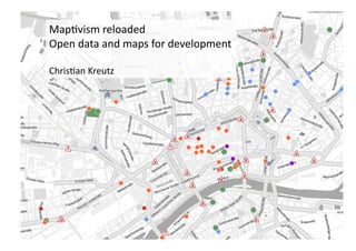
Maptivism reloaded: Open Data for Development @oddc
- 1. Map$vism ╠²reloaded ╠² Open ╠²data ╠²and ╠²maps ╠²for ╠²development ╠² Chris$an ╠²Kreutz ╠²
- 2. Open ╠²data ╠²ŌĆō ╠²another ╠²hype? ╠²
- 3. A ╠²map ╠²is ╠²worth ╠²a ╠²thousand ╠²words ╠²
- 4. A ╠²Map ╠²of ╠²the ╠²World ╠²An$-┬ŁŌĆÉSpanking ╠²League ╠² Jonas ╠²Dagson ╠² hAp://infographicsnews.blogspot.com/ 2008/12/save-┬ŁŌĆÉchildren-┬ŁŌĆÉmap.html ╠²
- 5. It ╠²is ╠²es6mated ╠²as ╠²much ╠²as ╠²80% ╠²of ╠² data ╠²contains ╠²geo-┬ŁŌĆÉreferenced ╠² informa6on. ╠²
- 7. Digital ╠²maps ╠²are ╠²a ╠²great ╠²way ╠²to ╠² digest ╠²data. ╠² ╠²
- 9. Is ╠²that ╠²useful? ╠²
- 13. Where does my money go? Andrew ╠²Turner ╠²(hAp://www.slideshare.net/ajturner/drupal-┬ŁŌĆÉand-┬ŁŌĆÉthe-┬ŁŌĆÉgeospa$al-┬ŁŌĆÉweb) ╠²
- 14. Data ╠²+ ╠²map ╠²+ ╠²mobile ╠²phone ╠²= ╠² ╠² a ╠²great ╠²informa6on ╠²service ╠²
- 16. We ╠²need ╠²to ╠²o’¼Ćer ╠²an ╠²added ╠²value ╠² with ╠²open ╠²data. ╠² ╠² Services ╠²that ╠²really ╠²help ╠² organiza6ons ╠²and ╠²bene’¼üciaries. ╠²
- 18. Photo: ╠²C. ╠²Kreutz ╠²
- 19. Local ╠²seismograph ╠² for ╠²your ╠²neighborhood ╠² OpenStreetMap ╠²(Crea$ve ╠²Commons ╠²CC-┬ŁŌĆÉby-┬ŁŌĆÉSA ╠²2.0 ╠²Lizenz). ╠²Rendering ╠²┬® ╠²2010 ╠²Cloudmade ╠² ╠²
- 21. Worldwide ╠²collabora6on ╠²for ╠²geo ╠²data ╠²
- 22. Before ╠²the ╠² Earthquake ╠² Openstreetmap.org ╠²
- 23. AXer ╠²the ╠² Earthquake ╠² Openstreetmap.org ╠²
- 24. Map ╠²Kibera ╠²-┬ŁŌĆÉ ╠²OpenStreetMaps ╠² www.mapkibera.org ╠²
- 27. 7.4.2011 ╠² h_da DJ | Daten Recherche | Christian Kreutz ╠² 27 ╠²
- 28. Real-┬ŁŌĆÉ6me ╠²data ╠²and ╠²mapping ╠²
- 30. Google ╠²Tra’¼āc ╠²Data ╠² hAp://www.datavisualiza$on.ch/showcases/tra’¼āc-┬ŁŌĆÉon-┬ŁŌĆÉgooglemaps ╠²
- 32. Data ╠²mining ╠²for ╠²development ╠²aid ╠²
- 33. Making ╠²sense ╠²of ╠²digital ╠²smoke ╠² signals ╠² Robert ╠²Kirkpatrick ╠²ŌĆō ╠²Global ╠²Pulse ╠²
- 34. Danger ╠²
- 37. Solly ╠²Benjamin ╠² Impact ╠²of ╠²the ╠²digi6za6on ╠²of ╠²land ╠²records ╠²in ╠² Bangalore. ╠² ╠² (CC) ╠²hAp://www.’¼éickr.com/photos/mckaysavage ╠²
- 39. Thank ╠²you ╠²for ╠²your ╠²aVen6on. ╠² ╠² hVp://www.crisscrossed.net/tag/map6vism/ ╠² ck@crisscrossed.de ╠²


