Kennis maken met GIS
Download as pptx, pdf0 likes1,861 views

presentatie tijdens AGGN dag over 'Onderwijs en GIS", www.aggn.nl, 17/12/2013, TU Delft.
1 of 34
Download to read offline

Ad
Recommended
260509 Amsterdam Samen Deskundig
260509 Amsterdam Samen Deskundigresiveldhoven
╠²
Uitleg van het samen deskundiger traject van Kennisnet in Amsterdam. Bovenschoolse icters komen bijeen voor kennisdeling en verspreiding.10 11-2016 workshop op weg met e twinning
10 11-2016 workshop op weg met e twinningTechnicles
╠²
presentatie for (V)MBO-groen bijeenkomst in Den Bosch 2016Samennogdeskundigerindetoekomstpabozweden 090513052309 Phpapp01
Samennogdeskundigerindetoekomstpabozweden 090513052309 Phpapp01guest1daad63
╠²
Kennisnet Studiereis Zweden 2009Samen N├│G Deskundiger In De Toekomst Pabo Zweden
Samen N├│G Deskundiger In De Toekomst Pabo ZwedenKennisnet
╠²
Presentatie gehouden bij studiereis samen deskundiger pabo. Mei 2009Frans Schouwenburg SD Zweden
Frans Schouwenburg SD ZwedenVerwater Frank
╠²
Presentatie van Frans Schouwenburg over de veranderende wereld van vandaag en de noodzaak van paboŌĆÖs om daar bij aan te sluitenToekomstperspectieven DLWO, SIS en LMS - Flip van Haaren - HO-link 2014
Toekomstperspectieven DLWO, SIS en LMS - Flip van Haaren - HO-link 2014HOlink
╠²
Sessieronde 5
Titel: Toekomstperspectieven DLWO, SIS en LMS
Sprekers: Flip van Haaren (Projectcampus, in samenwerking met TU Delft)
Locatie: Cambridge 30
Gis (geographic information system)
Gis (geographic information system)Saad Bare
╠²
The document outlines a project on Geographic Information Systems (GIS), detailing its functions, existing limitations of current systems like Google Maps, and proposing a new website for improved user navigation and information retrieval. It highlights the advantages of GIS in finding various locations and provides requirement specifications for both server and client-side systems. Three main development modules are identified: geographical survey, programming and development, and design of the website.Unearthing our spatial gene
Unearthing our spatial geneJan Willem van Eck
╠²
1) The document discusses how the rise of open data and web technologies has enabled the field of geographic information science (GIS) to innovate faster than ever before and increased people's natural interest in geography.
2) It argues that GIS education programs should encourage students' spatial curiosity and teach them how to learn new skills as the field is constantly evolving.
3) The presentation touches on how the web has changed maps by allowing open access, sharing and contribution; how the web is transforming education; and the joint challenges and responsibilities of educators in teaching the next generation.Op reis naar de (geo) toekomst - Geotrends 2018
Op reis naar de (geo) toekomst - Geotrends 2018Jan Willem van Eck
╠²
Presentatie over Trends in Geo, en specifiek over AI, ML, DL. Geo.A Spatial Journey
A Spatial JourneyJan Willem van Eck
╠²
Location intelligence has evolved from static government data to real-time data that adds value for both government and business. Geospatial services generate $400 billion annually. Key tipping points included aerial photography, computers, the web, GPS, and mobile devices, which led to widespread datafication. Location is now omnipresent in social media and increasingly important for business strategies and decisions. An experimental then structured approach to location data and analytics can help organizations discover patterns, gain insights, and support better decisions across business functions and ecosystems.On Spatial, Data and Mapping myopia
On Spatial, Data and Mapping myopiaJan Willem van Eck
╠²
The document discusses the purposes, perceptions, and implications of maps, emphasizing that they are more than mere representations of geography. It encourages critical geographic thinking and examines the evolving nature of spatial data infrastructures while highlighting the role of technology in data collection and visualization. Additionally, it stresses the importance of understanding maps beyond their aesthetic value, urging users to analyze their potential uses and distortions.Get Big Geo Data
Get Big Geo DataJan Willem van Eck
╠²
This document discusses developments in big geodata and its role in GIS. It encourages students to pay closer attention to data aspects of GIS and gain experience with large geodata sets. The presentation explains how data collection is changing from expert-driven and closed to crowd-sourced and open. Examples of big geodata sources include sensor data, social media, and the Internet of Things. Tips are provided for students to explore big geodata through MOOCs and recommended readings.GIS Trend 2025: data, data, data - at Tensing innoveert
GIS Trend 2025: data, data, data - at Tensing innoveertJan Willem van Eck
╠²
presentation at Tensing Innoveert, on megatrend data, innovation and a few tips. http://www.tensing.com/Duurzaam open data in almere
Duurzaam open data in almereJan Willem van Eck
╠²
Presentatie tijdens de kickoff van http://opendata.almere.nl/ , 24 maart 2015.Inzoomen op de kaart
Inzoomen op de kaartJan Willem van Eck
╠²
Presentatie voor communicatie professionals en webdesigners tijdens TYPO3 Congres 2014, Nemo, AmsterdamOpen data a la hollandaise, at Techday, Bern.Jan Willem van Eck
╠²
Das Dokument behandelt das Thema Open Data und Open Innovation, wobei betont wird, dass ein strukturierter Wissensfluss entscheidend ist, um interne Innovationen zu beschleunigen und den externen Markt zu erweitern. Es werden spezifische Ziele f├╝r die Verwendung von Open Data sowie Tipps zur Implementierung und Nutzung bereitgestellt, um das wirtschaftliche Potenzial und die Wiederverwendbarkeit von Daten zu maximieren. Zudem weist das Dokument auf die Vorteile eines transparenten und effizienten Umgangs mit Daten hin, um neue Anwendungen und Innovationen zu f├Črdern.The future of GIS as we know it
The future of GIS as we know itJan Willem van Eck
╠²
The document discusses the evolving role of Geographic Information Systems (GIS) in various organizational contexts and how it integrates with technology and data management. It emphasizes the importance of geodata, software, and mobile capabilities to enhance analysis and presentation of geographic information. The concept of making GIS accessible to everyone, regardless of their background, is highlighted as a key trend for the future.Breaking barriers for open data
Breaking barriers for open dataJan Willem van Eck
╠²
The document discusses the challenges and opportunities related to open data in the Netherlands, particularly emphasizing geographic data. It highlights the government's goal of becoming a digital entity by 2017 and the economic potential of commercial re-use of open data, estimated at Ōé¼200 million annually. Key barriers to effective open data utilization include market dynamics, privacy, licensing, and accessibility, with suggestions for overcoming these challenges through public dialogue and connection to existing initiatives.Solving the social media puzzle
Solving the social media puzzleJan Willem van Eck
╠²
This document discusses solving the puzzle of social media participation. It addresses understanding social media as a system of connected people communicating both visibly and invisibly through various mediums over time. Communication can take different forms from one-on-one to group interactions, both online and offline. Successfully navigating social media involves understanding one's own position and characteristics within their social networks and communities, and knowing when and how to participate or shift gears with the different audiences and platforms.The location factor
The location factorJan Willem van Eck
╠²
presentation for marketeers at a Datlinq event.How location and geography may provide insights and understanding of consumer behavior, how consumers are contributing themselves to better data, and how by analysing location we are able to make better decisions.ArcGIS als platform voor innovatie
ArcGIS als platform voor innovatieJan Willem van Eck
╠²
presentie over de relatie tussen ArcGIS, Esri en (open) innovatie, met een aantal praktische voorbeelden.On the esri contribution to the gis edu community
On the esri contribution to the gis edu communityJan Willem van Eck
╠²
The document discusses trends in education and GIS, and what Esri is doing to support teaching and learning with GIS. It outlines Esri's contributions to the education community, including a virtual campus, internships, guest lectures, scholarships, and support for open data initiatives. The goal is to make teaching and learning with GIS as easy as possible and help prepare students for careers that incorporate GIS.Where is the value of open innovation
Where is the value of open innovationJan Willem van Eck
╠²
This document discusses the concept of open innovation and where value is created through open innovation approaches. It defines open innovation as using external knowledge to accelerate internal innovation and expand markets for external use of innovation. The document notes that open innovation can provide benefits like faster time to market, greater diffusion of knowledge, and increased absorptive capacity. It emphasizes that open innovation is about jointly creating value through networks and ecosystems, and that while openness can be valuable, no organization is ever completely open or closed.Recap open geo data workshop
Recap open geo data workshopJan Willem van Eck
╠²
This document discusses open access to government data, open courseware, open source software, open innovation, open data, and Creative Commons licensing. It covers topics like who owns public teaching materials, how open source software benefits from an ecosystem of users and contributors, how open innovation allows ideas to flow both within and outside an organization, how open data starts with a definition and involves metadata portals, and how Creative Commons licenses can apply to open data. The workshop introduction covered these topics in the context of open geodata.On data mapping stories
On data mapping storiesJan Willem van Eck
╠²
The document discusses data, mapping, and stories. It notes that data provides a way to view the world through raster and vector formats in static or real-time topographic and thematic maps. The document also emphasizes that real stories that impact people can be told through appropriate data visualization methods and challenges people to stay critical of data and focus on stories that create real impact, such as in healthcare.Open Geodata Workshop
Open Geodata WorkshopJan Willem van Eck
╠²
presentation as an intro to several open topics, workshop Esri Nederland on Open GeodataComparative Genomics Methods And Protocols 1st Edition Joo C Setubal
Comparative Genomics Methods And Protocols 1st Edition Joo C Setubalxbhamef758
╠²
Comparative Genomics Methods And Protocols 1st Edition Joo C Setubal
Comparative Genomics Methods And Protocols 1st Edition Joo C Setubal
Comparative Genomics Methods And Protocols 1st Edition Joo C SetubalMultivariable Calculus 2nd Edition Brian E. Blank
Multivariable Calculus 2nd Edition Brian E. Blankvcoxhiq738
╠²
Multivariable Calculus 2nd Edition Brian E. Blank
Multivariable Calculus 2nd Edition Brian E. Blank
Multivariable Calculus 2nd Edition Brian E. BlankMore Related Content
More from Jan Willem van Eck (20)
Unearthing our spatial gene
Unearthing our spatial geneJan Willem van Eck
╠²
1) The document discusses how the rise of open data and web technologies has enabled the field of geographic information science (GIS) to innovate faster than ever before and increased people's natural interest in geography.
2) It argues that GIS education programs should encourage students' spatial curiosity and teach them how to learn new skills as the field is constantly evolving.
3) The presentation touches on how the web has changed maps by allowing open access, sharing and contribution; how the web is transforming education; and the joint challenges and responsibilities of educators in teaching the next generation.Op reis naar de (geo) toekomst - Geotrends 2018
Op reis naar de (geo) toekomst - Geotrends 2018Jan Willem van Eck
╠²
Presentatie over Trends in Geo, en specifiek over AI, ML, DL. Geo.A Spatial Journey
A Spatial JourneyJan Willem van Eck
╠²
Location intelligence has evolved from static government data to real-time data that adds value for both government and business. Geospatial services generate $400 billion annually. Key tipping points included aerial photography, computers, the web, GPS, and mobile devices, which led to widespread datafication. Location is now omnipresent in social media and increasingly important for business strategies and decisions. An experimental then structured approach to location data and analytics can help organizations discover patterns, gain insights, and support better decisions across business functions and ecosystems.On Spatial, Data and Mapping myopia
On Spatial, Data and Mapping myopiaJan Willem van Eck
╠²
The document discusses the purposes, perceptions, and implications of maps, emphasizing that they are more than mere representations of geography. It encourages critical geographic thinking and examines the evolving nature of spatial data infrastructures while highlighting the role of technology in data collection and visualization. Additionally, it stresses the importance of understanding maps beyond their aesthetic value, urging users to analyze their potential uses and distortions.Get Big Geo Data
Get Big Geo DataJan Willem van Eck
╠²
This document discusses developments in big geodata and its role in GIS. It encourages students to pay closer attention to data aspects of GIS and gain experience with large geodata sets. The presentation explains how data collection is changing from expert-driven and closed to crowd-sourced and open. Examples of big geodata sources include sensor data, social media, and the Internet of Things. Tips are provided for students to explore big geodata through MOOCs and recommended readings.GIS Trend 2025: data, data, data - at Tensing innoveert
GIS Trend 2025: data, data, data - at Tensing innoveertJan Willem van Eck
╠²
presentation at Tensing Innoveert, on megatrend data, innovation and a few tips. http://www.tensing.com/Duurzaam open data in almere
Duurzaam open data in almereJan Willem van Eck
╠²
Presentatie tijdens de kickoff van http://opendata.almere.nl/ , 24 maart 2015.Inzoomen op de kaart
Inzoomen op de kaartJan Willem van Eck
╠²
Presentatie voor communicatie professionals en webdesigners tijdens TYPO3 Congres 2014, Nemo, AmsterdamOpen data a la hollandaise, at Techday, Bern.Jan Willem van Eck
╠²
Das Dokument behandelt das Thema Open Data und Open Innovation, wobei betont wird, dass ein strukturierter Wissensfluss entscheidend ist, um interne Innovationen zu beschleunigen und den externen Markt zu erweitern. Es werden spezifische Ziele f├╝r die Verwendung von Open Data sowie Tipps zur Implementierung und Nutzung bereitgestellt, um das wirtschaftliche Potenzial und die Wiederverwendbarkeit von Daten zu maximieren. Zudem weist das Dokument auf die Vorteile eines transparenten und effizienten Umgangs mit Daten hin, um neue Anwendungen und Innovationen zu f├Črdern.The future of GIS as we know it
The future of GIS as we know itJan Willem van Eck
╠²
The document discusses the evolving role of Geographic Information Systems (GIS) in various organizational contexts and how it integrates with technology and data management. It emphasizes the importance of geodata, software, and mobile capabilities to enhance analysis and presentation of geographic information. The concept of making GIS accessible to everyone, regardless of their background, is highlighted as a key trend for the future.Breaking barriers for open data
Breaking barriers for open dataJan Willem van Eck
╠²
The document discusses the challenges and opportunities related to open data in the Netherlands, particularly emphasizing geographic data. It highlights the government's goal of becoming a digital entity by 2017 and the economic potential of commercial re-use of open data, estimated at Ōé¼200 million annually. Key barriers to effective open data utilization include market dynamics, privacy, licensing, and accessibility, with suggestions for overcoming these challenges through public dialogue and connection to existing initiatives.Solving the social media puzzle
Solving the social media puzzleJan Willem van Eck
╠²
This document discusses solving the puzzle of social media participation. It addresses understanding social media as a system of connected people communicating both visibly and invisibly through various mediums over time. Communication can take different forms from one-on-one to group interactions, both online and offline. Successfully navigating social media involves understanding one's own position and characteristics within their social networks and communities, and knowing when and how to participate or shift gears with the different audiences and platforms.The location factor
The location factorJan Willem van Eck
╠²
presentation for marketeers at a Datlinq event.How location and geography may provide insights and understanding of consumer behavior, how consumers are contributing themselves to better data, and how by analysing location we are able to make better decisions.ArcGIS als platform voor innovatie
ArcGIS als platform voor innovatieJan Willem van Eck
╠²
presentie over de relatie tussen ArcGIS, Esri en (open) innovatie, met een aantal praktische voorbeelden.On the esri contribution to the gis edu community
On the esri contribution to the gis edu communityJan Willem van Eck
╠²
The document discusses trends in education and GIS, and what Esri is doing to support teaching and learning with GIS. It outlines Esri's contributions to the education community, including a virtual campus, internships, guest lectures, scholarships, and support for open data initiatives. The goal is to make teaching and learning with GIS as easy as possible and help prepare students for careers that incorporate GIS.Where is the value of open innovation
Where is the value of open innovationJan Willem van Eck
╠²
This document discusses the concept of open innovation and where value is created through open innovation approaches. It defines open innovation as using external knowledge to accelerate internal innovation and expand markets for external use of innovation. The document notes that open innovation can provide benefits like faster time to market, greater diffusion of knowledge, and increased absorptive capacity. It emphasizes that open innovation is about jointly creating value through networks and ecosystems, and that while openness can be valuable, no organization is ever completely open or closed.Recap open geo data workshop
Recap open geo data workshopJan Willem van Eck
╠²
This document discusses open access to government data, open courseware, open source software, open innovation, open data, and Creative Commons licensing. It covers topics like who owns public teaching materials, how open source software benefits from an ecosystem of users and contributors, how open innovation allows ideas to flow both within and outside an organization, how open data starts with a definition and involves metadata portals, and how Creative Commons licenses can apply to open data. The workshop introduction covered these topics in the context of open geodata.On data mapping stories
On data mapping storiesJan Willem van Eck
╠²
The document discusses data, mapping, and stories. It notes that data provides a way to view the world through raster and vector formats in static or real-time topographic and thematic maps. The document also emphasizes that real stories that impact people can be told through appropriate data visualization methods and challenges people to stay critical of data and focus on stories that create real impact, such as in healthcare.Open Geodata Workshop
Open Geodata WorkshopJan Willem van Eck
╠²
presentation as an intro to several open topics, workshop Esri Nederland on Open GeodataRecently uploaded (8)
Comparative Genomics Methods And Protocols 1st Edition Joo C Setubal
Comparative Genomics Methods And Protocols 1st Edition Joo C Setubalxbhamef758
╠²
Comparative Genomics Methods And Protocols 1st Edition Joo C Setubal
Comparative Genomics Methods And Protocols 1st Edition Joo C Setubal
Comparative Genomics Methods And Protocols 1st Edition Joo C SetubalMultivariable Calculus 2nd Edition Brian E. Blank
Multivariable Calculus 2nd Edition Brian E. Blankvcoxhiq738
╠²
Multivariable Calculus 2nd Edition Brian E. Blank
Multivariable Calculus 2nd Edition Brian E. Blank
Multivariable Calculus 2nd Edition Brian E. BlankThe data warehouse toolkit the complete guide to dimensional modeling 2nd ed ...
The data warehouse toolkit the complete guide to dimensional modeling 2nd ed ...misjzdqlx0124
╠²
The data warehouse toolkit the complete guide to dimensional modeling 2nd ed Edition Ralph Kimball
The data warehouse toolkit the complete guide to dimensional modeling 2nd ed Edition Ralph Kimball
The data warehouse toolkit the complete guide to dimensional modeling 2nd ed Edition Ralph KimballRECENT DEVELOPMENTS IN BIOENERGY RESEARCH Vijai G. Gupta (Editor)
RECENT DEVELOPMENTS IN BIOENERGY RESEARCH Vijai G. Gupta (Editor)hsakvtrw562
╠²
RECENT DEVELOPMENTS IN BIOENERGY RESEARCH Vijai G. Gupta (Editor)
RECENT DEVELOPMENTS IN BIOENERGY RESEARCH Vijai G. Gupta (Editor)
RECENT DEVELOPMENTS IN BIOENERGY RESEARCH Vijai G. Gupta (Editor)Foodborne Disease Handbook. Volume 2: Viruses, Parasites, Pathogens, and HACC...
Foodborne Disease Handbook. Volume 2: Viruses, Parasites, Pathogens, and HACC...axswigb793
╠²
Foodborne Disease Handbook. Volume 2: Viruses, Parasites, Pathogens, and HACCP Y. H. Hui
Foodborne Disease Handbook. Volume 2: Viruses, Parasites, Pathogens, and HACCP Y. H. Hui
Foodborne Disease Handbook. Volume 2: Viruses, Parasites, Pathogens, and HACCP Y. H. HuiConcepts in Strategic Management and Business Policy Globalization Innovation...
Concepts in Strategic Management and Business Policy Globalization Innovation...ewlalgp855
╠²
Concepts in Strategic Management and Business Policy Globalization Innovation and Sustainability 15th Edition Wheelen Solutions Manual
Concepts in Strategic Management and Business Policy Globalization Innovation and Sustainability 15th Edition Wheelen Solutions Manual
Concepts in Strategic Management and Business Policy Globalization Innovation and Sustainability 15th Edition Wheelen Solutions ManualThe Making Of Gratians Decretum 1st Edition Anders Winroth
The Making Of Gratians Decretum 1st Edition Anders Winrothkutuskaine
╠²
The Making Of Gratians Decretum 1st Edition Anders Winroth
The Making Of Gratians Decretum 1st Edition Anders Winroth
The Making Of Gratians Decretum 1st Edition Anders WinrothSociology A Down to Earth Approach 13th Edition Henslin Test Bank
Sociology A Down to Earth Approach 13th Edition Henslin Test Bankssdygsoq114
╠²
Sociology A Down to Earth Approach 13th Edition Henslin Test Bank
Sociology A Down to Earth Approach 13th Edition Henslin Test Bank
Sociology A Down to Earth Approach 13th Edition Henslin Test BankAd
Kennis maken met GIS
- 1. Kennis maken met GIS AGGN, 17/12/2013, TU DELFT @jwvaneck
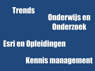
- 2. Trends Onderwijs en Onderzoek Esri en Opleidingen Kennis management
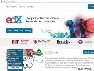
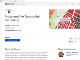
- 3. OCW / MOOC
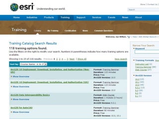
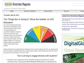
- 10. ŌĆ£Esri is aiming to engage directly with studentsŌĆØ
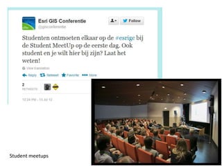
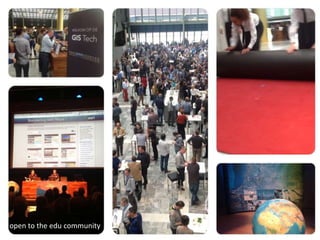
- 12. Student meetups
- 13. open to the edu community
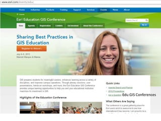
- 15. Guest lectures
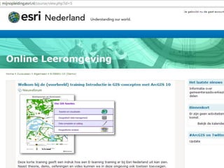
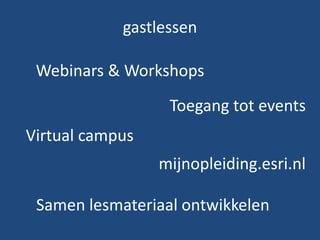
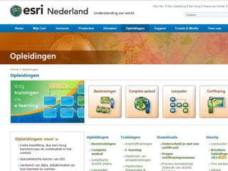
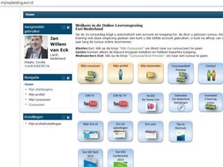
- 17. gastlessen Webinars & Workshops Toegang tot events Virtual campus mijnopleiding.esri.nl Samen lesmateriaal ontwikkelen
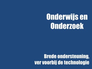
- 18. Onderwijs en Onderzoek Brede ondersteuning, ver voorbij de technologie
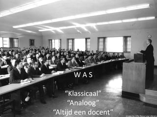
- 20. WAS ŌĆ£KlassicaalŌĆØ ŌĆ£AnaloogŌĆØ ŌĆ£Altijd een docentŌĆØ Image by Villa Nova Law Library
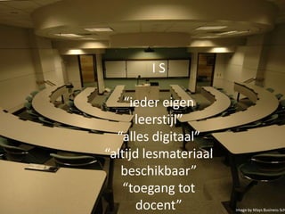
- 21. IS ŌĆ£ieder eigen leerstijlŌĆØ ŌĆ£alles digitaalŌĆØ ŌĆ£altijd lesmateriaal beschikbaarŌĆØ ŌĆ£toegang tot docentŌĆØ Image by Mays Business Sch
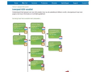
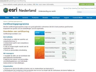
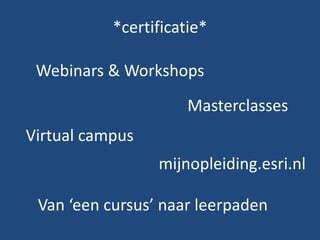
- 26. *certificatie* Webinars & Workshops Masterclasses Virtual campus mijnopleiding.esri.nl Van ŌĆśeen cursusŌĆÖ naar leerpaden
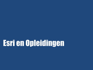
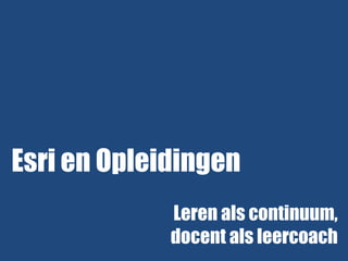
- 27. Esri en Opleidingen Leren als continuum, docent als leercoach
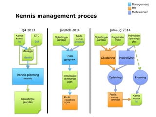
- 30. Management HR Medewerker Kennis management proces Click to edit Subtitle (optional) Q4 2013 Kennis Matrix Ist CTO Soll jan-aug 2014 jan/feb 2014 Opleidingsjaarplan Mede werker ambities Opleidingsjaarplan Registratie Profit Individueel opleidings plan Manager ideeën Kennis planning sessie Plan gesprek Individueel opleidings plan Clustering Inschrijving Opleiding Profit: Opleidingsjaarplan Profit: - registratie - OVK - tracking - certificaat Ervaring Kennis Matrix Ist
- 31. Click to edit Subtitle (optional)
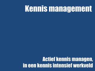
- 32. Kennis management Actief kennis managen, in een kennis intensief werkveld
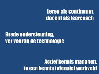
- 33. Leren als continuum, docent als leercoach Brede ondersteuning, ver voorbij de technologie Actief kennis managen, in een kennis intensief werkveld
- 34. Kennis maken met GIS AGGN, 17/12/2013, TU DELFT @jwvaneck
Editor's Notes
- #11: http://apb.directionsmag.com/entry/ten-things-esri-is-doing-to-move-the-needle-on-gis-education/326998
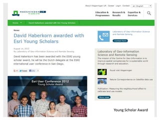
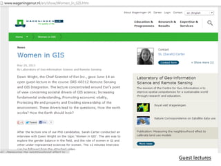
- #12: http://www.wageningenur.nl/en/show/David-Haberkorn-awarded-with-Esri-Young-Scholars.htm
- #16: http://www.wageningenur.nl/en/show/Women_in_GIS.htm
- #18: Consumers contribute data
- #21: Image credit http://www.flickr.com/photos/110521056@N07/ cc http://creativecommons.org/licenses/by-sa/2.0/
- #22: Image credit http://www.flickr.com/photos/maysbusinessschool/4506244646/sizes/l/in/photostream/
- #27: Consumers contribute data