Lesson 11 - Activity 2 Q.1
?Download as PPT, PDF?
0 likes?501 views

The document discusses the relief features of China. It describes several key relief features: mountain ranges, plateaus, basins, and plains. It provides examples of each in China, including the Himalayas mountain range, the Qingzang and Yungui plateaus, the Sichuan basin, and the Changjiang and Huabei plains. The document matches photographs of these relief features with their locations on a map of China.
![What is relief [ Ąžä▌ ]? Relief describes the shape [ ą╬ĀŅ ] and height [ Ė▀Č╚ ] of the land.](https://image.slidesharecdn.com/lesson11-activity2q-1-110416235530-phpapp01/85/Lesson-11-Activity-2-Q-1-2-320.jpg)
![Do you know about these relief features [ ╠žßń / ├µ├▓ ] ? Mountain range [ ╔Į├} ] Plateau (Gaoyuan) [ Ė▀įŁ ] Basin (Pendi) [ ┼ĶĄž ] Plain (Pingyuan) [ ŲĮįŁ ]](https://image.slidesharecdn.com/lesson11-activity2q-1-110416235530-phpapp01/85/Lesson-11-Activity-2-Q-1-3-320.jpg)
![Mountain range [ ╔Į├} ] A continuous line of highland reaching great heights](https://image.slidesharecdn.com/lesson11-activity2q-1-110416235530-phpapp01/85/Lesson-11-Activity-2-Q-1-4-320.jpg)
![Plateau (Gaoyuan) [ Ė▀įŁ ] A large area of high, flat [ ŲĮ╠╣Ą─ ] land](https://image.slidesharecdn.com/lesson11-activity2q-1-110416235530-phpapp01/85/Lesson-11-Activity-2-Q-1-5-320.jpg)
![Basin (Pendi) [ ┼ĶĄž ] A large area of flat land surrounded [ ░³ć· ] by mountains or highland.](https://image.slidesharecdn.com/lesson11-activity2q-1-110416235530-phpapp01/85/Lesson-11-Activity-2-Q-1-6-320.jpg)
![Plain (Pingyuan) [ ŲĮįŁ ] A large area of flat land with low relief](https://image.slidesharecdn.com/lesson11-activity2q-1-110416235530-phpapp01/85/Lesson-11-Activity-2-Q-1-7-320.jpg)
![Alluvium [ ø_Ęe╬’ ] Rivers carry away soil and rocks . Soils and rocks rest on the lowland . They are called alluvium.](https://image.slidesharecdn.com/lesson11-activity2q-1-110416235530-phpapp01/85/Lesson-11-Activity-2-Q-1-8-320.jpg)


![1(a) In which location do you think each of the photographs in Fig. 1 was taken? Correctly match these photographs with the location A to F in Fig.2. Write your answer on the answer lines below. Photograph Location 1 B 2 A 3 D 4 C 5 F 6 E The Himalayas [ Ž▓¼ö └Ł üå╔Į├} ] Qingzang Gaoyuan [ ŪÓ▓žĖ▀įŁ ] Yungui Gaoyuan [ ļģ┘FĖ▀įŁ ] Sichuan Pendi [ ╦─┤©┼ĶĄž ] Changjiang Zhongxiayou Pingyuan [ ķLĮŁųąĪóŽ┬ė╬ŲĮįŁ ] Huabei Pingyuan [ ╚A▒▒ŲĮįŁ ]](https://image.slidesharecdn.com/lesson11-activity2q-1-110416235530-phpapp01/85/Lesson-11-Activity-2-Q-1-12-320.jpg)

![Answers The Himalayas [ Ž▓¼ö └Ł üå╔Į├} ] Qingzang Gaoyuan [ ŪÓ▓žĖ▀įŁ ] Yungui Gaoyuan [ ļģ┘FĖ▀įŁ ] Sichuan Pendi [ ╦─┤©┼ĶĄž ] Changjiang Zhongxiayou Pingyuan [ ķLĮŁųąĪóŽ┬ė╬ŲĮįŁ ] Huabei Pingyuan [ ╚A▒▒ŲĮįŁ ]](https://image.slidesharecdn.com/lesson11-activity2q-1-110416235530-phpapp01/85/Lesson-11-Activity-2-Q-1-14-320.jpg)


Lesson 11 - Activity 2 Q.1
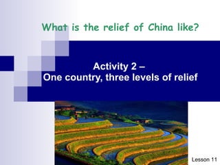
- 1. What is the relief of China like? Activity 2 ©C One country, three levels of relief Lesson 1 1
- 2. What is relief [ Ąžä▌ ]? Relief describes the shape [ ą╬ĀŅ ] and height [ Ė▀Č╚ ] of the land.
- 3. Do you know about these relief features [ ╠žßń / ├µ├▓ ] ? Mountain range [ ╔Į├} ] Plateau (Gaoyuan) [ Ė▀įŁ ] Basin (Pendi) [ ┼ĶĄž ] Plain (Pingyuan) [ ŲĮįŁ ]
- 4. Mountain range [ ╔Į├} ] A continuous line of highland reaching great heights
- 5. Plateau (Gaoyuan) [ Ė▀įŁ ] A large area of high, flat [ ŲĮ╠╣Ą─ ] land
- 6. Basin (Pendi) [ ┼ĶĄž ] A large area of flat land surrounded [ ░³ć· ] by mountains or highland.
- 7. Plain (Pingyuan) [ ŲĮįŁ ] A large area of flat land with low relief
- 8. Alluvium [ ø_Ęe╬’ ] Rivers carry away soil and rocks . Soils and rocks rest on the lowland . They are called alluvium.
- 9. Fig.1 Ž▓±R└Łč┼╔Į├} ŪÓ▓žĖ▀įŁ ļģ┘FĖ▀įŁ ╦─┤©┼ĶĄž ķLĮŁųąĪóŽ┬ė╬ŲĮįŁ ╚A▒▒ŲĮįŁ
- 10. Fig. 2
- 11. ?
- 12. 1(a) In which location do you think each of the photographs in Fig. 1 was taken? Correctly match these photographs with the location A to F in Fig.2. Write your answer on the answer lines below. Photograph Location 1 B 2 A 3 D 4 C 5 F 6 E The Himalayas [ Ž▓¼ö └Ł üå╔Į├} ] Qingzang Gaoyuan [ ŪÓ▓žĖ▀įŁ ] Yungui Gaoyuan [ ļģ┘FĖ▀įŁ ] Sichuan Pendi [ ╦─┤©┼ĶĄž ] Changjiang Zhongxiayou Pingyuan [ ķLĮŁųąĪóŽ┬ė╬ŲĮįŁ ] Huabei Pingyuan [ ╚A▒▒ŲĮįŁ ]
- 13. (b) What are the relief characteristics of these locations? Draw lines to join to their respective characteristics.
- 14. Answers The Himalayas [ Ž▓¼ö └Ł üå╔Į├} ] Qingzang Gaoyuan [ ŪÓ▓žĖ▀įŁ ] Yungui Gaoyuan [ ļģ┘FĖ▀įŁ ] Sichuan Pendi [ ╦─┤©┼ĶĄž ] Changjiang Zhongxiayou Pingyuan [ ķLĮŁųąĪóŽ┬ė╬ŲĮįŁ ] Huabei Pingyuan [ ╚A▒▒ŲĮįŁ ]
- 15. Photograph 1: B The Himalayas ( Ž▓±R└Łč┼╔Į├} ) It is the worldĪ»s largest mountain range ( ╔Į├} ), and has the highest peak in the world, the Qomolangma Feng ( ųķ─┬└╩¼öĘÕ ).
- 16. Photograph 2: A Qingzang Gaoyuan ( ŪÓ▓žĖ▀įŁ ) It is the largest plateau ( Ė▀įŁ ) in China, which rises to over 4500m in height.
- 17. Photograph 3: D Yungui Gaoyuan ( ļģ┘FĖ▀įŁ ) It is a lower plateau ( Ė▀įŁ ) (about 1000m to 2000m high) found to the east of the western plateaus and mountain ranges.
- 18. Photograph 4: C Sichuan Pendi ( ╦─┤©┼ĶĄž ) It is a large basin ( ┼ĶĄž ) located in the southwest of China, which is famous for its agriculture ( ▐rśI ).
- 19. Photograph 5: F Changjiang Zhongxiayou Pingyuan ( ķLĮŁųąĪóŽ┬ė╬ŲĮįŁ ) Photograph 6: E Huabei Pingyuan ( ╚A▒▒ŲĮįŁ ) It is a large and flat lowland ( Ą═Ąž ) (lower than 1000 m) formed by a large amount of alluvium ( ø_Ęe╬’ ) brought by the river.
- 20. Key words and knowledge Relief ( Ąžä▌ ) Some relief features of China: - mountain range - plateau (Gaoyuan) - basin (Pendi) - plain (Pingyuan)
- 21. Next lesson Activity 2 ©C Q.2,3