ºÝºÝߣ

ºÝºÝߣShare a Scribd company logo
MAPPING
SKILLS
LATITUDES
• Horizontal lines (east to
west)
• Divide the earth into
northern and southern
hemispheres
• Measured in degrees
North & South
• Maximum possible
latitude: 90 degrees
(North & south poles)
LONGITUDES
• Vertical lines (north to
south)
• Divide the earth into
Eastern and western
hemispheres
• Measured in degrees
East & West
• Maximum possible
longitude: 180 degrees
INTERNATIONAL DATE LINE
• Opposite the prime
meridian
• Lies in the pacific ocean
• Not a straight line
• Separates two calendar
days
• Eastern hemisphere is
one day ahead of the
western hemisphere
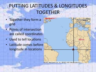
PUTTING LATITUDES & LONGITUDES
TOGETHER
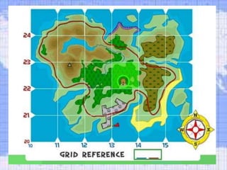
• Together they form a
grid
• Points of intersection
are called coordinates
• Used to tell locations
• Latitude comes before
longitude in locations
Mapping  skills
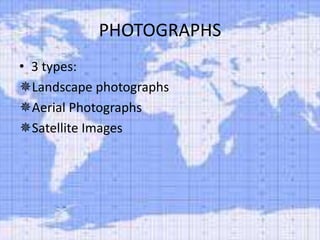
PHOTOGRAPHS
• 3 types:
Landscape photographs
Aerial Photographs
Satellite Images
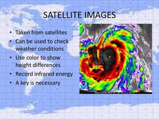
SATELLITE IMAGES
• Taken from satellites
• Can be used to check
weather conditions
• Use color to show
height differences
• Record infrared energy
• A key is necessary
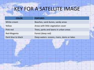
KEY FOR A SATELLITE IMAGE
COLOR

FEATURES

White-cream

Beaches, sand dunes, sandy areas

Yellow

Areas with little vegetation cover

Pink-red

Trees, parks and lawns in urban areas

Red-Magenta

Forest (deep red)

Dark blue to black

Deep waters- oceans, rivers, dams or lakes

More Related Content

Mapping skills

  • 2. LATITUDES • Horizontal lines (east to west) • Divide the earth into northern and southern hemispheres • Measured in degrees North & South • Maximum possible latitude: 90 degrees (North & south poles)
  • 3. LONGITUDES • Vertical lines (north to south) • Divide the earth into Eastern and western hemispheres • Measured in degrees East & West • Maximum possible longitude: 180 degrees
  • 4. INTERNATIONAL DATE LINE • Opposite the prime meridian • Lies in the pacific ocean • Not a straight line • Separates two calendar days • Eastern hemisphere is one day ahead of the western hemisphere
  • 5. PUTTING LATITUDES & LONGITUDES TOGETHER • Together they form a grid • Points of intersection are called coordinates • Used to tell locations • Latitude comes before longitude in locations
  • 7. PHOTOGRAPHS • 3 types: Landscape photographs Aerial Photographs Satellite Images
  • 8. SATELLITE IMAGES • Taken from satellites • Can be used to check weather conditions • Use color to show height differences • Record infrared energy • A key is necessary
  • 9. KEY FOR A SATELLITE IMAGE COLOR FEATURES White-cream Beaches, sand dunes, sandy areas Yellow Areas with little vegetation cover Pink-red Trees, parks and lawns in urban areas Red-Magenta Forest (deep red) Dark blue to black Deep waters- oceans, rivers, dams or lakes