2005 earthquake in pakistan
•
29 likes•8,618 views

The document discusses earthquakes that have impacted Pakistan from 893 to 2011. It provides details on magnitude, location, deaths for each earthquake. It then summarizes the 2005 Kashmir earthquake that had a magnitude of 7.8 and caused over 80,000 deaths. The document outlines the impacts to infrastructure and reasons for widespread destruction. It also describes government response through organizations like ERRA and NDMA to help with reconstruction efforts. The 2011 Balochistan earthquake that caused no major losses is compared to the devastating 2005 quake.


2005 earthquake in pakistan
- 2. M. Rizwan Riaz 2007-CIV-142 Muhammad Ammar 2007-CIV-136 Syed Murtaza Abbas 2007-CIV-140
- 5. History Year Location Magnitude Deaths 893 Shahbandar, Sindh 8.0 1 50 000 1668 Shahbandar, Sindh 7.6 50 000 1819 Allahband, Sindh 7.5 3 200 1827 Lahore, Punjab 7.8 1 000 1935 Alijan, Balochistan 7.7 40 000 1945 Balochistan 7.8 4 000 1974 Hunza, KPK 6.2 5 300 2005 Muzaferabad, AJK 7.8 80 000 2011 Dalbandin, Balochistan 7.2 NIL Source: JANG Magazine (Prof. Mona Liza)
- 6. Magnitude & Scale  The Moment magnitude scale (abbreviated as MMS; denoted as MW) is used to measure the size of earthquakes in terms of the energy released.  The scale was developed in the 1970’s to succeed the 1930’s-era Richter magnitude scale (ML)  Richer scale is improved form of Marcalli scale.
- 7. Richter Scale Source: www.setileague.org
- 8. Tectonic Plates ď‚— Tectonic plates are large plates of rock that make up the foundation of the earth's crust. ď‚— There are ten major plates on the earth and many more minor ones. ď‚— The plates are most famously known for being the source of Earthquakes.
- 9. Pakistan Tectonic Plates • Pakistan overlaps with the Indian and the Eurasian tectonic plates. • Sindh and Punjab lie on Indian plate. • Balochistan and Khyber Pukhtunkhwa lie within the Eurasian plate. Source: www.ecogeodb.com
- 10. Seismic Zones of Pakistan Source: NESPAK
- 11. 2005 EARTHQUAKE (Muzafferabad, AJK)
- 12. Earthquake Details Magnitude 7.8 Saturday, October 08, 2005 at 08:52:37 Date/Time AM Location Muzafferabad, AJK Depth 26 km (16.2 miles) 105 km (65 miles) NE of ISLAMABAD, Distance Pakistan Source: www. earthquake.usgs.gov
- 14. 13th Deadliest Earthquake Source: www.thepakistanquake.com
- 15. Losses Source: www.skidmail.com
- 16. Losses ď‚— 87,000 Dead (According to World Bank Report) ď‚— 100,000 injured ď‚— 171,884 houses completely demolished ď‚— 4 Million people homeless in 1,083 villages of Azad Kashmir ď‚— In Kashmir, the districts of Muzaffarabad, Bagh and Rawlakot were the most affected. Source: www.dripireland.org
- 17. Earthquake vs Tsunami The adverse effects of this earthquake are estimated to be larger than those of the Tsunami of December 2004
- 18. Reasons of Destruction ď‚— Stone masonry buildings (with poor bonding) ď‚— No horizontal bond beams were provided at the levels of plinth, or roof ď‚— No vertical members of concrete or wood were provided in walls ď‚— In some cases, certainly due to economic constraints, the stones were observed to have been laid even dry (no mortar at all) and the gaps were filled by small pieces of stones
- 19. Reasons of destruction ď‚— Poor quality of concrete used for fabrication of blocks ď‚— Inadequate thickness of walls (6 inch) ď‚— No integrity of the wall in the transverse direction ď‚— Weak connections at corners ď‚— Inadequate lap splices
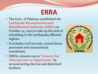
- 20. ERRA  The Govt. of Pakistan established the Earthquake Reconstruction and Rehabilitation Authority (ERRA) on October 24, 2005 to take up the task of rebuilding in the earthquake affected regions.  It includes civil servants, armed forces personnel and international consultants.  ERRA’s mission was to “Convert this Adversity into an Opportunity” by reconstructing the lost and destroyed facilities.
- 21. NDMA ď‚— National Disaster Management Authority (NDMA), is the lead agency at the Federal level to deal with Disaster Management Activities. ď‚— In event of disaster, Government Ministries & Departments, Armed Forces, NGOs, work through and from NDMA to conduct one window operation.
- 22. 2011 Earthquake, Pakistan Magnitude 7.2 Date/Time Friday, January 19, 2011 at 01:23 AM Location Dalbandin, Balochistan Depth 84 km (52 miles) 45 kilometers west of Dalbandin in Distance Balochistan. Source: www. earthquake.usgs.gov
- 23. 2005 vs 2011 Earthquake ď‚— 2005 Earthquake was Disaster while 2011 Earthquake was Hazard. ď‚— 2005- Magnitude 7.8 & Densely populated areas. ď‚— 2011- Magnitude 7.2 but Sparsely populated areas. ď‚— 2005- 80 000+ people died. ď‚— 2011- No major loss. ď‚— HAZARD can become DISASTER, if earthquake comes in Densely populated areas or near Coastal Areas.
- 24. Constraints ď‚— Lack of latest equipments. ď‚— Lack of funding from Govt. ď‚— Lack of implementation of Seismic Building Codes. ď‚— Lack of public awareness. ď‚— Lack of training programs and workshops. ď‚— Poverty
- 25. Thank You !