2009 Moorhead Fargo Flood
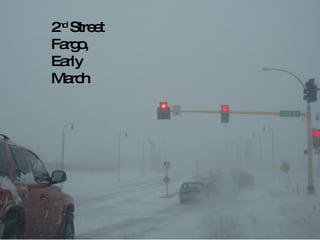
- 1. 2 nd Street Fargo, Early March
- 2. Downtown Moorhead, Early March
- 6. The other side of the dike on Rivershore
- 10. 7 th ave. and Elm street in Moorhead.
- 11. AT least 2 feet deep here.
- 12. Looking north across Woodlawn from 2 nd street.
- 13. Most signs just told the authorities that the house was vacant and the utilities were shut off.
- 14. Elm street at 7 th and 8 th ave. in Moorhead.
- 15. Ėý
- 16. Ėý
- 17. 4 th street entrance to Woodlawn, looking westerly.
- 18. Ėý
- 19. Ėý
- 20. Ėý


