GIS Example Map for Geography Students
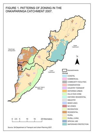
- 1. FIGURE 1. PATTERNS OF ZONING IN THE ONKAPARINGA CATCHMENT 2007. Upper Catchment Noarlunga Embayment ? Lower Catchment Subcatchments Zoning COASTAL COMMERCIAL COMMUNITY FACILITIES CONSERVATION McLaren Vale & Willunga COUNTRY TOWNSHIP DEFERRED URBAN HILLS FACE ZONE HISTORIC RESIDENTIAL INDUSTRY MIXED USES NO ZONES RECREATION RESIDENTIAL RURAL 0 2.5 5 10 15 20 Kilometers RURAL LIVING SPECIAL USE WATERSHED PROTECTION Source: SA Department of Transport and Urban Planning 2007.

