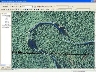
Wild and Scenic River Outstandingly Remarkable Value Identification and Assessment using Georeferenced Videomapping - Paul Ayers
- 1. Wild and Scenic River (WSR) Outstandingly Remarkable Value (ORV) Identification and Assessment using Georeferenced Videomapping Paul Ayers Biosystems Engineering University of Tennessee (Multiple UT and NPS cooperators)
- 2. Presentation Objectives • Use canoe and kayak-mounted above and underwater videomapping system to acquire georeferenced river attributes for ORV mapping and monitoring • Develop ORV and river habitat maps for WSR systems (Wekiva, Obed, Loxahatchee case studies) • Examples of defining and quantifying ORV • Determine optimum habitat locations for native and endangered aquatic species • Determine endangered and native fish population distribution using georeferenced snorkel video • Virtual tour opportunities
- 4. Outstandingly Remarkable Values for Wekiva WSR (NPS and Wekiva River System Advisory Management Committee) • Wild – remote, primitive, solitude, lack of human presence/detection, natural, habitat, native fish • Scenic – exemplary visual features and/or attractions, limited negative intrusions • Recreational – access, sightseeing, campsites, fishing, boating
- 5. Mapping Outstandingly Remarkable Values on the Wild and Scenic Wekiva River using Georeferenced Video
- 6. Wildness - Human Presence • Houses, docks, signs, trash, roads, bridges, invasive species
- 7. Scenery • Wildlife, plants, rock formations • Water clarity • No turbidity, algae
- 9. Wildness (lack of human presence) How to quantify and map?
- 10. Wildness ORV mapping - Human Presence
- 11. Site-specific ORV locations (monitor new dockages)
- 12. Site-specific ORV locations Can also map ―Scenic‖ and ―Recreational‖ ORV attributes
- 14. Obed Wild and Scenic River (NPS) • 45 miles (43 mile Wild) • Concerned about rare and endangered fish and mussel species • Develop landscape-scale river habitat maps for rare and endangered aquatic species
- 16. GPS-Instrumented Kayak Acquires Georeferenced above and below water video and depth sonar
- 18. Geo-referenced Image Recording DA Audio Convertor Audio output (GPS output) Audio Input (GPS input) Rear Front GPS Video input Video Camera Digital Video Recorder - DVR GPS NMEA Data (ASCII)
- 20. Georeferenced Above Water Image
- 21. GIS Attributes Defined • GPS Position (sinuosity) • Thalweg Depth (rugosity) • Substrate • River Characteristic (pool, riffle, run) • Embeddedness • River Width • Streambank Bank, Vegetation and Cover
- 23. Canoeing with Drop-down Camera
- 27. Modified Wentworth Scale Substrate Description Bedrock Unbroken Rock Surface Fines/Sand Particles < 0.25 cm (0.1 inch) Small Gravel Rocks 0.25—1.0 cm (0.1—0.4 inch) Large Gravel Rocks 1.0—10 cm (0.4—4 inch) Cobble Rocks 10—30 cm (4—12 inch) Small Boulder Rocks 30—60 cm (12—24 inch) Large Boulder Rocks > 60 cm (24 inch)
- 28. Sand Small Gravel Cobble Small Boulder Large Boulder Bedrock Some Substrate Types
- 29. Embeddedness EPA RBP 3 50-75% surrounded by fine sediment. EPA RBP 1 < 25% surrounded by fine sediment.
- 30. River Depth 0 5 10 15 20 25 30 35 40 1 115 229 343 457 571 685 799 913 1027 1141 1255 1369 1483 1597 1711 1825 1939 2053 2167 2281 2395 2509 2623 Distance Depth(ft)
- 31. Sonar Depth Map
- 33. Obed Wild and Scenic River
- 34. Obed’s ORV
- 35. GPS-based Snorkelmapping System Video Mask and Garmin 60csx GPS Receiver
- 40. GIS of Snorkel Survey Native Fish Population Survey
- 41. Interactive ArcGIS Virtual Tour
- 42. Virtual Tour – Zoom to desired reach
- 51. Kayak-based Videomapping for Identification and Assessment of Wild and Scenic River ORV (Conclusions) • Site-specific ―wild‖, ―scenic‖ and ―recreational‖ attributes can be identified, quantified and incorporated into a GIS • Case studies at Wekiva, Obed, Loxahatchee WSR • 10-15 miles of river reach can be mapped per day • Provides virtual video access opportunities • Georeferenced video to provide historical reference (baseline) which can be used to monitor and maintain ORV from time of designation
- 52. Questions Paul Ayers, University of Tennessee, ayers@utk.edu


