
biustnewsletter_Issue1_2016) Basuti
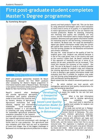
- 1. 30 31 Academic Research First post-graduate student completes MasterŌĆÖs Degree programme By Itumeleng Mangole Basuti Bolo Gerty Mathangwane BIUST post-graduate sponsorship recipient Ms Basuti Mathangwane, became the first BIUST graduate after completing her MasterŌƤs Degree programme in Information Systems under a Research Topic: ŌĆ×Developing a Geo-spatial Information based Land Quality Evaluation Model for Rain fed Farming in BotswanaŌƤ. poverty and food products import bill. This can be done by using advanced technologies used in land evaluation to match land in terms of its quality. It is expected that to match agricultural land with its use can improve and increase production. Models for assessing, evaluating and matching land quality and suitability are very scarce, and the information used is mostly analogue and outdated. Botswana lacks geo-spatial information models for evaluating land for rain-fed farming. Commenting on her research, Ms Basuti said her study has developed a digital geo spatial information model using the current geo spatial data systems for evaluating land quality for rain-fed farming suitable for the Botswana environment and climatic conditions. She says the study focused on the quality of land for sorghum grain crop. Sorghum was selected because it is one of the crops grown most in the country and used as the countryŌƤs staple food. Ms Basuti contends that if this approach of matching land use in terms of its quality can be used, production can be increased. ŌĆ£This could also improve the economy of the countryŌĆØ. She said. The aim of Ms BasutiŌƤs study is to identify possible land parcels suitable for sorghum crops and comparing the existing agricultural land use and their suitability. It aims to develop a geo spatial information model that evaluates land that is suitable for sorghum crop under rain fed farming using Geographical Information System (GIS) and Remote Sensing approachŌĆØ. Basuti stated that the research answered questions such as; ŌĆó By which method can land parcels with homogenous agricultural land quality characteristics for rain-fed farming be identified? ŌĆó What are the suitable evaluation criteria BasutiŌƤs research when developed will provide agricultural geo-spatial information land quality evaluation model at local level that could be used by farmers, Ministry of Agriculture, ŌĆ£Developing a Geospatial Information to assess the model for the rain fed land quality? ŌĆó What is the best information system used to develop agricultural land suitability map? Agricultural Institutions and other national, regional and international stakeholder. ŌĆ£Land evaluation and suitability analysis is a pre-requisite to achieving and using available land based Land Quality Evaluation Model for Rain fed Farming ŌĆó How much land is identified as quality land suitable for sorghum rain fed farming? The study was carried out in Palapye and Serowe Agricultural Districts, in the for sustainable agricultural production. The evaluation presented in this research involves multi-criteria of land characteristics in BotswanaŌĆØ Central District of Botswana. The area covers nineteen agricultural extension areas. The area is approximately 1090 000 for a specific agricultural land use. Botswana is a semi-arid environment with shortage of fertile land for crop production. The agricultural land also competes with other land use such as expansions of towns and villages. One of the biggest challenges in Botswana is to increase agricultural production to reduce hectares covered with different soil types and texture. The soil fertility ranges from shallow to very fertile soils, and the texture varies from fine to coarse textured soils. The vegetation is mophane and acacia species. Sorghum is the most grain crop grown followed by maize and millet. Other crops grown are melons, pulses, beans etc. The land use of the area is agriculture
- 2. 30 31 Academic Research and distribution of villages. GIS and Remote Sensing are the new tools available for land evaluation and for agricultural land resources planning and management via Information and Communication Technology (ICT). The land evaluation is based on the four main factors namely: biophysical, socio- economic, climate and crop constraints. The 1999 TAHAL Group general guidelines for soil suitability of Botswana, spatial data and information were used for assessing the suitability. The 1981 Sims crop requirements parameters for Botswana agro- climatological information were also used. The Remote Sensing data; soil moisture and rainfall estimate satellite images with 1km resolution were used to show the status of soil moisture and rainfall of the study. The existing land use was generated by interpreting 1: 80 000 scale ortho-photographs and fieldwork survey geographic coordinates or data picked by Global Positioning System (GPS) during the survey. The analysis aimed at producing a map that is suitable for sorghum. The data was analyzed using ARCGIS 10.2 software. In this study, fuzzy modeling integrated with GIS computer assisted overlay mapping method was applied to combine the information from several criteria to form a single suitability map. The results showed the land parcels that is suitable, marginal suitable and non- suitable for sorghum. The land identified as the suitable land is 368 366 ha (34%) of the area of the study area, marginal suitable 388 035 ha (36%), non-suitable 299 831 ha (28%) and areas without data 26 398 (2%). The suitability map was overlaid with the existing land use to identify areas that are ploughed for sorghum that are on suitable areas. The results showed that the present land that is used for sorghum and are on suitable land is 64 704 ha (18%) of the total suitable land. That scenario suggests that 82% of land that is suitable for sorghum is not in use. The marginal suitable land is 42 530 ha (11%) of the marginal land, non-suitable 16 262 ha (5%) of the non-suitable land and areas with no data 14 423ha (54%) of the land with no data. Basuti who intends to continue with PhD focusing on Precision Farming using Drones, under a new research to make correlation analysis between crop yield and land terrain profile using multispectral satellite imagery and produce comprehensive reports on traditional farming, joined BIUST on July 2014 after being offered the scholarship and a Teaching Assistant job tutoring under graduate students on Geographical Information Systems (GIS) and Introduction to Computing and Information Technology. She joined BIUST to further her studies after working as Head of the GIS Unit under the Ministry of Agriculture for some time. She worked on attachment as a GIS Consultant at Southern African Development Community (SADC) / European Union (EU) Land and Water Management Systems Portal and in Demography, Central Statistical Office of Botswana. Basuti also worked as a GIS Expert for a period of six months at the Natural Resources Institute (NRI), University of Greenwich in UK, working on Models of quelea birdsŌƤ movements and improved control strategies project. She holds a Post-Graduate Diploma in Space and Atmospheric Science, with the United Nations- African Regional Centre for Space Science and Technology Education in English (ARCSSTEE), based on Obafemi Awolowo University, Nigeria. A Certificate in International Development Studies for NGO with Capacity Africa Institute(Nairobi, Kenya); Technician Certificate in Remote Sensing and Cartography; and Certificate in Agriculture with Botswana College of Agriculture. Vision & MISSION Vision: The vision is to be premier research-based university of science, engineering & technology internationally recognised for the quality and excellence of its teaching and learning; research and innovation and engagement. Mission: Produce world class research and innovation in science, engineering and technology contributing to industry growth, development & advancement of a diversified knowedge-based economy. Produce tomorrowŌĆÖs leaders in industry and society through the provision of relevant, innovative, quality research intensive education of an international standard. Promote community, national, regional and international development through the transfer of the UniversityŌĆÖs knowledge and the provision of its skills and expertise. Core Values: Equality and Diversity ; Sincerity and Trust; Innovation; High performance and Quality; Quest for knowledge and understanding Strategic Themes: Academic Quality and Student Reputation; Research and Innovation Excellence; Engagement for Development; High Performance driven by cutting-edge Institutional Capabilities Private Bag 16 Palapye, Botswana Tel: 267 4900102 Fax: 267 4900117 www.biust.ac.bw BIUST | Driving Change