Book of Derbys Irish Estate 1824
0 likes194 views

The document describes a book of maps from 1824 depicting the Earl of Derby's landed estate in Ballykisteen, Limerick-Junction, Ireland. The estate consisted of 20 maps showing the fields, roads, buildings and tenants of the various townlands. Each field number, acreage and land use. A table provided details of tenant farmers' names and fields. The estate was later owned by the O'Brien O'Connor family in 1873 before being sold. The maps provide a record of landed estates and tenant farming in Ireland during this time period.

Book of Derbys Irish Estate 1824
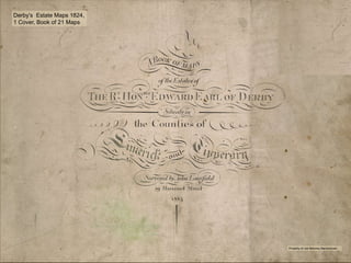
- 1. 1 Derby’s Estate Maps 1824, 1 Cover, Book of 21 Maps Property of Joe Moloney Barronstown
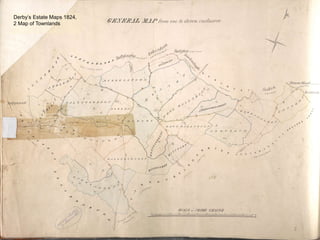
- 2. 2 Derby’s Estate Maps 1824, 2 Map of Townlands
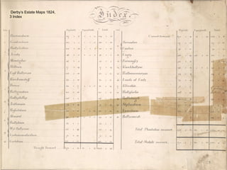
- 3. 3 Derby’s Estate Maps 1824, 3 Index
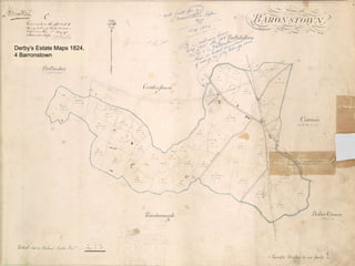
- 4. 4 Derby’s Estate Maps 1824, 4 Barronstown
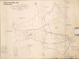
- 5. 5 Derby’s Estate Maps 1824, 5 Goatenstown
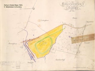
- 6. 6 Derby’s Estate Maps 1824, 6 Ballykisteen & Acroboy
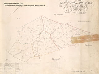
- 7. 7 Derby’s Estate Maps 1824, 7 Monetogher, Milltown, East Ballyryan & Knockaneduff
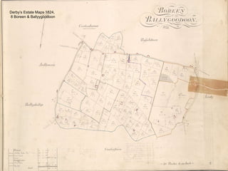
- 8. 8 Derby’s Estate Maps 1824, 8 Boreen & Ballyygoodoon
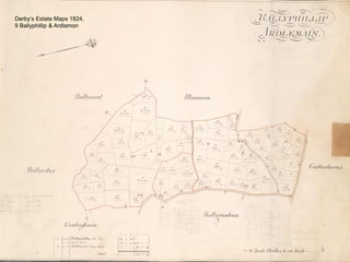
- 9. 9 Derby’s Estate Maps 1824, 9 Ballyphillip & Ardlamon
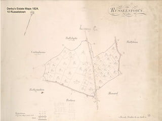
- 10. 10 Derby’s Estate Maps 1824, 10 Russelstown
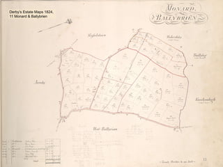
- 11. 11 Derby’s Estate Maps 1824, 11 Monard & Ballybrien
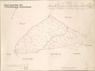
- 12. 12 Derby’s Estate Maps 1824, 12 West Ballyryan & Lisheenamalause
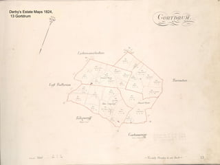
- 13. 13 Derby’s Estate Maps 1824, 13 Gortdrum
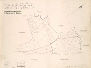
- 14. 14 Derby’s Estate Maps 1824, 14 Barnanlleen & Cauteen
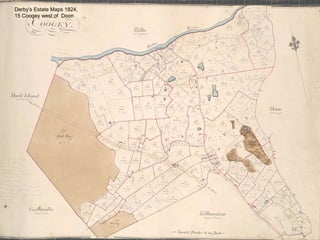
- 15. 15 Derby’s Estate Maps 1824, 15 Coogey west of Doon
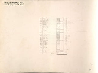
- 16. 16 Derby’s Estate Maps 1824, 15a Coogey west of Doon
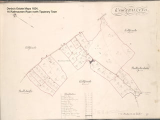
- 17. 17 Derby’s Estate Maps 1824, 16 Rathnaveen-Ryan north Tipperary Town
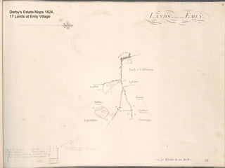
- 18. 18 Derby’s Estate Maps 1824, 17 Lands at Emly Village
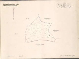
- 19. 19 Derby’s Estate Maps 1824, 18 Farranasa near Emly
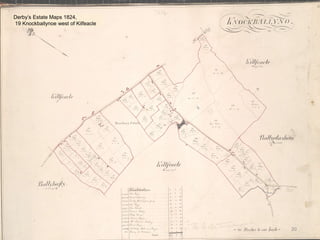
- 20. 20 Derby’s Estate Maps 1824, 19 Knockballynoe west of Kilfeacle
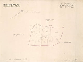
- 21. 21 Derby’s Estate Maps 1824, 20 Kilscobin East of Cashel
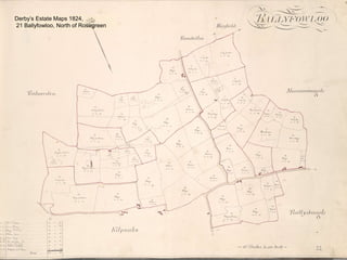
- 22. 22 Derby’s Estate Maps 1824, 21 Ballyfowloo, North of Rosegreen
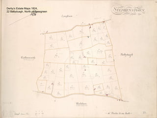
- 23. 23 Derby’s Estate Maps 1824, 22 Ballyduagh, North of Rosegreen
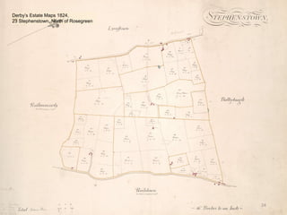
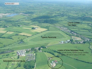
- 24. 24 Derby’s Estate Maps 1824, 23 Stephenstown, North of Rosegreen
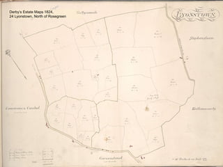
- 25. 25 Derby’s Estate Maps 1824, 24 Lyonstown, North of Rosegreen
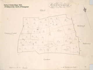
- 26. 26 Derby’s Estate Maps 1824, 25 Ballycomisk, North of Rosegreen
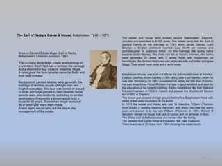
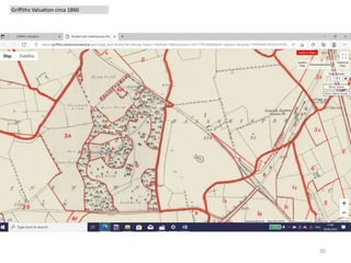
- 27. Book of Landed Estate Maps. Earl of Derby, Ballykisteen, Limerick-Junction. 1824. The 20 maps show fields, roads and buildings in a townland. Each field has a number, the acreage and a description e.g. pasture, meadow, tillage. A table gives the farm tenants name his fields and their total acreage. Background. Landed estates were generally the holdings of families usually of Anglo-Irish and English extraction. The land was rented or leased in small and large parcels to farm tenants. Some tenants were also landlords, subletting to smaller landholders. Frequently a tenant would hold a lease for 21 years. Sometimes longer leases of 99 or even 999 years were made. A land agent would carry out the day to day management of the estate. 27 The Earl of Derby’s Estate & House, Ballykisteen 1748 – 1873 The estate and house were located around Ballykisteen, Limerick- Junction and extended to 6,100 acres. The estate came into the Earl of Derby’s Family on the marriage in 1747 when James Stanley, Lord Strange a English aristocrat married Lucy Smith an heiress and granddaughter of Erasmus Smith. On the marriage the family name became Smith-Stanley. The land was let to Tenant Farmers, the farms were generally 20 areas with 2 acres fields with hedgerows as boundaries, the farmers had cows and produced milk and butter and grew tillage. They would have hens and a work horse. Ballykisteen House, was built in 1825 as the first marital home of the Hon. Edward Geoffrey Smith-Stanley (1799-1869), later Lord Stanley (when he was Irish Secretary), In 1851 succeeded his father as 14th Earl of Derby. He was three-times Prime Minister. He was a good landlord and paid for the education of his tenants’ children. Derby established the Irish National Education system in 1832 in Ireland and passed the Abolition of Slavery Act in1833 in England. The house was located on high ground behind the Ballykisteen Hotel with views of the Galty mountains to the south. In 1873 the estate and house was sold to Valentine O'Brien O'Connor from Dublin a wealthy tobacco merchant with ships. He died the same year and passed it to his son William O'Connor. In 1911, Robert B Heuston owned the house that had 20 rooms and 18 windows in front. The Derby and Oaks horseraces are named after the family. The present Lord Derby home is Knowsley Hall, near Liverpool. There is a book of 20 maps from 1824 showing the estate lands.
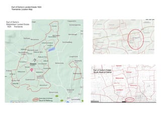
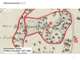
- 28. Earl of Derby’s Landed Estate 1824 Townlands Location Map
- 29. 29 By Drone 2017
- 30. 30 Griffiths Valuation circa 1860
- 31. 31 Griffiths Valuation circa 1860
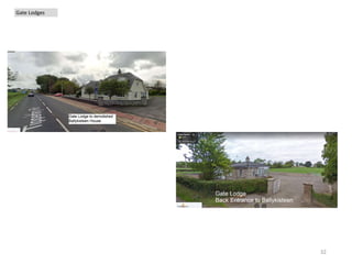
- 32. 32 Gate Lodges
- 33. •End 33