Brochura da visita a portugal
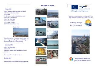
- 1. WELCOME TO ░┐│ó▒ß├ā░┐ Friday, 26th 10:00 - Meeting to discuss the Project - all teachers 12:00 - Concert by school children 13:30 - Lunch 15: 00 - Boat trip to Ilha do Farol (Lighthouse island) 16:00 - Visit to the lighthouse COMENIUS PROJECT LIVING BY THE SEA 17:00 - Tour of the island 18.15 ŌĆō Return to Olh├Żo 19:15 - Dinner at school 2nd Meeting ŌĆō Portugal 22:00 - Informal socialising in town 24th ŌĆō 27th March 2010 Ilha do Farol A small hamlet with a long beach offering peace and quiet in large doses. The lighthouse is 52m high and the view from the top is pretty amazing. Saturday, 27th Organiza├¦├Żo 10:00 - Visit of the town 13:00 - Lunch Free time for shopping and/or sightseeing in Faro in the afternoon Visitors from Denmark and Iceland leave Sunday, 28th AGRUPAMENTO DE ESCOLAS Departure of the French, Greek, Irish and Latvian groups JOS├ē CARLOS DA MAIA, ░┐│ó▒ß├ā░┐
- 2. ░┐│ó▒ß├ā░┐ Thursday, 25th PROGRAMME 09:00 ŌĆō 19:00 - Bus trip to several cultural and historic The town of Olh├Żo is Wednesday, 24th sites essentially and historically linked to the local fishing 10:00 - Oficial welcoming SILVES The origin of this industry and only grew into town traces back to some 11:00 - Coffee break 1.000 BC and it was already a existence in the 17th 11:30 - Tour of school and school grounds notable place in Roman times. Century. It has about 12:00 - Teachers visit classes that have adopted their During the Moorish occupa- 30,000 inhabitants and was raised to the status of a tion in the early 11th Century countries it was given the name of town after 17 local fishermen successfully crossed the 12: 00 - Lunch (students) Xelb. It became the cultural Atlantic Ocean in 1808 in the fishing boat ŌĆ£Bom centre of learning for the whole Iberian Peninsula under the 12:45 - Portuguese lesson (teachers) SucessoŌĆØ without charts, Their mantle of Cordoba in Spain. In 1189 it had already 15.000 12:45 - Students depart to Braveland inhabitants, when the city was sacked by the Knights of San- purpose was to announce to 13.30 ŌĆō Lunch (teachers) tiago with support of Anglo-Norman crusaders. The impor- the exiled King of Portugal, tance of Silves continued under the control of the Portugue- 14:15 - Meeting to discuss the project - two teachers Dom Jo├Żo IV, that the French se kings until the 15th Century, when its commerce began from each country; free time for the others to shrink due to the sitting-up of the Rio Arcade, Silves invading armies had been 15:30 - Coffee break access to the sea. defeated and had returned to 16:00 - 17:00 - Meeting France leaving Portugal free for the King to return. SAGRES The village of Sagres is situated on Europe's 18:00 - Departure from Braveland (French and Portu- It was in this town in 1882 that the first canning factory guese students arrive at school; Danish and Greek stu- most south-western corner near Cabo de S├Żo Vicente. for tuna and sardines was established. Very soon dents go to the hotel) canning factories spread along the coast and it became Due to its position on the southern side of the leading industry of the Algarve. the cape, Sagres is well Architecturally the town is protected against the well known for an older rough Atlantic Ocean quarter where the flat and strong westerly terraced roofs and straight winds. It was this exposed location that made Sagres the box-shaped chimneys show Braveland Adven- starting point of numerous expeditions during past centu- a definite Moorish touch. ture Park ries. The age of the Portuguese Discoveries began back in the 15th century, initiated by Henry the Navigator. The For- taleza de Sagres (Fortress of Sagres), located south-west of Sagres on a small headland about 1 km in length, is a monu- ment of national importance. After passing through the thick The fish and the vegetable tunnel entrance, one sees a giant pebble circle , detected markets in long building on only in 1921, of unknown age and purpose. The circle with a the waterfront are a diameter of 43m is interpreted as a compass rose (Rosa dos "must" to visitors. The Ventos). Normally compass roses are divided into 32 seg- http://www.brave-land.com/ walls inside are covered in ments, but strangely this one has 40 segments, so it could hand painted tiles. also have been a sundial. Most likely it dates back to the time of Henry the Navigator.


