CASFM 2009 Presentation On Stream Stability
Download as pps, pdf0 likes235 views
The document summarizes a revised methodology used by the Town of Castle Rock to determine long-term stable channel slopes in a more optimized way than traditional approaches. It involved analyzing reaches separately based on soil type, vegetation, and hydraulics to determine customized stable slopes. Case studies found this approach reduced required drop structures and resulted in estimated cost savings of $1.65 million compared to traditional uniform slope analyses. The town prioritizes improvements based on field observations and analysis to stabilize streams in phases, with estimated savings of implementing only higher priority projects.
1 of 25
Download to read offline
Ad
Recommended
Dannenbaum Engineering - River Update 9-19-2015
Dannenbaum Engineering - River Update 9-19-2015law138
╠²
The San Bernard River Project aims to develop an ecosystem restoration plan funded by a Restore Act grant, focusing on dredging historical channels and evaluating structure solutions to prevent siltation. Six management alternatives and various channel configurations are being studied, with options for jetties and dredging to enhance river flow and address sediment issues. Recommendations highlight a preference for double jetties and specific dredging approaches, alongside considerations for construction costs and maintenance requirements.New Ballast Technology Regulations
New Ballast Technology RegulationsHealthy Lakes, Healthy Lives
╠²
The document outlines the regulatory regime for ballast water discharge in the Great Lakes, led by the EPA and USCG, incorporating new technology standards and ensuring enforceability. It highlights the effectiveness of the current inspection program in preventing nonindigenous species introduction, and notes that while challenges remain, best practices are being enforced. Ultimately, effective ballast water treatment systems are anticipated to take years to establish in the Great Lakes region.bbwstormwaterbasinstechnicalanalysis
bbwstormwaterbasinstechnicalanalysisRegina Majercak, PE
╠²
This report summarizes a study of 125 stormwater basins in the Barnegat Bay Watershed that are owned by the New Jersey Department of Transportation, New Jersey Transit, and the New Jersey Turnpike Authority. The basins were inventoried, assessed, and classified according to type. Four general types were identified: constructed wetland basins, extended detention basins, infiltration basins, and wet pond basins. Each basin's condition was evaluated to determine needed repairs. The report provides detailed tables and maps of the basin locations and findings. Recommendations will be provided to the Governor and Legislature regarding priority repairs and estimated costs.SLIPP Water Quality Results 2011 for SLIPP WQ PAC Workshop 12-April-2012
SLIPP Water Quality Results 2011 for SLIPP WQ PAC Workshop 12-April-2012Erin Vieira
╠²
The document summarizes the results of the 2011 water quality monitoring program in the Shuswap Lake watershed. It describes how multiple agencies previously monitored water quality independently, but have now coordinated efforts under a new program called SLIPP. The monitoring objectives included examining nutrient conditions throughout the watershed and factors influencing algae blooms. Results showed slightly increased organic nitrogen and phosphorus levels compared to historical data, with the largest tributaries contributing higher nutrient loads. The program coordinated efforts and improved data sharing across agencies.Sustainable Groundwater Management Act (SGMA) | Enrique Lopezcalva, RMC Water...
Sustainable Groundwater Management Act (SGMA) | Enrique Lopezcalva, RMC Water...American Society of Civil Engineers, Orange County Branch
╠²
The Sustainable Groundwater Management Act (SGMA) aims to improve groundwater management in California, addressing the state's inability to meet ecological and human needs amid climate challenges and population growth. It involves the formation of Groundwater Sustainability Agencies (GSAs) and the development of Groundwater Sustainability Plans (GSPs) to promote sustainable management by 2040 in critical basins and by 2042 in non-critical basins. Funding opportunities, including Proposition 1, are available to support the implementation of these plans and address significant challenges in achieving groundwater sustainability.Maryland Dept. of Environment ║▌║▌▀Ż Deck for Marcellus Shale Public Meeting
Maryland Dept. of Environment ║▌║▌▀Ż Deck for Marcellus Shale Public MeetingMarcellus Drilling News
╠²
The Marcellus Shale public meeting on June 27, 2016, provided updates on the proposed oil and gas regulations, emphasizing the need for regulations to be adopted by October 1, 2016, with effective implementations starting October 1, 2017. Key components include maintaining protective measures for well construction, air emissions, and public health while allowing for responsible natural gas development in Maryland. Public participation was encouraged through comments on issue papers and future opportunities for formal public comment after regulations are proposed.Goa
Goahydrologywebsite1
╠²
The document summarizes the Hydrology Project-II implemented in Goa between 2006-2014 with funding from the World Bank. The key aspects include:
- Establishment of 11 river gauge stations, 4 automatic weather stations, and 6 automatic rain gauge stations to improve surface water and hydro-meteorological data collection.
- Installation of 47 open wells and 57 piezometers to monitor groundwater levels across 9 river basins in Goa.
- Construction of a new data center and level II+ laboratory to store, analyze and disseminate hydrological data to support water resource management and planning.
- Capacity building initiatives including training of over 200 local staff on hydrological monitoring and data management.Policy Context and Sustainable Drainage Issues and Application - Paul Stewart...
Policy Context and Sustainable Drainage Issues and Application - Paul Stewart...the Environment Centre (tEC)
╠²
This document provides an overview of sustainable drainage systems (SuDS) presented by Paul Stewart. It defines SuDS, outlines their key benefits and design principles, and discusses the timeline of relevant publications and events that have shaped their use in the UK. It also summarizes the Flood and Water Management Act and its establishment of SuDS Approval Bodies to oversee drainage systems, addressing prior issues around responsibility and adoption.Panola County GCD DFC Evaluations
Panola County GCD DFC EvaluationsTexas Alliance of Groundwater Districts
╠²
This document discusses the Panola County Groundwater Conservation District's (PCGCD) evaluation of desired future conditions (DFCs) and managed available groundwater (MAG) for the Carrizo-Wilcox and Queen City aquifers. It presents an analytical well impacts tool to evaluate impacts of existing and new wells. It also summarizes results from a modeling study comparing DFC scenarios to a baseline that removes Panola County pumping from the groundwater availability model, finding increased horizontal but decreased vertical drawdowns when accounting for the aquifers' confined properties. The goal is to adopt a meaningful, achievable DFC that realistically estimates the MAG.Na wai eha order 4 17-14
Na wai eha order 4 17-14Honolulu Civil Beat
╠²
The Commission on Water Resource Management approved a mediated agreement between parties involved in a contested case hearing regarding water permits and instream flow standards for streams in Maui. The agreement restored water flows to 'lao Stream and Waikapu Stream, and increased the amount of water HC&S must pump from wells as an alternative source. This resolved issues remanded by the Hawaii Supreme Court pertaining to current and proposed stream flows, the status of HC&S lands and wells, and water needs of various users.1.43.3.1 2009-hartland-landfill-groundwater-surface-water-and-leachate-monito...
1.43.3.1 2009-hartland-landfill-groundwater-surface-water-and-leachate-monito...Adrian Frantescu
╠²
The report summarizes groundwater, surface water, and leachate monitoring data collected between April 2009 and March 2010 at the Hartland landfill and surrounding area. Key findings include: (1) Groundwater flow patterns were consistent with previous years, with some northward and southeastward flow captured by purge wells. (2) Groundwater quality showed contained leachate impacts. (3) Elevated parameters near the Hartland North Pad indicated ongoing impacts from historical composting and current aggregate stockpiling. Water quality is closely monitored.8. Flow and Form
8. Flow and FormEnvironmental Protection Agency, Ireland
╠²
The document outlines the process and methodologies for integrated catchment management (ICM), emphasizing the importance of river flow and form in understanding and managing ecosystems. It discusses data availability from gauging stations in Ireland and the significance of hydrometric information for assessing river conditions and planning management strategies. Key points include the need for partnerships in creating a comprehensive ICM vision, characterizing the catchment, and implementing a river basin management plan while tracking progress and adjusting as necessary.DSD-INT 2020 Forecasting the Mississippi River During Hurricane Season
DSD-INT 2020 Forecasting the Mississippi River During Hurricane SeasonDeltares
╠²
The document outlines strategies for forecasting the Mississippi River during hurricane season, detailing regulatory measures and flood control operations managed by various agencies. It emphasizes the importance of coordinated efforts in managing dams and the operational triggers for key structures like the Morganza and Bonnet Carre spillways. Additionally, it highlights the impact of hurricane surges, the need for advance preparedness, and modeling techniques used to assess potential flood scenarios.Permitting and Hydraulic Fracturing, Leslie Savage
Permitting and Hydraulic Fracturing, Leslie SavageTXGroundwaterSummit
╠²
The document discusses regulations in Texas around unconventional oil and gas development. It provides an overview of oil and gas production statistics in Texas, as well as issues related to development like water usage, air emissions, and waste management. It outlines the jurisdiction of the Railroad Commission of Texas regarding permitting and regulations for well drilling, completions including hydraulic fracturing, pipelines, and waste disposal. The presentation discusses recent rule changes around chemical disclosure, casing and cementing requirements, and rules regarding disposal and recycling of hydraulic fracturing wastewater.Solutions for Compensatory Mitigation in the Mining Industry And Challenges o...
Solutions for Compensatory Mitigation in the Mining Industry And Challenges o...Ray Ewing
╠²
The document discusses solutions for compensatory mitigation in the mining industry, focusing on a West Virginia coal company's challenges in fulfilling its historic liabilities under water quality regulations. A conversion methodology from stream habitat units (SHU) to stream and wetland valuation metric (SWVM) was developed and approved by regulatory agencies, enabling the company to meet its mitigation obligations effectively. This new approach sets a precedent for future projects, addressing issues related to historical impact assessments and stream restoration stability.Mwrra.regulation.pptx
Mwrra.regulation.pptxMaharashtra Water Resources Regulatory Authority
╠²
The document discusses water resource management in Maharashtra. It outlines the mandate of the Maharashtra Water Resources Regulatory Authority (MWRRA) which includes determining bulk water tariffs, entitlement criteria, equitable water distribution, and acting as the state groundwater regulatory authority. The MWRRA regulates water usage for irrigation, domestic, and industrial purposes. It has implemented an entitlement program across 256 projects and 1,368 water user associations. The MWRRA also works to preserve water quality, promote conservation, and resolve disputes. Moving forward, key challenges include preparing an integrated state water plan, converting irrigation agencies to river basin agencies, and controlling pollution while ensuring sufficient non-irrigation supply.Water Talks: New Challenges, New Supplies
Water Talks: New Challenges, New SuppliesSan Diego County Water Authority
╠²
The document presents an overview of San Diego's water supply sources, highlighting the reliance on imports, local conservation efforts, and challenges posed by regulatory restrictions, drought, and climate change. It outlines the contributions of various water sources, including groundwater and seawater desalination, in response to increasing demand. The presentation underscores the impact of environmental factors and the trend in water availability from 1991 to 2011.9 greg mc carty-svi_choptank
9 greg mc carty-svi_choptankSoil and Water Conservation Society
╠²
This document aims to validate the Soil Vulnerability Index (SVI) for identifying Critical Source Areas (CSAs) of pollution in two watersheds in the Chesapeake Bay region. The SVI ranks soil vulnerability based on characteristics like drainage and slope. It was applied to the Tuckahoe Creek Watershed and Greensboro Watershed, which have different soil types. Hydrologic modeling outputs from SWAT were used as a reference to validate the accuracy of the SVI classifications in each watershed. The results suggest the SVI performs differently depending on landscape characteristics, so multiple approaches should be used to identify CSAs to inform conservation practices.The Use of Nutrient Credits in Virginia
The Use of Nutrient Credits in Virginia CleanH2O
╠²
Virginia established a nutrient trading program and watershed permit in 2005 to help meet Chesapeake Bay nutrient reduction goals cost effectively. The program allows point sources to purchase credits from other point sources or nonpoint nutrient reduction projects. A 2012 law expanded the program by establishing a framework for certifying and using credits from additional nonpoint source practices. Key aspects include establishing baselines, only allowing use of certified credits listed in a public registry, and requiring local water quality protections are not contravened. The program aims to facilitate cost-effective reductions while maintaining regulatory oversight and permanent water quality benefits.2004 02 Nhcrwa Speaker Notes
2004 02 Nhcrwa Speaker NotesSoutheast Chapter of Texas AWWA
╠²
The North Harris County Regional Water Authority was created by the state legislature to provide a long-term water supply for North Harris County. It presented an overview of its creation, regulatory requirements to reduce groundwater usage, plans to obtain surface water from Houston via contracts, and its Groundwater Transfer Program to address short-term water needs while developing the regional water system. The Authority also discussed funding its initial projects through bond sales and water fees.Desired Future Condition (DFC) Presentation
Desired Future Condition (DFC) Presentationhtgcd
╠²
The document outlines the Cypress Creek Project and the Desired Future Conditions (DFC) process as established by the Texas legislature to manage groundwater resources effectively. It discusses the hydrogeology of the region, the approvals for DFCs in Groundwater Management Area (GMA) #9, and various strategies for implementing management practices to ensure sustainable groundwater use. Key challenges include balancing public interests, exempt well usage, and regulatory constraints while planning for future water needs in the context of drought and environmental health.Arkansas Oil and Gas Commission Update
Arkansas Oil and Gas Commission UpdateAIPRO
╠²
The document provides an update from the Arkansas Oil and Gas Commission Director at an annual meeting in October 2018. It summarizes natural gas production trends in Arkansas, including a decline in production from over 1 trillion cubic feet in 2014 to an estimated 640 billion cubic feet in 2018. It also lists the number of producing wells in the Fayetteville Shale from 2006 to 2016. Crude oil production trends from 2014 to 2018 are also noted. The document outlines recent and upcoming Commission activities, including proposed rules regarding gas storage, saltwater disposal well spacing and transfers, temporary well abandonment, and drilling pit requirements. It also summarizes an ADEQ regulation amendment related to saltwater disposal well permitting.GCD's - Joint and Regional Planning_Velma Danielson
GCD's - Joint and Regional Planning_Velma DanielsonTexas Alliance of Groundwater Districts
╠²
This document provides an overview of joint planning between Groundwater Conservation Districts (GCDs) and Groundwater Management Areas (GMAs), including:
- GCDs are required to jointly plan within GMAs to develop Desired Future Conditions (DFCs) for relevant aquifers.
- DFCs are quantitative descriptions of the desired condition of groundwater resources at future times.
- The joint planning process involves GCDs considering models/data to propose DFCs, which are adopted by GMAs and submitted to the Texas Water Development Board.
- The TWDB then provides Modeled Available Groundwater amounts based on the adopted DFCs to GCDs and regional planning groupsWhat it takes to manage Lake Okeechobee
What it takes to manage Lake OkeechobeeChristin Erazo
╠²
The US Army Corps of Engineers made a decision on February 12th to increase the flow of water from Lake Okeechobee to the Caloosahatchee River to 1,700 cubic feet per second and to the St. Lucie River to 500 cubic feet per second. This was an increase from their previous decision on January 15th to release 1,500 cfs and 300 cfs to the respective rivers. However, current guidelines call for releasing up to 3,000 cfs and 1,170 cfs. The document also includes charts and information on the water levels and management of Lake Okeechobee.Report on the dynamic ground water resources of Maharashtra (2008-2009)
Report on the dynamic ground water resources of Maharashtra (2008-2009)People's Archive of Rural India
╠²
This report summarizes the findings of the dynamic groundwater resources assessment of Maharashtra conducted for the year 2008-2009 by the Groundwater Surveys and Development Agency of Maharashtra in association with the Central Ground Water Board of India. The total rechargeable groundwater resources in Maharashtra are estimated to be 35.73 billion cubic meters, with a net availability of 33.81 billion cubic meters after accounting for domestic and industrial needs. Of this, 17 billion cubic meters are currently being withdrawn for various uses like irrigation, domestic, and industrial purposes. Compared to 2004, groundwater use has increased by 1.91 billion cubic meters. While there appears to be adequate remaining groundwater resources, much of it exists in areas that areMetz Lateral Conservation Project
Metz Lateral Conservation ProjectSoil and Water Conservation Society
╠²
This document summarizes a collaboration between 15 local, state, federal, non-profit, corporate, agriculture, and private partners to reconstruct a stream through the Metz Lateral Conservation Project. The partners worked together to benefit both agricultural production and conservation by implementing a two-stage ditch design that provides stable banks, minimal maintenance, increased capacity, and nutrient reduction while balancing increased initial costs and loss of tillable land. Communication between all involved parties was key to the ultimate success of the large-scale project.Aldergrove Aquifer Issues
Aldergrove Aquifer Issuesjgabateman
╠²
The document details a Phase 1 hydrogeological assessment for a proposed gravel extraction and aquaculture operation in Aldergrove, BC, commissioned to evaluate potential impacts on local groundwater resources. It identifies significant data gaps regarding the aquifer's depth, current groundwater levels, and potential risks to water sources, recommending further exploration and monitoring for effective impact assessment. The property is underlain by the vulnerable Abbotsford-Sumas aquifer, and without additional studies, the implications for local groundwater resources cannot be adequately determined.H063771
H063771Laian Silva
╠²
The document discusses U.S. shale gas resources and the challenges of developing them. It notes that shale gas reserves are conservatively estimated at 500-1000 trillion cubic feet and that hydraulic fracturing and horizontal drilling first made shale gas production economically viable. However, each shale play has unique characteristics that require tailored solutions. The document summarizes characteristics of major shale plays like the Barnett, Woodford, Haynesville, Bakken and Fayetteville and notes that best practices must evolve locally to address specific challenges in each play. Unconventional resources like shale gas require unconventional solutions to optimize production and costs.Brug alumni bedrijfskunde sessie | B2B marketing & sales | klantbrein ontrafe...
Brug alumni bedrijfskunde sessie | B2B marketing & sales | klantbrein ontrafe...Paul Hassels M├Čnning
╠²
Verkopen in zakelijke markten verandert razendsnel. De klant zit stevig in de ŌĆśdriverŌĆÖs seatŌĆÖ en heeft dankzij het internet, sociale media en mobiele technologie altijd en overal de beschikking over een overvloed aan informatie. Op 12 mei 2014 verkenden we met een groep van BRUG alumni en introduc├®s welke vragen (en antwoorden) dit oproept voor marketing en salesteams in B2B.More Related Content
What's hot (20)
Panola County GCD DFC Evaluations
Panola County GCD DFC EvaluationsTexas Alliance of Groundwater Districts
╠²
This document discusses the Panola County Groundwater Conservation District's (PCGCD) evaluation of desired future conditions (DFCs) and managed available groundwater (MAG) for the Carrizo-Wilcox and Queen City aquifers. It presents an analytical well impacts tool to evaluate impacts of existing and new wells. It also summarizes results from a modeling study comparing DFC scenarios to a baseline that removes Panola County pumping from the groundwater availability model, finding increased horizontal but decreased vertical drawdowns when accounting for the aquifers' confined properties. The goal is to adopt a meaningful, achievable DFC that realistically estimates the MAG.Na wai eha order 4 17-14
Na wai eha order 4 17-14Honolulu Civil Beat
╠²
The Commission on Water Resource Management approved a mediated agreement between parties involved in a contested case hearing regarding water permits and instream flow standards for streams in Maui. The agreement restored water flows to 'lao Stream and Waikapu Stream, and increased the amount of water HC&S must pump from wells as an alternative source. This resolved issues remanded by the Hawaii Supreme Court pertaining to current and proposed stream flows, the status of HC&S lands and wells, and water needs of various users.1.43.3.1 2009-hartland-landfill-groundwater-surface-water-and-leachate-monito...
1.43.3.1 2009-hartland-landfill-groundwater-surface-water-and-leachate-monito...Adrian Frantescu
╠²
The report summarizes groundwater, surface water, and leachate monitoring data collected between April 2009 and March 2010 at the Hartland landfill and surrounding area. Key findings include: (1) Groundwater flow patterns were consistent with previous years, with some northward and southeastward flow captured by purge wells. (2) Groundwater quality showed contained leachate impacts. (3) Elevated parameters near the Hartland North Pad indicated ongoing impacts from historical composting and current aggregate stockpiling. Water quality is closely monitored.8. Flow and Form
8. Flow and FormEnvironmental Protection Agency, Ireland
╠²
The document outlines the process and methodologies for integrated catchment management (ICM), emphasizing the importance of river flow and form in understanding and managing ecosystems. It discusses data availability from gauging stations in Ireland and the significance of hydrometric information for assessing river conditions and planning management strategies. Key points include the need for partnerships in creating a comprehensive ICM vision, characterizing the catchment, and implementing a river basin management plan while tracking progress and adjusting as necessary.DSD-INT 2020 Forecasting the Mississippi River During Hurricane Season
DSD-INT 2020 Forecasting the Mississippi River During Hurricane SeasonDeltares
╠²
The document outlines strategies for forecasting the Mississippi River during hurricane season, detailing regulatory measures and flood control operations managed by various agencies. It emphasizes the importance of coordinated efforts in managing dams and the operational triggers for key structures like the Morganza and Bonnet Carre spillways. Additionally, it highlights the impact of hurricane surges, the need for advance preparedness, and modeling techniques used to assess potential flood scenarios.Permitting and Hydraulic Fracturing, Leslie Savage
Permitting and Hydraulic Fracturing, Leslie SavageTXGroundwaterSummit
╠²
The document discusses regulations in Texas around unconventional oil and gas development. It provides an overview of oil and gas production statistics in Texas, as well as issues related to development like water usage, air emissions, and waste management. It outlines the jurisdiction of the Railroad Commission of Texas regarding permitting and regulations for well drilling, completions including hydraulic fracturing, pipelines, and waste disposal. The presentation discusses recent rule changes around chemical disclosure, casing and cementing requirements, and rules regarding disposal and recycling of hydraulic fracturing wastewater.Solutions for Compensatory Mitigation in the Mining Industry And Challenges o...
Solutions for Compensatory Mitigation in the Mining Industry And Challenges o...Ray Ewing
╠²
The document discusses solutions for compensatory mitigation in the mining industry, focusing on a West Virginia coal company's challenges in fulfilling its historic liabilities under water quality regulations. A conversion methodology from stream habitat units (SHU) to stream and wetland valuation metric (SWVM) was developed and approved by regulatory agencies, enabling the company to meet its mitigation obligations effectively. This new approach sets a precedent for future projects, addressing issues related to historical impact assessments and stream restoration stability.Mwrra.regulation.pptx
Mwrra.regulation.pptxMaharashtra Water Resources Regulatory Authority
╠²
The document discusses water resource management in Maharashtra. It outlines the mandate of the Maharashtra Water Resources Regulatory Authority (MWRRA) which includes determining bulk water tariffs, entitlement criteria, equitable water distribution, and acting as the state groundwater regulatory authority. The MWRRA regulates water usage for irrigation, domestic, and industrial purposes. It has implemented an entitlement program across 256 projects and 1,368 water user associations. The MWRRA also works to preserve water quality, promote conservation, and resolve disputes. Moving forward, key challenges include preparing an integrated state water plan, converting irrigation agencies to river basin agencies, and controlling pollution while ensuring sufficient non-irrigation supply.Water Talks: New Challenges, New Supplies
Water Talks: New Challenges, New SuppliesSan Diego County Water Authority
╠²
The document presents an overview of San Diego's water supply sources, highlighting the reliance on imports, local conservation efforts, and challenges posed by regulatory restrictions, drought, and climate change. It outlines the contributions of various water sources, including groundwater and seawater desalination, in response to increasing demand. The presentation underscores the impact of environmental factors and the trend in water availability from 1991 to 2011.9 greg mc carty-svi_choptank
9 greg mc carty-svi_choptankSoil and Water Conservation Society
╠²
This document aims to validate the Soil Vulnerability Index (SVI) for identifying Critical Source Areas (CSAs) of pollution in two watersheds in the Chesapeake Bay region. The SVI ranks soil vulnerability based on characteristics like drainage and slope. It was applied to the Tuckahoe Creek Watershed and Greensboro Watershed, which have different soil types. Hydrologic modeling outputs from SWAT were used as a reference to validate the accuracy of the SVI classifications in each watershed. The results suggest the SVI performs differently depending on landscape characteristics, so multiple approaches should be used to identify CSAs to inform conservation practices.The Use of Nutrient Credits in Virginia
The Use of Nutrient Credits in Virginia CleanH2O
╠²
Virginia established a nutrient trading program and watershed permit in 2005 to help meet Chesapeake Bay nutrient reduction goals cost effectively. The program allows point sources to purchase credits from other point sources or nonpoint nutrient reduction projects. A 2012 law expanded the program by establishing a framework for certifying and using credits from additional nonpoint source practices. Key aspects include establishing baselines, only allowing use of certified credits listed in a public registry, and requiring local water quality protections are not contravened. The program aims to facilitate cost-effective reductions while maintaining regulatory oversight and permanent water quality benefits.2004 02 Nhcrwa Speaker Notes
2004 02 Nhcrwa Speaker NotesSoutheast Chapter of Texas AWWA
╠²
The North Harris County Regional Water Authority was created by the state legislature to provide a long-term water supply for North Harris County. It presented an overview of its creation, regulatory requirements to reduce groundwater usage, plans to obtain surface water from Houston via contracts, and its Groundwater Transfer Program to address short-term water needs while developing the regional water system. The Authority also discussed funding its initial projects through bond sales and water fees.Desired Future Condition (DFC) Presentation
Desired Future Condition (DFC) Presentationhtgcd
╠²
The document outlines the Cypress Creek Project and the Desired Future Conditions (DFC) process as established by the Texas legislature to manage groundwater resources effectively. It discusses the hydrogeology of the region, the approvals for DFCs in Groundwater Management Area (GMA) #9, and various strategies for implementing management practices to ensure sustainable groundwater use. Key challenges include balancing public interests, exempt well usage, and regulatory constraints while planning for future water needs in the context of drought and environmental health.Arkansas Oil and Gas Commission Update
Arkansas Oil and Gas Commission UpdateAIPRO
╠²
The document provides an update from the Arkansas Oil and Gas Commission Director at an annual meeting in October 2018. It summarizes natural gas production trends in Arkansas, including a decline in production from over 1 trillion cubic feet in 2014 to an estimated 640 billion cubic feet in 2018. It also lists the number of producing wells in the Fayetteville Shale from 2006 to 2016. Crude oil production trends from 2014 to 2018 are also noted. The document outlines recent and upcoming Commission activities, including proposed rules regarding gas storage, saltwater disposal well spacing and transfers, temporary well abandonment, and drilling pit requirements. It also summarizes an ADEQ regulation amendment related to saltwater disposal well permitting.GCD's - Joint and Regional Planning_Velma Danielson
GCD's - Joint and Regional Planning_Velma DanielsonTexas Alliance of Groundwater Districts
╠²
This document provides an overview of joint planning between Groundwater Conservation Districts (GCDs) and Groundwater Management Areas (GMAs), including:
- GCDs are required to jointly plan within GMAs to develop Desired Future Conditions (DFCs) for relevant aquifers.
- DFCs are quantitative descriptions of the desired condition of groundwater resources at future times.
- The joint planning process involves GCDs considering models/data to propose DFCs, which are adopted by GMAs and submitted to the Texas Water Development Board.
- The TWDB then provides Modeled Available Groundwater amounts based on the adopted DFCs to GCDs and regional planning groupsWhat it takes to manage Lake Okeechobee
What it takes to manage Lake OkeechobeeChristin Erazo
╠²
The US Army Corps of Engineers made a decision on February 12th to increase the flow of water from Lake Okeechobee to the Caloosahatchee River to 1,700 cubic feet per second and to the St. Lucie River to 500 cubic feet per second. This was an increase from their previous decision on January 15th to release 1,500 cfs and 300 cfs to the respective rivers. However, current guidelines call for releasing up to 3,000 cfs and 1,170 cfs. The document also includes charts and information on the water levels and management of Lake Okeechobee.Report on the dynamic ground water resources of Maharashtra (2008-2009)
Report on the dynamic ground water resources of Maharashtra (2008-2009)People's Archive of Rural India
╠²
This report summarizes the findings of the dynamic groundwater resources assessment of Maharashtra conducted for the year 2008-2009 by the Groundwater Surveys and Development Agency of Maharashtra in association with the Central Ground Water Board of India. The total rechargeable groundwater resources in Maharashtra are estimated to be 35.73 billion cubic meters, with a net availability of 33.81 billion cubic meters after accounting for domestic and industrial needs. Of this, 17 billion cubic meters are currently being withdrawn for various uses like irrigation, domestic, and industrial purposes. Compared to 2004, groundwater use has increased by 1.91 billion cubic meters. While there appears to be adequate remaining groundwater resources, much of it exists in areas that areMetz Lateral Conservation Project
Metz Lateral Conservation ProjectSoil and Water Conservation Society
╠²
This document summarizes a collaboration between 15 local, state, federal, non-profit, corporate, agriculture, and private partners to reconstruct a stream through the Metz Lateral Conservation Project. The partners worked together to benefit both agricultural production and conservation by implementing a two-stage ditch design that provides stable banks, minimal maintenance, increased capacity, and nutrient reduction while balancing increased initial costs and loss of tillable land. Communication between all involved parties was key to the ultimate success of the large-scale project.Aldergrove Aquifer Issues
Aldergrove Aquifer Issuesjgabateman
╠²
The document details a Phase 1 hydrogeological assessment for a proposed gravel extraction and aquaculture operation in Aldergrove, BC, commissioned to evaluate potential impacts on local groundwater resources. It identifies significant data gaps regarding the aquifer's depth, current groundwater levels, and potential risks to water sources, recommending further exploration and monitoring for effective impact assessment. The property is underlain by the vulnerable Abbotsford-Sumas aquifer, and without additional studies, the implications for local groundwater resources cannot be adequately determined.H063771
H063771Laian Silva
╠²
The document discusses U.S. shale gas resources and the challenges of developing them. It notes that shale gas reserves are conservatively estimated at 500-1000 trillion cubic feet and that hydraulic fracturing and horizontal drilling first made shale gas production economically viable. However, each shale play has unique characteristics that require tailored solutions. The document summarizes characteristics of major shale plays like the Barnett, Woodford, Haynesville, Bakken and Fayetteville and notes that best practices must evolve locally to address specific challenges in each play. Unconventional resources like shale gas require unconventional solutions to optimize production and costs.Report on the dynamic ground water resources of Maharashtra (2008-2009)
Report on the dynamic ground water resources of Maharashtra (2008-2009)People's Archive of Rural India
╠²
Viewers also liked (7)
Brug alumni bedrijfskunde sessie | B2B marketing & sales | klantbrein ontrafe...
Brug alumni bedrijfskunde sessie | B2B marketing & sales | klantbrein ontrafe...Paul Hassels M├Čnning
╠²
Verkopen in zakelijke markten verandert razendsnel. De klant zit stevig in de ŌĆśdriverŌĆÖs seatŌĆÖ en heeft dankzij het internet, sociale media en mobiele technologie altijd en overal de beschikking over een overvloed aan informatie. Op 12 mei 2014 verkenden we met een groep van BRUG alumni en introduc├®s welke vragen (en antwoorden) dit oproept voor marketing en salesteams in B2B.Rachelle Zoromski
Rachelle ZoromskiBrad Klitzke
╠²
The document summarizes key events and causes of World War 1, including nationalism, imperialism, militarism, alliances, trench warfare, Germany's unrestricted submarine warfare that drew the U.S. into the war, and General Pershing's leadership of American forces. It concludes with details on the Treaty of Versailles that ended the war and established new countries while punishing Germany.Funjet Social Media Marketing
Funjet Social Media MarketingFunjet Vacations
╠²
The document provides an overview of social media marketing for travel agencies. It discusses why agencies should engage in social media marketing and which social media sites are best. It outlines Funjet Vacations' strategy to help agencies grow through social media by acting as a lead generation resource and creating educational resources. The document also discusses best practices for social media use and the types of people needed to support social media efforts.Brug alumni bedrijfskunde sessie | B2B marketing & sales | klantbrein ontrafe...
Brug alumni bedrijfskunde sessie | B2B marketing & sales | klantbrein ontrafe...Paul Hassels M├Čnning
╠²
Ad
Similar to CASFM 2009 Presentation On Stream Stability (20)
Implementation of In-Stream, Streambank and Riparian Practices in Conjunction...
Implementation of In-Stream, Streambank and Riparian Practices in Conjunction...National Institute of Food and Agriculture
╠²
This document describes a research project that aims to identify cost-effective combinations of upland, in-stream, streambank, and riparian conservation practices to reduce sediment loads and protect water resources in the Fort Cobb watershed in Oklahoma. The research uses biophysical modeling, economic analysis, and social surveys. Key activities included characterizing streambanks, modeling bank erosion rates, estimating costs and sediment reductions of stabilization practices, and determining farmer motivations for adopting conservation practices. The goal is to develop a prioritization scheme to target specific practices to locations where they can most effectively improve long-term water quality.Measured effects of conservation watershed scale
Measured effects of conservation watershed scaleSoil and Water Conservation Society
╠²
This document summarizes findings from multiple watershed-scale studies on the effects of conservation practices conducted between 2004-2018 as part of the USDA CEAP program. Key findings include:
1) The implementation of conservation practices like cover crops, riparian buffers, and nutrient management plans effectively reduced nutrients and sediments in surface waters in several watersheds across the country.
2) Models were used to identify priority areas for conservation and predict load reductions, however watershed responses were complex and variations in practices and conditions made broad effects difficult to detect.
3) While edge-of-field water quality often improved with conservation practices, stream impacts were more dependent on factors like bank erosion and riparian conditions.Planning & design of water conservation (water harvesting) structures by nave...
Planning & design of water conservation (water harvesting) structures by nave...NAVEEN PATEKAR
╠²
The document discusses the planning and design of water conservation structures, focusing on water harvesting through geospatial datasets and remote sensing technologies. It outlines site selection criteria, soil types, land cover, and the importance of hydrological features such as watersheds and stream orders for efficient water management. The document emphasizes the application of modern techniques for surveying and mapping to enhance the effectiveness of water conservation measures like check dams and percolation tanks.Planing for water conservation structures
Planing for water conservation structuresPRAJWAL SHRIRAO
╠²
The document provides guidance on determining potential sites for water conservation structures. It discusses identifying suitable sites using remote sensing and GIS tools to create maps showing things like watershed boundaries, soil types, and slope. It also covers properties of soil relevant to runoff and infiltration like texture, permeability, and slope. Different soil types are classified based on these properties into groups A through D in terms of their runoff potential and suitability for various water conservation measures. Guidelines for designing structures like check dams and percolation tanks are also outlined.Hunnicutt Creak Stream Restoration Design
Hunnicutt Creak Stream Restoration Design Grace Wachowski
╠²
This document provides details of a proposed stream restoration design for Hunnicutt Creek on Clemson University's campus. The design aims to stabilize streambanks and reduce sediment loads by controlling water velocity. Elements of the proposed design include sedimentation basins, a sinuous vegetated stream channel, and floodplain. Analysis was conducted to size the channel and determine sediment and flow rate reductions. Planting and construction costs were also estimated. The proposed design aims to control erosion while providing habitat in a way that is safe, cost effective and maintains downstream water quality.PowerPoint Presentation(1)
PowerPoint Presentation(1)Jesse Jones
╠²
The document outlines plans to restore the Johnson Creek Watershed through stream bank stabilization projects, abandoned mine drainage remediation, and community education. The project area focuses on a two mile section of Johnson Creek and its tributaries. Goals are to improve water quality and aquatic habitat to increase diversity of fish and macroinvertebrates, improve recreational opportunities, and encourage long-term stewardship of the watershed through community involvement. Specific restoration sites are described along with their existing conditions and recommended stabilization techniques.Assessing the Impact of Farm Management on Water Quality - sharpley
Assessing the Impact of Farm Management on Water Quality - sharpleySoil and Water Conservation Society
╠²
This document summarizes water quality monitoring research being conducted near a hog farm in the Buffalo River Watershed in Arkansas. Key findings so far include:
- Monitoring of nutrient and bacteria levels in surface runoff from fields where hog waste is applied has found concentrations of phosphorus and solids below levels of concern.
- Monitoring upstream and downstream of the farm has not found any consistent trends in nutrient or bacteria levels that could be attributed to the farm. Natural variability and hydrologic legacies make conclusive impacts difficult to determine.
- The researchers plan to continue monitoring for over 4 more years to account for variability and gain more conclusive results on potential water quality impacts. They note that transparency is important but can lead to dataRc201 day 1 jennings 10
Rc201 day 1 jennings 10Greg Jennings
╠²
This document provides an overview of stream restoration, including definitions of key concepts like what constitutes a healthy stream and ecosystem restoration. It discusses common stream insults or degradation factors and describes several approaches to restoration, emphasizing the importance of designing projects based on a specified guiding image and reference reaches. Specific restoration components are outlined, such as reconnecting the channel to its floodplain, installing in-stream structures, and enhancing riparian buffers. Design methods like threshold channels, alluvial channels using regime equations, hydraulic geometry, and analytical models are also summarized.Clean Rivers, Clean Lake 8 -- Restoration Issues/Root River Restoration Plan ...
Clean Rivers, Clean Lake 8 -- Restoration Issues/Root River Restoration Plan ...Sweet Water
╠²
This document provides background information on the development of a watershed restoration plan for the Root River Watershed in southeastern Wisconsin. It discusses the watershed characteristics, key issues identified in prior planning efforts around water quality, habitat and flooding. It outlines the plan's goals to identify focus issues and recommend actions to address them over five years. The plan will characterize the watershed, identify targets, recommend actions and develop an implementation strategy.Be 3220 final presentation
Be 3220 final presentationSarahLangston5
╠²
This project analyzed stormwater runoff for a 100-year storm event in the Bear Island Creek watershed before and after a hypothetical land development. Currently, the land usage includes timber, brush/grass, and agriculture. The proposed development would convert some forest and farmland to residential lots, a disc golf course, and a parking lot. Modeling found total runoff would increase from 3.69 cfs currently to 4.82 cfs after development, and peak runoff would rise slightly from 30.77 cfs to 29.01 cfs. The increased runoff occurs because development reduces infiltration by replacing permeable surfaces with impermeable structures and pavement. A hydrograph shows the changes in runoff rate over time before and afterTuesday Plenary Panel - Tomer
Tuesday Plenary Panel - Tomer Soil and Water Conservation Society
╠²
The document provides an overview of the Agricultural Conservation Planning Framework (ACPF), a database, concept, and GIS toolbox for watershed planning in the Midwest. The ACPF uses data on soils, land use, terrain and other factors to identify opportunities for placing different conservation practices in fields, at field edges, and in riparian zones. It emphasizes a tiered approach starting with improving soil health within fields, then placing water control practices below fields and riparian buffers along streams. The ACPF can help develop planning alternatives to reduce nutrient loads and prioritize practices, but does not make final recommendations, as watershed planning requires local stakeholder involvement.Birr - Identifying Critical Portions of the Landscape
Birr - Identifying Critical Portions of the LandscapeJose A. Hernandez
╠²
Terrain attributes derived from digital elevation models can be used to identify critical source areas for water quality protection. A study calculated terrain attributes like slope, curvature, and stream power index for two pilot watersheds in Minnesota. Field surveys showed higher values of attributes like specific catchment area and stream power index corresponded to locations of gullies and other erosion features. The results indicate terrain analysis can efficiently identify priority areas for conservation practices to reduce sediment and nutrient runoff.Watershed Condition Frameworks by Angela Coleman
Watershed Condition Frameworks by Angela ColemanSoutheast Alaska Watershed Coalition
╠²
This document discusses frameworks for assessing watershed conditions and prioritizing restoration projects on the Tongass National Forest. It outlines gathering existing information, identifying data gaps, developing watershed assessments to identify restoration projects, implementing those projects, and monitoring them through adaptive management. Key parts of the framework include classifying watershed conditions, conducting landscape and aquatic assessments at multiple tiers, setting habitat management objectives, and leveraging partnerships to fund restoration. The overall goal is to maintain and improve watershed health and aquatic habitat.Eagle County Town Hall Meeting
Eagle County Town Hall MeetingWalter Davidson
╠²
The document summarizes an Eagle County Town Hall meeting about water issues in the Colorado River Basin. It provides background on water history in Eagle County, the Colorado Water Plan, and the Basin Implementation Plan (BIP) process. It discusses key themes from public outreach, the status of BIP projects, and upcoming opportunities for public input into the plan. The goal is to develop a grassroots document through the BIP process that identifies projects, policies, and processes to help address the projected gap between future water supply and demand in Colorado through 2050.PIC 2 Display Boards
PIC 2 Display BoardsToronto Public Consultation Unit
╠²
The document outlines the development of a master plan for the Taylor-Massey Creek, aiming to identify restoration needs and establish prioritized actions to mitigate erosion and improve habitat. It highlights the history of infrastructure damage from storm events and emphasizes the need for a long-term management strategy that incorporates natural processes. The plan will include recommendations for creek stabilization projects, habitat improvements, and an assessment of alternative strategies for managing erosion and maintaining infrastructure integrity.WATERSHED MANAGEMENT AT BHARANANGANAM PANCHAYATH OF KOTTAYAM DISTRICT,INDIA
WATERSHED MANAGEMENT AT BHARANANGANAM PANCHAYATH OF KOTTAYAM DISTRICT,INDIAIRJET Journal
╠²
This document summarizes a study on watershed management in the Bharananganam Panchayath of Kottayam district, India. The study aims to identify and distribute water resources in the area through surveys, maps created with QGIS software, and water budgeting. Based on the collected data, the study provides design proposals and management plans to properly guide and conserve the water resources, including constructing dams and barriers, improving infrastructure, and identifying suitable household practices. The overall goal is to achieve a balance between water demand and availability in a sustainable manner.WP as per WS
WP as per WSanoop_wp
╠²
The document outlines a plan to improve forest productivity and watershed management through increasing soil moisture levels. It discusses dividing forest areas into micro and milli watersheds, prioritizing watersheds based on criteria like slope and soil type. Watershed management techniques will be incorporated into working plans, with separate felling series for silviculture and watershed management. A manual details scientific treatment methods and GIS software will map site-based treatments. The aim is to enhance flora and fauna productivity through sustainable forest management.Rc101 day1
Rc101 day1Greg Jennings
╠²
This document provides an overview of stream assessment and watershed functions. It defines a stream as a body of water with a current confined within banks. It discusses key components of watersheds like hydrologic cycles, stream networks, and how watersheds transport water, sediment, and dissolved materials. The document also covers stream impairments, restoration principles, and functions like transporting water and sediment and providing habitat.Clean Rivers, Clean Lake 8 -- New Projects on KK and Menomonee Rivers -- Dave...
Clean Rivers, Clean Lake 8 -- New Projects on KK and Menomonee Rivers -- Dave...Sweet Water
╠²
The document summarizes projects to improve rivers and streams in the Milwaukee area for cleaner water and flood management. It discusses rehabilitation of the Kinnickinnic and Menomonee Rivers, including removing concrete channels, adding riffles and pools, and repairing walls to improve fish passage and water quality. It also outlines plans to rehabilitate segments of Underwood Creek to sustain water resources in a sustainable watershed approach. The projects aim to reduce flood risks and improve public safety through natural stream restoration.Aquatic Connectivity: Benefitting Streams and Communities-Ramsdell, 2012
Aquatic Connectivity: Benefitting Streams and Communities-Ramsdell, 2012Healthy Lakes, Healthy Lives
╠²
Huron Pines is a nonprofit organization focused on environmental conservation in northeast Michigan, addressing aquatic connectivity issues impacting streams, communities, and wildlife. The document details the barriers to waterway connectivity, such as dams and road/stream crossings, and outlines strategies for prioritizing projects based on unbiased data. Collaboration with various stakeholders is emphasized to enhance conservation efforts and effectively use funding.Implementation of In-Stream, Streambank and Riparian Practices in Conjunction...
Implementation of In-Stream, Streambank and Riparian Practices in Conjunction...National Institute of Food and Agriculture
╠²
Assessing the Impact of Farm Management on Water Quality - sharpley
Assessing the Impact of Farm Management on Water Quality - sharpleySoil and Water Conservation Society
╠²
Aquatic Connectivity: Benefitting Streams and Communities-Ramsdell, 2012
Aquatic Connectivity: Benefitting Streams and Communities-Ramsdell, 2012Healthy Lakes, Healthy Lives
╠²
Ad
CASFM 2009 Presentation On Stream Stability
- 1. Is It Stable Yet? A Lessons Learned Approach to Predicting Long Term Stable Channel Slopes 2009 CASFM Conference Crested Butte, CO. September 16 ŌĆō 18, 2009 Alan Turner P.E., CFM, CH2M╠²HILL J. David Van Dellen, P.E., CFM, Town of Castle Rock Pieter Van Ry, P.E., CFM, Town of Castle Rock Mark Glidden, P.E., CH2M╠²HILL
- 2. Objectives Overview of the Castle Rock Master Planning process and history Development and implementation of the preferred stream stability methodology Philosophy and approach to CIP implementation program Potential stream stability cost savings for the Town
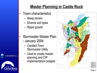
- 3. Master Planning in Castle Rock Town characteristics Steep terrain Diverse soil types Rapid growth Stormwater Master Plan - January 2004 Created Town Stormwater Utility Used to create master planning and CIP implementation budgets
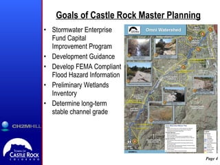
- 4. Goals of Castle Rock Master Planning Stormwater Enterprise Fund Capital Improvement Program Development Guidance Develop FEMA Compliant Flood Hazard Information Preliminary Wetlands Inventory Determine long-term stable channel grade
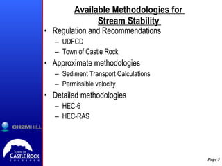
- 5. Available Methodologies for Stream Stability Regulation and Recommendations UDFCD Town of Castle Rock Approximate methodologies Sediment Transport Calculations Permissible velocity Detailed methodologies HEC-6 HEC-RAS
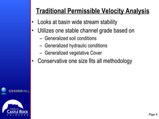
- 6. Traditional Permissible Velocity Analysis Looks at basin wide stream stability Utilizes one stable channel grade based on Generalized soil conditions Generalized hydraulic conditions Generalized vegetative Cover Conservative one size fits all methodology
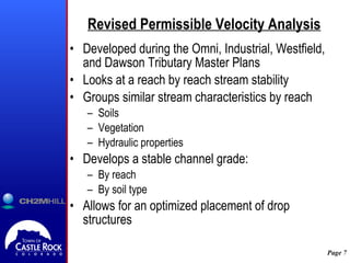
- 7. Revised Permissible Velocity Analysis Developed during the Omni, Industrial, Westfield, and Dawson Tributary Master Plans Looks at a reach by reach stream stability Groups similar stream characteristics by reach Soils Vegetation Hydraulic properties Develops a stable channel grade: By reach By soil type Allows for an optimized placement of drop structures
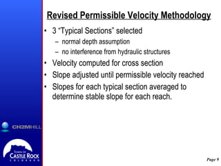
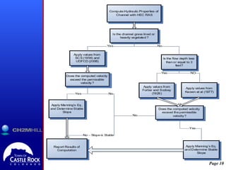
- 9. Revised Permissible Velocity Methodology 3 ŌĆ£Typical SectionsŌĆØ selected normal depth assumption no interference from hydraulic structures Velocity computed for cross section Slope adjusted until permissible velocity reached Slopes for each typical section averaged to determine stable slope for each reach.
- 10. ╠²
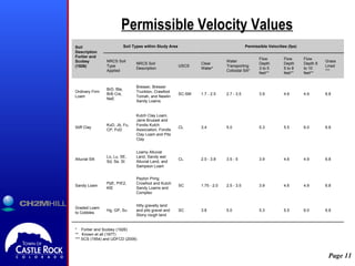
- 11. Permissible Velocity Values * Fortier and Scobey (1926) ** Known et all (1977) *** SCS (1954) and UDFCD (2006) 6.8 6.0 5.5 5.3 5.0 3.8 SC Hilly gravelly land and pits gravel and Stony rough land Hg, GP, Su Graded Loam to Cobbles 6.8 4.9 4.6 3.9 2.5 - 3.5 1.75 - 2.0 SC Peyton Pring Crowfoot and Kutch Sandy Loams and Complex PpE, PrE2, KtE Sandy Loam 6.8 4.9 4.6 3.9 3.5 - 5 2.0 - 3.8 CL Loamy Alluvial Land, Sandy wet Alluvial Land, and Sampson Loam Lo, Lu, SE, Sd, Se, St Alluvial Silt 6.8 6.0 5.5 5.3 5.0 3.4 CL Kutch Clay Loam, Jarre Brusset and Fondis Kutch Association, Fondis Clay Loam and Pits Clay KuD, Jb, Fu, CP, FoD Stiff Clay 6.8 4.9 4.6 3.9 2.7 - 3.5 1.7 - 2.5 SC-SM Bresser, Bresser Truckton, Crawfoot Tomah, and Newlin Sandy Loams BrD, Bte, BrB Cre, NeE Ordinary Firm Loam Grass Lined *** Flow Depth 8 to 10 feet** Flow Depth 5 to 8 feet** Flow Depth 3 to 5 feet** Water Transporting Colloidal Silt* Clear Water* USCS NRCS Soil Description NRCS Soil Type Applied Permissible Velocities (fps) Soil Types within Study Area Soil Description Fortier and Scobey (1926) ╠²
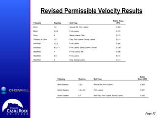
- 12. Revised Permissible Velocity Results 0.041 Clay, Sandy Loams 4 Westfield 0.012 Firm Loams 2,3 Westfield 0.006 Firms Loams, Silt 1 Westfield 0.018 Firm Loams, Sandy Loams, Gravel 4,5,IT1 Industrial 0.004 Firm Loams 1,2,3 Industrial 0.013 Clay, Firm Loams, Sandy Loams 1,2 Tributary to Omni 0.015 Sandy Loams, Clay 6 Omni 0.010 Firm Loams 3,4,5 Omni 0.004 Alluvial Silt, Firm Loams 1,2 Omni Stable Slope (ft/ft) Soil Type Reaches Tributary 0.020 Stiff Clay, Firm Loams, Sandy Loams 6.7 South Dawson 0.007 Firm Loams 1,2,3,4,5 South Dawson 0.004 Alluvial Silt, Firm Loams 1,2,3 North Dawson Stable Slope (ft/ft) Soil Type Reaches Tributary
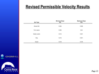
- 13. Revised Permissible Velocity Results 0.018 0.018 Gravel 0.041 0.013 Clay 0.041 0.013 Sandy Loams 0.02 0.004 Firm Loams 0.006 0.004 Alluvial Silt Maximum Slope Ft/ft Minimum Slope ft/ft Soil Type
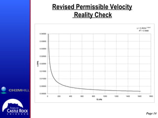
- 14. Revised Permissible Velocity Reality Check
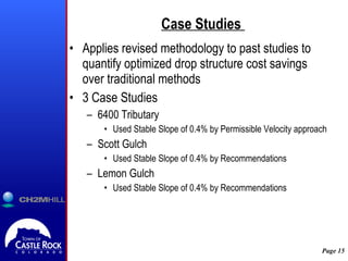
- 15. Case Studies Applies revised methodology to past studies to quantify optimized drop structure cost savings over traditional methods 3 Case Studies 6400 Tributary Used Stable Slope of 0.4% by Permissible Velocity approach Scott Gulch Used Stable Slope of 0.4% by Recommendations Lemon Gulch Used Stable Slope of 0.4% by Recommendations
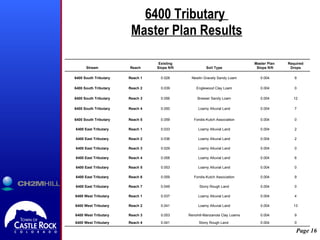
- 16. 6400 Tributary Master Plan Results 0 0.004 Stony Rough Land╠² 0.041 Reach 4 6400 West Tributary 9 0.004 Renohill-Manzanola Clay Loams 0.053 Reach 3 6400 West Tributary 13 0.004 Loamy Alluvial Land 0.041 Reach 2 6400 West Tributary 4 0.004 Loamy Alluvial Land 0.037 Reach 1 6400 West Tributary 0 0.004 Stony Rough Land 0.049 Reach 7 6400 East Tributary 9 0.004 Fondis-Kutch Association 0.059 Reach 6 6400 East Tributary 0 0.004 Loamy Alluvial Land 0.053 Reach 5 6400 East Tributary 6 0.004 Loamy Alluvial Land 0.058 Reach 4 6400 East Tributary 0 0.004 Loamy Alluvial Land 0.029 Reach 3 6400 East Tributary 2 0.004 Loamy Alluvial Land 0.036 Reach 2 6400 East Tributary 2 0.004 Loamy Alluvial Land 0.033 Reach 1 6400 East Tributary 0 0.004 Fondis-Kutch Association 0.059 Reach 5 6400 South Tributary 7 0.004 Loamy Alluvial Land 0.050 Reach 4 6400 South Tributary 12 0.004 Bresser Sandy Loam 0.056 Reach 3 6400 South Tributary 0 0.004 Englewood Clay Loam 0.039 Reach 2 6400 South Tributary 9 0.004 Newlin Gravely Sandy Loam 0.028 Reach 1 6400 South Tributary Required Drops Master Plan Slope ft/ft Soil Type Existing Slope ft/ft Reach Stream
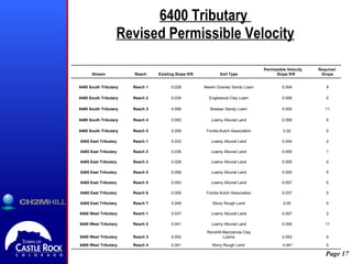
- 17. 6400 Tributary Revised Permissible Velocity 0 ╠² 0.041 Stony Rough Land╠² 0.041 Reach 4 6400 West Tributary 0 0.053 Renohill-Manzanola Clay Loams 0.053 Reach 3 6400 West Tributary 11 0.009 Loamy Alluvial Land 0.041 Reach 2 6400 West Tributary 2 0.007 Loamy Alluvial Land 0.037 Reach 1 6400 West Tributary 0 0.05 Stony Rough Land 0.049 Reach 7 6400 East Tributary 5 0.037 Fondis-Kutch Association 0.059 Reach 6 6400 East Tributary 0 0.007 Loamy Alluvial Land 0.053 Reach 5 6400 East Tributary 5 0.005 Loamy Alluvial Land 0.058 Reach 4 6400 East Tributary 0 0.005 Loamy Alluvial Land 0.029 Reach 3 6400 East Tributary 1 0.005 Loamy Alluvial Land 0.036 Reach 2 6400 East Tributary 2 0.004 Loamy Alluvial Land 0.033 Reach 1 6400 East Tributary 0 0.02 Fondis-Kutch Association 0.059 Reach 5 6400 South Tributary 5 0.009 Loamy Alluvial Land 0.050 Reach 4 6400 South Tributary 11 0.005 Bresser Sandy Loam 0.056 Reach 3 6400 South Tributary 0 0.006 Englewood Clay Loam 0.039 Reach 2 6400 South Tributary 9 0.004 Newlin Gravely Sandy Loam 0.028 Reach 1 6400 South Tributary Required Drops Permissible Velocity Slope ft/ft Soil Type Existing Slope ft/ft Reach Stream
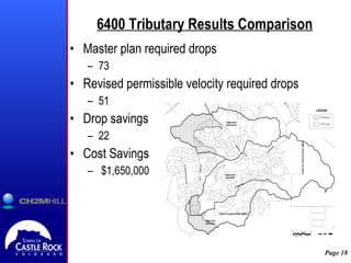
- 18. 6400 Tributary Results Comparison Master plan required drops 73 Revised permissible velocity required drops 51 Drop savings 22 Cost Savings $1,650,000
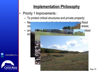
- 19. Implementation Philosophy Priority 1 Improvements : To protect critical structures and private property; Necessary now to mitigate damage to existing flood control facilities and environmentally sensitive areas; and at locations with active head cutting or streambed erosion.
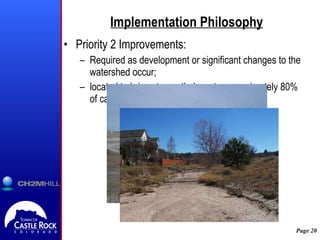
- 20. Implementation Philosophy Priority 2 Improvements: Required as development or significant changes to the watershed occur; located to bring stream thalwag to approximately 80% of calculated stable slope.
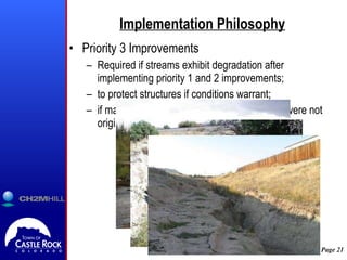
- 21. Implementation Philosophy Priority 3 Improvements Required if streams exhibit degradation after implementing priority 1 and 2 improvements; to protect structures if conditions warrant; if major changes in the watershed occur that were not originally considered.
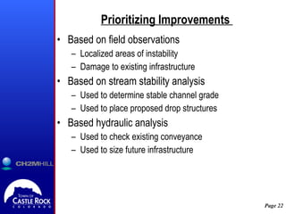
- 22. Prioritizing Improvements Based on field observations Localized areas of instability Damage to existing infrastructure Based on stream stability analysis Used to determine stable channel grade Used to place proposed drop structures Based hydraulic analysis Used to check existing conveyance Used to size future infrastructure
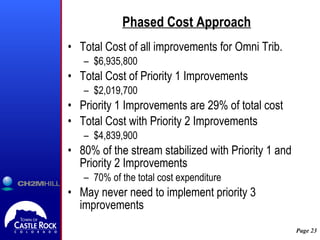
- 23. Phased Cost Approach Total Cost of all improvements for Omni Trib. $6,935,800 Total Cost of Priority 1 Improvements $2,019,700 Priority 1 Improvements are 29% of total cost Total Cost with Priority 2 Improvements $4,839,900 80% of the stream stabilized with Priority 1 and Priority 2 Improvements 70% of the total cost expenditure May never need to implement priority 3 improvements
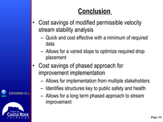
- 24. Conclusion Cost savings of modified permissible velocity stream stability analysis Quick and cost effective with a minimum of required data Allows for a varied slope to optimize required drop placement Cost savings of phased approach for improvement implementation Allows for implementation from multiple stakeholders Identifies structures key to public safety and health Allows for a long term phased approach to stream improvement
- 25. Questions?