Chap 1 Living with Tectonic Hazards
- 1. Landforms (TB Pg. 3) <-~ Click on one of the links to begin…
- 5. At the end of this lesson, we will learn… • Why are some areas more prone to tectonic hazards? • What landforms and associated tectonic phenomena are found at plate boundaries?
- 6. • The Earth has an extremely varied landscape made up of many different types of landforms • They are…
- 7. 1. Mountains > 600m, steep slopes; form a mountain range when located in groups A mountain
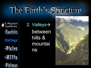
- 8. 2. Valleysïƒ between hills & mountai ns
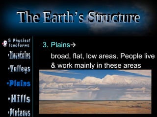
- 9. 3. Plainsïƒ broad, flat, low areas. People live & work mainly in these areas
- 10. 4. Hills usually > 600m in height, rounded in shape with gentle slopes A hill
- 11. 5. Plateauxïƒ large flat-topped areas that are elevated above the surroundings
- 15. • Core – the centre of Earth – About 50000C – Solid
- 16. Mantle • Middle layer • Semi-molten state • Constantly generating convectional currents which creates
- 18. Crust • About 6-70 km thick • Uppermost layer • Rigid & solid • Made up of separate pieces called platesïƒ fit like puzzle (Moving
- 19. • 2 types of crust – 1 type makes up continents (continental-lighter; less dense) – Another type makes up ocean floors (oceanic)
- 22. • This sliding of the plates is caused by the mantle's convection currents • It is this constant movement/ motion (of the plates), called PLATE TECTONICS, that causes earthquakes, mountain
- 24. • These different PLATE MOVEMENTS lead to the formation of different processes and landforms  ïƒ Earth is a dynamic (i.e. constantly changing) planet.
- 36. Bromo Pics?
Editor's Notes
- not flat and smooth — it has been shaped into features of different sizes and heights over millions of years not one solid mass of rock Landforms make up most of the physical features on the Earth’s surface
- the outermost layer which is made up of many separate pieces called plates
- In a nutshell…
- JOURNEY TO THE CTR OF THE EARTH Theory of Continental Drift/ Plate Tectonics 19:12 – 19:54 Transform Plate Boundary/ San Andreas Fault 19:55 - 20:45 Subduction Plate Boundary/ Boso Peninsula, Tokyo Bay, Japan 20:46 - 27:21 Subduction of Pacific Plate under Asia. Incredible pressure builds and… A hotspot for Volcanoes and Earthquakes Hot rock buckles and breaks + Cold water flows in = Explosive Earthquakes prediction Causes of Earthquakes Comprehensive network of sensors in Japan so that data can be mapped (1700 underground sensors) To find a pattern to predict earthquakes Tokyo has > 12 millions people; hit by earthquakes every 200 yrs. Long overdue.


