Development of GIS based 3-D information System of College Campus
ŌĆó
0 likesŌĆó43 views

This document presents the development of a 3D spatial information system using GIS for a college campus. The system was created by developing separate layers to represent features of the campus such as buildings, routes, and boundaries. Attributes were assigned to each layer to store related information. The layers were then merged into a geospatial database in ArcGIS software. Users can perform queries on the system to locate specific features and obtain related attribute data. The 3D model allows querying spatial relationships and navigation between campus buildings.


Development of GIS based 3-D information System of College Campus
- 1. Development of GIS based 3-D spatial information system for a college campus Dr. B.M.Kunar Keshav Mudgal Neel Gupta Sunil Kumar
- 2. ’āś Spatial Information system ’āś GIS (Geographic information system) ’āś 3-D Model of campus Area ’āś Representation Model ’āś Vector representation and vector data model ’āś Querying and reasoning the database in GIS OUTLINE
- 3. This study presents ’āś a representation based approach to 3-D model of a campus area ’āś A Spatial information system for the college campus area ’āś Use of GIS techniques and tools ’āś Querying the spatial information ’āś College database management and development techniques Introduction
- 4. ŌĆó The case study area is a campus spread over 88 hectares (220 acres ) ŌĆó Campus of Indian School of Mines, Dhanbad ŌĆó comprises the academic buildings , student hostels and residential facilities for staff ŌĆó campus area is well developed in all means which makes it perfect for this kind of analysis Case Study area
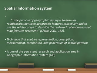
- 5. Spatial Information system ’é¦ ŌĆ£ŌĆ”the purpose of geographic inquiry is to examine relationships between geographic features collectively and to use the relationships to describe the real-world phenomena that map features represent.ŌĆØ (Clarke 2001, 182). ’é¦ Technique that enables representation, description, measurement, comparison, and generation of spatial patterns ’é¦ is one of the persistent research and application area in Geographic Information System (GIS)
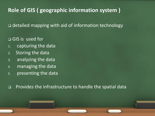
- 6. ’ü▒ detailed mapping with aid of information technology ’ü▒ GIS is used for 1. capturing the data 2. Storing the data 3. analyzing the data 4. managing the data 5. presenting the data ’ü▒ Provides the infrastructure to handle the spatial data Role of GIS ( geographic information system )
- 7. ’ü▒ provides a wide range of application and tools for development of a well classified extensive spatial information system ’ü▒ manipulation and analysis of individual layer of spatial data ’ü▒ Connecting all the information to geographic location Role of GISŌĆ”.
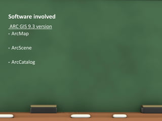
- 8. ARC GIS 9.3 version ŌĆó ArcMap ŌĆó ArcScene ŌĆó ArcCatalog Software involved
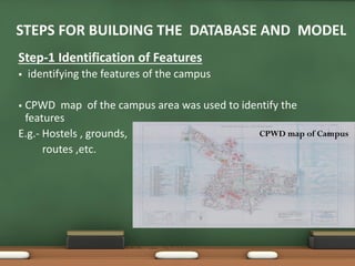
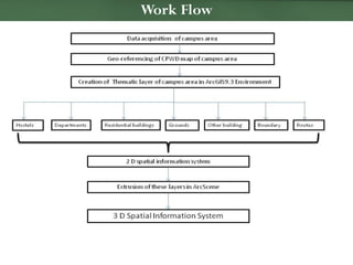
- 9. Step-1 Identification of Features ’é¦ identifying the features of the campus ’é¦ CPWD map of the campus area was used to identify the features E.g.- Hostels , grounds, routes ,etc. STEPS FOR BUILDING THE DATABASE AND MODEL CPWD map of Campus
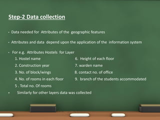
- 10. ŌĆó Data needed for Attributes of the geographic features ŌĆó Attributes and data depend upon the application of the information system ŌĆó For e.g. Attributes Hostels for Layer 1. Hostel name 6. Height of each floor 2. Construction year 7. warden name 3. No. of block/wings 8. contact no. of office 4. No. of rooms in each floor 9. branch of the students accommodated 5 . Total no. Of rooms ’é¦ Similarly for other layers data was collected Step-2 Data collection
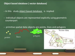
- 11. ŌĆó In this study object based database is implied ŌĆó individual objects are represented explicitly using geometric counterpart ŌĆó primitive spatial data objects are points, lines and polygons Object based database ( vector database) points lines polygons Vector data
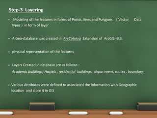
- 12. ’é¦ Modeling of the features in forms of Points, lines and Polygons ( Vector Data Types ) in form of layer ’é¦ A Geo-database was created in ArcCatalog Extension of ArcGIS -9.3. ’é¦ physical representation of the features ’é¦ Layers Created in database are as follows : Academic buildings, Hostels , residential buildings, department, routes , boundary, ’é¦ Various Attributes were defined to associated the information with Geographic location and store it in GIS Step-3 Layering
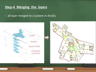
- 13. ŌĆó all layer merged to a system in ArcGis Step-4 Merging the layers
- 14. Work Flow
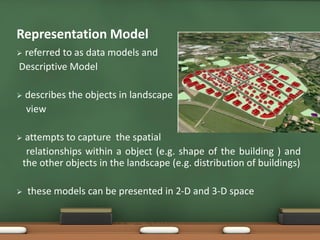
- 15. ’āś referred to as data models and Descriptive Model ’āś describes the objects in landscape view ’āś attempts to capture the spatial relationships within a object (e.g. shape of the building ) and the other objects in the landscape (e.g. distribution of buildings) ’āś these models can be presented in 2-D and 3-D space Representation Model
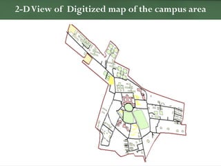
- 16. 2-DView of Digitized map of the campus area
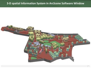
- 17. 3-D spatial Information System in ArcScene Software Window
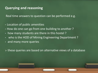
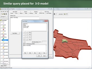
- 18. Real time answers to question can be performed e.g. ŌĆó Location of public amenities ŌĆó How do one can go from one building to another ? ŌĆó how many students are there in this hostel ? ŌĆó who is the HOD of Mining Engineering Department ? ŌĆó and many more queries ’āś these queries are based on alternative views of a database Querying and reasoning
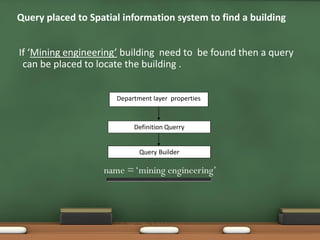
- 19. Query placed to Spatial information system to find a building If ŌĆśMining engineeringŌĆÖ building need to be found then a query can be placed to locate the building . Department layer properties Definition Querry Query Builder name =ŌĆśmining engineeringŌĆÖ
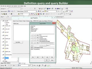
- 20. Definition query and query Builder
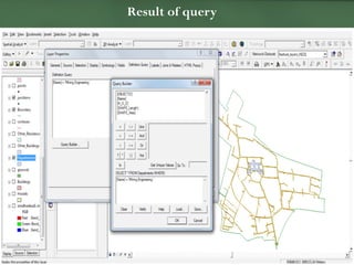
- 21. Result of query
- 22. Similar query placed for 3-D model
- 23. 1. SPATIAL INFORMATION SYSTEM FOR 3D DOCUMENTATION OF PLAKA, THE HISTORICAL CENTER OF ATHENS (N. Charkiolakis, Ch. Ioannidis, Ch. Kantza, I. Keramida, A. Koumna, M. Leni , M. Liakaki, V. Pragasti, M. Psallida, 2007) 2. ARCGIS DESKTOP HELP 3. 3D urban models: recent developments in the digital modelling of urban environments in three-dimensions(Narushige Shiode ,Centre for Advanced Spatial Analysis, University College London, Torrington Place, London WC1E6BT, UK) 4. Spatial Information System for 3-D Documentation of plaka , the historical centre of Athens (N. Charkiolakis, Ch. Ioannidis, Ch. Kantz , I. Keramida, A. Koumna, M. Leni , M. Liakaki, V.Pragasti, M.Psallida, A.Georgopoulos) References