Dimensional Control of Construction works afloat. A view from 3 dimensions.
Download as PPTX, PDF0 likes1,030 views

Dimensional Control of Construction works afloat. A view from 3 dimensions by IJsbrand van der Bent, Ingenieursbureau Passe Partout
1 of 23
Download to read offline


Recommended
Inverted heading calibration
Inverted heading calibrationHydrographic Society Benelux
╠²
Move a position reference frame to the work deck. Presentation by Nicol├Ās de Hilster (Starmountain Survey and Consultancy) en Erich Gaickhorst (GeoVisie).Deformation effects 
Deformation effects Hydrographic Society Benelux
╠²
The deformation of a vessel by its load, and that of positioning piles by temperature have consequences for the accuracy of the survey. This presentation by Erich Gaickhorst (GeoVisie) shows how.Kalibratie en scheepsgeometrie met een historisch perspectief
Kalibratie en scheepsgeometrie met een historisch perspectiefHydrographic Society Benelux
╠²
Het onderwerp wordt door Nicol├Ās de Hilster, Starmountain Survey & Consultancy, belicht. Hoe is de aandacht voor kalibratie en scheepsgeometrie in de loop van de jaren gegroeid?RWS AMUST
RWS AMUSTHydrographic Society Benelux
╠²
Rijkswaterstaat heeft het programma MEET laten doorgroeien naar AMUST. Dit komt voort uit een samenwerking met TU Delft waarbij het programma helemaal opnieuw doorgenomen is om bij de tijd te passen. Presentator: Kees BoogaardToepassing van seismiek voor bepaling van de nautische bodem en detectie van ...
Toepassing van seismiek voor bepaling van de nautische bodem en detectie van ...Hydrographic Society Benelux
╠²
Coen Werner, Senior Geoloog en manager
R&D, Stema SystemsSedimentologisch en nautisch achtergrondonderzoek ten behoeve van baggerplann...
Sedimentologisch en nautisch achtergrondonderzoek ten behoeve van baggerplann...Hydrographic Society Benelux
╠²
Styn Claeys, Hoofd Instrumentatie en Techniek
WL HIC, Departement Mobiliteit & Openbare Werken, VlaanderenSlibvaren
SlibvarenHydrographic Society Benelux
╠²
Leendert Bourgonjen, Project manager & Manager Unit Dredging & Surveying, Groningen Seaports NVInnovative hydrographic data management: now and in the future
Innovative hydrographic data management: now and in the futureHydrographic Society Benelux
╠²
IntellinQ provides software solutions for hydrographic data management. Their GeolinQ software allows users to integrate data from various sources, map data models, and publish data through web services and file exports. IntellinQ sees the future of hydrographic data management involving virtual databases that can automatically generate products from diverse, real-time data sources accessed through multiple channels. GeolinQ is designed to handle these complex future needs through its flexible data modeling and ability to link various data sources and services.Hydrographic and marine software Solutions
Hydrographic and marine software SolutionsHydrographic Society Benelux
╠²
The document discusses future developments in hydrographic software by QPS. It summarizes that QPS will focus on managing increasing data volumes from new sensor technologies through real-time processing and cloud computing. New visualization and user experience techniques will be needed to analyze larger and more complex 4D datasets. QPS will integrate new sensors like sub-bottom profilers and ADCPs into its software suite and optimize workflows. Short term developments at QPS include changes to its product suite and a new feedback voting system.Software for the Hydrographic ocean
Software for the Hydrographic oceanHydrographic Society Benelux
╠²
1. Teledyne CARIS is developing new data-centric workflows and products to improve efficiency in processing large, multi-sensor survey datasets. This includes increased automation, variable resolution surfaces that integrate data of different densities, and support for open standards like S-100.
2. Organizations are moving to data-centric approaches to more quickly process bigger survey data, better utilize resources, and transition to being marine data providers. This supports producing new customized products and services for broader user bases.
3. CARIS is working on automating processing and creating variable resolution surfaces from multiple sensor data to help organizations efficiently manage higher survey volumes and backlogs from autonomous and crowd-sourced sources.Software for survey and engineering at sea
Software for survey and engineering at seaHydrographic Society Benelux
╠²
This document provides an overview of trends in the hydrographic surveying industry from a presentation given by EIVA, a company that provides hydrographic software solutions. It discusses the adoption of 3D modeling and data visualization, increasing data sizes from new sensor technologies, a focus on cost reduction through automation and optimization of workflows. Upcoming developments mentioned include improvements to automated data cleaning algorithms, point cloud processing tools, and more advanced autonomous mission planning capabilities. The presentation concludes by offering a free software package to hydrographic offices and noting EIVA's support of educational uses of their software.Drivers and uncertainties in past and future sea level changes
Drivers and uncertainties in past and future sea level changesHydrographic Society Benelux
╠²
1. Sea level rise is driven by thermal expansion of oceans, melting of land ice such as glaciers and ice sheets, and changes to land water storage.
2. Past rates of sea level rise have varied over time, with the 20th century rise likely the fastest in the past 2700 years.
3. Future projections estimate a rise between 0.5 to over 1 meter by 2100 depending on emissions scenario, with a long term commitment of 1-3 meters of rise for sustained warming over millennia.Opportunities for the Hydrographic Sector Using Satellite Observation Services
Opportunities for the Hydrographic Sector Using Satellite Observation ServicesHydrographic Society Benelux
╠²
(1) The document discusses opportunities for the hydrographic sector using satellite observation services. Examples of applications demonstrated include urban mapping, land subsidence monitoring, weather forecasting, dredging support, and oil pollution monitoring.
(2) It notes that huge public and private investments in satellite infrastructure will provide continuous global data access for decades, opening opportunities. The Dutch value-adding sector has organized to support hydrographic activities and businesses through NEVASCO.
(3) In summary, the earth observation sector is a high potential market for strategic information and economic growth, and satellite data can support many hydrographic applications now and in the future as more data becomes available.Advantages of a combined sonar data acquisition system for AUVs and ASVs
Advantages of a combined sonar data acquisition system for AUVs and ASVsHydrographic Society Benelux
╠²
Autonomous underwater vehicles (AUVs) often operate close to the seabed (5m-15m) enabling higher resolution surveys using high frequency sonars. Compact Autonomous surface vessels (ASVs) are often deployed in shallow water environments where deeper-draft manned survey vessels are unable to operate. On such vehicles there is limited space to deploy separate imaging, mapping and sub-bottom sonars. This presentation describes the technology deployed in the EdgeTech 2205 sonar system, which enables combined data acquisition in one system on AUVs and ASVs. Examples of the data acquired are given, which can include dual- or triple- frequency side scan, Multiphase Echosounder (MPES) swath bathymetry, and sub-bottom profiler data.The unmanned system in hydrographic applications (Z-Boat)
The unmanned system in hydrographic applications (Z-Boat)Hydrographic Society Benelux
╠²
The use of remotely operated Autonomous Surface Vehicles (ASVŌĆÖs) has become easy accessible since the introduction of the Teledyne Oceanscience Z-Boat, a versatile solution for a wide range of applications. In this session we will take a closer look at the various hydrographic applications and the advantages of using an unmanned system.Current developments in underwater autonomy
Current developments in underwater autonomyHydrographic Society Benelux
╠²
Unmanned underwater systems become increasingly important in the maritime and offshore, security and defence domain. TNO conducts research and experimentation on autonomous
underwater vehicles and underwater communication to advise government and industry on this topic and develop new concept solutions. An overview of the current development will be given
with focus on autonomous decision making for underwater application, cooperative autonomy and new application of underwater autonomous systems for maritime and offshore operations Positioning challenges on fallpipe vessels
Positioning challenges on fallpipe vesselsHydrographic Society Benelux
╠²
After a short review of the general principles of vessel and ROV positioning, the specific challenges that surface when carrying out fallpipe works will be treated. Positioning comes in double flavours: absolute versus relative positioning; offshore versus nearshore surveys; planimetric versus vertical positioning. In different circumstances, one has to adopt different approaches to reach both the contractorŌĆÖs and the clientŌĆÖs goal: a swift execution of the works meeting all partiesŌĆÖ expectations.Enabling RTK-like positioning offshore using the global VERIPOS GNSS network
Enabling RTK-like positioning offshore using the global VERIPOS GNSS networkHydrographic Society Benelux
╠²
The document discusses VERIPOS' PPP-AR positioning service which provides centimeter-level global positioning using GNSS networks. PPP-AR offers faster initialization and reinitialization than traditional PPP, providing RTK-like accuracy globally. It works by estimating additional bias parameters to resolve carrier phase ambiguities. VERIPOS upgraded its infrastructure to support PPP-AR, including new reference stations and servers. PPP-AR demonstrates rapid reconvergence from signal outages, bridging gaps within seconds, making it suitable for applications where GNSS signals may be interrupted.Gemini ŌĆō Wind farm positioning beyond the horizon
Gemini ŌĆō Wind farm positioning beyond the horizonHydrographic Society Benelux
╠²
This document discusses positioning for the Gemini Offshore Wind Farm project. It describes how Van Oord used RTK-GNSS with a virtual reference station network to provide accurate 3D positioning for construction activities in real time. Quality control measures included regular checks on position check objects and comparisons between the virtual reference station positioning and local reference stations installed on site. The 06-GPS network provided reliable positioning and helped ensure successful installation of project components within tolerance requirements.G2+ worldwide positioning services
G2+ worldwide positioning servicesHydrographic Society Benelux
╠²
This document summarizes Fugro's G2+ worldwide centimetre-level positioning service. It discusses the history of Fugro's positioning capabilities from 1974 to present, including the introduction of G2+ in 2015. G2+ uses precise satellite orbit and clock data with integer ambiguity resolution to provide centimetre-level positioning accuracy globally in real-time. Static and dynamic testing shows G2+ achieves 95% horizontal accuracy of 3.5 cm and vertical accuracy of 8 cm. G2+ is being used for offshore applications like tide measurement, platform monitoring, and unmanned vessel navigation.Positioning the Solitaire
Positioning the SolitaireHydrographic Society Benelux
╠²
This document provides information about the Solitaire, the world's largest pipelaying vessel. It can lay pipes from 2 inches to 60 feet in diameter. It stores up to 22,000 tons of pipe and has a multi-purpose crane that can lift 300 tons. The Solitaire uses a complex GPS system with multiple antennas to precisely position pipes from the surface to the seabed, avoiding danger areas and laying pipes through tiny corridors. It requires specialized hardware, software and human operators to complete its tasks of laying pipes from beaches to subsea locations.GPS Status en Evolutie
GPS Status en EvolutieHydrographic Society Benelux
╠²
Dr Ton Willems van Septentrio geeft een overview van de huidige status van GPS en de GPS constellatie.De eerste GLONASS-K Satellieten en de CDMA formaten
De eerste GLONASS-K Satellieten en de CDMA formatenHydrographic Society Benelux
╠²
Jean-Paul Henry van 06-GPS geeft een update van de GLONASS constellatie en de ontwikkelingen op gebied van dit Russische navigatiesysteem.Galileo 6 satellieten gelanceerd. Een statusoverzicht.
Galileo 6 satellieten gelanceerd. Een statusoverzicht.Hydrographic Society Benelux
╠²
The document summarizes the status of the Galileo satellite navigation system operated by the European Union and European Space Agency. It describes the constellation plans including the initial and full operational capabilities. It provides details on the satellites, ground infrastructure, atomic clocks, signals, services, and system performance. The status of the initial in-orbit validation satellites and deployment of the full operational capability satellites is outlined.Made in China: BEIDOU. 
Made in China: BEIDOU. Hydrographic Society Benelux
╠²
Hans Visser, Fugro Intersite BV geeft de presenatie: Made in China: BeiDou: 14 BeiDou satellieten met dekking over Azië.
Welke mogelijkheden liggen hier? Wat kunnen we ermee, ook in het Westen? Hoe is de werking van dit systeem? Een update en voorspelling naar de toekomst.Presentatie maak en meet nauwkeurigheden
Presentatie maak en meet nauwkeurighedenHydrographic Society Benelux
╠²
Presentatie over nauwkeurigheden bij meten en maken van baggerwerkzaamheden. Presentatie door Huibert-Jan Lekkerkerk.Construction and survey accuracies for the execution of rockworks
Construction and survey accuracies for the execution of rockworksHydrographic Society Benelux
╠²
Presentation by Eric Peeters emphasising on best practices when surveying for the Maasvlakte 2 extension of the Port of Rotterdam and related works.Gravity Expeditions at Sea
Gravity Expeditions at SeaHydrographic Society Benelux
╠²
Meting van zwaartekracht voor navigatie en plaatsbepaling doeleinden.More Related Content
More from Hydrographic Society Benelux (20)
Hydrographic and marine software Solutions
Hydrographic and marine software SolutionsHydrographic Society Benelux
╠²
The document discusses future developments in hydrographic software by QPS. It summarizes that QPS will focus on managing increasing data volumes from new sensor technologies through real-time processing and cloud computing. New visualization and user experience techniques will be needed to analyze larger and more complex 4D datasets. QPS will integrate new sensors like sub-bottom profilers and ADCPs into its software suite and optimize workflows. Short term developments at QPS include changes to its product suite and a new feedback voting system.Software for the Hydrographic ocean
Software for the Hydrographic oceanHydrographic Society Benelux
╠²
1. Teledyne CARIS is developing new data-centric workflows and products to improve efficiency in processing large, multi-sensor survey datasets. This includes increased automation, variable resolution surfaces that integrate data of different densities, and support for open standards like S-100.
2. Organizations are moving to data-centric approaches to more quickly process bigger survey data, better utilize resources, and transition to being marine data providers. This supports producing new customized products and services for broader user bases.
3. CARIS is working on automating processing and creating variable resolution surfaces from multiple sensor data to help organizations efficiently manage higher survey volumes and backlogs from autonomous and crowd-sourced sources.Software for survey and engineering at sea
Software for survey and engineering at seaHydrographic Society Benelux
╠²
This document provides an overview of trends in the hydrographic surveying industry from a presentation given by EIVA, a company that provides hydrographic software solutions. It discusses the adoption of 3D modeling and data visualization, increasing data sizes from new sensor technologies, a focus on cost reduction through automation and optimization of workflows. Upcoming developments mentioned include improvements to automated data cleaning algorithms, point cloud processing tools, and more advanced autonomous mission planning capabilities. The presentation concludes by offering a free software package to hydrographic offices and noting EIVA's support of educational uses of their software.Drivers and uncertainties in past and future sea level changes
Drivers and uncertainties in past and future sea level changesHydrographic Society Benelux
╠²
1. Sea level rise is driven by thermal expansion of oceans, melting of land ice such as glaciers and ice sheets, and changes to land water storage.
2. Past rates of sea level rise have varied over time, with the 20th century rise likely the fastest in the past 2700 years.
3. Future projections estimate a rise between 0.5 to over 1 meter by 2100 depending on emissions scenario, with a long term commitment of 1-3 meters of rise for sustained warming over millennia.Opportunities for the Hydrographic Sector Using Satellite Observation Services
Opportunities for the Hydrographic Sector Using Satellite Observation ServicesHydrographic Society Benelux
╠²
(1) The document discusses opportunities for the hydrographic sector using satellite observation services. Examples of applications demonstrated include urban mapping, land subsidence monitoring, weather forecasting, dredging support, and oil pollution monitoring.
(2) It notes that huge public and private investments in satellite infrastructure will provide continuous global data access for decades, opening opportunities. The Dutch value-adding sector has organized to support hydrographic activities and businesses through NEVASCO.
(3) In summary, the earth observation sector is a high potential market for strategic information and economic growth, and satellite data can support many hydrographic applications now and in the future as more data becomes available.Advantages of a combined sonar data acquisition system for AUVs and ASVs
Advantages of a combined sonar data acquisition system for AUVs and ASVsHydrographic Society Benelux
╠²
Autonomous underwater vehicles (AUVs) often operate close to the seabed (5m-15m) enabling higher resolution surveys using high frequency sonars. Compact Autonomous surface vessels (ASVs) are often deployed in shallow water environments where deeper-draft manned survey vessels are unable to operate. On such vehicles there is limited space to deploy separate imaging, mapping and sub-bottom sonars. This presentation describes the technology deployed in the EdgeTech 2205 sonar system, which enables combined data acquisition in one system on AUVs and ASVs. Examples of the data acquired are given, which can include dual- or triple- frequency side scan, Multiphase Echosounder (MPES) swath bathymetry, and sub-bottom profiler data.The unmanned system in hydrographic applications (Z-Boat)
The unmanned system in hydrographic applications (Z-Boat)Hydrographic Society Benelux
╠²
The use of remotely operated Autonomous Surface Vehicles (ASVŌĆÖs) has become easy accessible since the introduction of the Teledyne Oceanscience Z-Boat, a versatile solution for a wide range of applications. In this session we will take a closer look at the various hydrographic applications and the advantages of using an unmanned system.Current developments in underwater autonomy
Current developments in underwater autonomyHydrographic Society Benelux
╠²
Unmanned underwater systems become increasingly important in the maritime and offshore, security and defence domain. TNO conducts research and experimentation on autonomous
underwater vehicles and underwater communication to advise government and industry on this topic and develop new concept solutions. An overview of the current development will be given
with focus on autonomous decision making for underwater application, cooperative autonomy and new application of underwater autonomous systems for maritime and offshore operations Positioning challenges on fallpipe vessels
Positioning challenges on fallpipe vesselsHydrographic Society Benelux
╠²
After a short review of the general principles of vessel and ROV positioning, the specific challenges that surface when carrying out fallpipe works will be treated. Positioning comes in double flavours: absolute versus relative positioning; offshore versus nearshore surveys; planimetric versus vertical positioning. In different circumstances, one has to adopt different approaches to reach both the contractorŌĆÖs and the clientŌĆÖs goal: a swift execution of the works meeting all partiesŌĆÖ expectations.Enabling RTK-like positioning offshore using the global VERIPOS GNSS network
Enabling RTK-like positioning offshore using the global VERIPOS GNSS networkHydrographic Society Benelux
╠²
The document discusses VERIPOS' PPP-AR positioning service which provides centimeter-level global positioning using GNSS networks. PPP-AR offers faster initialization and reinitialization than traditional PPP, providing RTK-like accuracy globally. It works by estimating additional bias parameters to resolve carrier phase ambiguities. VERIPOS upgraded its infrastructure to support PPP-AR, including new reference stations and servers. PPP-AR demonstrates rapid reconvergence from signal outages, bridging gaps within seconds, making it suitable for applications where GNSS signals may be interrupted.Gemini ŌĆō Wind farm positioning beyond the horizon
Gemini ŌĆō Wind farm positioning beyond the horizonHydrographic Society Benelux
╠²
This document discusses positioning for the Gemini Offshore Wind Farm project. It describes how Van Oord used RTK-GNSS with a virtual reference station network to provide accurate 3D positioning for construction activities in real time. Quality control measures included regular checks on position check objects and comparisons between the virtual reference station positioning and local reference stations installed on site. The 06-GPS network provided reliable positioning and helped ensure successful installation of project components within tolerance requirements.G2+ worldwide positioning services
G2+ worldwide positioning servicesHydrographic Society Benelux
╠²
This document summarizes Fugro's G2+ worldwide centimetre-level positioning service. It discusses the history of Fugro's positioning capabilities from 1974 to present, including the introduction of G2+ in 2015. G2+ uses precise satellite orbit and clock data with integer ambiguity resolution to provide centimetre-level positioning accuracy globally in real-time. Static and dynamic testing shows G2+ achieves 95% horizontal accuracy of 3.5 cm and vertical accuracy of 8 cm. G2+ is being used for offshore applications like tide measurement, platform monitoring, and unmanned vessel navigation.Positioning the Solitaire
Positioning the SolitaireHydrographic Society Benelux
╠²
This document provides information about the Solitaire, the world's largest pipelaying vessel. It can lay pipes from 2 inches to 60 feet in diameter. It stores up to 22,000 tons of pipe and has a multi-purpose crane that can lift 300 tons. The Solitaire uses a complex GPS system with multiple antennas to precisely position pipes from the surface to the seabed, avoiding danger areas and laying pipes through tiny corridors. It requires specialized hardware, software and human operators to complete its tasks of laying pipes from beaches to subsea locations.GPS Status en Evolutie
GPS Status en EvolutieHydrographic Society Benelux
╠²
Dr Ton Willems van Septentrio geeft een overview van de huidige status van GPS en de GPS constellatie.De eerste GLONASS-K Satellieten en de CDMA formaten
De eerste GLONASS-K Satellieten en de CDMA formatenHydrographic Society Benelux
╠²
Jean-Paul Henry van 06-GPS geeft een update van de GLONASS constellatie en de ontwikkelingen op gebied van dit Russische navigatiesysteem.Galileo 6 satellieten gelanceerd. Een statusoverzicht.
Galileo 6 satellieten gelanceerd. Een statusoverzicht.Hydrographic Society Benelux
╠²
The document summarizes the status of the Galileo satellite navigation system operated by the European Union and European Space Agency. It describes the constellation plans including the initial and full operational capabilities. It provides details on the satellites, ground infrastructure, atomic clocks, signals, services, and system performance. The status of the initial in-orbit validation satellites and deployment of the full operational capability satellites is outlined.Made in China: BEIDOU.
Made in China: BEIDOU. Hydrographic Society Benelux
╠²
Hans Visser, Fugro Intersite BV geeft de presenatie: Made in China: BeiDou: 14 BeiDou satellieten met dekking over Azië.
Welke mogelijkheden liggen hier? Wat kunnen we ermee, ook in het Westen? Hoe is de werking van dit systeem? Een update en voorspelling naar de toekomst.Presentatie maak en meet nauwkeurigheden
Presentatie maak en meet nauwkeurighedenHydrographic Society Benelux
╠²
Presentatie over nauwkeurigheden bij meten en maken van baggerwerkzaamheden. Presentatie door Huibert-Jan Lekkerkerk.Construction and survey accuracies for the execution of rockworks
Construction and survey accuracies for the execution of rockworksHydrographic Society Benelux
╠²
Presentation by Eric Peeters emphasising on best practices when surveying for the Maasvlakte 2 extension of the Port of Rotterdam and related works.Gravity Expeditions at Sea
Gravity Expeditions at SeaHydrographic Society Benelux
╠²
Meting van zwaartekracht voor navigatie en plaatsbepaling doeleinden.Opportunities for the Hydrographic Sector Using Satellite Observation Services
Opportunities for the Hydrographic Sector Using Satellite Observation ServicesHydrographic Society Benelux
╠²
Advantages of a combined sonar data acquisition system for AUVs and ASVs
Advantages of a combined sonar data acquisition system for AUVs and ASVsHydrographic Society Benelux
╠²
Enabling RTK-like positioning offshore using the global VERIPOS GNSS network
Enabling RTK-like positioning offshore using the global VERIPOS GNSS networkHydrographic Society Benelux
╠²
Dimensional Control of Construction works afloat. A view from 3 dimensions.
- 1. Maatvoering op drijfzand 3 gezichtspunten, 3D
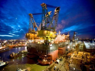
- 4. Persoonlijke dimensie Construction projects ŌĆó(Zeeburgertunnel) ŌĆóTunnel onder de Noord ŌĆóTweede Benelux
- 7. Refereren WGS 84 3 Rotaties 3 Translaties 1 Schaalfactor Hayford
- 8. Refereren
- 9. Refereren
- 10. Refereren
- 13. Maatvoering op drijfzand Wat meten? (Datum, referentie) Hoe nauwkeurig? Keuze meetopzet en instrumentatie
- 16. Maatvoering op drijfzand 1. Synchroniseren ŌĆō ŌĆō Koppelen van positiesensor en overige sensoren aan boord Gyro / MRU calibratie
- 17. Maatvoering op drijfzand 2. Aligneren (=ŌĆ£Fysiek transformerenŌĆØ) Wat is hier het datum? ( (
- 18. Maatvoering op drijfzand 3. Rekenkundig transformeren Tachymeter WGS 84 3 Rotaties 3 Translaties 1 Schaalfactor Hayford Scheepsstelsel Of preciezer: datum ontwerper
- 20. Maatvoering op drijfzand 3. Rekenkundig transformeren
- 21. Maatvoering op drijfzand 3. Rekenkundig transformeren Fotogrammetrie, vanuit de lucht maar ook terrestrisch. Centrale projectie
- 22. Maatvoering op drijfzand Instrumentatie: Tachymeter Lasertracker Vlakheidslaser Uitlijn laser Laserscanner Fotografie Klein meetgereedschap