Eman Oriby CV
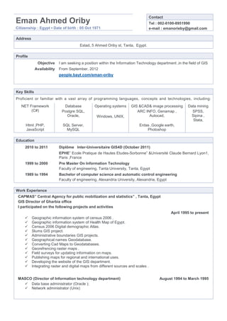
- 1. Contact Eman Ahmed Oriby Tel : 002-0100-8951990 Citizenship : Egypt ⊠Date of birth : 05 Oct 1971 e-mail : emanorieby@gmail.com Address Estad, 5 Ahmed Oriby st, Tanta, Egypt. Profile Objective I am seeking a position within the Information Technology department ,in the field of GIS Availability From September, 2012 people.bayt.com/eman-oriby Key Skills Proficient or familiar with a vast array of programming languages, concepts and technologies, including: NET Framework Database Operating systems GIS &CAD& image processing Data mining (C#) Postgre SQL, ARC INFO, Genamap , SPSS, Oracle, Windows, UNIX, Autocad, Sipina , Stata, Html ,PHP, SQL Server, Erdas ,Google earth, JavaScript MySQL Photoshop Education 2010 to 2011 DiplÃīme Inter-Universitaire GIS4D (October 2011) EPHEâ Ecole Pratique de Hautes Etudes-Sorbonneâ &UniversitÃĐ Claude Bernard Lyon1, Paris ,France 1999 to 2000 Pre Master On Information Technology Faculty of engineering, Tanta University, Tanta, Egypt 1989 to 1994 Bachelor of computer science and automatic control engineering Faculty of engineering, Alexandria University, Alexandria, Egypt Work Experience CAPMASâ Central Agency for public mobilization and statisticsâ , Tanta, Egypt GIS Director of Gharbia office I participated on the following projects and activities April 1995 to present ïž Geographic information system of census 2006 . ïž Geographic information system of Health Map of Egypt. ïž Census 2006 Digital demographic Atlas. ïž Slums GIS project. ïž Administrative boundaries GIS projects. ïž Geographical names Geodatabase. ïž Converting Cad Maps to Geodatabases. ïž Georefrencing raster maps . ïž Field surveys for updating information on maps. ïž Publishing maps for regional and international uses. ïž Developing the website of the GIS department. ïž Integrating raster and digital maps from different sources and scales . MASCO (Director of Information technology department) August 1994 to March 1995 ïž Data base administrator (Oracle ); ïž Network administrator (Unix)
- 2. Languages Arabic (native) English (fluent) French (basic) Membership UNGEGN United Nation Group of experts on geographical names ADEGN Arab Division On Geographical Names IGU/ICA Toponymy commission International Geography Union /International Cartographic association Task team of Africa UNGEGN Task force for Africa Country names working group UNGEGN working group for country names Khwarzmy ISI Group International statistics Institute Working group for Arab Women ISI commission International statistics Institute working group for women Certificates &Trainings Introduction to Arc INFO . ESRI (Environmental Systems Research Institute ) 7-11 Nov 1999 Introduction to Programming Map ESRI (Environmental Systems Research Institute ) 03-15 May 2003 objects with Visual Basic. United Nations Educational Scientific and Cultural ICDL EGY000166418 organization16/07/2008 Certificate on Developing advanced Management supervisory skills CAPMAS âStatistics training centre 2010 Advanced Data Mining& Statistics CAPMAS-Training Centre Jun âSeptember 2010 Advanced English course CAPMAS-Training Centre September 2010 Basic French course CAPMAS-Training Centre September 2010 Time series Analysis SPSS training course CAPMAS-Training Centre September 2010 Certificate of Advanced Egyptian Authority for management and administration . Management Skills Honors Winner of UNGEGN African Toponymy contest âUNGEGN 25th session-Kenya 2009 The best employee -CAPMAS
- 3. Publications & Papers W.B.52 âGIS applications in the 2006 population ,housing and building census ) UNGEGN 25th session Nairobi May 2009. Annex no 1 of Technical paper W.B.53 (Report on Egyptian geographic names Activities). UNGEGN 25th session Nairobi- May 2009. Awarded Essay âPresent challenges and Future Hopes Towards Standardization of geographical TH names of Egyptâ âUNGEGN African Toponymy Contest-UNGEGN 25 Session Kenya 2009. News from Egypt UNGEGN 37th bulletin September 2009. th âExonym use on Egyptâ ,Trends in Exonym Use Proceeding of the 10 UNGEGN working group on exonym meeting Tainach 28-30 May 2010 . TH W.B. 6 âGeographical names as A part of Egyptian heritageâ UNGEGN 26 Session Vienna -Austria 2011. âSpatial analysis of access to safe water on Egyptâ ISI (International Statistics Institute) 58th congress âDublin Ireland August 2011. Participation in international conferences The free flow of information conference in Alexandria library- Egypt February 2008 . Conference on artificial Intelligence on Menoufiya province âEgypt March 2008 . The Second International Environment forum: New Environmental Horizons of Sustainable development -November 2008 Tanta University . The Workshop on standardization of geographical names March 2009 with CULNAT (Center for Cultural and Natural heritage) Cairo Egypt 2009. TH UNGEGN (United Nations Group Of Experts on Geographical Names) 25 session Nairobi Kenya May 2009. TH ADEGN (Arab Division on Geographical Names) 5 session Beirut Lebanon May 2010. UNGEGN-Exonym working group meeting âAustria May 2010. TH UNGEGN (United Nations Group Of Experts on Geographical Names) 26 Vienna Austria May 2011. ISI (International Statistics Institute) 58th congress âDublin Ireland August 2011.


