際際滷

際際滷Share a Scribd company logo
SARIM WARIS KHAN
IX-F
Environment 4 geography project ppt.pptx
Weather refers to the state of the atmosphere over an area at
any point of time. The elements of weather are temperature,
atmospheric pressure, wind speed, humidity and precipitation.
FOR EXAMPLE : todays weather :-
temp. : max. : 29 C
min. : 24 C
atmospheric pressure : 74 %
wind speed : 10 kmph  35 kmph
humidity : 68 % - 75 %
precipitation : nill.
Climate refers to the average weather condition and
variations over a large area for a long period of time
(more than 30 years).
There are many types of climates 
Monsoon type of climate, Desert type of climate,
Caribbean type of climate, etc.
There are six major controls of the climate of any place 
1) Latitude  due to the curvature of the earth, the amount of
solar energy received varies according to latitude.
2) Altitude  as one goes from the surface of the earth to higher
altitudes, the atmosphere becomes less dense and
temperature decreases.
3) Pressure & wind system : the pressure and wind system of
any area depend on the latitude and altitude of the place.
Thus it influences the temperature and rainfall pattern.
4) Distance from the sea (continentality) : as the distance from
the sea increases, its moderating influence decreases and the
people experience extreme weather conditions. This
condition is known as continentality.
5) Ocean currents : ocean currents along with onshore winds
affect the climate of the area, for example, any coastal area
with warm or cold ocean currents flowing past it, will be
warmed or cooled if the winds are onshore.
6) Relief : relief plays a major role in determining the
climate of a place. High mountains act as barriers for cold
or hot winds ; they may also cause rainfall if they are high
enough and lie in the path of rain bearing winds.
Environment 4 geography project ppt.pptx
1) Latitude : the Tropic of Cancer passes through the middle of
the country from the Rann of Kuchh in the west to Mizoram
in the east. Almost half of the country lying south of the
Tropic of Cancer, belongs to the tropical area. All the
remaining area, north of the Tropic, lies in the sub  tropics.
2) Altitude : India has mountains to the north which have an
average elevation of 6000 metres. India also has a vast
coastline area where the maximum elevation is about 30
metres. The Himalayas prevent the cold winds from central
Asia from entering the sub  continent. It is because of these
mountains that this sub  continent experiences
comparatively milder winters than central Asia.
3) Pressure and wind system : the climate and associated weather
conditions in India are governed by the following atmospheric
conditions 
 pressure and surface winds
 upper air circulation
 western cyclonic disturbances and tropical cyclones
4) Ocean currents : ocean currents along with onshore winds
affect the climate of the area, for example, any coastal area with
warm or cold ocean currents flowing past it, will be warmed or
cooled if the winds are onshore.
5) Distance from the sea : as the distance from the sea increases,
its moderating influence decreases and the people experience
extreme weather conditions. This condition is known as
continentality.
6) Relief features : High mountains act as barriers for cold or hot
winds ; they may also cause rainfall if they are high enough and
lie in the path of rain bearing winds. The leeward side of the
mountain remains relatively dry.
An apparent force caused by the earths rotation, the
coriolis force is responsible for deflecting towards the
right in the northern hemisphere and towards the left in
the southern hemisphere.
Environment 4 geography project ppt.pptx
India lies in the region of north  easterly winds. These winds
originate from the sub  tropical high pressure belt of the
northern hemisphere. They blow south, get deflected to the right
due to the coriolis force and move on towards the equatorial low
pressure zone. These winds carry very little moisture as they
originate and blow over land. Therefore, they bring little or no
rainfall.
The pressure and wind condition over India are
unique. During winter, there is a high pressure area north of the
Himalayas. Cold, dry winds blow from this region to the south.
In summer, a low pressure area develops over interior Asia as
well as over north  western India. This causes a complete
reversal of the direction of the winds during summer. Air moves
from the high pressure area over the southern Indian Ocean, in
direction, crosses the equator and turns right towards the low
pressure area over the Indian sub  continent. These are known
as southwest monsoon winds.
These are a narrow belt of high altitude westerly winds
in the troposphere. These streams are located
approximately over 27 to 30 north latitude, therefore
they are called sub tropical westerly jet streams. Their
speed varies from 110 kmph in summer to 184 kmph in
winter.
Environment 4 geography project ppt.pptx
The Inter Tropical Convergence Zone (ITCZ) is a
broad trough of low pressure in equatorial latitudes.
This is where the northeast and the southeast trade
winds converge. This convergence zone lies more or less
parallel to the equator but moves north or south with
the apparent movement of the sun.
Normally when the tropical eastern south Pacific Ocean
experiences high pressure, the tropical eastern Indian Ocean
experiences low pressure. But in certain years, there is a reversal
in the pressure conditions. This periodic change is known as
southern oscillation or SO. The difference in pressure over Tahiti
and Darwin in northern Australia is computed to predict the
intensity of the monsoons. A feature connected with SO is the El
Nino phenomenon in which a warm ocean current that flows
past the Peruvian Coast, in place of the cold Peruvian current ,
every 2  5 yrs. The changes in pressure conditions are
connected to the El Nino. Therefore, the phenomenon is
referred to as ENSO (El Nino Southern Oscillation).
Environment 4 geography project ppt.pptx
The monsoon, unlike the traders, are not steady winds but are
pulsating in nature, affected by different atmospheric conditions
encountered by it, on its way over the warm tropical seas. The
duration of the monsoon is between 100  120 days from early
June to mid  September. Around the time of its arrival, the
normal rainfall increases suddenly and continues for several
days. This is known as the burst of monsoon.
Environment 4 geography project ppt.pptx
There are four main seasons in India. They are 
i) The cold weather season (winter)
ii) The hot weather season (summer)
iii) Advancing monsoon (the rainy season)
iv) Retreating monsoon (the transition season)
The cold weather season begins from mid  November in
northern India and stays till February. December and January
are the coldest months in the northern part of India. During this
season, the northeast trade winds prevail over the country. The
weather is normally marked by clear skies, low temperatures
and low humidity and feeble variable winds. The peninsular
region does not have a well defined cold season. This season is
important for Rabi crops.
Environment 4 geography project ppt.pptx
The hot weather season begins from March and continues up to
May. In March, the highest temperature is about 38C recorded
in the Deccan plateau. In peninsular India, temperatures remain
lower due to the moderating influence of the oceans. A striking
feature of the hot weather season is the loo. These are strong,
gusty, hot and dry winds blowing during the day. Dust storms
are very common during the month of May in northern India. In
West Bengal it is known as kaal baisakhi. Towards the end of
the summer season, pre - monsoon showers are common in
Kerala and Karnataka.
Environment 4 geography project ppt.pptx
By early June, the low pressure condition over the northern
plains intensifies. It attracts the trade winds of the southern
hemisphere. As these winds blow over warm oceans, they bring
abundant moisture to the sub  continent. The in flow of the
southwest monsoon in India brings about a total change in the
weather. The maximum rainfall of this season is received in the
northeastern part of the country. Another phenomenon
associated with the monsoon is its tendency to have breaks in
rainfall. Thus, it has wet and dry spells. These breaks in
monsoon are related to the movement of the monsoon trough.
The monsoon is known for its uncertainty. The alteration of
dry and wet spells vary in intensity. It may be responsible for
droughts or floods.
Environment 4 geography project ppt.pptx
During October  November with the apparent movement of the
sun towards the south, the monsoon or the low pressure trough
becomes weaker. This gradually replaced by a high pressure
system. By the beginning of October, the monsoon withdraws
from the northern plains. It is marked by clear sky and rise in
temperature. The low pressure conditions, over northwestern
India get transferred to the Bay of Bengal by early November.
Environment 4 geography project ppt.pptx
Ad

Recommended

ppt on Climate for class 9
sohamfrankenstein1
Pragya jainn
Pragya jainn
Dinesh Singhai
Climate - sst class9
Parth Kshirsagar
Ch 4 Climate 2.pdfclass 9 social geography
swetha614975
SST Class 9- Climate
Aditya Sharma
Climate of india
Climate of india
makemyslide
Climate of india
Climate of india
Aditya Meena
Climate of india
Climate of india
Krut Patel
Climate.pptx for class 9 students usefull
DeepMane4
Climate
Climate
Uday Pal
ABA SSC.pptx
ABA SSC.pptx
lathashivakumar3
"Contemporary India I" CHAPTER 4 NCERT
saidibyanshubehera
climate.pptx
climate.pptx
Nazima Hussain
India:climate,vegetation and wildlife
aarushigoyal33
Climate
Climate
Rituz Agarwal
Climate
Climate
Rituz Agarwal
Climate
Climate
Adityareader
Climate 2
Climate 2
Tibetan Homes School
Monsoon.pptx
Monsoon.pptx
removed_10b50ff61d9bff77eb4ed2f5c882753b
Climate cbse 9 class geography
Abhiram Kamini
Climate
Climate
Srishti Singh
Geo - climate , soil , natural vegetation, water resources.pdf
singhsukhman273
Indian agriculture gambling with monsoon.ppt
UAS, Dharwad
Climate
Climate
melvin1811
Climate
Climate
UshaJoy
Climate
Climate
Sumana Roychoudhury
indian_climate_and_monsoon_77 (1).docx
Prem359576
climate
climate
letsenjoy
350 Asia Climate Action Based on Science & Justice
Global Landscapes Forum (GLF)
HSE_Soil_and_Microbial_Life_Protection.pptx
dextercalderon206

More Related Content

Similar to Environment 4 geography project ppt.pptx (20)

Climate.pptx for class 9 students usefull
DeepMane4
Climate
Climate
Uday Pal
ABA SSC.pptx
ABA SSC.pptx
lathashivakumar3
"Contemporary India I" CHAPTER 4 NCERT
saidibyanshubehera
climate.pptx
climate.pptx
Nazima Hussain
India:climate,vegetation and wildlife
aarushigoyal33
Climate
Climate
Rituz Agarwal
Climate
Climate
Rituz Agarwal
Climate
Climate
Adityareader
Climate 2
Climate 2
Tibetan Homes School
Monsoon.pptx
Monsoon.pptx
removed_10b50ff61d9bff77eb4ed2f5c882753b
Climate cbse 9 class geography
Abhiram Kamini
Climate
Climate
Srishti Singh
Geo - climate , soil , natural vegetation, water resources.pdf
singhsukhman273
Indian agriculture gambling with monsoon.ppt
UAS, Dharwad
Climate
Climate
melvin1811
Climate
Climate
UshaJoy
Climate
Climate
Sumana Roychoudhury
indian_climate_and_monsoon_77 (1).docx
Prem359576
climate
climate
letsenjoy
Climate.pptx for class 9 students usefull
DeepMane4
Climate
Climate
Uday Pal
"Contemporary India I" CHAPTER 4 NCERT
saidibyanshubehera
India:climate,vegetation and wildlife
aarushigoyal33
Climate cbse 9 class geography
Abhiram Kamini
Geo - climate , soil , natural vegetation, water resources.pdf
singhsukhman273
Indian agriculture gambling with monsoon.ppt
UAS, Dharwad
Climate
Climate
UshaJoy
indian_climate_and_monsoon_77 (1).docx
Prem359576

Recently uploaded (20)

350 Asia Climate Action Based on Science & Justice
Global Landscapes Forum (GLF)
HSE_Soil_and_Microbial_Life_Protection.pptx
dextercalderon206
Young Professionals for Agricultural Development (YPARD) LLC Asia
Global Landscapes Forum (GLF)
liposomes qxsj qwjx wjn xxwjnx wnc wcw cw
sahaldevu02
Center Enamel Provides Biogas Storage Tanks Design and Manufacturing for Cust...
AllenLin596164
TYPHOID fever and the causes of the thyroid fever
Susis10
CALCULATION TOOLS FOR ESTIMATING GREENHOUSE GAS EMISSIONS FROM PULP AND PAPER...
tuannguyenvan123
Bullitt Center- A Model of Green Building
562904586
Financing nature-based solutions in Southeast Asia
CIFOR-ICRAF
Biogas Storage Tank for Biogas Projects A Sustainable Solution for Renewable ...
AllenLin596164
Worldmap 際際滷s Powerpoint Template.pptx
911ak11062003
SandraLazaro_RetailStoreScvengerHunt.pdf
SLazaroLugo
Pembuatan pabrik kertas_Harun alrasyid.pptx
harun706371
Psychromhhuihuhhuhuygygyggyetrics - Copy.pptx
vpmital110057
China Grain Silos Manufacturer Center Enamels Premium Storage Solutions for ...
AllenLin596164
Role of Nitrogen-Fixing Trees/Shrubs in Agroforestry
hinamandle07
Our planet-R-Siddharth 6-C(Holiday Homework)
siddharthravula21cmi
Rooted & Rising GLFx Kalimantan LLC Asia
Global Landscapes Forum (GLF)
FIRE SAFETY PRESENTATION (what to do incase of fire).pptx
GOMA29
Shifting Grounds_ How Climate Change Forces Wildlife to Adapt by Amol Sahasra...
Amol Sahasrabudhe
350 Asia Climate Action Based on Science & Justice
Global Landscapes Forum (GLF)
HSE_Soil_and_Microbial_Life_Protection.pptx
dextercalderon206
Young Professionals for Agricultural Development (YPARD) LLC Asia
Global Landscapes Forum (GLF)
liposomes qxsj qwjx wjn xxwjnx wnc wcw cw
sahaldevu02
Center Enamel Provides Biogas Storage Tanks Design and Manufacturing for Cust...
AllenLin596164
TYPHOID fever and the causes of the thyroid fever
Susis10
CALCULATION TOOLS FOR ESTIMATING GREENHOUSE GAS EMISSIONS FROM PULP AND PAPER...
tuannguyenvan123
Bullitt Center- A Model of Green Building
562904586
Financing nature-based solutions in Southeast Asia
CIFOR-ICRAF
Biogas Storage Tank for Biogas Projects A Sustainable Solution for Renewable ...
AllenLin596164
Worldmap 際際滷s Powerpoint Template.pptx
911ak11062003
SandraLazaro_RetailStoreScvengerHunt.pdf
SLazaroLugo
Pembuatan pabrik kertas_Harun alrasyid.pptx
harun706371
Psychromhhuihuhhuhuygygyggyetrics - Copy.pptx
vpmital110057
China Grain Silos Manufacturer Center Enamels Premium Storage Solutions for ...
AllenLin596164
Role of Nitrogen-Fixing Trees/Shrubs in Agroforestry
hinamandle07
Our planet-R-Siddharth 6-C(Holiday Homework)
siddharthravula21cmi
FIRE SAFETY PRESENTATION (what to do incase of fire).pptx
GOMA29
Shifting Grounds_ How Climate Change Forces Wildlife to Adapt by Amol Sahasra...
Amol Sahasrabudhe
Ad

Environment 4 geography project ppt.pptx

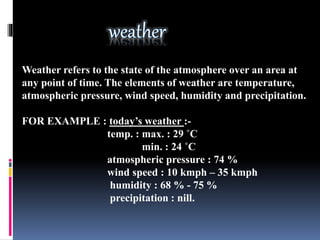
  • 3. Weather refers to the state of the atmosphere over an area at any point of time. The elements of weather are temperature, atmospheric pressure, wind speed, humidity and precipitation. FOR EXAMPLE : todays weather :- temp. : max. : 29 C min. : 24 C atmospheric pressure : 74 % wind speed : 10 kmph 35 kmph humidity : 68 % - 75 % precipitation : nill.
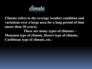
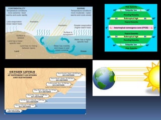
  • 4. Climate refers to the average weather condition and variations over a large area for a long period of time (more than 30 years). There are many types of climates Monsoon type of climate, Desert type of climate, Caribbean type of climate, etc.
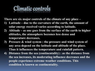
  • 5. There are six major controls of the climate of any place 1) Latitude due to the curvature of the earth, the amount of solar energy received varies according to latitude. 2) Altitude as one goes from the surface of the earth to higher altitudes, the atmosphere becomes less dense and temperature decreases. 3) Pressure & wind system : the pressure and wind system of any area depend on the latitude and altitude of the place. Thus it influences the temperature and rainfall pattern. 4) Distance from the sea (continentality) : as the distance from the sea increases, its moderating influence decreases and the people experience extreme weather conditions. This condition is known as continentality.
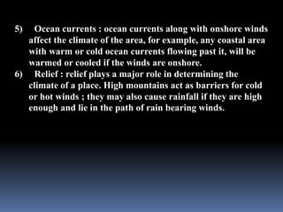
  • 6. 5) Ocean currents : ocean currents along with onshore winds affect the climate of the area, for example, any coastal area with warm or cold ocean currents flowing past it, will be warmed or cooled if the winds are onshore. 6) Relief : relief plays a major role in determining the climate of a place. High mountains act as barriers for cold or hot winds ; they may also cause rainfall if they are high enough and lie in the path of rain bearing winds.
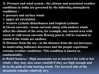
  • 10. 1) Latitude : the Tropic of Cancer passes through the middle of the country from the Rann of Kuchh in the west to Mizoram in the east. Almost half of the country lying south of the Tropic of Cancer, belongs to the tropical area. All the remaining area, north of the Tropic, lies in the sub tropics. 2) Altitude : India has mountains to the north which have an average elevation of 6000 metres. India also has a vast coastline area where the maximum elevation is about 30 metres. The Himalayas prevent the cold winds from central Asia from entering the sub continent. It is because of these mountains that this sub continent experiences comparatively milder winters than central Asia.
  • 11. 3) Pressure and wind system : the climate and associated weather conditions in India are governed by the following atmospheric conditions pressure and surface winds upper air circulation western cyclonic disturbances and tropical cyclones 4) Ocean currents : ocean currents along with onshore winds affect the climate of the area, for example, any coastal area with warm or cold ocean currents flowing past it, will be warmed or cooled if the winds are onshore. 5) Distance from the sea : as the distance from the sea increases, its moderating influence decreases and the people experience extreme weather conditions. This condition is known as continentality. 6) Relief features : High mountains act as barriers for cold or hot winds ; they may also cause rainfall if they are high enough and lie in the path of rain bearing winds. The leeward side of the mountain remains relatively dry.
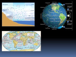
  • 12. An apparent force caused by the earths rotation, the coriolis force is responsible for deflecting towards the right in the northern hemisphere and towards the left in the southern hemisphere.
  • 14. India lies in the region of north easterly winds. These winds originate from the sub tropical high pressure belt of the northern hemisphere. They blow south, get deflected to the right due to the coriolis force and move on towards the equatorial low pressure zone. These winds carry very little moisture as they originate and blow over land. Therefore, they bring little or no rainfall. The pressure and wind condition over India are unique. During winter, there is a high pressure area north of the Himalayas. Cold, dry winds blow from this region to the south. In summer, a low pressure area develops over interior Asia as well as over north western India. This causes a complete reversal of the direction of the winds during summer. Air moves from the high pressure area over the southern Indian Ocean, in
  • 15. direction, crosses the equator and turns right towards the low pressure area over the Indian sub continent. These are known as southwest monsoon winds.
  • 16. These are a narrow belt of high altitude westerly winds in the troposphere. These streams are located approximately over 27 to 30 north latitude, therefore they are called sub tropical westerly jet streams. Their speed varies from 110 kmph in summer to 184 kmph in winter.
  • 18. The Inter Tropical Convergence Zone (ITCZ) is a broad trough of low pressure in equatorial latitudes. This is where the northeast and the southeast trade winds converge. This convergence zone lies more or less parallel to the equator but moves north or south with the apparent movement of the sun.
  • 19. Normally when the tropical eastern south Pacific Ocean experiences high pressure, the tropical eastern Indian Ocean experiences low pressure. But in certain years, there is a reversal in the pressure conditions. This periodic change is known as southern oscillation or SO. The difference in pressure over Tahiti and Darwin in northern Australia is computed to predict the intensity of the monsoons. A feature connected with SO is the El Nino phenomenon in which a warm ocean current that flows past the Peruvian Coast, in place of the cold Peruvian current , every 2 5 yrs. The changes in pressure conditions are connected to the El Nino. Therefore, the phenomenon is referred to as ENSO (El Nino Southern Oscillation).
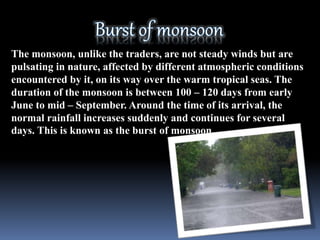
  • 21. The monsoon, unlike the traders, are not steady winds but are pulsating in nature, affected by different atmospheric conditions encountered by it, on its way over the warm tropical seas. The duration of the monsoon is between 100 120 days from early June to mid September. Around the time of its arrival, the normal rainfall increases suddenly and continues for several days. This is known as the burst of monsoon.
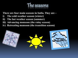
  • 23. There are four main seasons in India. They are i) The cold weather season (winter) ii) The hot weather season (summer) iii) Advancing monsoon (the rainy season) iv) Retreating monsoon (the transition season)
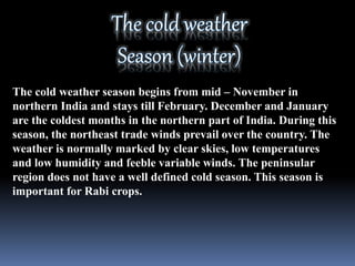
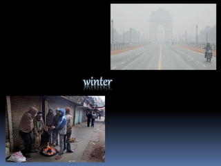
  • 24. The cold weather season begins from mid November in northern India and stays till February. December and January are the coldest months in the northern part of India. During this season, the northeast trade winds prevail over the country. The weather is normally marked by clear skies, low temperatures and low humidity and feeble variable winds. The peninsular region does not have a well defined cold season. This season is important for Rabi crops.
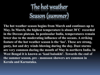
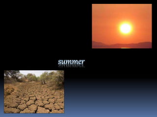
  • 26. The hot weather season begins from March and continues up to May. In March, the highest temperature is about 38C recorded in the Deccan plateau. In peninsular India, temperatures remain lower due to the moderating influence of the oceans. A striking feature of the hot weather season is the loo. These are strong, gusty, hot and dry winds blowing during the day. Dust storms are very common during the month of May in northern India. In West Bengal it is known as kaal baisakhi. Towards the end of the summer season, pre - monsoon showers are common in Kerala and Karnataka.
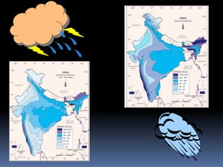
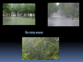
  • 28. By early June, the low pressure condition over the northern plains intensifies. It attracts the trade winds of the southern hemisphere. As these winds blow over warm oceans, they bring abundant moisture to the sub continent. The in flow of the southwest monsoon in India brings about a total change in the weather. The maximum rainfall of this season is received in the northeastern part of the country. Another phenomenon associated with the monsoon is its tendency to have breaks in rainfall. Thus, it has wet and dry spells. These breaks in monsoon are related to the movement of the monsoon trough. The monsoon is known for its uncertainty. The alteration of dry and wet spells vary in intensity. It may be responsible for droughts or floods.
  • 31. During October November with the apparent movement of the sun towards the south, the monsoon or the low pressure trough becomes weaker. This gradually replaced by a high pressure system. By the beginning of October, the monsoon withdraws from the northern plains. It is marked by clear sky and rise in temperature. The low pressure conditions, over northwestern India get transferred to the Bay of Bengal by early November.