Geo Analyzer - Geocoding Indian Addresses
1 like879 views

This document describes a custom built geocoding software called GeoAnalyzer that takes raw Indian addresses and provides accurate latitude and longitude information. It helps rectify incorrect data and provides location intelligence that can be used for decision making, analyzing customer distribution networks, and visualizing data density on maps. The software includes a geo data processor that standardizes addresses and a user interface that allows users to group, analyze, and export processed location data. It has been tested on large data sets with high accuracy rates.
1 of 13
Downloaded 11 times

Ad
Recommended
Geo analyzer(ind)
Geo analyzer(ind)Shubhashish Pandey
?
This document describes GeoAnalyzer, a software that takes raw Indian addresses as input and returns the corresponding latitude and longitude along with a standardized address. It achieves 70% accuracy within 2km for most addresses and 95% accuracy within 100m for touchpoints. The software includes a geo data processor engine and UI portal for users to analyze and visualize geocoded data on maps. It is intended to help businesses with location-based tasks like targeted marketing, sales routing, and strategic decision making. Pricing depends on the size and type of data to be processed. Custom mobile or web apps can also be developed using the geocoded output.eyestate brochure
eyestate brochureIndicus Analytics Private Limited
?
Knight Frank India and Indicus Analytics have created 'Eyestate,' a primary survey-based real estate database service to tackle the transparency issues in the Indian real estate market. This tool provides reliable and authentic information about residential, commercial, and retail properties across major metropolitan regions, allowing users to run queries, create graphs, and more through an intuitive web-based interface. Eyestate aims to support developers, banks, and financial institutions by delivering high-quality, updated market data.The Rise and Evolution of the Open Source Software Foundation
The Rise and Evolution of the Open Source Software FoundationStephen Walli
?
The document discusses the importance of Free and Open Source Software (FOSS) foundations in supporting the growth and sustainability of FOSS projects, particularly through legal and operational structures that promote community involvement. It highlights how independent governance of projects by these foundations facilitates collaboration and innovation while managing intellectual property issues. The conclusions emphasize that while shared software development is advantageous, the presence of FOSS foundations is critical for long-term success and community support.Afrimakers maker faire 2014
Afrimakers maker faire 2014Stefania DRUGA
?
This document discusses Afrimakers, an organization that aims to solve challenges in African communities through hands-on learning and making. It outlines several big problems they are tackling in different countries like air pollution in Egypt and electricity issues in Nigeria. For each problem, local teams will design solutions like building air quality stations or smart solar panels. The document provides details on partners on the ground in different countries and describes the Afrimakers approach of empowering youth through workshops and design thinking classes to develop solutions and entrepreneurial skills. It concludes by promoting an upcoming Makers Summer Camp in Berlin and provides a contact email.Volunteered Geographic Information and OpenStreetMap
Volunteered Geographic Information and OpenStreetMapchippy
?
The document discusses OpenStreetMap (OSM) as a collaboratively edited map platform utilizing volunteered geographic information (VGI) from users. It highlights OSM's potential to enhance geographic databases while addressing concerns such as data accuracy and user privacy. The document also compares OSM's performance and quality metrics against other mapping sources, emphasizing its utility in regions with poor mapping coverage.Example BIM Validation service with BIMSie
Example BIM Validation service with BIMSieL©”on Berlo
?
This document discusses the potential for standardizing BIM web service APIs. It describes how a BIM model stored on a central data server could trigger various subscribed services like clash detection, validation checking, and CO2 analysis when updated. These remote services would analyze the model and return JSON reports to the server. A standardized API would allow different services from various providers to integrate. This could create new markets for niche BIM applications and allow distributed use of BIM without requiring all tools on one platform. The document outlines a demonstrator using multiple suppliers updating an IFC model with clash detection and other analysis services reporting back results.GeoCommons Open-Source GeoCoder
GeoCommons Open-Source GeoCoderAndrew Turner
?
The document discusses geocoding challenges and the use of geocommons for data definition and location parsing. It highlights the architecture of a geocoding engine and its capabilities, such as processing 240,000 geocodes per hour. Additionally, it provides resources for the community to engage with geocommons and contribute to its development.Location Intelligence And Banks in India
Location Intelligence And Banks in India Shubhashish Pandey
?
Location intelligence enables organizations to understand complex data through geographic relationships, enhancing decision-making and streamlining business processes. It helps banks optimize customer engagement by identifying customer distribution and planning new locations based on data-driven insights. Geo Analyzer is a specialized tool for accurately geocoding Indian addresses, offering significant improvements in location data accuracy compared to existing services.QlikView and Location / Map Intelligence
QlikView and Location / Map IntelligenceMISNet - Integeo SE Asia
?
The document discusses the importance and benefits of associative analytics and Integeo Map Intelligence, highlighting their user-friendly interfaces and rapid results. It emphasizes the significance of location data in business decision-making across various industries, such as retail and finance, and underscores the integration of business intelligence with geographic information systems. The presentation concludes with an overview of how these analytics can drive better business performance and insights without requiring advanced technical skills.Maporama Solutions (English
Maporama Solutions (EnglishXavMaporama
?
This corporate presentation summarizes the services of Maporama Solutions, a company that provides web and mobile mapping solutions. It discusses Maporama's areas of expertise including geomarketing, business intelligence applications, and location-enabled solutions. It also outlines Maporama's solutions such as a marketplace locator, geospatial analytical dashboard, and web-based geographic information systems. Finally, it describes Maporama's technologies including its geoplatform, AJAX API, and web services as well as its database services, mapping coverage, and training/support offerings.Telenavis Smart Map
Telenavis Smart MapTelenavis Hellas S.A.
?
The document describes the features of the Telenavis Smart Map system, which allows users to upload and manage map data, create thematic maps and zones, geocode addresses, and display and search data on an interactive map. Key features include data management, user and customer management, data entry, manual geocoding, display controls, thematic analysis, zone creation, and search tools.Learn How to Turbocharge Your AI/ML Data Workflows with Data Enrichment
Learn How to Turbocharge Your AI/ML Data Workflows with Data EnrichmentPrecisely
?
The document discusses enhancing AI/ML data workflows through data enrichment, emphasizing location data challenges such as messy addresses and complex data sources. It outlines strategies for organizing, enriching, and analyzing location data to gain competitive advantages using Precisely's location analytics and data enrichment solutions. Key features include a global dataset portfolio, cloud-based technology, and sophisticated spatial functions to streamline data handling for effective decision-making.Location Intelligence - The where factor
Location Intelligence - The where factorThomas Lejars
?
The document provides an overview of Galigeo, a company that provides location intelligence solutions. It discusses how Galigeo combines geographical data with business intelligence data to provide insights. It highlights some of Galigeo's key products and capabilities, including its platform for analyzing business data within its geographic context. It also provides examples of Galigeo's clients and success stories.Keeping the Pulse of Your Data:? Why You Need Data Observability to Improve D...
Keeping the Pulse of Your Data:? Why You Need Data Observability to Improve D...Precisely
?
The document discusses efficient data enrichment in business operations to enhance decision-making and data integrity. It highlights the importance of accurate location intelligence, data standardization, and spatial analytics for operational efficiency and improved customer engagement. Key benefits include a single view of data across processes, faster decision-making, and reduced resource allocation for data preparation.Efficiently Incorporating Data Enrichment into Business Operations for More I...
Efficiently Incorporating Data Enrichment into Business Operations for More I...Precisely
?
This document discusses how incorporating data enrichment into business operations can enable more informed decision making. It describes how Precisely provides solutions to verify addresses, enrich data with thousands of attributes from expert curated datasets, and perform spatial analytics to reveal relationships hidden in data. These solutions increase data accuracy and context to deliver new insights. The document also provides examples of how Precisely has helped customers in industries like real estate, retail, and insurance leverage location data for success.Power Decision-making at Scale with Address-based?Spatial Data Science
Power Decision-making at Scale with Address-based?Spatial Data SciencePrecisely
?
The document outlines the challenges and complexities of working with spatial data, including issues like messy locations, varied data formats, and the need for reliable data enrichment. It discusses strategies for applying data science at scale, emphasizing the importance of organizing and enriching location data to gain a competitive advantage. Additionally, itĮķ╔▄es Precisely's advanced location analytics technology and data solutions that enhance geocoding, validation, and demographic insights across a wide array of datasets.Coderize Company Profile Geosptail company india
Coderize Company Profile Geosptail company indiaShivamSharma393029
?
Coderize Technologies Pvt. Ltd. is an expert in geospatial intelligence, offering services ranging from software development and geospatial consulting to system integration, with over 15 years of industry experience. They provide custom solutions to enhance operations and decision-making for clients in government and private sectors. Their product portfolio includes innovative mobile and web applications designed for asset management, data collection, and analysis, empowering organizations to leverage location intelligence effectively.Bringing
Geospatial Business Intelligence
to the Enterprise
Bringing
Geospatial Business Intelligence
to the Enterprisemkarren
?
KOREM provides geospatial business intelligence (location intelligence) solutions to help organizations understand how location impacts business operations. They offer consulting, data management, software integration, and training services. Their solutions integrate spatial data and analysis with existing business intelligence tools to provide strategic, operational, and analytic insights. KOREM works across industries with both public and private sector customers to develop customized geospatial business intelligence applications.Alteryx (Tri Fild) Brochure V2 Low Res
Alteryx (Tri Fild) Brochure V2 Low Reslduane
?
The document describes the SRC Geographic Business Intelligence platform, which provides scalable and high-performance geographic business intelligence and analytics solutions. It highlights customer testimonials praising SRC's expertise and ability to eliminate limitations of other solutions. The platform includes tools for data integration, spatial analytics, visualization, and geocoding. It is designed to serve users across all levels of technical expertise.Geospatial Analytics
Geospatial AnalyticsDickinson + Associates
?
The document outlines the services and expertise of Dickinson + Associates in geospatial analytics, highlighting their partnerships and the application of SAP Business Suite for various consulting services. It underscores the importance of integrating geospatial data for decision-making in areas such as marketing, sales, and logistics. The discussion encompasses the benefits, real-life applications, and potential challenges associated with utilizing geospatial analytics to enhance business strategies.GIS in the finacial sector ©C a case of the banking industry
GIS in the finacial sector ©C a case of the banking industrySamuel Dekolo
?
The document discusses the importance of Geographic Information Systems (GIS) in the banking sector, emphasizing how GIS can enhance strategic decision-making, improve customer relations, and optimize marketing efforts. It outlines various applications of GIS in market analysis, customer segmentation, competitor analysis, and site selection for new branches and ATMs. The author advocates for the integration of a GIS-based system to better support financial institutions in managing assets and improving service delivery.Derak Presentation
Derak Presentation Eric Gero
?
The document outlines a new data project plan for DERAK, an analytical support team for a young credit card company. It describes the company background and goals of consolidating various data sources. A SWOT analysis is presented identifying strengths, weaknesses, opportunities and threats. Key issues of understanding customers, credit risk, and fraud are discussed. Plans are outlined for acquiring, storing, maintaining, and accessing data from various sources like customer databases, social media, and mobile phones. Issues around data integration, storage, governance and access are addressed.Leveraging BI and GIS: value proposition
Leveraging BI and GIS: value propositionEsri
?
The document discusses leveraging business intelligence (BI) and geographic information systems (GIS) to provide value. It defines BI and GIS and explains how integrating the two enables geospatial business intelligence (GBI) through spatial analysis of business data. The integration of BI and GIS can broaden demand for GIS resources, reduce burden on specialists, and distribute data and insights to executives. Demo products like Geo-Net and Geo-Retail were shown to provide location-based dashboards and analytics for industries like telecoms, healthcare, and retail.From producers to consumers: democratizing the access to reference data
From producers to consumers: democratizing the access to reference dataJorge Sanz
?
This document discusses Carto's location intelligence platform and services. It notes that by 2020 approximately 25 billion devices will be connected to the internet and generating location data. Carto aims to democratize access to this location data and analytics by empowering business users and data scientists to analyze and extract insights from location data through self-service tools and APIs without specialized skills. It provides overviews of Carto's Builder drag-and-drop analysis tool, Engine APIs and services, and Data Observatory reference data services.Optimising Network and Subscriber Analytics in a Cloud-Native Environment?
Optimising Network and Subscriber Analytics in a Cloud-Native Environment?Precisely
?
The document discusses a data management system that collects, analyzes, and shares customer data from various sources. It normalizes, profiles, cleans, and enriches data which is then used across different business functions and systems. The system provides spatial and non-spatial data, mapping, and reporting capabilities to stakeholders in operations, sales, marketing, and products.Market pulse
Market pulseLeptonmaps
?
The document outlines a comprehensive location intelligence solution focused on enhancing business performance through demographic benchmarking, customer segmentation, and predictive modeling. It highlights key features such as channel hierarchy mapping, competition mapping, and distribution gap analysis, all supported by a web-based platform that facilitates real-time access and collaborative decision-making. The solution aims to optimize sales and operational efficiency while enabling businesses to identify market opportunities and strategically plan for expansion.CARTO for Retail: Driving Site Selection Decisions with Advanced Spatial Anal...
CARTO for Retail: Driving Site Selection Decisions with Advanced Spatial Anal...CARTO
?
This document summarizes a presentation about using CARTO, a spatial analytics platform, for retail site selection and expansion decisions. It discusses CARTO's toolbox of analytics functions like commercial hotspot analysis, twin area analysis, and revenue prediction. It also overview CARTO's data sources and gives an example use case of using spatial analysis to find the best new locations for a Pizza Hut in Honolulu. The presentation demonstrates CARTO's ability to integrate internal and external data and perform advanced spatial analytics for tackling important retail decisions.Operationalizing a Vision for the Monetization of Telco Consumer Data
Operationalizing a Vision for the Monetization of Telco Consumer DataPrecisely
?
The document outlines how a telecommunications company can monetize subscriber activity data by integrating and enriching it with contextual information for various sectors like retail and banking. It emphasizes the importance of accurate data processing and visualization to drive actionable insights and improved decision-making. The company is now equipped with fast processes to capture, enrich, and design outputs tailored to individual client needs, unlocking new monetization opportunities.Viral>Wondershare Filmora 14.5.18.12900 Crack Free Download
Viral>Wondershare Filmora 14.5.18.12900 Crack Free DownloadPuppy jhon
?
? ???COPY & PASTE LINK??? ? ?? https://drfiles.net/
Wondershare Filmora Crack is a user-friendly video editing software designed for both beginners and experienced users.
Raman Bhaumik - Passionate Tech Enthusiast
Raman Bhaumik - Passionate Tech EnthusiastRaman Bhaumik
?
A Junior Software Developer with a flair for innovation, Raman Bhaumik excels in delivering scalable web solutions. With three years of experience and a solid foundation in Java, Python, JavaScript, and SQL, she has streamlined task tracking by 20% and improved application stability.More Related Content
Similar to Geo Analyzer - Geocoding Indian Addresses (20)
QlikView and Location / Map Intelligence
QlikView and Location / Map IntelligenceMISNet - Integeo SE Asia
?
The document discusses the importance and benefits of associative analytics and Integeo Map Intelligence, highlighting their user-friendly interfaces and rapid results. It emphasizes the significance of location data in business decision-making across various industries, such as retail and finance, and underscores the integration of business intelligence with geographic information systems. The presentation concludes with an overview of how these analytics can drive better business performance and insights without requiring advanced technical skills.Maporama Solutions (English
Maporama Solutions (EnglishXavMaporama
?
This corporate presentation summarizes the services of Maporama Solutions, a company that provides web and mobile mapping solutions. It discusses Maporama's areas of expertise including geomarketing, business intelligence applications, and location-enabled solutions. It also outlines Maporama's solutions such as a marketplace locator, geospatial analytical dashboard, and web-based geographic information systems. Finally, it describes Maporama's technologies including its geoplatform, AJAX API, and web services as well as its database services, mapping coverage, and training/support offerings.Telenavis Smart Map
Telenavis Smart MapTelenavis Hellas S.A.
?
The document describes the features of the Telenavis Smart Map system, which allows users to upload and manage map data, create thematic maps and zones, geocode addresses, and display and search data on an interactive map. Key features include data management, user and customer management, data entry, manual geocoding, display controls, thematic analysis, zone creation, and search tools.Learn How to Turbocharge Your AI/ML Data Workflows with Data Enrichment
Learn How to Turbocharge Your AI/ML Data Workflows with Data EnrichmentPrecisely
?
The document discusses enhancing AI/ML data workflows through data enrichment, emphasizing location data challenges such as messy addresses and complex data sources. It outlines strategies for organizing, enriching, and analyzing location data to gain competitive advantages using Precisely's location analytics and data enrichment solutions. Key features include a global dataset portfolio, cloud-based technology, and sophisticated spatial functions to streamline data handling for effective decision-making.Location Intelligence - The where factor
Location Intelligence - The where factorThomas Lejars
?
The document provides an overview of Galigeo, a company that provides location intelligence solutions. It discusses how Galigeo combines geographical data with business intelligence data to provide insights. It highlights some of Galigeo's key products and capabilities, including its platform for analyzing business data within its geographic context. It also provides examples of Galigeo's clients and success stories.Keeping the Pulse of Your Data:? Why You Need Data Observability to Improve D...
Keeping the Pulse of Your Data:? Why You Need Data Observability to Improve D...Precisely
?
The document discusses efficient data enrichment in business operations to enhance decision-making and data integrity. It highlights the importance of accurate location intelligence, data standardization, and spatial analytics for operational efficiency and improved customer engagement. Key benefits include a single view of data across processes, faster decision-making, and reduced resource allocation for data preparation.Efficiently Incorporating Data Enrichment into Business Operations for More I...
Efficiently Incorporating Data Enrichment into Business Operations for More I...Precisely
?
This document discusses how incorporating data enrichment into business operations can enable more informed decision making. It describes how Precisely provides solutions to verify addresses, enrich data with thousands of attributes from expert curated datasets, and perform spatial analytics to reveal relationships hidden in data. These solutions increase data accuracy and context to deliver new insights. The document also provides examples of how Precisely has helped customers in industries like real estate, retail, and insurance leverage location data for success.Power Decision-making at Scale with Address-based?Spatial Data Science
Power Decision-making at Scale with Address-based?Spatial Data SciencePrecisely
?
The document outlines the challenges and complexities of working with spatial data, including issues like messy locations, varied data formats, and the need for reliable data enrichment. It discusses strategies for applying data science at scale, emphasizing the importance of organizing and enriching location data to gain a competitive advantage. Additionally, itĮķ╔▄es Precisely's advanced location analytics technology and data solutions that enhance geocoding, validation, and demographic insights across a wide array of datasets.Coderize Company Profile Geosptail company india
Coderize Company Profile Geosptail company indiaShivamSharma393029
?
Coderize Technologies Pvt. Ltd. is an expert in geospatial intelligence, offering services ranging from software development and geospatial consulting to system integration, with over 15 years of industry experience. They provide custom solutions to enhance operations and decision-making for clients in government and private sectors. Their product portfolio includes innovative mobile and web applications designed for asset management, data collection, and analysis, empowering organizations to leverage location intelligence effectively.Bringing
Geospatial Business Intelligence
to the Enterprise
Bringing
Geospatial Business Intelligence
to the Enterprisemkarren
?
KOREM provides geospatial business intelligence (location intelligence) solutions to help organizations understand how location impacts business operations. They offer consulting, data management, software integration, and training services. Their solutions integrate spatial data and analysis with existing business intelligence tools to provide strategic, operational, and analytic insights. KOREM works across industries with both public and private sector customers to develop customized geospatial business intelligence applications.Alteryx (Tri Fild) Brochure V2 Low Res
Alteryx (Tri Fild) Brochure V2 Low Reslduane
?
The document describes the SRC Geographic Business Intelligence platform, which provides scalable and high-performance geographic business intelligence and analytics solutions. It highlights customer testimonials praising SRC's expertise and ability to eliminate limitations of other solutions. The platform includes tools for data integration, spatial analytics, visualization, and geocoding. It is designed to serve users across all levels of technical expertise.Geospatial Analytics
Geospatial AnalyticsDickinson + Associates
?
The document outlines the services and expertise of Dickinson + Associates in geospatial analytics, highlighting their partnerships and the application of SAP Business Suite for various consulting services. It underscores the importance of integrating geospatial data for decision-making in areas such as marketing, sales, and logistics. The discussion encompasses the benefits, real-life applications, and potential challenges associated with utilizing geospatial analytics to enhance business strategies.GIS in the finacial sector ©C a case of the banking industry
GIS in the finacial sector ©C a case of the banking industrySamuel Dekolo
?
The document discusses the importance of Geographic Information Systems (GIS) in the banking sector, emphasizing how GIS can enhance strategic decision-making, improve customer relations, and optimize marketing efforts. It outlines various applications of GIS in market analysis, customer segmentation, competitor analysis, and site selection for new branches and ATMs. The author advocates for the integration of a GIS-based system to better support financial institutions in managing assets and improving service delivery.Derak Presentation
Derak Presentation Eric Gero
?
The document outlines a new data project plan for DERAK, an analytical support team for a young credit card company. It describes the company background and goals of consolidating various data sources. A SWOT analysis is presented identifying strengths, weaknesses, opportunities and threats. Key issues of understanding customers, credit risk, and fraud are discussed. Plans are outlined for acquiring, storing, maintaining, and accessing data from various sources like customer databases, social media, and mobile phones. Issues around data integration, storage, governance and access are addressed.Leveraging BI and GIS: value proposition
Leveraging BI and GIS: value propositionEsri
?
The document discusses leveraging business intelligence (BI) and geographic information systems (GIS) to provide value. It defines BI and GIS and explains how integrating the two enables geospatial business intelligence (GBI) through spatial analysis of business data. The integration of BI and GIS can broaden demand for GIS resources, reduce burden on specialists, and distribute data and insights to executives. Demo products like Geo-Net and Geo-Retail were shown to provide location-based dashboards and analytics for industries like telecoms, healthcare, and retail.From producers to consumers: democratizing the access to reference data
From producers to consumers: democratizing the access to reference dataJorge Sanz
?
This document discusses Carto's location intelligence platform and services. It notes that by 2020 approximately 25 billion devices will be connected to the internet and generating location data. Carto aims to democratize access to this location data and analytics by empowering business users and data scientists to analyze and extract insights from location data through self-service tools and APIs without specialized skills. It provides overviews of Carto's Builder drag-and-drop analysis tool, Engine APIs and services, and Data Observatory reference data services.Optimising Network and Subscriber Analytics in a Cloud-Native Environment?
Optimising Network and Subscriber Analytics in a Cloud-Native Environment?Precisely
?
The document discusses a data management system that collects, analyzes, and shares customer data from various sources. It normalizes, profiles, cleans, and enriches data which is then used across different business functions and systems. The system provides spatial and non-spatial data, mapping, and reporting capabilities to stakeholders in operations, sales, marketing, and products.Market pulse
Market pulseLeptonmaps
?
The document outlines a comprehensive location intelligence solution focused on enhancing business performance through demographic benchmarking, customer segmentation, and predictive modeling. It highlights key features such as channel hierarchy mapping, competition mapping, and distribution gap analysis, all supported by a web-based platform that facilitates real-time access and collaborative decision-making. The solution aims to optimize sales and operational efficiency while enabling businesses to identify market opportunities and strategically plan for expansion.CARTO for Retail: Driving Site Selection Decisions with Advanced Spatial Anal...
CARTO for Retail: Driving Site Selection Decisions with Advanced Spatial Anal...CARTO
?
This document summarizes a presentation about using CARTO, a spatial analytics platform, for retail site selection and expansion decisions. It discusses CARTO's toolbox of analytics functions like commercial hotspot analysis, twin area analysis, and revenue prediction. It also overview CARTO's data sources and gives an example use case of using spatial analysis to find the best new locations for a Pizza Hut in Honolulu. The presentation demonstrates CARTO's ability to integrate internal and external data and perform advanced spatial analytics for tackling important retail decisions.Operationalizing a Vision for the Monetization of Telco Consumer Data
Operationalizing a Vision for the Monetization of Telco Consumer DataPrecisely
?
The document outlines how a telecommunications company can monetize subscriber activity data by integrating and enriching it with contextual information for various sectors like retail and banking. It emphasizes the importance of accurate data processing and visualization to drive actionable insights and improved decision-making. The company is now equipped with fast processes to capture, enrich, and design outputs tailored to individual client needs, unlocking new monetization opportunities.Recently uploaded (20)
Viral>Wondershare Filmora 14.5.18.12900 Crack Free Download
Viral>Wondershare Filmora 14.5.18.12900 Crack Free DownloadPuppy jhon
?
? ???COPY & PASTE LINK??? ? ?? https://drfiles.net/
Wondershare Filmora Crack is a user-friendly video editing software designed for both beginners and experienced users.
Raman Bhaumik - Passionate Tech Enthusiast
Raman Bhaumik - Passionate Tech EnthusiastRaman Bhaumik
?
A Junior Software Developer with a flair for innovation, Raman Bhaumik excels in delivering scalable web solutions. With three years of experience and a solid foundation in Java, Python, JavaScript, and SQL, she has streamlined task tracking by 20% and improved application stability.FIDO Seminar: Targeting Trust: The Future of Identity in the Workforce.pptx
FIDO Seminar: Targeting Trust: The Future of Identity in the Workforce.pptxFIDO Alliance
?
FIDO Seminar: Targeting Trust: The Future of Identity in the WorkforceReducing Conflicts and Increasing Safety Along the Cycling Networks of East-F...
Reducing Conflicts and Increasing Safety Along the Cycling Networks of East-F...Safe Software
?
In partnership with the Belgian Province of East-Flanders this project aimed to reduce conflicts and increase safety along a cycling route between the cities of Oudenaarde and Ghent. To achieve this goal, the current cycling network data needed some extra key information, including: Speed limits for segments, Access restrictions for different users (pedestrians, cyclists, motor vehicles, etc.), Priority rules at intersections. Using a 360ĪŃ camera and GPS mounted on a measuring bicycle, we collected images of traffic signs and ground markings along the cycling lanes building up mobile mapping data. Image recognition technologies identified the road signs, creating a dataset with their locations and codes. The data processing entailed three FME workspaces. These included identifying valid intersections with other networks (e.g., roads, railways), creating a topological network between segments and intersections and linking road signs to segments and intersections based on proximity and orientation. Additional features, such as speed zones, inheritance of speed and access to neighbouring segments were also implemented to further enhance the data. The final results were visualized in ArcGIS, enabling analysis for the end users. The project provided them with key insights, including statistics on accessible road segments, speed limits, and intersection priorities. These will make the cycling paths more safe and uniform, by reducing conflicts between users.Floods in Valencia: Two FME-Powered Stories of Data Resilience
Floods in Valencia: Two FME-Powered Stories of Data ResilienceSafe Software
?
In October 2024, the Spanish region of Valencia faced severe flooding that underscored the critical need for accessible and actionable data. This presentation will explore two innovative use cases where FME facilitated data integration and availability during the crisis. The first case demonstrates how FME was used to process and convert satellite imagery and other geospatial data into formats tailored for rapid analysis by emergency teams. The second case delves into making human mobility dataĪ¬collected from mobile phone signalsĪ¬accessible as source-destination matrices, offering key insights into population movements during and after the flooding. These stories highlight how FME's powerful capabilities can bridge the gap between raw data and decision-making, fostering resilience and preparedness in the face of natural disasters. Attendees will gain practical insights into how FME can support crisis management and urban planning in a changing climate.AI VIDEO MAGAZINE - June 2025 - r/aivideo
AI VIDEO MAGAZINE - June 2025 - r/aivideo1pcity Studios, Inc
?
AI VIDEO MAGAZINE - r/aivideo community newsletter ©C Exclusive Tutorials: How to make an AI VIDEO from scratch, PLUS: How to make AI MUSIC, Hottest ai videos of 2025, Exclusive Interviews, New Tools, Previews, and MORE - JUNE 2025 ISSUE -Ī░Key Requirements to Successfully Implement Generative AI in Edge DevicesĪ¬Opt...
Ī░Key Requirements to Successfully Implement Generative AI in Edge DevicesĪ¬Opt...Edge AI and Vision Alliance
?
For the full video of this presentation, please visit: https://www.edge-ai-vision.com/2025/06/key-requirements-to-successfully-implement-generative-ai-in-edge-devices-optimized-mapping-to-the-enhanced-npx6-neural-processing-unit-ip-a-presentation-from-synopsys/
Gordon Cooper, Principal Product Manager at Synopsys, presents the Ī░Key Requirements to Successfully Implement Generative AI in Edge DevicesĪ¬Optimized Mapping to the Enhanced NPX6 Neural Processing Unit IPĪ▒ tutorial at the May 2025 Embedded Vision Summit.
In this talk, Cooper discusses emerging trends in generative AI for edge devices and the key role of transformer-based neural networks. He reviews the distinct attributes of transformers, their advantages over conventional convolutional neural networks and how they enable generative AI.
Cooper then covers key requirements that must be met for neural processing units (NPU) to support transformers and generative AI in edge device applications. He uses transformer-based generative AI examples to illustrate the efficient mapping of these workloads onto the enhanced Synopsys ARC NPX NPU IP family.Crypto Super 500 - 14th Report - June2025.pdf
Crypto Super 500 - 14th Report - June2025.pdfStephen Perrenod
?
This OrionX's 14th semi-annual report on the state of the cryptocurrency mining market. The report focuses on Proof-of-Work cryptocurrencies since those use substantial supercomputer power to mint new coins and encode transactions on their blockchains. Only two make the cut this time, Bitcoin with $18 billion of annual economic value produced and Dogecoin with $1 billion. Bitcoin has now reached the Zettascale with typical hash rates of 0.9 Zettahashes per second. Bitcoin is powered by the world's largest decentralized supercomputer in a continuous winner take all lottery incentive network.Enabling BIM / GIS integrations with Other Systems with FME
Enabling BIM / GIS integrations with Other Systems with FMESafe Software
?
Jacobs has successfully utilized FME to tackle the complexities of integrating diverse data sources in a confidential $1 billion campus improvement project. The project aimed to create a comprehensive digital twin by merging Building Information Modeling (BIM) data, Construction Operations Building Information Exchange (COBie) data, and various other data sources into a unified Geographic Information System (GIS) platform. The challenge lay in the disparate nature of these data sources, which were siloed and incompatible with each other, hindering efficient data management and decision-making processes.
To address this, Jacobs leveraged FME to automate the extraction, transformation, and loading (ETL) of data between ArcGIS Indoors and IBM Maximo. This process ensured accurate transfer of maintainable asset and work order data, creating a comprehensive 2D and 3D representation of the campus for Facility Management. FME's server capabilities enabled real-time updates and synchronization between ArcGIS Indoors and Maximo, facilitating automatic updates of asset information and work orders. Additionally, Survey123 forms allowed field personnel to capture and submit data directly from their mobile devices, triggering FME workflows via webhooks for real-time data updates. This seamless integration has significantly enhanced data management, improved decision-making processes, and ensured data consistency across the project lifecycle.Artificial Intelligence in the Nonprofit Boardroom.pdf
Artificial Intelligence in the Nonprofit Boardroom.pdfOnBoard
?
OnBoard recently partnered with Microsoft Tech for Social Impact on the AI in the Nonprofit Boardroom Survey, an initiative designed to uncover the current and future role of artificial intelligence in nonprofit governance. FIDO Seminar: Perspectives on Passkeys & Consumer Adoption.pptx
FIDO Seminar: Perspectives on Passkeys & Consumer Adoption.pptxFIDO Alliance
?
FIDO Seminar: Perspectives on Passkeys & Consumer AdoptionWar_And_Cyber_3_Years_Of_Struggle_And_Lessons_For_Global_Security.pdf
War_And_Cyber_3_Years_Of_Struggle_And_Lessons_For_Global_Security.pdfbiswajitbanerjee38
?
Russia is one of the most aggressive nations when it comes to state coordinated cyberattacks?Ī¬?and Ukraine has been at the center of their crosshairs for 3 years. This report, provided the State Service of Special Communications and Information Protection of Ukraine contains an incredible amount of cybersecurity insights, showcasing the coordinated aggressive cyberwarfare campaigns of Russia against Ukraine.
It brings to the forefront that understanding your adversary, especially an aggressive nation state, is important for cyber defense. Knowing their motivations, capabilities, and tactics becomes an advantage when allocating resources for maximum impact.
Intelligence shows Russia is on a cyber rampage, leveraging FSB, SVR, and GRU resources to professionally target UkraineĪ»s critical infrastructures, military, and international diplomacy support efforts.
The number of total incidents against Ukraine, originating from Russia, has steadily increased from 1350 in 2021 to 4315 in 2024, but the number of actual critical incidents has been managed down from a high of 1048 in 2022 to a mere 59 in 2024?Ī¬?showcasing how the rapid detection and response to cyberattacks has been impacted by UkraineĪ»s improved cyber resilience.
Even against a much larger adversary, Ukraine is showcasing outstanding cybersecurity, enabled by strong strategies and sound tactics. There are lessons to learn for any enterprise that could potentially be targeted by aggressive nation states.
Definitely worth the read!FME for Good: Integrating Multiple Data Sources with APIs to Support Local Ch...
FME for Good: Integrating Multiple Data Sources with APIs to Support Local Ch...Safe Software
?
Have-a-skate-with-Bob (HASB-KC) is a local charity that holds two Hockey Tournaments every year to raise money in the fight against Pancreatic Cancer. The FME Form software is used to integrate and exchange data via API, between Google Forms, Google Sheets, Stripe payments, SmartWaiver, and the GoDaddy email marketing tools to build a grass-roots Customer Relationship Management (CRM) system for the charity. The CRM is used to communicate effectively and readily with the participants of the hockey events and most importantly the local area sponsors of the event. Communication consists of a BLOG used to inform participants of event details including, the ever-important team rosters. Funds raised by these events are used to support families in the local area to fight cancer and support PanCan research efforts to find a cure against this insidious disease. FME Form removes the tedium and error-prone manual ETL processes against these systems into 1 or 2 workbenches that put the data needed at the fingertips of the event organizers daily freeing them to work on outreach and marketing of the events in the community.Creating Inclusive Digital Learning with AI: A Smarter, Fairer Future
Creating Inclusive Digital Learning with AI: A Smarter, Fairer FutureImpelsys Inc.
?
Have you ever struggled to read a tiny label on a medicine box or tried to navigate a confusing website? Now imagine if every learning experience felt that wayĪ¬every single day.
For millions of people living with disabilities, poorly designed content isnĪ»t just frustrating. ItĪ»s a barrier to growth. Inclusive learning is about fixing that. And today, AI is helping us build digital learning thatĪ»s smarter, kinder, and accessible to everyone.
Accessible learning increases engagement, retention, performance, and inclusivity for everyone. Inclusive design is simply better design.Down the Rabbit Hole ©C Solving 5 Training Roadblocks
Down the Rabbit Hole ©C Solving 5 Training RoadblocksRustici Software
?
Feeling stuck in the Matrix of your training technologies? YouĪ»re not alone. Managing your training catalog, wrangling LMSs and delivering content across different tools and audiences can feel like dodging digital bullets. At some point, you hit a fork in the road: Keep patching things up as issues pop upĪŁ or follow the rabbit hole to the root of the problems.
Good news, weĪ»ve already been down that rabbit hole. Peter Overton and Cameron Gray of Rustici Software are here to share what we found. In this webinar, weĪ»ll break down 5 training roadblocks in delivery and management and show you how theyĪ»re easier to fix than you might think.Edge-banding-machines-edgeteq-s-200-en-.pdf
Edge-banding-machines-edgeteq-s-200-en-.pdfAmirStern2
?
????? ????? ??????? ??????? ????? ?? ?????? (?????? ?????).
?????? ????? ????? ?? ????, ?? ???? ??? ©C 3 ?"? ????? ???? ?? 40 ?"?. ??? ?????? ?????? ?? ?????, ??????? ???????? ????????? ??? ??????? ???????.FME for Distribution & Transmission Integrity Management Program (DIMP & TIMP)
FME for Distribution & Transmission Integrity Management Program (DIMP & TIMP)Safe Software
?
Peoples Gas in Chicago, IL has changed to a new Distribution & Transmission Integrity Management Program (DIMP & TIMP) software provider in recent years. In order to successfully deploy the new software we have created a series of ETL processes using FME Form to transform our gas facility data to meet the required DIMP & TIMP data specifications. This presentation will provide an overview of how we used FME to transform data from ESRIĪ»s Utility Network and several other internal and external sources to meet the strict data specifications for the DIMP and TIMP software solutions.OpenACC and Open Hackathons Monthly Highlights June 2025
OpenACC and Open Hackathons Monthly Highlights June 2025OpenACC
?
The OpenACC organization focuses on enhancing parallel computing skills and advancing interoperability in scientific applications through hackathons and training. The upcoming 2025 Open Accelerated Computing Summit (OACS) aims to explore the convergence of AI and HPC in scientific computing and foster knowledge sharing. This year's OACS welcomes talk submissions from a variety of topics, from Using Standard Language Parallelism to Computer Vision Applications. The document also highlights several open hackathons, a call to apply for NVIDIA Academic Grant Program and resources for optimizing scientific applications using OpenACC directives.Integration of Utility Data into 3D BIM Models Using a 3D Solids Modeling Wor...
Integration of Utility Data into 3D BIM Models Using a 3D Solids Modeling Wor...Safe Software
?
Jacobs has developed a 3D utility solids modelling workflow to improve the integration of utility data into 3D Building Information Modeling (BIM) environments. This workflow, a collaborative effort between the New Zealand Geospatial Team and the Australian Data Capture Team, employs FME to convert 2D utility data into detailed 3D representations, supporting enhanced spatial analysis and clash detection.
To enable the automation of this process, Jacobs has also developed a survey data standard that standardizes the capture of existing utilities. This standard ensures consistency in data collection, forming the foundation for the subsequent automated validation and modelling steps. The workflow begins with the acquisition of utility survey data, including attributes such as location, depth, diameter, and material of utility assets like pipes and manholes. This data is validated through a custom-built tool that ensures completeness and logical consistency, including checks for proper connectivity between network components. Following validation, the data is processed using an automated modelling tool to generate 3D solids from 2D geometric representations. These solids are then integrated into BIM models to facilitate compatibility with 3D workflows and enable detailed spatial analyses.
The workflow contributes to improved spatial understanding by visualizing the relationships between utilities and other infrastructure elements. The automation of validation and modeling processes ensures consistent and accurate outputs, minimizing errors and increasing workflow efficiency.
This methodology highlights the application of FME in addressing challenges associated with geospatial data transformation and demonstrates its utility in enhancing data integration within BIM frameworks. By enabling accurate 3D representation of utility networks, the workflow supports improved design collaboration and decision-making in complex infrastructure projectsĪ░Key Requirements to Successfully Implement Generative AI in Edge DevicesĪ¬Opt...
Ī░Key Requirements to Successfully Implement Generative AI in Edge DevicesĪ¬Opt...Edge AI and Vision Alliance
?
Ad
Geo Analyzer - Geocoding Indian Addresses
- 1. Presented By
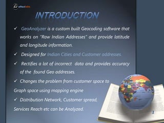
- 2. ? GeoAnalyzer is a custom built Geocoding software that works on Ī░Raw Indian AddressesĪ▒ and provide latitude and longitude information. ? Designed for Indian Cities and Customer addresses. ? Rectifies a lot of incorrect data and provides accuracy of the found Geo addresses. ? Changes the problem from customer space to Graph space using mapping engine ? Distribution Network, Customer spread, Services Reach etc can be Analyzed. 1
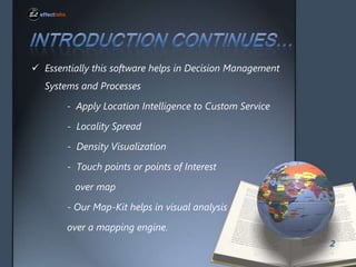
- 3. ? Essentially this software helps in Decision Management Systems and Processes - Apply Location Intelligence to Custom Service - Locality Spread - Density Visualization - Touch points or points of Interest over map - Our Map-Kit helps in visual analysis over a mapping engine. 2
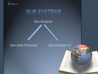
- 4. Geo Analyzer Geo Data Processor Geo Analyzer UI 3
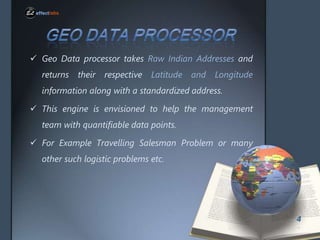
- 5. ? Geo Data processor takes Raw Indian Addresses and returns their respective Latitude and Longitude information along with a standardized address. ? This engine is envisioned to help the management team with quantifiable data points. ? For Example Travelling Salesman Problem or many other such logistic problems etc. 4
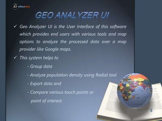
- 6. ? Geo Analyzer UI is the User Interface of this software which provides end users with various tools and map options to analyze the processed data over a map provider like Google maps. ? This system helps to - Group data - Analyze population density using Radial tool - Export data and - Compare various touch points or point of interest. 5
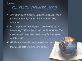
- 7. ? 70% of GA (GeoAnalyzer) LatitudeLongitude would fall within 2kms of actual Latitudelongitude of customer. ? GA2 (Engine working only for Touch Points) ©C 95% accuracy of GA2 processed data would be within. 100 meters of actual address. (works only for touch points or data < 20k). ? GA (GeoAnalyzer) has been tested on more than 25Lac data (meeting 70% limits). 6
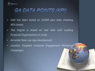
- 8. ? GA2 has been tested on 20,000 plus data (meeting 95% limits). ? This Engine is tested on real data with Leading Financial Organizations in India. ? Accurate Near-me App development ? Location Targeted Customer Engagement Marketing Campaigns 7
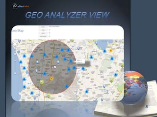
- 9. 8
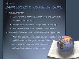
- 10. ? Visual Analyzer ? Customer Data, ATM data, Branch Data and Offer Data Visual Location over map. ? Visual Analyzer for better strategic decision making. ? ATM Coverage and Point of Interest Visual reach etc. ? Accurate Customer Email Notification with Offer Data ? With the accurate knowledge of offer location and approximated knowledge of customer address, Email notifications can be made intelligent and personalized based on the location. 9
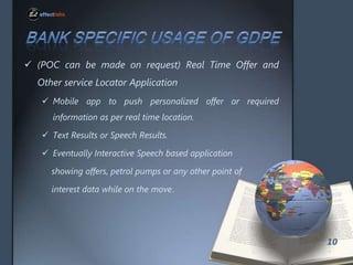
- 11. ? (POC can be made on request) Real Time Offer and Other service Locator Application ? Mobile app to push personalized offer or required information as per real time location. ? Text Results or Speech Results. ? Eventually Interactive Speech based application showing offers, petrol pumps or any other point of interest data while on the move. 10
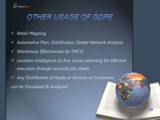
- 12. ? Retail Mapping ? Automotive Plan, Distribution, Dealer Network Analysis ? Warehouse Effectiveness for FMCG ? Location Intelligence to Any survey planning for effective execution through accurate job sheets ? Any Distribution of Assets or Services or Customers can be Visualized & Analyzed 10