Geo Location Initial PoC
0 likes506 views
Short walkthrough of the initial implementation of the geo location enabled discovery service for SimpleSAMLphp.
1 of 8
Download to read offline


Recommended
Web Mapping with Drupal
Web Mapping with DrupalRanel Padon
Ã˝
The document discusses various modules in Drupal that enable web mapping capabilities. It describes the Geofield module, which stores and displays geospatial data as fields that can then be used in Views to show the data on a map. It also covers the Leaflet and OpenLayers modules, with Leaflet being newer and lighter than OpenLayers. The OpenLayers module allows for more customizations but requires two Views to implement - one for the data and one for the map. The document provides an overview of how these modules can be used to build web maps with Drupal.Of Nodes and Maps (Web Mapping with Drupal - Part II)
Of Nodes and Maps (Web Mapping with Drupal - Part II)Ranel Padon
Ã˝
Discusses the input, storage, and display mechanisms of spatial fields on nodes: how to utilize Geofield's input widgets and output formatters, how to integrate Geofield with Leaflet and OpenLayers, and how to integrate them with Views.Using QGIS to create 3D indoor maps
Using QGIS to create 3D indoor mapsRoss McDonald
Ã˝
Tim Jenks (eeGeo) gave a quick overview of how they built their indoor 3D mapping application with QGIS. Presented at the 6th Scottish QGIS UK user group meeting.Gpu implementation of satellite image filtering
Gpu implementation of satellite image filteringermiasbet
Ã˝
This document discusses implementing satellite image filtering algorithms using GPUs with OpenCL. It evaluates the Sobel and Laplacian edge detection algorithms for efficiency and quality. The host code uses C++ and OpenCL API to transfer image data to the GPU device, compile and run the OpenCL program, then retrieve results. Testing on Landsat imagery shows the GPU outperforms the CPU for both Sobel and Laplacian filtering. An open issue is applying preprocessing like smoothing and contrast adjustment during filtering.Mapping in Drupal using OpenLayers
Mapping in Drupal using OpenLayersPeter Vanhee
Ã˝
This document discusses mapping in Drupal using the OpenLayers module. It begins by introducing OpenLayers and describing its functionality as a JavaScript framework for building map applications. It then provides an overview of Drupal and relevant mapping modules. The document outlines a three step process for creating maps: 1) adding layers, 2) setting map presets, and 3) displaying maps through Views. It provides examples and screenshots for configuring geofield data, layers, styles, and behaviors. Finally, it discusses extensions, improvements, and the status of OpenLayers for Drupal 7.OpenGeoData Italia - Roma - Simone Cortesi | Maurizio Napolitano | openstreet...
OpenGeoData Italia - Roma - Simone Cortesi | Maurizio Napolitano | openstreet...Simone Cortesi
Ã˝
Discussione su OpenStreetMap, sistemi GIS classici, confronti, potenzialità di OSM e dei suoi strumenti di estrazione dati.
∫›∫›fl£ per la conferenza OpenGeoData Italia - Roma - 27 febbraio 2014.QGIS server: the good, the not-so-good and the ugly
QGIS server: the good, the not-so-good and the uglyRoss McDonald
Ã˝
Fiona Hemsley-Flint's presentation on QGIS Server given at the 6th Scottish QGIS UK user group meeting. Compares QGIS server with Mapserver and Geognosis.Core Reference Geographies - London Underground
Core Reference Geographies - London UndergroundGeoEnable Limited
Ã˝
Conceptual Assets on the London Underground (from Tube Lines).
Term 'Core Reference Geographies' taken from INSPIRE.
Note - this is not an official list of asset types, this is only to be used to discuss the concept of asset classification (taxonomy).Edina Geoservices Review - Emma Diffley
Edina Geoservices Review - Emma DiffleyEDINA, University of Edinburgh
Ã˝
Presentation given as part of the EDINA Digimap GeoForum 2013 on Thursday 20th June 2013 at the Congress Centre, London. Wherecamp Navigation Conference 2015 - New written standards for the new maps?
Wherecamp Navigation Conference 2015 - New written standards for the new maps?WhereCampBerlin
Ã˝
This document discusses standards for maps and geospatial data. It begins by introducing Nutiteq, a company that provides offline maps using OpenStreetMap (OSM) and other data sources. The document then covers official geo standards from organizations like OGC as well as de facto standards commonly used in practice, such as vector tile formats. It notes issues with unstable, incomplete de facto standards and suggests establishing a meta-standard process for describing, sharing, and testing standards to avoid vendor lock-in and support development.Nutiteq Wherecamp Berlin 2015
Nutiteq Wherecamp Berlin 2015Jaak Laineste
Ã˝
This document discusses standards for maps and geospatial data. It begins by introducing Nutiteq, a company that provides offline maps using OpenStreetMap (OSM) and other data sources. The document then outlines existing official and de facto standards, noting issues like unstable implementations, vendor lock-in, and forks that don't maintain standards. It proposes establishing a meta-standard process for describing, sharing, testing, and improving standards through open communication and technical test suites to avoid single vendor control.Koss Lab 세미나 오픈소스 인공지능(AI) 프레임웍파헤치기 
Koss Lab 세미나 오픈소스 인공지능(AI) 프레임웍파헤치기 Mario Cho
Ã˝
- Mario Cho is a developer with experience in image recognition using neural networks, bio-medical data processing, human brain mapping, medical image reconstruction, enterprise systems, and open source software development using frameworks like OpenStack and TensorFlow.
- The document discusses machine learning and various deep learning frameworks like Caffe, Chainer, CNTK, DL4J, Keras, MXNet, TensorFlow, Theano, and Torch - comparing their creators, release dates, applications, and motivations.
- It provides a table comparing the frameworks on attributes like supporting organization, platforms, languages, interfaces, GPU/multi-GPU support, and distributed capabilities.Latest Developments in H2O
Latest Developments in H2OSri Ambati
Ã˝
This document provides an overview of latest developments at H2O.ai, including enhancements to their machine learning platform H2O such as Deep Water for distributed deep learning using GPUs, xgboost integration, stacked ensembles, automatic machine learning, and model interpretation capabilities. It also discusses H2O's community involvement through meetup groups and conferences like PyData.Going Mobile with HTML5
Going Mobile with HTML5John Reiser
Ã˝
The document provides an overview of using HTML5 for mobile mapping applications. It discusses the history and rise of HTML5, how it enables web applications to work across browsers, and its support for mobile functionality. It also covers various HTML5 mapping APIs, using geolocation, common data formats, tile maps and projections, and considerations for designing mobile user interfaces.Location-Based Marketing Application Development Made Easier with GeoSimulator
Location-Based Marketing Application Development Made Easier with GeoSimulatorSundeep Dawale
Ã˝
GeoSimulator is a patent pending platform for development of location based solutions.
Current development/testing methods requires deep knowledge of GIS computations. It involves handling complex GPX, KML files or dealing with limited locations in IDEs. Inevitably application developers spend more time in location functionality rather than business logic or user interfaces.
GeoSimulator takes the location specific complexity out of the application development process with its simple few-lines-of-code integration.
Apart from development, testing becomes simpler and cost efficient due to the fact that it can be done straight from the desk as opposed to field testing.
The presentation explains all the salient features of this testing and development platform. PEARC17: Live Integrated Visualization Environment:
An Experiment in General...
PEARC17: Live Integrated Visualization Environment:
An Experiment in General...moneyjh
Ã˝
Live Integrated Visualization Environment:
An Experiment in Generalized Structured Frameworks for Visualization and AnalysisCytoscape: Now and Future
Cytoscape: Now and FutureKeiichiro Ono
Ã˝
Presentation slides for Ideker Lab meeting on 12/1/2014. Briefly describes current status of the projects and future vision.Google App Engine Java, Groovy and Gaelyk
Google App Engine Java, Groovy and GaelykGuillaume Laforge
Ã˝
Patrick Chanezon and Guillaume Laforge are presenting Google App Engine Java and Gaelyk, the lightweight groovy toolkit on top of the GAE SDK, at the Devoxx conferenceNSBudapest Presentation
NSBudapest PresentationPéter Ádám Wiesner
Ã˝
Besides the giants like Facebook, Google and Twitter only a few smaller companies are able to work at scale. Skyscanner Budapest stepped on this exciting journey last year and set the goal: enable more and more engineers inside the company to work together on Skyscanner’s apps but at the same time keep our pace and fix release schedule that allows us iterative development.
My presentation aims to be an insider-tour in Skyscanner’s engineering culture and more specifically in the daily routine of our Budapest-based mobile app development team: we are 40 engineers working to satisfy the needs of over 40 million travellers. It is also a story about how we slowly evolved from coders to product engineers whose most important job is to creatively solve complex problems.
We haven't reached the end of our journey yet, however we think that our first learnings can be interesting for others.Leveraging the Globus Platform (GlobusWorld Tour - Columbia University)
Leveraging the Globus Platform (GlobusWorld Tour - Columbia University)Globus
Ã˝
The document discusses how the Globus platform can be leveraged to build science gateways, web portals, and other applications. It provides examples of how the Globus Auth, APIs, and Connect services can be used to enable authentication, file transfer, and data sharing. The Globus Python SDK and helper pages are also described as tools for developing applications that integrate Globus functionality.Foss4G2013 Mappy-ing Open Source
Foss4G2013 Mappy-ing Open SourceAudrey Malherbe
Ã˝
Mappy overhauled their mapping engine, migrating from a proprietary system to an open-source stack based around Mapnik and PostGIS. They took a gradual, multi-step approach to learn the new technologies and transition components over time. This reduced risks and allowed them to optimize the new platform. Key achievements include significant performance improvements, standardization, and contributions to the Mapnik open source project. The new system now handles 85% of Mappy's map rendering load with high throughput and cache hit ratios.Aleksandr_Savelyev_Resume_Mar_2016
Aleksandr_Savelyev_Resume_Mar_2016Aleksandr Savelyev
Ã˝
This document provides a summary of Aleksandr Savelyev's experience as a Senior Software Engineer including his skills, projects, and employment history. He has over 15 years of experience developing web and desktop applications using technologies like C#, Java, .NET, SQL, and more. Notable projects include rewriting a desktop application to be web-based, developing services to transfer video files between servers, and building monitoring applications. He was previously employed at CCH Wolters Kluwer and DGFastChannel where he worked on various projects delivering digital video advertisements.Integrating PostGIS in Web Applications
Integrating PostGIS in Web ApplicationsCommand Prompt., Inc
Ã˝
Leo Hsu and Regina Obe
We'll demonstrate integrating PostGIS in both PHP and ASP.NET applications.
We'll demonstrate using the new PostGIS 1.5 geography offering to extend existing web applications with proximity analysis.
More advanced use to display maps and stats using OpenLayers, WMS/WFS services and roll your own WFS like service using the PostGIS KML/GML/and or GeoJSON output functions.Monitoring a Kubernetes-backed microservice architecture with Prometheus
Monitoring a Kubernetes-backed microservice architecture with PrometheusFabian Reinartz
Ã˝
As many startups of the last decade, SoundCloud’s architecture started as a Ruby-on-Rails monolith, which later had to be broken into microservices to cope with the growing size and complexity of the site. The microservices initially ran on an in-house container management and deployment platform. Recently, the company has started to migrate to Kubernetes.
With the introduction of microservices, the existing conventional monitoring setup failed both conceptually and in terms of scalability. Thus, starting in 2012, SoundCloud invested heavily into the development of the open-source monitoring system Prometheus, which was designed for large-scale highly dynamic service-oriented architectures.
Migrating to Kubernetes, it became apparent that Prometheus and Kubernetes are a match made in open-source heaven. The talk will demonstrate the current Prometheus setup at SoundCloud, monitoring a large-scale Kubernetes cluster.Social Photos - My presentation at Microsoft Tech Day
Social Photos - My presentation at Microsoft Tech DayTechMaster Vietnam
Ã˝
Social Photos is an online social network for photographers and photo lovers. Users can take photos and share them on the network. Other users can like, dislike, or comment on photos. The network also integrates location-based features so photos can be listed near the location where they were taken. The social network is built using various Microsoft and non-Microsoft technologies integrated seamlessly. It uses technologies like Entity Framework, WCF data services, OData, and supports multiple client platforms like Windows Phone, Android, iOS, and web clients.Ml based detection of users anomaly activities (20th OWASP Night Tokyo, English)
Ml based detection of users anomaly activities (20th OWASP Night Tokyo, English)Yury Leonychev
Ã˝
This is a English slides of my presentation about machine learning implementation for model web application. Some advices for developers, which decided to create the same implementation in real production environment.Project Matsu
Project MatsuCollin Bennett
Ã˝
Project Matsu aimed to provide persistent data resources and elastic computing for disaster relief by making imagery available for processing using large-scale cloud computing. It evaluated three approaches: 1) Using Hadoop and MapReduce to split images and process parts in parallel; 2) Using Hadoop streaming with Python to preprocess images into a single file and process line-by-line; and 3) Using the Sector distributed file system to keep images together on nodes and applying user-defined functions to process images without splitting. The goal was to enable change detection on images from different times to assist relief workers.MartinVanha
MartinVanhaMartin Vanha
Ã˝
Martin Vanha has over 20 years of experience as a senior software engineer with expertise in Java, C#, JavaScript, SQL, and various frameworks. He has worked on projects involving web and mobile applications, enterprise software, databases, and more for companies like Spritz, Exelis, Time Warner Cable, and Digital Globe. His skills include designing and developing features, web services, parsers, SDKs, and other software.More Related Content
Similar to Geo Location Initial PoC (20)
Edina Geoservices Review - Emma Diffley
Edina Geoservices Review - Emma DiffleyEDINA, University of Edinburgh
Ã˝
Presentation given as part of the EDINA Digimap GeoForum 2013 on Thursday 20th June 2013 at the Congress Centre, London. Wherecamp Navigation Conference 2015 - New written standards for the new maps?
Wherecamp Navigation Conference 2015 - New written standards for the new maps?WhereCampBerlin
Ã˝
This document discusses standards for maps and geospatial data. It begins by introducing Nutiteq, a company that provides offline maps using OpenStreetMap (OSM) and other data sources. The document then covers official geo standards from organizations like OGC as well as de facto standards commonly used in practice, such as vector tile formats. It notes issues with unstable, incomplete de facto standards and suggests establishing a meta-standard process for describing, sharing, and testing standards to avoid vendor lock-in and support development.Nutiteq Wherecamp Berlin 2015
Nutiteq Wherecamp Berlin 2015Jaak Laineste
Ã˝
This document discusses standards for maps and geospatial data. It begins by introducing Nutiteq, a company that provides offline maps using OpenStreetMap (OSM) and other data sources. The document then outlines existing official and de facto standards, noting issues like unstable implementations, vendor lock-in, and forks that don't maintain standards. It proposes establishing a meta-standard process for describing, sharing, testing, and improving standards through open communication and technical test suites to avoid single vendor control.Koss Lab 세미나 오픈소스 인공지능(AI) 프레임웍파헤치기
Koss Lab 세미나 오픈소스 인공지능(AI) 프레임웍파헤치기 Mario Cho
Ã˝
- Mario Cho is a developer with experience in image recognition using neural networks, bio-medical data processing, human brain mapping, medical image reconstruction, enterprise systems, and open source software development using frameworks like OpenStack and TensorFlow.
- The document discusses machine learning and various deep learning frameworks like Caffe, Chainer, CNTK, DL4J, Keras, MXNet, TensorFlow, Theano, and Torch - comparing their creators, release dates, applications, and motivations.
- It provides a table comparing the frameworks on attributes like supporting organization, platforms, languages, interfaces, GPU/multi-GPU support, and distributed capabilities.Latest Developments in H2O
Latest Developments in H2OSri Ambati
Ã˝
This document provides an overview of latest developments at H2O.ai, including enhancements to their machine learning platform H2O such as Deep Water for distributed deep learning using GPUs, xgboost integration, stacked ensembles, automatic machine learning, and model interpretation capabilities. It also discusses H2O's community involvement through meetup groups and conferences like PyData.Going Mobile with HTML5
Going Mobile with HTML5John Reiser
Ã˝
The document provides an overview of using HTML5 for mobile mapping applications. It discusses the history and rise of HTML5, how it enables web applications to work across browsers, and its support for mobile functionality. It also covers various HTML5 mapping APIs, using geolocation, common data formats, tile maps and projections, and considerations for designing mobile user interfaces.Location-Based Marketing Application Development Made Easier with GeoSimulator
Location-Based Marketing Application Development Made Easier with GeoSimulatorSundeep Dawale
Ã˝
GeoSimulator is a patent pending platform for development of location based solutions.
Current development/testing methods requires deep knowledge of GIS computations. It involves handling complex GPX, KML files or dealing with limited locations in IDEs. Inevitably application developers spend more time in location functionality rather than business logic or user interfaces.
GeoSimulator takes the location specific complexity out of the application development process with its simple few-lines-of-code integration.
Apart from development, testing becomes simpler and cost efficient due to the fact that it can be done straight from the desk as opposed to field testing.
The presentation explains all the salient features of this testing and development platform. PEARC17: Live Integrated Visualization Environment:
An Experiment in General...
PEARC17: Live Integrated Visualization Environment:
An Experiment in General...moneyjh
Ã˝
Live Integrated Visualization Environment:
An Experiment in Generalized Structured Frameworks for Visualization and AnalysisCytoscape: Now and Future
Cytoscape: Now and FutureKeiichiro Ono
Ã˝
Presentation slides for Ideker Lab meeting on 12/1/2014. Briefly describes current status of the projects and future vision.Google App Engine Java, Groovy and Gaelyk
Google App Engine Java, Groovy and GaelykGuillaume Laforge
Ã˝
Patrick Chanezon and Guillaume Laforge are presenting Google App Engine Java and Gaelyk, the lightweight groovy toolkit on top of the GAE SDK, at the Devoxx conferenceNSBudapest Presentation
NSBudapest PresentationPéter Ádám Wiesner
Ã˝
Besides the giants like Facebook, Google and Twitter only a few smaller companies are able to work at scale. Skyscanner Budapest stepped on this exciting journey last year and set the goal: enable more and more engineers inside the company to work together on Skyscanner’s apps but at the same time keep our pace and fix release schedule that allows us iterative development.
My presentation aims to be an insider-tour in Skyscanner’s engineering culture and more specifically in the daily routine of our Budapest-based mobile app development team: we are 40 engineers working to satisfy the needs of over 40 million travellers. It is also a story about how we slowly evolved from coders to product engineers whose most important job is to creatively solve complex problems.
We haven't reached the end of our journey yet, however we think that our first learnings can be interesting for others.Leveraging the Globus Platform (GlobusWorld Tour - Columbia University)
Leveraging the Globus Platform (GlobusWorld Tour - Columbia University)Globus
Ã˝
The document discusses how the Globus platform can be leveraged to build science gateways, web portals, and other applications. It provides examples of how the Globus Auth, APIs, and Connect services can be used to enable authentication, file transfer, and data sharing. The Globus Python SDK and helper pages are also described as tools for developing applications that integrate Globus functionality.Foss4G2013 Mappy-ing Open Source
Foss4G2013 Mappy-ing Open SourceAudrey Malherbe
Ã˝
Mappy overhauled their mapping engine, migrating from a proprietary system to an open-source stack based around Mapnik and PostGIS. They took a gradual, multi-step approach to learn the new technologies and transition components over time. This reduced risks and allowed them to optimize the new platform. Key achievements include significant performance improvements, standardization, and contributions to the Mapnik open source project. The new system now handles 85% of Mappy's map rendering load with high throughput and cache hit ratios.Aleksandr_Savelyev_Resume_Mar_2016
Aleksandr_Savelyev_Resume_Mar_2016Aleksandr Savelyev
Ã˝
This document provides a summary of Aleksandr Savelyev's experience as a Senior Software Engineer including his skills, projects, and employment history. He has over 15 years of experience developing web and desktop applications using technologies like C#, Java, .NET, SQL, and more. Notable projects include rewriting a desktop application to be web-based, developing services to transfer video files between servers, and building monitoring applications. He was previously employed at CCH Wolters Kluwer and DGFastChannel where he worked on various projects delivering digital video advertisements.Integrating PostGIS in Web Applications
Integrating PostGIS in Web ApplicationsCommand Prompt., Inc
Ã˝
Leo Hsu and Regina Obe
We'll demonstrate integrating PostGIS in both PHP and ASP.NET applications.
We'll demonstrate using the new PostGIS 1.5 geography offering to extend existing web applications with proximity analysis.
More advanced use to display maps and stats using OpenLayers, WMS/WFS services and roll your own WFS like service using the PostGIS KML/GML/and or GeoJSON output functions.Monitoring a Kubernetes-backed microservice architecture with Prometheus
Monitoring a Kubernetes-backed microservice architecture with PrometheusFabian Reinartz
Ã˝
As many startups of the last decade, SoundCloud’s architecture started as a Ruby-on-Rails monolith, which later had to be broken into microservices to cope with the growing size and complexity of the site. The microservices initially ran on an in-house container management and deployment platform. Recently, the company has started to migrate to Kubernetes.
With the introduction of microservices, the existing conventional monitoring setup failed both conceptually and in terms of scalability. Thus, starting in 2012, SoundCloud invested heavily into the development of the open-source monitoring system Prometheus, which was designed for large-scale highly dynamic service-oriented architectures.
Migrating to Kubernetes, it became apparent that Prometheus and Kubernetes are a match made in open-source heaven. The talk will demonstrate the current Prometheus setup at SoundCloud, monitoring a large-scale Kubernetes cluster.Social Photos - My presentation at Microsoft Tech Day
Social Photos - My presentation at Microsoft Tech DayTechMaster Vietnam
Ã˝
Social Photos is an online social network for photographers and photo lovers. Users can take photos and share them on the network. Other users can like, dislike, or comment on photos. The network also integrates location-based features so photos can be listed near the location where they were taken. The social network is built using various Microsoft and non-Microsoft technologies integrated seamlessly. It uses technologies like Entity Framework, WCF data services, OData, and supports multiple client platforms like Windows Phone, Android, iOS, and web clients.Ml based detection of users anomaly activities (20th OWASP Night Tokyo, English)
Ml based detection of users anomaly activities (20th OWASP Night Tokyo, English)Yury Leonychev
Ã˝
This is a English slides of my presentation about machine learning implementation for model web application. Some advices for developers, which decided to create the same implementation in real production environment.Project Matsu
Project MatsuCollin Bennett
Ã˝
Project Matsu aimed to provide persistent data resources and elastic computing for disaster relief by making imagery available for processing using large-scale cloud computing. It evaluated three approaches: 1) Using Hadoop and MapReduce to split images and process parts in parallel; 2) Using Hadoop streaming with Python to preprocess images into a single file and process line-by-line; and 3) Using the Sector distributed file system to keep images together on nodes and applying user-defined functions to process images without splitting. The goal was to enable change detection on images from different times to assist relief workers.MartinVanha
MartinVanhaMartin Vanha
Ã˝
Martin Vanha has over 20 years of experience as a senior software engineer with expertise in Java, C#, JavaScript, SQL, and various frameworks. He has worked on projects involving web and mobile applications, enterprise software, databases, and more for companies like Spritz, Exelis, Time Warner Cable, and Digital Globe. His skills include designing and developing features, web services, parsers, SDKs, and other software.Geo Location Initial PoC
- 1. Discovery Ã˝Service Ã˝suppor.ng Ã˝ Geo-¬≠‚ÄêLoca.on Ã˝ Jacob Ã˝Chris.ansen Ã˝ <jach@wayf.dk> Ã˝ TF-¬≠‚ÄêEMC2, Ã˝22 Ã˝September Ã˝2010, Ã˝Copenhagen, Ã˝Denmark Ã˝
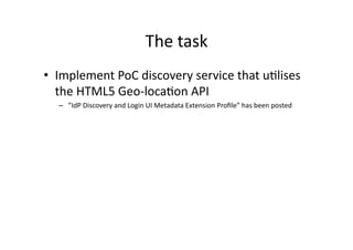
- 2. The Ã˝task Ã˝ ‚Ä¢‚Äà Implement Ã˝PoC Ã˝discovery Ã˝service Ã˝that Ã˝u.lises Ã˝ the Ã˝HTML5 Ã˝Geo-¬≠‚Äêloca.on Ã˝API Ã˝ ‚Äì‚Äà ‚ÄùIdP Ã˝Discovery Ã˝and Ã˝Login Ã˝UI Ã˝Metadata Ã˝Extension Ã˝ProÔ¨Åle‚Äù Ã˝has Ã˝been Ã˝posted Ã˝
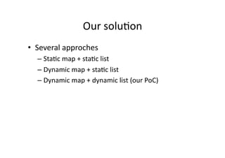
- 4. Our Ã˝solu.on Ã˝ ‚Ä¢‚Äà Several Ã˝approches Ã˝ ‚Äì‚ÄàSta.c Ã˝map Ã˝+ Ã˝sta.c Ã˝list Ã˝ ‚Äì‚ÄàDynamic Ã˝map Ã˝+ Ã˝sta.c Ã˝list Ã˝ ‚Äì‚ÄàDynamic Ã˝map Ã˝+ Ã˝dynamic Ã˝list Ã˝(our Ã˝PoC) Ã˝
- 5. DEMO Ã˝
- 6. Problems Ã˝ ‚Ä¢‚Äà Mul.ple Ã˝loca.ons Ã˝for Ã˝single Ã˝en.ty Ã˝ ‚Ä¢‚Äà Loca.on Ã˝informa.on Ã˝comes Ã˝in Ã˝many Ã˝diÔ¨Äerent Ã˝ formats Ã˝depending Ã˝on Ã˝source Ã˝ ‚Äì‚Äà Long/Lat Ã˝coordinates Ã˝(can Ã˝be Ã˝uses Ã˝directly Ã˝i Ã˝Gmaps) Ã˝ ‚Äì‚Äà UTM Ã˝coordinates Ã˝ ‚Äì‚Äà ‚Ä¶ Ã˝and Ã˝many Ã˝more Ã˝
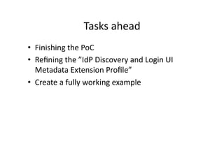
- 7. Tasks Ã˝ahead Ã˝ ‚Ä¢‚Äà Finishing Ã˝the Ã˝PoC Ã˝ ‚Ä¢‚Äà ReÔ¨Åning Ã˝the Ã˝‚ÄùIdP Ã˝Discovery Ã˝and Ã˝Login Ã˝UI Ã˝ Metadata Ã˝Extension Ã˝ProÔ¨Åle‚Äù Ã˝ ‚Ä¢‚Äà Create Ã˝a Ã˝fully Ã˝working Ã˝example Ã˝
- 8. References Ã˝ ‚Ä¢‚Äà IdP Ã˝Discovery Ã˝and Ã˝Login Ã˝UI Ã˝Metadata Ã˝Extension Ã˝ProÔ¨Åle Ã˝ ‚Äì‚Äà h^ps://spaces.internet2.edu/download/a^achments/9731/saml_ds_login_ui_02.odt?version=1 Ã˝ ‚Ä¢‚Äà HTML5 Ã˝Geo-¬≠‚Äêloca.on Ã˝API Ã˝ ‚Äì‚Äà h^p://www.w3.org/TR/geoloca.on-¬≠‚ÄêAPI/ Ã˝ ‚Ä¢‚Äà Google Ã˝Maps Ã˝Javascript Ã˝API Ã˝ ‚Äì‚Äà h^p://code.google.com/apis/maps/documenta.on/javascript/ Ã˝ ‚Ä¢‚Äà Demo Ã˝ ‚Äì‚Äà h^p://jach-¬≠‚Äêmap-¬≠‚Äêtest2.test.wayf.dk Ã˝