Geojson
?Download as PPTX, PDF?
0 likes?371 views

This document lists the group members for a project which includes 6 people: Muhammad Taqi, Waqas ali, Husnain haider, Saddam hussain, Hassn mustafa, and Muhammad aamir.


![?
? { "type": "Feature",
? "bbox": [-180.0, -90.0, 180.0, 90.0],
? "geometry": { "type": "Polygon", ˇ°
? coordinates":
? [[ [-180.0, 10.0], [20.0, 90.0], [180.0, -5.0], [-30.0, -90.0] ]] }
... }
Example](https://image.slidesharecdn.com/gsdpresentation-150607093044-lva1-app6892/85/Geojson-15-320.jpg)

Geojson
- 1. Group members: Bitf11a001 Muhammad Taqi Bitf11a002 Waqas ali Bitf11a004 Husnain haider Bitf11a006 Saddam hussain Bitf11a008 Hasssan mustafa Bitf11a009 Muhammad aamir
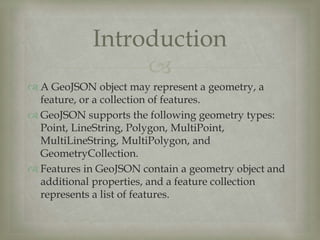
- 2. ? ? A GeoJSON object may represent a geometry, a feature, or a collection of features. ? GeoJSON supports the following geometry types: Point, LineString, Polygon, MultiPoint, MultiLineString, MultiPolygon, and GeometryCollection. ? Features in GeoJSON contain a geometry object and additional properties, and a feature collection represents a list of features. Introduction
- 3. ? ? GeoJSON is a format for encoding a variety of geographic data structures. ? JavaScript Object Notation (JSON), and the terms object, name, value, array, and number, are defined inIETF RFC 4627. ? The key words "MUST", "MUST NOT", "REQUIRED", "SHALL", "SHALL NOT", "SHOULD", "SHOULD NOT", "RECOMMENDED", "MAY", and "OPTIONAL" in this document are to be interpreted as described in IETF RFC 2119. Definition
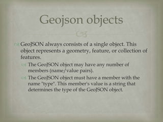
- 4. ? ? GeoJSON always consists of a single object. This object represents a geometry, feature, or collection of features. ? The GeoJSON object may have any number of members (name/value pairs). ? The GeoJSON object must have a member with the name "type". This member's value is a string that determines the type of the GeoJSON object. Geojson objects
- 5. ? ? The value of the type member must be one of: "Point", "LineString", "Polygonˇ° etc. ? A GeoJSON object may have an optional "crsˇ° member, the value of which must be a coordinate reference system object. ? A GeoJSON object may have a "bbox" member, the value of which must be a bounding box array. Cont..
- 6. ? ? A geometry is a GeoJSON object where the type member's value is one of the following strings: "Point","MultiPoint", "LineString", "Geometry Collectionˇ° etc. ? A GeoJSON geometry object of any type other than "GeometryCollection" must have a member with the name"coordinates". The value of the coordinates member is always an array. Geometry objects
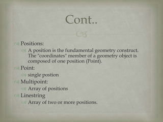
- 7. ? ? Positions: ? A position is the fundamental geometry construct. The "coordinates" member of a geometry object is composed of one position (Point). ? Point: ? single postion ? Multipoint: ? Array of positions ? Linestring ? Array of two or more positions. Cont..
- 8. ? ? Multilinestring: ? Array of linestring coordinates of array ? Polygon: ? Array of line ring coordinates of arrays ? Multipolygon: ? Array of polygon coordinates arrays. ? Geometry collections: ? A geometry collection must have a member with the name "geometries". The value corresponding to "geometries" is an array. Each element in this array is a GeoJSON geometry object. Cont..
- 9. ? ? A feature object must have a member with the name "geometry". The value of the geometry member is a geometry object or a JSON null value. ? A feature object must have a member with the name "properties". The value of the properties member is an object. ? If a feature has a commonly used identifier, that identifier should be included as a member of the feature object with the name "id". Feature objects
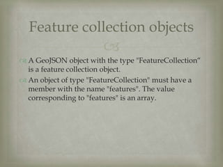
- 10. ? ? A GeoJSON object with the type "FeatureCollectionˇ° is a feature collection object. ? An object of type "FeatureCollection" must have a member with the name "features". The value corresponding to "features" is an array. Feature collection objects
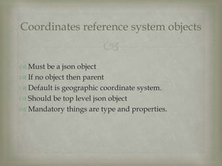
- 11. ? ? Must be a json object ? If no object then parent ? Default is geographic coordinate system. ? Should be top level json object ? Mandatory things are type and properties. Coordinates reference system objects
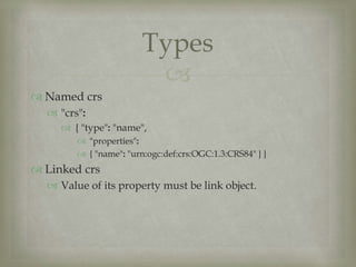
- 12. ? ? Named crs ? "crs": ? { "type": "name", ? "properties": ? { "name": "urn:ogc:def:crs:OGC:1.3:CRS84" } } ? Linked crs ? Value of its property must be link object. Types
- 13. ? ? Link object ? "href" member must be a dereferenceable URI ? "crs": ? { "type": "link", ? "properties": ? { "href": "data.crs", ? "type": "ogcwkt" } } Cont..
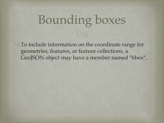
- 14. ? ? To include information on the coordinate range for geometries, features, or feature collections, a GeoJSON object may have a member named "bbox". Bounding boxes
- 15. ? ? { "type": "Feature", ? "bbox": [-180.0, -90.0, 180.0, 90.0], ? "geometry": { "type": "Polygon", ˇ° ? coordinates": ? [[ [-180.0, 10.0], [20.0, 90.0], [180.0, -5.0], [-30.0, -90.0] ]] } ... } Example
- 16. Questions??