Introduction to OpenStreetMap
- 1. An introduction to OpenStreetMap presented by David Dean şÝşÝߣs will be available at http://www.slideshare.net/dbdean
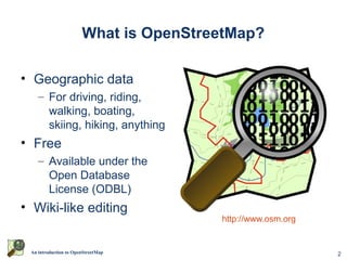
- 2. 2An introduction to OpenStreetMap What is OpenStreetMap? ? Geographic data ¨C For driving, riding, walking, boating, skiing, hiking, anything ? Free ¨C Available under the Open Database License (ODBL) ? Wiki-like editing http://www.osm.org
- 3. 3An introduction to OpenStreetMap Why not just use Google Maps? or WhereIs/Yahoo/Bing Maps? or whatever is on your GPS/Phone?
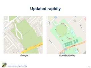
- 4. 4An introduction to OpenStreetMap Updated rapidly OpenStreetMapGoogle
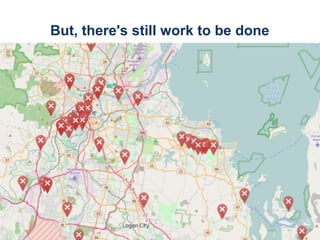
- 5. 5An introduction to OpenStreetMap But, there's still work to be done
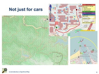
- 6. 6An introduction to OpenStreetMap Not just for cars
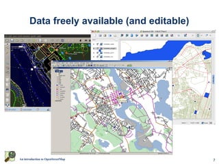
- 7. 7An introduction to OpenStreetMap Data freely available (and editable)
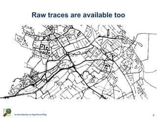
- 8. 8An introduction to OpenStreetMap Raw traces are available too
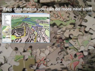
- 9. 9An introduction to OpenStreetMap Free data means you can do more neat stuff
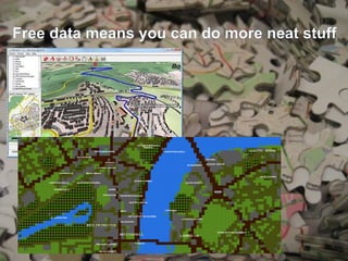
- 10. 10An introduction to OpenStreetMap Free data means you can do more neat stuff
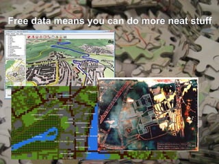
- 11. 11An introduction to OpenStreetMap Free data means you can do more neat stuff
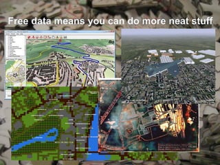
- 12. 12An introduction to OpenStreetMap Free data means you can do more neat stuff
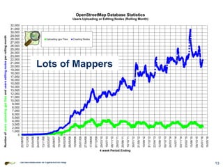
- 13. 13An introduction to OpenStreetMap Lots of Mappers
- 14. 14An introduction to OpenStreetMap Worldwide activity 2013 Year of Edits (from https://vimeo.com/83164362 )
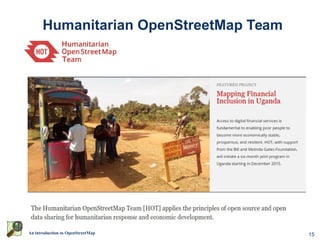
- 15. 15An introduction to OpenStreetMap Humanitarian OpenStreetMap Team
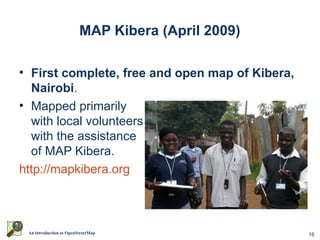
- 16. 16An introduction to OpenStreetMap MAP Kibera (April 2009) ? First complete, free and open map of Kibera, Nairobi. ? Mapped primarily with local volunteers with the assistance of MAP Kibera. http://mapkibera.org
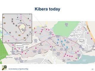
- 17. 17An introduction to OpenStreetMap Kibera today
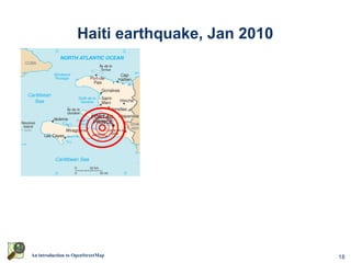
- 18. 18An introduction to OpenStreetMap Haiti earthquake, Jan 2010
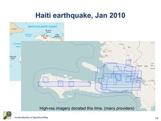
- 19. 19An introduction to OpenStreetMap Haiti earthquake, Jan 2010 High-res imagery donated this time. (many providers)
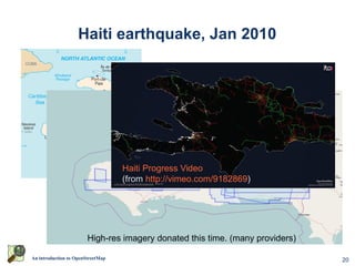
- 20. 20An introduction to OpenStreetMap Haiti earthquake, Jan 2010 High-res imagery donated this time. (many providers) Haiti Progress Video (from http://vimeo.com/9182869)
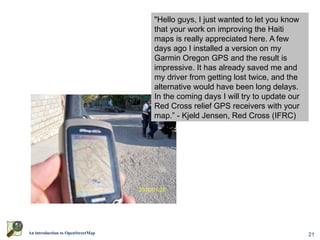
- 21. 21An introduction to OpenStreetMap World Bank Situation RoomWorld Bank Situation Room "Hello guys, I just wanted to let you know that your work on improving the Haiti maps is really appreciated here. A few days ago I installed a version on my Garmin Oregon GPS and the result is impressive. It has already saved me and my driver from getting lost twice, and the alternative would have been long delays. In the coming days I will try to update our Red Cross relief GPS receivers with your map.ˇ± - Kjeld Jensen, Red Cross (IFRC)
- 22. 22An introduction to OpenStreetMap So, how can you help map?
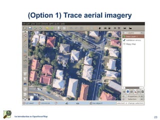
- 23. 23An introduction to OpenStreetMap (Option 1) Trace aerial imagery
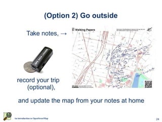
- 24. 24An introduction to OpenStreetMap (Option 2) Go outside Take notes, ˇú record your trip (optional), and update the map from your notes at home
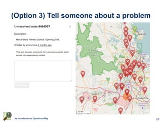
- 25. 25An introduction to OpenStreetMap (Option 3) Tell someone about a problem
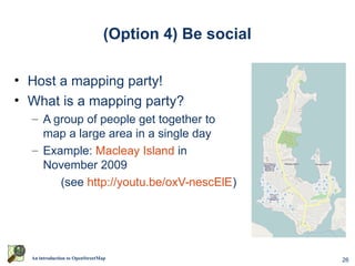
- 26. 26An introduction to OpenStreetMap (Option 4) Be social ? Host a mapping party! ? What is a mapping party? ¨C A group of people get together to map a large area in a single day ¨C Example: Macleay Island in November 2009 (see http://youtu.be/oxV-nescElE)
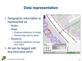
- 27. 27An introduction to OpenStreetMap Data representation ? Geographic information is represented as ¨C Nodes ¨C Ways ? Ordered collections of nodes ? Closed ways can be areas ¨C Relations ? Ordered collections of ways and nodes ? All can be tagged with any key/value pairs
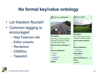
- 28. 28An introduction to OpenStreetMap No formal key/value ontology ? Let freedom flourish! ? Common tagging is encouraged ¨C Map Features wiki ¨C Editor presets ¨C Renderers ¨C OSMDoc ¨C Tagwatch
- 29. 29An introduction to OpenStreetMap Questions? Thanks for listening.