Large maps and WordPress
- 1. Blacknight WordUp Edinburgh 22 October 2011 â How Did You Do That?â Heather Burns
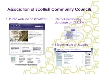
- 2. Association of Scottish Community Councils Public web site on WordPress Internal membership database on CiviCRM E-learning site on Moodle
- 3. How did we do that? ASCC requested an interactive, searchable map of their 1,200+ member Community Councils for use on their WordPress web site. This raised two issues: First, the technical issues regarding the sheer size, usability, and API call load of a map with over 1200 densely packed points; Second, the functionality issue of the map points. Community Councils are volunteer-led and run. Each individual CC's contact information tends to be a home address and phone number, or that of a local church, community centre, etc
- 4. Project Assumptions The solution had to be easy to populate. There is no shortcut around 1200 map points. Ideally ASCC staff should have the ability to update the map with changes of address and CC closures. A direct embedded Google Map was an option, but those 1200 points still had to be input. The map's purpose was to note villages, neighbourhoods, and towns which had Community Councils, not the precise physical locations to which they were registered. Therefore, the map was not required to be a street-by-street âstore finderâ or a map like the one you used to find your way here to Surgeon's Hall this morning.
- 5. Technical Issues We began to tackle the challenge using the popular Google Map integration WP plugins which were available at the time (summer/autumn 2010) in hopes that the plugins would provide an easy way to input the information as well as display it. But we found that the plugins were in a sorry state. Plugin A had gone dormant and was unsupported. It simply did not work on the contemporary build of WordPress. Plugin B balked at any more than 100 map points. Insertion of more than 100 was a premium (paid) feature!
- 6. Technical Issues Plugin C worked up to a point. We had to split the Community Councils by the 32 local authorities, which necessitated the creation of 32 subpages on the site to hold these 32 maps. The use of postcode data to generate these maps meant that pins might appear in the wrong neighbourhood, village, or even on an entirely different island. Plugin C was picked up and updated by a new developer. His first update killed the plugin for us. It began loading all 1200 points in the background even when one local authority map was selected. Result: blank maps or maps centred over the North Sea. Developer could not fix this within our project time frame.
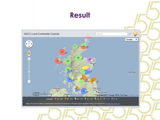
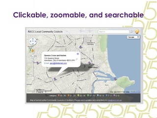
- 7. The Solution! http://www.batchgeo.com allowed us to automate the process as much as was realistically possible to produce an externally hosted and interactive map. BatchGeo automatically assigns latitude and longitude coordinates to addresses to produce an interactive, clickable, and embeddable map. â Embeddableâ is not a word. I just invented it.
- 8. The Process We exported a branch list from the CiviCRM membership database. Cleaning the list and adapting it to the BatchGeo format took approximately six hours. We deleted closed and dormant Community Councils and removed characters like & (âWoodlands & Park CCâ) and / (âFlat 1/3, 142 Fore Streetâ). The cleaned list had 1151 rows x 17 columns. The first attempt to upload the map to BatchGeo generated correctly coordinated latitudes and longitudes for around 85% of the Community Councils. That left around 150 Community Councils whose latitudes and longitudes had to be manually corrected.
- 9. The Process What's the quickest way to find a village's latitude and longitude? Wikipedia! At last the map was complete. BatchGeo gives you a simple line of code to embed in your site â in this case, on the âFind a Councilâ page on ASCC's WordPress site. Cut, Paste, Simples.
- 10. Result
- 11. Clickable, zoomable, and searchable
- 12. The Lesson WordPress plugins are often an interface between an external solution and WP's architecture. That means sometimes you don't need a plugin. Think outside the plugin! Use latitude and longitude data, not postcodes. There's another lesson with this project...
- 13. All for naught
- 14. End of the road The writing on the wall for an organisation serving Digital Immigrants and Reluctant Adopters Dispute with Scottish Government resulted in the announcement of organisation's closure in July 2011 Staggered âwinding downâ process to April 2012 CCs will continue but there will be no central organisation. Interesting implications for branch finder map and the organisation's web sites in general, with many considerations ranging from political disputes to hosting costs. No formal decisions made yet on what will be done with the organisation's web sites. Moodle VLE will ideally continue on as a training and development portal.
