Linked Open Data Usage in Geohazard System Supporting Crisis Management
- 1. Polish Geological Institute National Research Institute Linked┬ĀOpen┬ĀData┬Āusage┬Āin┬Āgeohazard system┬Āsupporting┬Ācrisis┬Āmanagement INSPIRE┬ĀŌĆÉ Aalborg,┬Ā16ŌĆÉ20┬ĀJune 2014 Tomasz┬ĀNa┼é─Öcz┬Ā┬Ā┬ĀGrzegorz┬ĀRy┼╝y┼äski Adam┬ĀIwaniak
- 2. Polish Geological Institute National Research Institute the Earth under our feet
- 3. Polish Geological Institute National Research Institute Safe infrastructure Critical┬Āmineral┬Ā resources Geohazadrs Groundwater┬Ā protection Geological┬Ā mapping Geoinformation
- 4. Polish Geological Institute National Research Institute It┬Āis┬Āalways┬Āunexpected┬Āand┬Ā extremely┬Ādifficult┬Āto┬ĀpredictRight┬Āinformation┬Ācan┬Āsave┬Ā damage┬Āin┬Āinfrastructure┬Ā and┬Āavoid casualties Help┬Āto┬Āassess┬Āthe┬Ādisaster┬Ārisk┬Ā associated┬Āwith┬Āextreme┬Ā geohazards Mitigation┬Āof┬Āpossible┬Ā threats┬Āfor┬Āsociety
- 5. Polish Geological Institute National Research Institute Before┬Ādisaster┬Āstrikes everything will┬Ābe┬Āready┬Ā to┬Āsecure┬Āpeople
- 6. Polish Geological Institute National Research Institute Geohazard Information┬ĀCenter
- 7. Polish Geological Institute National Research Institute Crisis┬ĀManagement┬Āin┬ĀPoland COUNTRY NATIONAL┬ĀOCCURRENCE VOIVODESHIP VOIVODESHIP┬ĀOCCURRENCE DISTRICT DISTRICT┬ĀOCCURRENCE MUNICIPALITY MUNICIPAL┬ĀOCCURRENCE VOYT┬Ā/┬ĀMAYOR ŌĆÉŌĆÉŌĆÉŌĆÉŌĆÉŌĆÉŌĆÉŌĆÉŌĆÉŌĆÉŌĆÉŌĆÉŌĆÉŌĆÉŌĆÉŌĆÉŌĆÉŌĆÉŌĆÉŌĆÉŌĆÉŌĆÉŌĆÉŌĆÉŌĆÉŌĆÉŌĆÉŌĆÉŌĆÉŌĆÉŌĆÉŌĆÉŌĆÉŌĆÉŌĆÉŌĆÉŌĆÉŌĆÉŌĆÉŌĆÉŌĆÉŌĆÉ Municipal┬ĀEmergency Response┬ĀBoard Municipal┬Ā Emergency┬Ā Response┬Ā Center┬Ā Municipal┬Ā Emergency┬Ā Response┬Ā Center┬Ā HEAD┬ĀOF┬ĀDISTRICT ŌĆÉŌĆÉŌĆÉŌĆÉŌĆÉŌĆÉŌĆÉŌĆÉŌĆÉŌĆÉŌĆÉŌĆÉŌĆÉŌĆÉŌĆÉŌĆÉŌĆÉŌĆÉŌĆÉŌĆÉŌĆÉŌĆÉŌĆÉŌĆÉŌĆÉŌĆÉŌĆÉŌĆÉ District┬ĀEmergency Response┬ĀBoard┬Ā District┬Ā Emergency┬Ā Response┬Ā Center┬Ā District┬Ā Emergency┬Ā Response┬Ā Center┬Ā VOIVODE ŌĆÉŌĆÉŌĆÉŌĆÉŌĆÉŌĆÉŌĆÉŌĆÉŌĆÉŌĆÉŌĆÉŌĆÉŌĆÉŌĆÉŌĆÉŌĆÉŌĆÉŌĆÉŌĆÉŌĆÉŌĆÉŌĆÉŌĆÉŌĆÉŌĆÉŌĆÉŌĆÉŌĆÉŌĆÉŌĆÉŌĆÉŌĆÉŌĆÉ Voivodeship┬ĀEmergency Response┬ĀBoard┬Ā Voivodeship┬Ā Emergency┬Ā Response┬Ā Center┬Ā Voivodeship┬Ā Emergency┬Ā Response┬Ā Center┬Ā Government┬Ā Center┬Āfor┬Ā Security Government┬Ā Center┬Āfor┬Ā Security COUNCIL┬ĀOF┬ĀMINISTERS Minister┬Āof┬Āthe┬ĀInterior ŌĆÉŌĆÉŌĆÉŌĆÉŌĆÉŌĆÉŌĆÉŌĆÉŌĆÉŌĆÉŌĆÉŌĆÉŌĆÉŌĆÉŌĆÉŌĆÉŌĆÉŌĆÉŌĆÉŌĆÉŌĆÉŌĆÉŌĆÉŌĆÉŌĆÉŌĆÉŌĆÉŌĆÉ Government┬ĀEmergency Response┬ĀBoard┬Ā Municipal┬Ā crisis Voivodeship┬Ā crisis District┬Ā crisis
- 8. Polish Geological Institute National Research Institute Simple┬Ā&┬Āclear┬ĀInformation
- 9. Polish Geological Institute National Research Institute General┬ĀConcept┬ĀGIC Coordination Knowledge Communication
- 10. Polish Geological Institute National Research Institute General┬ĀConcept┬ĀGIC Coordination Knowledge Communication
- 11. Polish Geological Institute National Research Institute Dispatch┬Ā Desk Expert┬Ā System┬Ā (GIC) Video┬Ā Conference┬Ā Module GEOHAZARD┬ĀINFORMATION┬ĀCENTER GIC┬Ā(BI)┬ĀData┬ĀRepository GIC┬Ādata ’ü« ’ü« ’ü« Landslides┬Ā (SOPO) Flash┬Āfloods┬Āand┬Ā Hydrogeohazards┬Ā (CBDH) Seismic┬Ārisks┬Ā (Geodynamic┬Ā monitoring┬Āof┬Ā Poland) ŌĆ”others (f.e.┬ĀgeologicalŌĆÉ engineering┬Ādata┬ĀŌĆō BDGI) GIC┬ĀReport quick┬Āreaction┬Ā (max.┬Ā1┬Āday) General┬ĀcrossŌĆÉ sectional┬Ā information┬Āon┬Ā geohazards┬Āin┬Ā the┬Āgiven┬Āplace GIC┬ĀExpertise performance┬Āperiod┬Ā from┬Āseveral┬Ādays┬Ā to┬Āseveral┬Āweeks Detailed┬Ā information,┬Ā advanced┬Āanalysis┬Ā carried┬Āout┬Āby┬ĀGIC┬Ā experts,┬Āalso┬Āusing┬Ā information┬Ā gathered┬Āby┬Ā intervention┬Āgroup Coordination Knowledge Communication PGI┬Ā thematic┬Ā resources
- 12. Polish Geological Institute National Research Institute Information┬ĀdesiminationGovernment┬ĀCentre┬Āof┬ĀSecurity Government┬ĀProtection┬ĀBureau Crisis┬ĀManagement┬ĀCentres National┬ĀAtomic┬ĀEnergy┬ĀAgency State┬ĀFire┬ĀService┬Āof┬ĀPoland Ministry┬Āof┬ĀForeign┬ĀAffairs┬Ā dispatch┬Ādesk nonŌĆÉstandard┬Ā reports┬Ā&┬Āexpertise public┬Āinfo reports GCS┬ĀŌĆÉ Central┬ĀReport┬ĀApplication standard┬Ā┬Āreport web┬Āmap┬Āportal maps prognoses analyses expertise
- 13. Polish Geological Institute National Research Institute NonŌĆÉstandard┬Āreports┬Ā&┬Āexpertise
- 14. Polish Geological Institute National Research Institute Dispatch Desk &┬ĀTeleconference┬ĀSystem┬Ā Government┬Ā┬ĀCrisis┬Ā┬ĀManagement┬Ā Support┬ĀTeam Information┬ĀTechnology┬Āand┬ĀCommunication┬ĀTeam
- 15. Polish Geological Institute National Research Institute System┬ĀArchitecture geohazard analyses┬Āsystem despatcher┬Āsystem teleconference┬Āsystem external┬Āsystems┬Āin┬ĀPGI external┬Āsystems┬Āout┬Āof┬ĀPGI
- 16. Polish Geological Institute National Research Institute
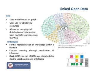
- 17. Polish Geological Institute National Research Institute Linked┬ĀOpen┬ĀData RDF┬Ā ŌĆó Data┬Āmodel┬Ābased on┬Āgraph ŌĆó Uses URI┬Āfor┬Āidentifying resources ŌĆó Allows for┬Āmerging and┬Ā distribution of┬Āinformation from┬Āmultiple sources across the┬ĀWeb Ontologies ŌĆó Formal representation of knowledge within a domain ŌĆó Express meaning through mechanism of inference ŌĆó OWL, RDFS instead of UML as a standards for storing vocabularies and ontologies Linking Open┬ĀData┬Ācloud diagram,┬Āby┬ĀRichard┬ĀCyganiak┬Āand┬Ā Anja Jentzsch.┬Āhttp://lodŌĆÉcloud.net/
- 18. Polish Geological Institute National Research Institute Linked┬ĀOpen┬ĀData PGI┬Āthematic resources Triplestore (merging) SPARQL┬Āendpoint Application Interface Analytics LOD┬Ācloud alignment converters,┬Āwrappers Ontologies Local┬Āadministration Ministry┬Āof┬Ā┬ĀEnvironment Crisis┬ĀManagement┬ĀSystems┬Ā algorithms┬Ā
- 19. Polish Geological Institute National Research Institute Summarise ŌĆó Support decision┬Āmakers┬Āin┬Ācrisis┬Āsituations ŌĆó Standard┬Āreports┬Āfor┬Ācentral┬Āapplication ŌĆó Deliver┬Āclient┬Āoriented┬Āexpertise┬Āright┬Āin┬Ātime ŌĆó Theme┬Āoriented┬Āalgorithms┬Āto┬Ābuild┬Āreports ŌĆó LOD┬Āas┬Āa┬Ātool┬Āfor┬Ādelivering wide┬Ārange┬Āof┬Ā information┬Āfrom┬Āinternal┬Āresources ŌĆó LOD┬Āextend┬Āscope┬Āfor┬Āexpert┬Āneeds
- 20. Polish Geological Institute National Research Institute Thank you for┬Ā@10tion Tomasz.Nalecz@pgi.gov.pl @tomasznalecz tomasznalecz


