Map kit
Download as pptx, pdf1 like636 views
This document provides an overview and instructions for using MapKit to display maps and add location-based functionality to iPhone applications. It discusses adding the MapKit and CoreLocation frameworks, setting the map region and position, adding annotations to mark points of interest, using geocoding to convert between addresses and coordinates, and interacting with the user's location via Core Location.
1 of 13
Downloaded 14 times


![Managing Annotation Views
- (MKAnnotationView *)mapView:(MKMapView *)theMapView
viewForAnnotation:(id <MKAnnotation>)annotation?{? MKPinAnnotationView *annotationView =
(MKPinAnnotationView *)([theMapView
dequeueReusableAnnotationViewWithIdentifier:@"annotation"]);? ? if (annotationView == NULL)? {? annotationView
= [[[MKPinAnnotationView alloc]
initWithAnnotation:annotation reuseIdentifier:@"annotation"] autorelease];? annotationView.canShowCallout = YES;?
annotationView.animatesDrop = YES;? }?? annotationView.annotation = annotation;? return annotationView;?}](https://image.slidesharecdn.com/mapkit-130111135008-phpapp02/85/Map-kit-9-320.jpg)

Recommended
Introduction to MapKit
Introduction to MapKitRob C
?
An introductory presentation on how to use MapKit in your iPhone applications.
(From Melbourne Cocoaheads July 2009)Getting Oriented with MapKit: Everything you need to get started with the new...
Getting Oriented with MapKit: Everything you need to get started with the new...John Wilker
?
New in 3.0 Map Kit works with the Google Mobile Maps Service and features panning and zooming, custom annotations, current location and geocoding. This new framework opens up many new possibilities programs not previously possible. Come learn everything you need to know to get started as well as some tips and tricks to speed your programming along.OpenLayers vs. Leaflet
OpenLayers vs. Leafletdasjo
?
Do you choose Openlayers or Leaflet to generate maps on your websites because that's what you always choose?
Is one better than the other?
We will take a few use cases and show how they could be build with both Openlayers and Leaflet, and discuss what criteria could be to choose either.Google Maps API 101
Google Maps API 101Sebastian Roming
?
This document provides an introduction to using the Google Maps API, including how to load the API, create a map container, add a map to the container with default styling, and add a marker to the map. It also briefly outlines some additional features that can be used like geocoding, custom styling, drawing tools, and more. The document encourages exploring the API further and provides resources for doing so.51811680 open layers
51811680 open layersGien Rockmantic
?
This document provides an overview and introduction to OpenLayers, an open source JavaScript library for displaying map data in web browsers. It discusses what OpenLayers is, who uses it, and provides examples for getting started with OpenLayers by creating a basic map, adding layers like WMS and XYZ tile layers, and using controls.Mapstraction
Mapstractionlokku
?
This document discusses Mapstraction, an open source JavaScript library that provides a unified API for different mapping APIs and providers. It allows developers to use a single code base while taking advantage of features from different mapping services. This reduces dependency on any single provider and offers flexibility. The document provides a brief history of Mapstraction, describes some of its key features, and includes a mini tutorial for using the latest version. It notes that while Mapstraction is actively developed, more support for additional providers and features is still needed.Of Nodes and Maps (Web Mapping with Drupal - Part II)
Of Nodes and Maps (Web Mapping with Drupal - Part II)Ranel Padon
?
Discusses the input, storage, and display mechanisms of spatial fields on nodes: how to utilize Geofield's input widgets and output formatters, how to integrate Geofield with Leaflet and OpenLayers, and how to integrate them with Views.Overview of Geomajas plug-ins and faces
Overview of Geomajas plug-ins and facesJoachim Van der Auwera
?
The document discusses Geomajas, an open source spatial application framework, and describes its core components including faces, plugins, and independent projects that provide functionality like caching, editing, geocoding, and layers for formats like WMS, KML, and OSM. It also explains Geomajas plug-ins that add capabilities for GWT, REST, printing, profiling, and more.Easily Create Maps in Drupal with Leaflet
Easily Create Maps in Drupal with LeafletAmber Matz
?
Mapping solutions in Drupal range from powerful configuration options in OpenLayers to simple one-line address fields that display a Google Map. Leaflet is a lightweight, mobile-friendly Javascript mapping library that uses Geofield to store location data. Geofield plus Leaflet is a solution with more options and flexibility than the Simple Google Maps contributed module, for example, and far less complexity, and fewer configuration options, than OpenLayers. If you're looking for an easy way to dive into mapping without pulling your hair out, then this webinar is for you.
Join Amber Matz, as she walks through the process of adding a map to your Drupal site using Geofield and Leaflet. In this webinar, you'll learn:
How to use Geofield to store location data in Drupal 7
How to display a single location marker on a map using Leaflet
How to use Views to create a map of many locationsUI optimization for night
UI optimization for nightKeishin Yokomaku
?
This document discusses UI optimization for nighttime usage of Android apps. It recommends using a dark theme at night by setting different themes for day and night. It provides details on calculating sunrise and sunset times using the TwilightCalculator class to determine when to switch themes. The class calculates sunrise/sunset times based on location, date and time. It also discusses alternatives like using UiModeManager but notes some drawbacks around needing to enable CarMode. The goal is to make the UI easier on the eyes during nighttime usage.mago3D: Let's integrate BIM and 3D GIS on top of FOSS4G
mago3D: Let's integrate BIM and 3D GIS on top of FOSS4GSANGHEE SHIN
?
This presentation was given at FOSS4G Europe 2017 which was held at ENSG, France.
***
Let's integrate BIM and 3D GIS on top of FOSS4G!
Sanghee Shin, Sungdo Son, BJ Jang, JeongDae Cheon, Hakjoon Kim
Although there has been numerous attempts to integrate indoor and outdoor space on a single geospatial platform, the outcome of these attempts are not so satisfactory till to date. Difference of data model, massive number of data to be rendered, big volume of file size are among those major technical barriers that hindered seamless integration of indoor and outdoor space. This talk will introduce a brand-new FOSS4G project called Mago3D that could seamlessly integrate BIM(Building Information Model) and popular 3D GIS model in web browser using Cesium or Web World Wind. Mago3D project aims at developing a JavaScript plug-in for existing WebGL Globe to expand WebGL Globe's functionality and usability even to indoor space and architectural(BIM) areas. To do this, Mago3D.js has been designed and developed as a WebGL independent JavaScript. Mago3D.js is composed of 6 main components like follows:
Mago3D Connector that interacts with WebGL Globe such as Cesium
Mago3D Renderer that shades and renders 3D data
Mago3D Accelerator that carries out performance enhancing algorithms such frustum & occlusion culling, indexing, LOD(Level Of Detail) handing
Mago3D Data Container that contains and manages 3D data
Mago3D Process Manager that manages whole process from data receiving to rendering
Mago3D REST API that provides API for 3D data sending and receiving
By plug in Mago3D.js to Cesium, Web World Wind, users can expand those WebGL functionality and usability to indoor space. One of big hurdle to integrate indoor and outdoor space simultaneously is handling and visualisation of massive 3D data. To overcome this hurdle, new format called F4D has been devised adopting block reference concept. Also a format converter that converts popular 3D format to F4D has been developed. Currently industry standard IFC(Industry Foundation Classes), JT(Jupiter Tessellation), and popular 3D formats such as OBJ, 3DS, COLLADA DAE can be converted to F4D format. F4D format coupled with Mago3D.js has proven that it can increase memory management efficiency and rendering speed drastically. MAGO3D can now visualise massive 3D data including indoor objects, at least 100k objects, in a single scene seamlessly with traditional outdoor 3D GIS objects. Users can now manage and handle almost every geospatial object from bolt & nut level to whole globe level with MAGO3D. This project will evolve to manage and service more dynamic data such as IoT (Internet of Things), point clouds, climate & weather data, and transportation..Terra formation control or how to move mountains
Terra formation control or how to move mountainsijcga
?
The new Uplift Model of terrain generation is generalized here and provides new possibilities for terra
formation control unlike previous fractal terrain generation methods. With the Uplift Model fine-grained
editing is possible allowing the designer to move mountains and small hills to more suitable locations
creating gaps or valleys or deep bays rather than only being able to accept the positions dictated by the
algorithm itself. Coupled with this is a compressed file storage format considerably smaller in size that the
traditional height field or height map storage requirements.Web Mapping with Drupal
Web Mapping with DrupalRanel Padon
?
The document discusses various modules in Drupal that enable web mapping capabilities. It describes the Geofield module, which stores and displays geospatial data as fields that can then be used in Views to show the data on a map. It also covers the Leaflet and OpenLayers modules, with Leaflet being newer and lighter than OpenLayers. The OpenLayers module allows for more customizations but requires two Views to implement - one for the data and one for the map. The document provides an overview of how these modules can be used to build web maps with Drupal.Google Earth
Google Earthbananagrl6913
?
Google Earth is available in four versions - a free basic version, a $20/year Plus version with additional features, a $400/year Pro version for commercial use, and an on-site Enterprise version without a published price. It is used by small businesses for tasks like finding hotels and restaurants, and large businesses can track assets. Government agencies also use it for purposes like environmental monitoring, infrastructure projects, and homeland security.Google Earth
Google Earthchrissy3130
?
Google Earth is a 3D satellite map application that allows users to easily research and share views of locations around the world. It utilizes broadband streaming technology and 3D graphics to interactively explore locations from neighborhoods to far corners of the globe. Key features include 3D buildings and terrain, dynamic navigation, video playback, and sharing annotations.Google Maps JS API
Google Maps JS APIAlberto Sim?es
?
This document provides information on using the Google Maps JavaScript API, including:
- The API is available free with usage limits or as a paid service. An API key is required.
- Basic HTML is shown to load the Google Maps script and initialize a map on a page.
- Default user interface elements like zoom controls can be configured or disabled. Custom buttons can be added.
- Markers can be placed on the map and configured with info windows, animations, and custom icons.
- Shapes like polylines and circles can be drawn on the map.
- Services provide capabilities like geocoding addresses and locations, directions, and accessing Fusion Tables data.Global mapper
Global mapperupn
?
Global Mapper is a GIS software that allows users to view, edit, and export various geospatial data formats including DEMs, shapefiles, and rasters. It can display data in 2D and 3D, generate elevation profiles and contours from DEMs, and export data to formats like DXF for use in CAD software. This document provides step-by-step instructions for loading a DEM into Global Mapper, viewing it in 3D, creating an elevation profile, exporting the DEM as a 3D DXF mesh, and generating contours.Map Feature Extraction from Satellite Imagery
Map Feature Extraction from Satellite ImageryIgor Berman
?
This document discusses using convolutional networks to classify pixels in satellite images into categories like road, water, and landscape. It finds that the category of landscape is too broad and leads to errors, as it includes diverse objects like buildings, forests, and parks. It also notes that classifying each pixel independently ignores the relationships between adjacent pixels, leading to irregular boundaries. The document proposes addressing these issues by breaking landscape into more specific categories, and by training on larger windows of pixels or an additional post-processing layer.Google earth
Google earthkondalarao7
?
Google Earth is a virtual globe program that displays satellite images of Earth allowing users to view locations from above. It supports 3D models and GIS data. Users can search locations, enter coordinates, view places in 23 languages. Features include Street View, a flight simulator, and sky viewing mode to see stars. It requires basic system specifications and is available in free, Plus, and Pro versions with different export and data options.Google Earth Presentation
Google Earth Presentationabc
?
Google Earth is a virtual globe program that maps the Earth using satellite imagery, aerial photography, and GIS data. It allows users to view 3D images of locations on Earth, take virtual tours of places, and find driving directions. Additional features include searching for locations of interest, viewing historical Street View images, and exploring 3D models of places on Earth as well as images of Mars from various space missions.Android location
Android locationKrazy Koder
?
The document discusses location services in Android and the Google Maps external library. It describes how to get location data from the LocationManager service, provide mock location data through DDMS or command line, and use the MapView class to display maps from the Google Maps API. The MapView is a subclass of ViewGroup that handles displaying maps tiles and user gestures to pan and zoom. It provides built-in functionality to work with Google Maps data.ICU MULTIVIEW
ICU MULTIVIEWG2 Research Ltd.
?
An overview of our ability to view multiple targets and/or data sources on the same map for comparison.Map reduce presentation
Map reduce presentationrajab ssemwogerere
?
The document discusses MapReduce, a programming model for processing large datasets in a distributed manner. It describes how MapReduce works by mapping data to transform it and then reducing the data to aggregate it. An example application given is counting the number of movies each user rated using a movie ratings dataset from MovieLens. The mapping and reducing functions are defined to extract user IDs and movie IDs from the raw data, count the occurrences of each user ID, and output the final counts.High-Quality Server Side Rendering using the OGC°Øs 3D Portrayal Service ®C App...
High-Quality Server Side Rendering using the OGC°Øs 3D Portrayal Service ®C App...Martin Christen
?
This document discusses high-quality server side rendering using the OGC's 3D Portrayal Service. It summarizes work using the service to render 3D buildings from OpenStreetMap data, generate depth maps and other outputs. Caching was added to improve performance. A JavaScript API allows rendering outputs on clients. Future work includes using GPU raytracing to generate outputs in one pass and combining server rendering with interactive graphics. The author believes the 3D Portrayal Service has potential for fast visualization of large 3D datasets on the web.Design pattern proxyΩÈΩB 20130805
Design pattern proxyΩÈΩB 20130805LearningTech
?
This document introduces the Proxy design pattern in C#. It provides examples of static and dynamic proxies. A static proxy controls access to its subject class by extending the subject. A dynamic proxy uses reflection at runtime to invoke methods on the proxied object, allowing the proxy to intercept and modify calls. Dynamic proxies are more flexible but require runtime code generation. The document provides sample code demonstrating how to create a dynamic proxy using an invocation handler interface to check permissions before method calls.Proxy pattern
Proxy patternShakil Ahmed
?
The proxy pattern provides a placeholder for another object to control access to it. A common use is for a local proxy to represent an object in a remote space. Here, a local help system acts as a proxy for an online help system. The local help is faster to access but less complete, while the online help is more robust but requires an internet connection. The proxy pattern allows the local help to be accessed first as a representative for the online help, providing faster access in many cases while retaining the ability to access the more full-featured online help when needed.Proxy pattern
Proxy patternChester Hartin
?
The Proxy Pattern allows for the creation of a proxy object that controls access to a real object. A proxy implements the same interface as the real object and delegates requests to it. This allows proxies to perform additional processing like lazy loading of objects to defer costs, or controlling access to shared objects. Clients receive a reference to the proxy instead of the real object and are unaware that a proxy is being used.Proxy Design Patterns
Proxy Design PatternsZafer Genc
?
The proxy pattern provides a surrogate or placeholder for another object to control access to it. It is used when the real object needs to be accessed remotely, created on demand, or access control is required. The proxy maintains a reference to the real subject and provides the same interface as the subject so it can be substituted. There are different types of proxies like virtual, remote, and protective proxies that are used in situations like lazy loading large objects, accessing remote resources, and enforcing access control respectively. The proxy pattern structure consists of a proxy class that references the real subject and controls access to it through an identical interface.Proxy design pattern (Class Ambassador)
Proxy design pattern (Class Ambassador)Sameer Rathoud
?
The proxy design pattern provides a surrogate or placeholder for another object to control access to it. It works by adding an extra layer of indirection between clients and the real subject. This allows the proxy to perform additional tasks like lazy initialization, access control, caching and logging before forwarding the request to the real subject. There are different types of proxies like remote, virtual and protection proxies. The proxy pattern implementation in C# creates a proxy class that implements the same interface as the real subject and holds a reference to an instance of the real subject. The proxy forwards requests to the real subject while also performing other operations like access control.Proxy Design Pattern
Proxy Design PatternAnjan Kumar Bollam
?
The Proxy design pattern provides a surrogate or placeholder for another object to control access to it. A proxy can act as a placeholder for complex, expensive objects that should not be initialized until needed. This delays the creation of these objects until they are actually required. Proxies can also protect the real component from undue complexity or provide extra functionality. Some common uses of proxies include remote proxies for objects in a different address space, virtual proxies that create objects on demand, and protection proxies that control access to the original object.More Related Content
What's hot (16)
Easily Create Maps in Drupal with Leaflet
Easily Create Maps in Drupal with LeafletAmber Matz
?
Mapping solutions in Drupal range from powerful configuration options in OpenLayers to simple one-line address fields that display a Google Map. Leaflet is a lightweight, mobile-friendly Javascript mapping library that uses Geofield to store location data. Geofield plus Leaflet is a solution with more options and flexibility than the Simple Google Maps contributed module, for example, and far less complexity, and fewer configuration options, than OpenLayers. If you're looking for an easy way to dive into mapping without pulling your hair out, then this webinar is for you.
Join Amber Matz, as she walks through the process of adding a map to your Drupal site using Geofield and Leaflet. In this webinar, you'll learn:
How to use Geofield to store location data in Drupal 7
How to display a single location marker on a map using Leaflet
How to use Views to create a map of many locationsUI optimization for night
UI optimization for nightKeishin Yokomaku
?
This document discusses UI optimization for nighttime usage of Android apps. It recommends using a dark theme at night by setting different themes for day and night. It provides details on calculating sunrise and sunset times using the TwilightCalculator class to determine when to switch themes. The class calculates sunrise/sunset times based on location, date and time. It also discusses alternatives like using UiModeManager but notes some drawbacks around needing to enable CarMode. The goal is to make the UI easier on the eyes during nighttime usage.mago3D: Let's integrate BIM and 3D GIS on top of FOSS4G
mago3D: Let's integrate BIM and 3D GIS on top of FOSS4GSANGHEE SHIN
?
This presentation was given at FOSS4G Europe 2017 which was held at ENSG, France.
***
Let's integrate BIM and 3D GIS on top of FOSS4G!
Sanghee Shin, Sungdo Son, BJ Jang, JeongDae Cheon, Hakjoon Kim
Although there has been numerous attempts to integrate indoor and outdoor space on a single geospatial platform, the outcome of these attempts are not so satisfactory till to date. Difference of data model, massive number of data to be rendered, big volume of file size are among those major technical barriers that hindered seamless integration of indoor and outdoor space. This talk will introduce a brand-new FOSS4G project called Mago3D that could seamlessly integrate BIM(Building Information Model) and popular 3D GIS model in web browser using Cesium or Web World Wind. Mago3D project aims at developing a JavaScript plug-in for existing WebGL Globe to expand WebGL Globe's functionality and usability even to indoor space and architectural(BIM) areas. To do this, Mago3D.js has been designed and developed as a WebGL independent JavaScript. Mago3D.js is composed of 6 main components like follows:
Mago3D Connector that interacts with WebGL Globe such as Cesium
Mago3D Renderer that shades and renders 3D data
Mago3D Accelerator that carries out performance enhancing algorithms such frustum & occlusion culling, indexing, LOD(Level Of Detail) handing
Mago3D Data Container that contains and manages 3D data
Mago3D Process Manager that manages whole process from data receiving to rendering
Mago3D REST API that provides API for 3D data sending and receiving
By plug in Mago3D.js to Cesium, Web World Wind, users can expand those WebGL functionality and usability to indoor space. One of big hurdle to integrate indoor and outdoor space simultaneously is handling and visualisation of massive 3D data. To overcome this hurdle, new format called F4D has been devised adopting block reference concept. Also a format converter that converts popular 3D format to F4D has been developed. Currently industry standard IFC(Industry Foundation Classes), JT(Jupiter Tessellation), and popular 3D formats such as OBJ, 3DS, COLLADA DAE can be converted to F4D format. F4D format coupled with Mago3D.js has proven that it can increase memory management efficiency and rendering speed drastically. MAGO3D can now visualise massive 3D data including indoor objects, at least 100k objects, in a single scene seamlessly with traditional outdoor 3D GIS objects. Users can now manage and handle almost every geospatial object from bolt & nut level to whole globe level with MAGO3D. This project will evolve to manage and service more dynamic data such as IoT (Internet of Things), point clouds, climate & weather data, and transportation..Terra formation control or how to move mountains
Terra formation control or how to move mountainsijcga
?
The new Uplift Model of terrain generation is generalized here and provides new possibilities for terra
formation control unlike previous fractal terrain generation methods. With the Uplift Model fine-grained
editing is possible allowing the designer to move mountains and small hills to more suitable locations
creating gaps or valleys or deep bays rather than only being able to accept the positions dictated by the
algorithm itself. Coupled with this is a compressed file storage format considerably smaller in size that the
traditional height field or height map storage requirements.Web Mapping with Drupal
Web Mapping with DrupalRanel Padon
?
The document discusses various modules in Drupal that enable web mapping capabilities. It describes the Geofield module, which stores and displays geospatial data as fields that can then be used in Views to show the data on a map. It also covers the Leaflet and OpenLayers modules, with Leaflet being newer and lighter than OpenLayers. The OpenLayers module allows for more customizations but requires two Views to implement - one for the data and one for the map. The document provides an overview of how these modules can be used to build web maps with Drupal.Google Earth
Google Earthbananagrl6913
?
Google Earth is available in four versions - a free basic version, a $20/year Plus version with additional features, a $400/year Pro version for commercial use, and an on-site Enterprise version without a published price. It is used by small businesses for tasks like finding hotels and restaurants, and large businesses can track assets. Government agencies also use it for purposes like environmental monitoring, infrastructure projects, and homeland security.Google Earth
Google Earthchrissy3130
?
Google Earth is a 3D satellite map application that allows users to easily research and share views of locations around the world. It utilizes broadband streaming technology and 3D graphics to interactively explore locations from neighborhoods to far corners of the globe. Key features include 3D buildings and terrain, dynamic navigation, video playback, and sharing annotations.Google Maps JS API
Google Maps JS APIAlberto Sim?es
?
This document provides information on using the Google Maps JavaScript API, including:
- The API is available free with usage limits or as a paid service. An API key is required.
- Basic HTML is shown to load the Google Maps script and initialize a map on a page.
- Default user interface elements like zoom controls can be configured or disabled. Custom buttons can be added.
- Markers can be placed on the map and configured with info windows, animations, and custom icons.
- Shapes like polylines and circles can be drawn on the map.
- Services provide capabilities like geocoding addresses and locations, directions, and accessing Fusion Tables data.Global mapper
Global mapperupn
?
Global Mapper is a GIS software that allows users to view, edit, and export various geospatial data formats including DEMs, shapefiles, and rasters. It can display data in 2D and 3D, generate elevation profiles and contours from DEMs, and export data to formats like DXF for use in CAD software. This document provides step-by-step instructions for loading a DEM into Global Mapper, viewing it in 3D, creating an elevation profile, exporting the DEM as a 3D DXF mesh, and generating contours.Map Feature Extraction from Satellite Imagery
Map Feature Extraction from Satellite ImageryIgor Berman
?
This document discusses using convolutional networks to classify pixels in satellite images into categories like road, water, and landscape. It finds that the category of landscape is too broad and leads to errors, as it includes diverse objects like buildings, forests, and parks. It also notes that classifying each pixel independently ignores the relationships between adjacent pixels, leading to irregular boundaries. The document proposes addressing these issues by breaking landscape into more specific categories, and by training on larger windows of pixels or an additional post-processing layer.Google earth
Google earthkondalarao7
?
Google Earth is a virtual globe program that displays satellite images of Earth allowing users to view locations from above. It supports 3D models and GIS data. Users can search locations, enter coordinates, view places in 23 languages. Features include Street View, a flight simulator, and sky viewing mode to see stars. It requires basic system specifications and is available in free, Plus, and Pro versions with different export and data options.Google Earth Presentation
Google Earth Presentationabc
?
Google Earth is a virtual globe program that maps the Earth using satellite imagery, aerial photography, and GIS data. It allows users to view 3D images of locations on Earth, take virtual tours of places, and find driving directions. Additional features include searching for locations of interest, viewing historical Street View images, and exploring 3D models of places on Earth as well as images of Mars from various space missions.Android location
Android locationKrazy Koder
?
The document discusses location services in Android and the Google Maps external library. It describes how to get location data from the LocationManager service, provide mock location data through DDMS or command line, and use the MapView class to display maps from the Google Maps API. The MapView is a subclass of ViewGroup that handles displaying maps tiles and user gestures to pan and zoom. It provides built-in functionality to work with Google Maps data.ICU MULTIVIEW
ICU MULTIVIEWG2 Research Ltd.
?
An overview of our ability to view multiple targets and/or data sources on the same map for comparison.Map reduce presentation
Map reduce presentationrajab ssemwogerere
?
The document discusses MapReduce, a programming model for processing large datasets in a distributed manner. It describes how MapReduce works by mapping data to transform it and then reducing the data to aggregate it. An example application given is counting the number of movies each user rated using a movie ratings dataset from MovieLens. The mapping and reducing functions are defined to extract user IDs and movie IDs from the raw data, count the occurrences of each user ID, and output the final counts.High-Quality Server Side Rendering using the OGC°Øs 3D Portrayal Service ®C App...
High-Quality Server Side Rendering using the OGC°Øs 3D Portrayal Service ®C App...Martin Christen
?
This document discusses high-quality server side rendering using the OGC's 3D Portrayal Service. It summarizes work using the service to render 3D buildings from OpenStreetMap data, generate depth maps and other outputs. Caching was added to improve performance. A JavaScript API allows rendering outputs on clients. Future work includes using GPU raytracing to generate outputs in one pass and combining server rendering with interactive graphics. The author believes the 3D Portrayal Service has potential for fast visualization of large 3D datasets on the web.Viewers also liked (9)
Design pattern proxyΩÈΩB 20130805
Design pattern proxyΩÈΩB 20130805LearningTech
?
This document introduces the Proxy design pattern in C#. It provides examples of static and dynamic proxies. A static proxy controls access to its subject class by extending the subject. A dynamic proxy uses reflection at runtime to invoke methods on the proxied object, allowing the proxy to intercept and modify calls. Dynamic proxies are more flexible but require runtime code generation. The document provides sample code demonstrating how to create a dynamic proxy using an invocation handler interface to check permissions before method calls.Proxy pattern
Proxy patternShakil Ahmed
?
The proxy pattern provides a placeholder for another object to control access to it. A common use is for a local proxy to represent an object in a remote space. Here, a local help system acts as a proxy for an online help system. The local help is faster to access but less complete, while the online help is more robust but requires an internet connection. The proxy pattern allows the local help to be accessed first as a representative for the online help, providing faster access in many cases while retaining the ability to access the more full-featured online help when needed.Proxy pattern
Proxy patternChester Hartin
?
The Proxy Pattern allows for the creation of a proxy object that controls access to a real object. A proxy implements the same interface as the real object and delegates requests to it. This allows proxies to perform additional processing like lazy loading of objects to defer costs, or controlling access to shared objects. Clients receive a reference to the proxy instead of the real object and are unaware that a proxy is being used.Proxy Design Patterns
Proxy Design PatternsZafer Genc
?
The proxy pattern provides a surrogate or placeholder for another object to control access to it. It is used when the real object needs to be accessed remotely, created on demand, or access control is required. The proxy maintains a reference to the real subject and provides the same interface as the subject so it can be substituted. There are different types of proxies like virtual, remote, and protective proxies that are used in situations like lazy loading large objects, accessing remote resources, and enforcing access control respectively. The proxy pattern structure consists of a proxy class that references the real subject and controls access to it through an identical interface.Proxy design pattern (Class Ambassador)
Proxy design pattern (Class Ambassador)Sameer Rathoud
?
The proxy design pattern provides a surrogate or placeholder for another object to control access to it. It works by adding an extra layer of indirection between clients and the real subject. This allows the proxy to perform additional tasks like lazy initialization, access control, caching and logging before forwarding the request to the real subject. There are different types of proxies like remote, virtual and protection proxies. The proxy pattern implementation in C# creates a proxy class that implements the same interface as the real subject and holds a reference to an instance of the real subject. The proxy forwards requests to the real subject while also performing other operations like access control.Proxy Design Pattern
Proxy Design PatternAnjan Kumar Bollam
?
The Proxy design pattern provides a surrogate or placeholder for another object to control access to it. A proxy can act as a placeholder for complex, expensive objects that should not be initialized until needed. This delays the creation of these objects until they are actually required. Proxies can also protect the real component from undue complexity or provide extra functionality. Some common uses of proxies include remote proxies for objects in a different address space, virtual proxies that create objects on demand, and protection proxies that control access to the original object.Proxy design pattern
Proxy design patternSase Kleckovski
?
The Proxy pattern provides a surrogate or placeholder for another object to control access to it. A proxy object offers the same interface as the target object and interacts with the target object on behalf of a client object, taking care of communication details. Proxy objects are useful when the target object is remote, expensive to create, or access needs to be controlled. Common proxy types include remote, virtual, and protection proxies.Proxy Pattern
Proxy PatternH®πseyin Ergin
?
The document describes the proxy pattern. The proxy pattern provides a surrogate or placeholder for another object to control access to it. A proxy can act as a local representative for real objects located elsewhere. Some key points:
- A proxy maintains a reference to a real subject and provides an interface identical to the real subject. This allows clients to access the real subject indirectly through the proxy.
- Proxies are useful when accessing heavy weight real subjects would result in performance issues. The proxy can allow lighter-weight access when the full functionality of the real subject is not needed.
- Common proxy types include remote proxies, virtual proxies that load lazily, and access control proxies that restrict access to the real subject.Design Patterns Presentation - Chetan Gole
Design Patterns Presentation - Chetan GoleChetan Gole
?
This presentation discusses design patterns, which are general reusable solutions to commonly occurring problems in software design. It describes several design patterns including creational patterns like factory and singleton that deal with object creation, structural patterns like adapter and proxy that deal with relationships between entities, and behavioral patterns like strategy and observer that deal with communication between objects. Specific patterns like singleton, factory, observer, strategy, and adapter are explained in more detail through their definitions and purposes.Similar to Map kit (20)
Core Location and Map Kit: Bringing Your Own Maps [Voices That Matter: iPhone...
Core Location and Map Kit: Bringing Your Own Maps [Voices That Matter: iPhone...Chris Adamson
?
The iPhone SDK provides a nearly-complete toolkit for navigation and travel applications. Its Core Location framework uses a variety of technologies to pinpoint your location, direction, and orientation, while Map Kit easily serves up map images to show where you are. But there's a missing piece: what's nearby and how to get to it. This middle step, which Apple refers to as "bringing your own maps", is what your app needs in order to provide local search and turn-by-turn directions. In this presentation, we'll look at how iPhone apps can use third-party mapping APIs like MapQuest, Google Maps, NAVTEQ, and Bing, and how to connect between Core Location, geodata, and Map Kit.Keeping Track of Moving Things: MapKit and CoreLocation in Depth
Keeping Track of Moving Things: MapKit and CoreLocation in DepthGeoffrey Goetz
?
Adding a Map to an App and recording a User°Øs location as they use the App has become a common must have feature in may of todays popular applications. This presentation will go over the APIs for accomplishing such tasks including map annotations, dragging and dropping custom pins as well as delve into some of the finer aspects of the required location based calculations one needs to consider to find the center of the map or the distance between two points. Additionally the presentation will go over techniques to update a MapView with a moving object as well as positioning the image for the object properly along its heading. This will be a straight forward hands on development presentation with plenty of code examples.WhereCamp EU talk: iPhone location 101
WhereCamp EU talk: iPhone location 101Michael Dales
?
This document discusses techniques for geolocation and reverse geocoding on iPhone using the CoreLocation and MapKit frameworks. It provides code examples for getting the user's current location using CoreLocation, performing reverse geocoding to get placemark details like address from coordinates using MKReverseGeocoder, and displaying user location and annotations on a map using MapKit. It also demonstrates integrating with the AddressBook framework to get address details of the user to display.Boldly Go Where No Man Has Gone Before. Explore Geo on iPhone & Android
Boldly Go Where No Man Has Gone Before. Explore Geo on iPhone & AndroidBess Ho
?
A Star Trek fan developer will tell her story how she learn Objective-C, Cocoa-Touch Framework, MVC model, CoreLocation Framework to build her first two Tricorder apps °∞Sound Tricorder°± and °∞Doctor Tricorder°± in Apple App Store. She will explain mapping options in iphone SDK. She will explain how to use 3rd party SDK framework to detect geographic coordinates in both iPhone and Android app. Surely this will be a fun entertaining way to learn Geo in mobile.Swift Map
Swift MapFutada Takashi
?
The document discusses APIs for working with maps and location in iOS apps. It provides examples of how to use the MapKit API to display maps, add pins to locations, and set regions. It also demonstrates using the Core Location API to get the device's current location via GPS, Wi-Fi or cellular data and print the latitude and longitude coordinates. Code snippets are given to import MapKit, create a map view, set the initial region, add annotations for pins, and implement the location manager delegate to handle location updates.Introduction to the geolocation & Apple's maps API
Introduction to the geolocation & Apple's maps APIJulian Kr®Æl
?
It's a short presentation (which can be treated as an introduction to the topic) about geolocation and Apple's maps API. Getting Oriented with MapKit
Getting Oriented with MapKitJuio Barros
?
∫›∫›fl£s of a presentation I did at 360iDev in Denver in September 2009. Sample code is available at E-String.com
Let me know if you have any questions.DIY Uber
DIY UberNSCoder Mexico
?
Como desarrollar una App estilo Uber para el mercado Mexicano. Se explicaran el uso de frameworks de websockets, geolocalizaci®Æn, pagos y m®¢s.
Fernando Guti®¶rrez Lozano (@fernando_gl_) y Salvador Rodr®™guez D®¢vila (@srdzdv)Mapping on iOS and Android, Wally McClure
Mapping on iOS and Android, Wally McClureXamarin
?
This document provides an overview of location-based services and mapping capabilities for iOS applications. It discusses determining a device's location using GPS, cellular, and WiFi; displaying maps using the MapKit framework; annotating maps with points and overlays; monitoring location changes; and geocoding between addresses and geographic coordinates. The document also briefly mentions switching to Android mapping and issues with Apple Maps.Finding Your Way Around Map Kit
Finding Your Way Around Map Kitmobiledatasolutions
?
The basics of Core Location and Map Kit.
As presented to the MN Cocoa Heads Group for the April 2012 Meeting.
Code Available Here:
https://github.com/mobiledatasolutions/MDSMapKitDemo
Licensed Under Attribution-NonCommercial-NoDerivs 3.0
http://creativecommons.org/licenses/by-nc-nd/3.0/us/IOS 8 Indoor Location
IOS 8 Indoor LocationLudovic Privat
?
This document discusses indoor positioning technologies and Apple's approach using Core Location APIs and iBeacon technology. It provides an overview of existing location technologies like GPS and WiFi and their limitations indoors. It then describes how Core Location can provide precise indoor positioning using WiFi and Bluetooth signals. An example use case of an art gallery app is presented to demonstrate indoor navigation, proximity-based notifications, and region monitoring capabilities. The document encourages developers to leverage these technologies while respecting user privacy.Core Location in iOS
Core Location in iOSJuan C Catalan
?
In this session, I will explain in depth how the iPhone gets your location and which APIs are available in the latest version of iOS.
Do you know that the iPhone combines three different radio signals to obtain your location?
Do you know how to track the location even when your app is not running?
Do you want to get an alert when the user arrives to one specific location?
Even if your app is killed or is not active?
Do you know how to debug your location code with the iOS simulator?
Come to the session and you°Øll get the answers.
This session will be a presentation with some slides and some short demos with Xcode. No prior knowledge is necessary. Everyone is welcomed.iOS Core location
iOS Core locationRicha Jain
?
The document discusses launch daemons and launch agents on macOS, which control processes that start at boot or login. LaunchDaemons contain processes that run as root at startup, while LaunchAgents contain user-level jobs or agents that run when users login. Daemons in LaunchDaemons run even without users logged in, while agents in LaunchAgents only run when users are active. The document advises placing processes in LaunchDaemons if they need to run without users, and in LaunchAgents or personal agent directories if they only need to run when users are present. The /System/Library folder is reserved for system processes and should be avoided.Google Map Implementation with offline feature.
Google Map Implementation with offline feature.Jayanta Sinhamahapatra
?
You can use google map in your native ios application (Objective- C only) even internet connection will not available inside your device.This ppt will help you to do same.Zenly - Reverse geocoding
Zenly - Reverse geocodingCocoaHeads France
?
Architecture d°Øun reverse geocoder, pour aller au del®§ des limites de l°Øobjet de base par Laurent Cerveau de Zenly.Curso IOS - Intro
Curso IOS - IntroPlatzi
?
This document contains notes from coding tutorials and demos about building iOS apps. It discusses connecting interface elements like buttons and text fields to controller code, creating a Tweet class to store tweet data, and building a demo map app that allows zooming and adding pins to a map view. Key steps mentioned include importing frameworks like MapKit, enabling user location for the map, and consulting Apple's documentation for guidance.Continuaci®Æn Intro iOS
Continuaci®Æn Intro iOSbrainybogota
?
The document is a series of notes from coding sessions and demos by Raquel Hernandez on October 17. It covers setting up a basic tweet class with a text field and label, connecting these to a controller, and initializing a tweet property. It also covers configuring a demo project to display the user's location on a map, including importing the MapKit framework, enabling user location, adding a map view, zooming the map, and adding a pin. The notes emphasize reviewing Apple's documentation.I os developers_meetup_4_sessionon_locationservices
I os developers_meetup_4_sessionon_locationservicesMahboob Nur
?
This document summarizes a presentation on location services in iOS, including GPS, MapKit, Core Location, and region monitoring/geofencing. It provides code examples for initializing a location manager, activating GPS using Core Location, implementing region monitoring by defining regions and monitoring for boundary crossings, and important classes like CLCircularRegion for defining circular geo fences.203 Is It Real or Is It Virtual? Augmented Reality on the iPhone
203 Is It Real or Is It Virtual? Augmented Reality on the iPhonejonmarimba
?
This document summarizes iPhone augmented reality capabilities and existing apps. It discusses the history of VR/AR including work by Sutherland and Nintendo. Existing AR apps mentioned include Theolodite, DishPointer, and Layar. The AR Drone is described as an iPhone-controlled remote flyer. Baby steps to building AR apps are outlined from a basic "Hello World" to adding positioning, orientation sensors and tagging landmarks. Challenges with accuracy and battery life are noted. The potential for transitioning to a full 3D virtual world is discussed.Geolocation and Mapping
Geolocation and MappingIvano Malavolta
?
This document provides an overview of geolocation and mapping using Google Maps services. It defines geolocation as identifying the real-world location of an object like a mobile phone or computer. Mapping refers to map-making and cartography. The document reviews the navigator.geolocation API for accessing location data, the Google Maps Javascript API for embedding maps, and common overlays like markers and polylines that can be added to maps. It also summarizes services for obtaining directions and distance matrix information between locations.More from Chester Hartin (7)
Xamarin 101
Xamarin 101Chester Hartin
?
The document provides an introduction to Xamarin.Forms for building cross-platform mobile apps. It outlines the basic building blocks of Xamarin.Forms including pages, layouts, views and cells. It also covers key topics like data binding, view customization through platform specifics, effects, behaviors and custom renderers. The document recommends resources for learning more about Xamarin.Forms development.Asynchronous programming
Asynchronous programmingChester Hartin
?
This document discusses asynchronous programming and provides examples of implementing asynchronous operations using different techniques such as background workers, the Task Parallel Library (TPL), and the async and await pattern. It defines asynchronous operations as those that allow other tasks to be done in the meantime while waiting for long-running operations to complete. Examples demonstrate how to refactor synchronous code to make it asynchronous and non-blocking using these different approaches.Elapsed time
Elapsed timeChester Hartin
?
The document discusses how to calculate the elapsed time to complete a task based on a resource's proficiency code (RPC) and availability code (RAC). It provides an example where a 6 hour task would take 18 hours to complete given an RPC of 0.8 and RAC of 0.5, plus a 20% contingency.Dependency injection
Dependency injectionChester Hartin
?
Dependency injection is a technique where dependencies are provided to classes through constructors, setters, or interfaces rather than having the class create the dependencies directly. This allows for looser coupling between classes and makes testing easier. Common forms of dependency injection include constructor injection, setter injection, and interface injection. While dependency injection improves testability, it can also leak implementation details and prevent deferred creation of dependencies, so it should be used carefully.Hash tables
Hash tablesChester Hartin
?
The document provides an overview of hash tables, including how they store key-value pairs using hashing to map keys to indexes. It discusses hashing functions and how they should be stable, uniform, efficient and possibly secure. It describes how hash tables handle collisions through open addressing or chaining and how items can be added, removed, searched for and enumerated from a hash table.Parallel extensions
Parallel extensionsChester Hartin
?
This document discusses parallelization and provides examples using eggs boiling as an analogy. It defines parallelization as computations carried out simultaneously by dividing large problems into smaller concurrent problems. Real-world examples show how adding processing "pots" (cores) can decrease task completion time up to a point, after which no further improvement occurs. LINQ and parallel extensions/PLINQ are introduced as ways to parallelize operations on data collections in .NET.Reflection
ReflectionChester Hartin
?
This document discusses .NET reflection, which allows examining types at runtime to access metadata and dynamically invoke methods, properties, and fields without knowing the specific types at compile time. It describes using the System.Reflection and System.Type classes to reflect on types and members. Dynamic loading of external assemblies and late binding techniques are also covered, along with attributed programming and some predefined attributes in .NET. Building custom attributes by inheriting from the System.Attribute class is demonstrated.Map kit
- 1. Intro to the MapKit Code Review: 3/30/12
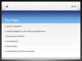
- 2. The Plan ? What is MapKit? ? Adding MapKit to your iPhone Application ? Setting the Position ? Annotations ? Geocoding ? Interacting with Core Location
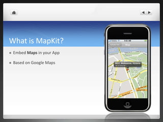
- 3. What is MapKit? ? Embed Maps in your App ? Based on Google Maps
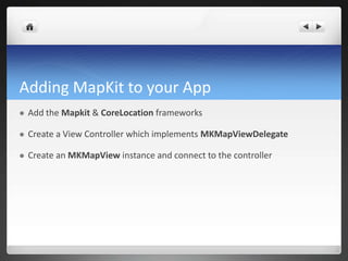
- 4. Adding MapKit to your App ? Add the Mapkit & CoreLocation frameworks ? Create a View Controller which implements MKMapViewDelegate ? Create an MKMapView instance and connect to the controller
- 5. Setting the Position ? Set the region property ? Define the center point and a span ? Span defines the vertical & horizontal distance to display (zoom) - (void)viewDidLoad?{? MKCoordinateRegion region;? region.center.latitude = [eventVenue.latitude doubleValue }
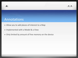
- 6. Annotations ? Allow you to add places-of-interest to a Map ? Implemented with a Model & a View ? Only limited by amount of free memory on the device
- 7. Annotation Models ? Implement the MKAnnotation protocol ? Exposes a Title, Subtitle, and Coordinate Title Subtitle Coordinate
- 8. Annotation Views ? Use MKAnnotationView ? Easiest trick to set the image property ? Use MKPinAnnotationView if you want the Pin ? If you don°Øt need a specific image, it°Øs best to just use the Pin. ? NB: Pin has 3 different colors: Red (which is the default for indicating a location), Green (for indicating the start point), and Purple (which is user defined).
- 9. Managing Annotation Views - (MKAnnotationView *)mapView:(MKMapView *)theMapView viewForAnnotation:(id <MKAnnotation>)annotation?{? MKPinAnnotationView *annotationView = (MKPinAnnotationView *)([theMapView dequeueReusableAnnotationViewWithIdentifier:@"annotation"]);? ? if (annotationView == NULL)? {? annotationView = [[[MKPinAnnotationView alloc] initWithAnnotation:annotation reuseIdentifier:@"annotation"] autorelease];? annotationView.canShowCallout = YES;? annotationView.animatesDrop = YES;? }?? annotationView.annotation = annotation;? return annotationView;?}
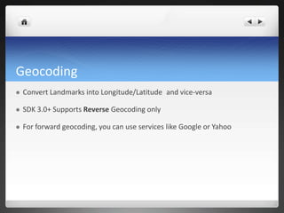
- 10. Geocoding ? Convert Landmarks into Longitude/Latitude?and vice-versa ? SDK 3.0+ Supports Reverse Geocoding only ? For forward geocoding, you can use services like Google or Yahoo
- 11. Reverse Geocoding ? Use MKReverseGeocoder ? Requires network access (Wifi/3G/EDGE) ? Asynchronous lookups
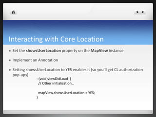
- 12. Interacting with Core Location ? Set the showsUserLocation property on the MapView instance ? Implement an Annotation ? Setting showsUserLocation to YES enables it (so you°Øll get CL authorization pop-ups) - (void)viewDidLoad?{ // Other initialisation°≠ mapView.showsUserLocation = YES; }
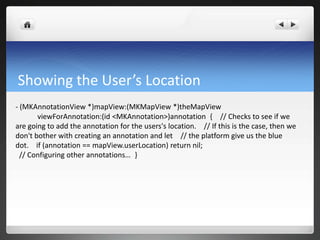
- 13. Showing the User°Øs Location - (MKAnnotationView *)mapView:(MKMapView *)theMapView viewForAnnotation:(id <MKAnnotation>)annotation?{? // Checks to see if we are going to add the annotation for the users's location.? // If this is the case, then we don't bother with creating an annotation and let? // the platform give us the blue dot.? if (annotation == mapView.userLocation) return nil;? // Configuring other annotations°≠?}