Mapping space around us
- 1. NAME RISHABH KOLVENKAR ROLL NO 17PEO56 SUB- MATHEMATICS STD- VIII TOPIC- MAPPING SCAPE AROUND US
- 2. INTRODUCTION •You have been dealing with maps since you were in primary, classes. •In Geography, you have been asked to locate a particular State, a particular river, a mountain etc., on a map. •In History, you might have been asked to locate a particular place where some event had occurred long back. •You have traced routes of rivers, roads, railway lines, traders and many others.
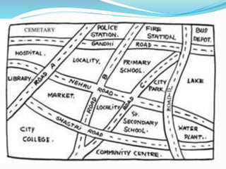
- 3. •How do we read maps? •What can we conclude and understand while reading a map? • What information does a map have and what it does not have? • Is it any different from a picture? • In this section, we will try to find answers to some of these questions. Look at the map of a house whose picture is given alongside. LET US SEE
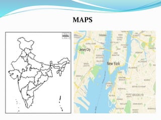
- 4. MAPS
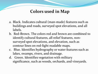
- 7. Colors used in Map a. Black. Indicates cultural (man-made) features such as buildings and roads, surveyed spot elevations, and all labels. b. Red-Brown. The colors red and brown are combined to identify cultural features, all relief features, non- surveyed spot elevations, and elevation, such as contour lines on red-light readable maps. c. Blue. Identifies hydrography or water features such as lakes, swamps, rivers, and drainage. d. Green. Identifies vegetation with military significance, such as woods, orchards, and vineyards.
- 8. e. Brown. Identifies all relief features and elevation, such as contours on older edition maps, and cultivated land on red-light readable maps. f. Red. Classifies cultural features, such as populated areas, main roads, and boundaries, on older maps. g. Other. Occasionally other colors may be used to show special information. These are indicated in the marginal information as a rule
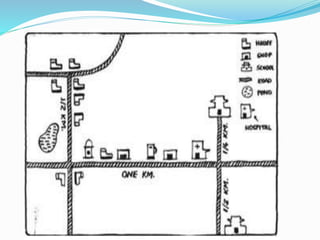
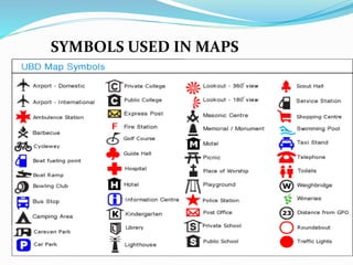
- 9. SYMBOLS USED IN MAPS
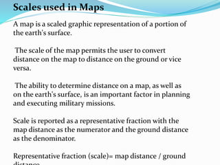
- 10. Scales used in Maps A map is a scaled graphic representation of a portion of the earth's surface. The scale of the map permits the user to convert distance on the map to distance on the ground or vice versa. The ability to determine distance on a map, as well as on the earth's surface, is an important factor in planning and executing military missions. Scale is reported as a representative fraction with the map distance as the numerator and the ground distance as the denominator. Representative fraction (scale)= map distance / ground
- 11. Scales used in Maps -Distances Shown on the map are proportional to the actual distance on the ground. -While drawing a map, we should take care about: How much of actual distance is denoted by 1mm or 1cm in the map -It can be : 1cm = 1 Kilometers or 10 Km or 100Km etc. -This scale can vary from map to map but not with in the map.
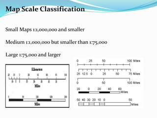
- 12. Map Scale Classification Small Maps 1:1,000,000 and smaller Medium 1:1,000,000 but smaller than 1:75,000 Large 1:75,000 and larger
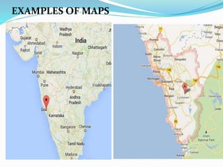
- 13. EXAMPLES OF MAPS
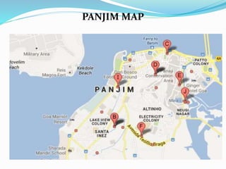
- 14. PANJIM MAP
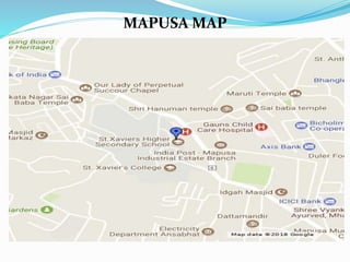
- 15. MAPUSA MAP
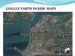
- 16. GOGGLE EARTH PANJIM MAPS
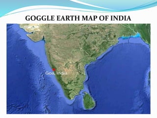
- 17. GOGGLE EARTH MAP OF INDIA
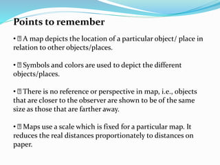
- 18. Points to remember • A map depicts the location of a particular object/ place in relation to other objects/places. • Symbols and colors are used to depict the different objects/places. • There is no reference or perspective in map, i.e., objects that are closer to the observer are shown to be of the same size as those that are farther away. • Maps use a scale which is fixed for a particular map. It reduces the real distances proportionately to distances on paper.
- 19. THANKYOU