Maps for Local Studies - LocScot 24 April 2013
Download as PPT, PDF1 like704 views

This document provides an overview and schedule for a one-day event on maps for local history studies held at the National Library of Scotland. The day includes sessions on historical maps of Scotland, cataloguing and finding aids, storage and conservation of maps, and digital mapping resources. Hands-on sessions allow attendees to view specific maps and online tools. The event aims to educate attendees on the purposes, content, and value of historical maps for local studies and the best sources for maps research.

![John Rocque, A Plan of ye Garden Plantation of Drumlangrig [sic] in Scotland,
the Seat of his Grace the Duke of Queensburry (1739)](https://image.slidesharecdn.com/2012locscot-130424113654-phpapp01/85/Maps-for-Local-Studies-LocScot-24-April-2013-10-320.jpg)


More Related Content
Similar to Maps for Local Studies - LocScot 24 April 2013 (20)
Recently uploaded (20)


Maps for Local Studies - LocScot 24 April 2013
- 1. Maps for Local Studies LocScot Dayschool and AGM - National Library of Scotland Weds 24 April 2013 10.00 Welcome and introduction (CILIP) 10.15 Maps for local history (Chris). An overview of historical maps of Scotland, their purposes, audiences, content and value for local studies. 11.00 Cataloguing, metadata, and finding aids (Paula). 11.45 AGM (CILIP) 12.15 Lunch 13.30 Split into two groups: 1. Storage, map stacks, classification, and conservation (Paula) 2. Hands-on viewing of specific maps and finding aids (Chris) (Groups swap around after half an hour) 14.30 Digital mapping and online resources (Chris). Including a brief look at map scanning, online delivery and georeferencing, and then primarily looking at the best online sources of maps and related info (NLS Map Images, Old Maps Online, ScotlandsPlaces, Map Curators' Toolbox) 15.30 Questions and wrap-up discussion 16.00 Finish
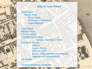
- 2. Maps for Local History Rural Maps: County Maps Estate Maps Enclosure / Commonty Legal disputes Town Plans Military Maps Coastal charts Transportation Maps - Canals / railways / roads Ordnance Survey : History County Series National Grid Scales, map contents and editions Legends and abbreviations Air photos General principles. Copyright
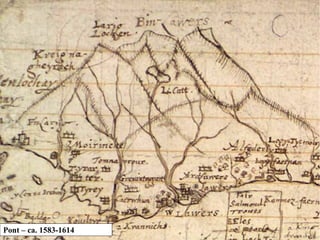
- 3. Pont ŌĆō ca. 1583-1614
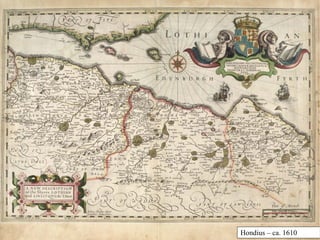
- 4. Hondius ŌĆō ca. 1610
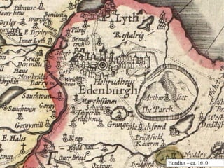
- 5. Hondius ŌĆō ca. 1610
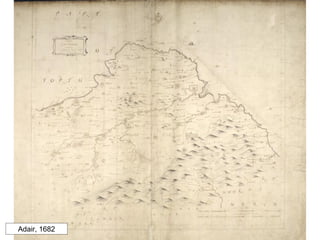
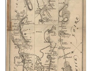
- 6. Adair, 1682
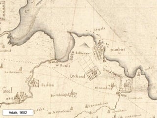
- 7. Adair, 1682
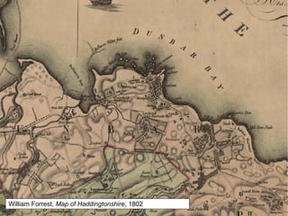
- 8. William Forrest, Map of Haddingtonshire, 1802
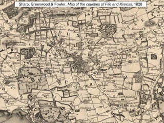
- 9. Sharp, Greenwood & Fowler, Map of the counties of Fife and Kinross, 1828
- 10. John Rocque, A Plan of ye Garden Plantation of Drumlangrig [sic] in Scotland, the Seat of his Grace the Duke of Queensburry (1739)
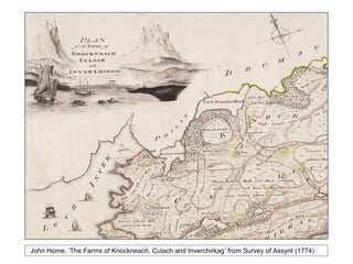
- 11. John Home, ŌĆśThe Farms of Knockneach, Culach and InverchirkagŌĆÖ from Survey of Assynt (1774)
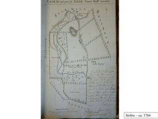
- 12. Stobie ŌĆō ca. 1784
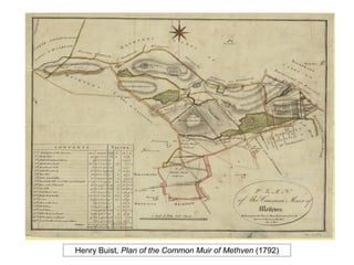
- 13. Henry Buist, Plan of the Common Muir of Methven (1792)
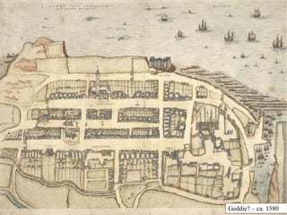
- 15. Geddie? ŌĆō ca. 1580
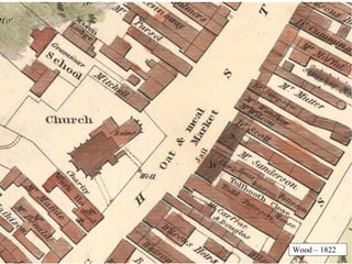
- 16. Wood ŌĆō 1822
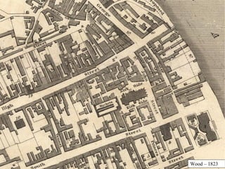
- 17. Wood ŌĆō 1823
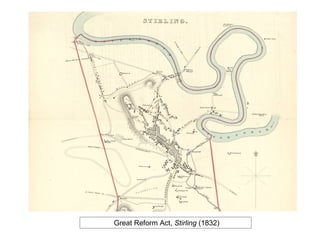
- 18. Great Reform Act, Stirling (1832)
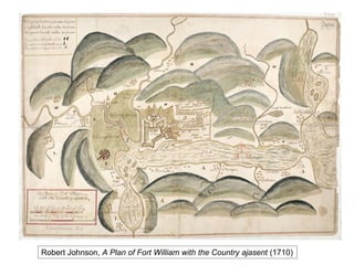
- 19. Robert Johnson, A Plan of Fort William with the Country ajasent (1710)
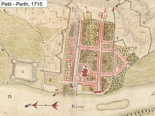
- 20. Petit - Perth, 1715
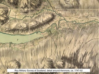
- 22. Roy Military Survey of Scotland, detail around Kenmore, ca. 1747-52
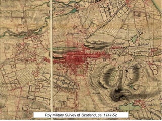
- 23. Roy Military Survey of Scotland, ca. 1747-52
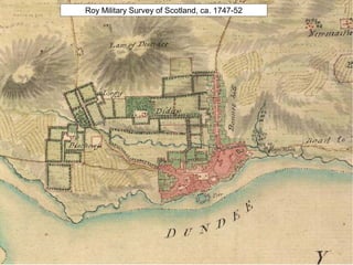
- 24. Roy Military Survey of Scotland, ca. 1747-52
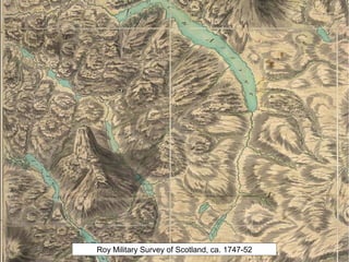
- 25. Roy Military Survey of Scotland, ca. 1747-52
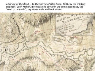
- 26. A Survey of the Road... to the Spittle of Glen-Shee, 1749, by the military engineer, John Archer, distinguishing between the completed road, the ŌĆ£road to be madeŌĆØ, dry stone walls and back drains.
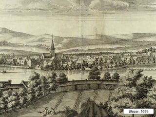
- 27. Slezer, 1693
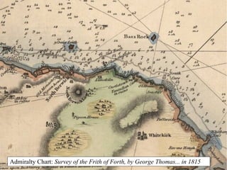
- 28. Admiralty Chart: Survey of the Frith of Forth, by George Thomas... in 1815
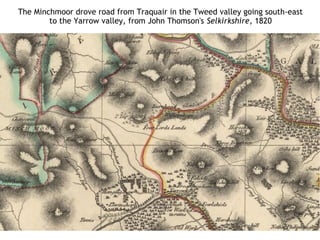
- 29. The Minchmoor drove road from Traquair in the Tweed valley going south-east to the Yarrow valley, from John Thomson's Selkirkshire, 1820
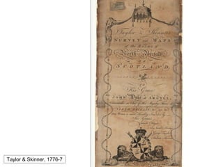
- 30. Taylor & Skinner, 1776-7
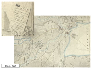
- 32. Brown, 1898
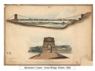
- 33. Stevenson / Lizars ŌĆō Union Bridge, Paxton, 1820
- 34. R. Kirkwood, This plan of the City of Edinburgh and its environsŌĆ” 1817
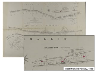
- 35. West Highland Railway, 1888
- 36. Ordnance Survey 1.History 2.County Series 3.National Grid 4.Scales, map contents and editions 5.Legends and abbreviations
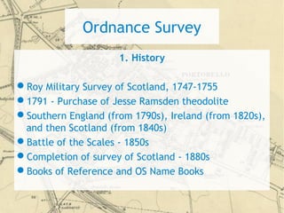
- 37. Ordnance Survey 1. History ’ü¼Roy Military Survey of Scotland, 1747-1755 ’ü¼1791 - Purchase of Jesse Ramsden theodolite ’ü¼Southern England (from 1790s), Ireland (from 1820s), and then Scotland (from 1840s) ’ü¼Battle of the Scales - 1850s ’ü¼Completion of survey of Scotland - 1880s ’ü¼Books of Reference and OS Name Books
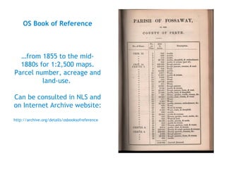
- 39. OS Book of Reference ŌĆ”from 1855 to the mid- 1880s for 1:2,500 maps. Parcel number, acreage and land-use. Can be consulted in NLS and on Internet Archive website: http://archive.org/details/osbooksofreference
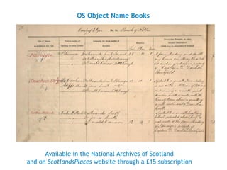
- 40. OS Object Name Books Available in the National Archives of Scotland and on ScotlandsPlaces website through a ┬Ż15 subscription
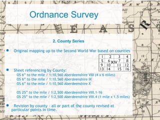
- 41. Ordnance Survey 2. County Series ’ü¼ Original mapping up to the Second World War based on counties ’ü¼ Sheet referencing by County: OS 6ŌĆØ to the mile / 1:10,560 Aberdeenshire VIII (4 x 6 miles) OS 6ŌĆØ to the mile / 1:10,560 Aberdeenshire IX OS 6ŌĆØ to the mile / 1:10,560 Aberdeenshire X OS 25ŌĆØ to the mile / 1:2,500 Aberdeenshire VIII.1-16 OS 25ŌĆØ to the mile / 1:2,500 Aberdeenshire VIII.4 (1 mile x 1.5 miles) ’ü¼ Revision by county - all or part of the county revised at particular points in time.
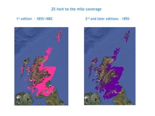
- 43. 25 inch to the mile coverage 1st edition - 1855-1882 2nd and later editions ŌĆō 1892-
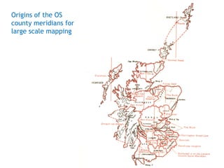
- 44. Origins of the OS county meridians for large scale mapping
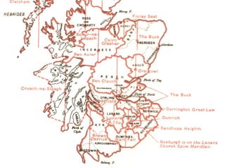
- 46. Survey and Revision Dates for County Series Mapping Online at: http://maps.nls.uk/os/county_series_list.html
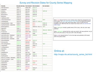
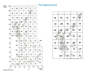
- 47. Ordnance Survey 3.National Grid ŌĆó Davidson Committee from late 1930s recommended the recasting onto a new projection for the whole of Great Britain, the National Grid: a Transverse Mercator projection with a central North-South meridian, and a point of origin based west of the Scilly Isles. New metric grid based on 100 Km squares. OS 6ŌĆØ to the mile / 1:10,560 NJ 45 NW (5 x 5 km area) OS 6ŌĆØ to the mile / 1:10,560 NJ 45 NE OS 25ŌĆØ to the mile / 1:2,500 NJ 4254 (1 x 1 km area) OS 25ŌĆØ to the mile / 1:2,500 NJ 4255 ŌĆó Following initial survey, sheets placed under continuous revision
- 49. Ordnance Survey 3. National Grid ŌĆó Davidson Committee from late 1930s recommended the recasting onto a new projection for the whole of Great Britain, the National Grid: a Transverse Mercator projection with a central North-South meridian, and a point of origin based west of the Scilly Isles. New metric grid based on 100 Km squares. OS 6ŌĆØ to the mile / 1:10,560 NJ 45 NW (5 x 5 km area) OS 6ŌĆØ to the mile / 1:10,560 NJ 45 NE OS 25ŌĆØ to the mile / 1:2,500 NJ 4254 (1 x 1 km area) OS 25ŌĆØ to the mile / 1:2,500 NJ 4255 ŌĆó Following initial survey, sheets placed under continuous revision
- 50. Richard OliverŌĆÖs town lists Chapter 6 of Ordnance Survey Maps: a concise guide for historians (London: Charles Close, 2005)
- 51. Richard OliverŌĆÖs County Listings Chapter 7 of Ordnance Survey Maps: a concise guide for historians (London: Charles Close, 2005)
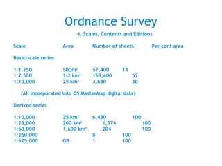
- 52. Ordnance Survey 4. Scales, Contents and Editions Scale Area Number of sheets Per cent area Basic-scale series 1:1,250 500m2 57,400 18 1:2,500 1-2 km2 163,400 52 1:10,000 25 km2 3,680 30 (All incorporated into OS MasterMap digital data) Derived series 1:10,000 25 km2 6,480 100 1:25,000 200 km2 1,374 100 1:50,000 1,600 km2 204 100 1:250,000 8 100 1:625,000 GB 1 100
- 53. OS 1:1056, surveyed 1852
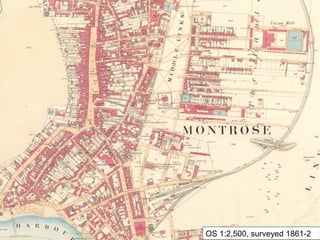
- 55. OS 1:2,500, surveyed 1861-2
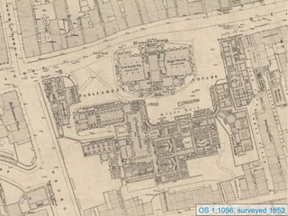
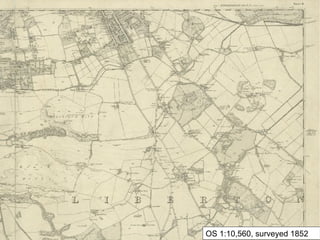
- 57. OS 1:10,560, surveyed 1852
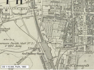
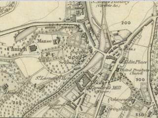
- 58. OS 1:10,560, Perth, 1860
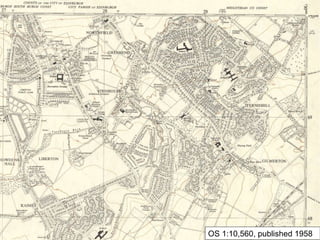
- 60. OS 1:10,560, published 1958
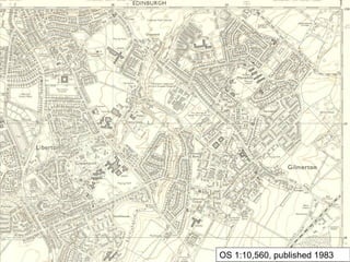
- 61. OS 1:10,560, published 1983
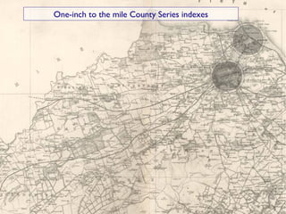
- 63. One-inch to the mile County Series indexes
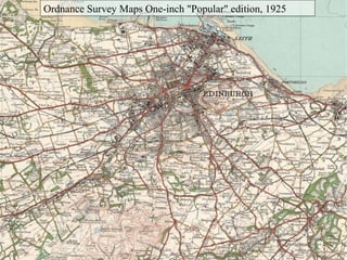
- 64. Ordnance Survey Maps One-inch "Popular" edition, 1925
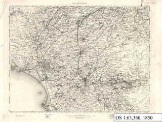
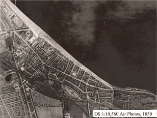
- 65. OS 1:10,560 Air Photos, 1850
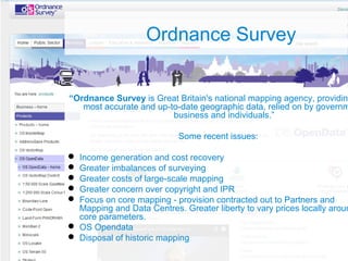
- 67. Ordnance Survey ŌĆ£Ordnance Survey is Great Britain's national mapping agency, providing most accurate and up-to-date geographic data, relied on by governm business and individuals.ŌĆØ Some recent issues: ’ü¼ Income generation and cost recovery ’ü¼ Greater imbalances of surveying ’ü¼ Greater costs of large-scale mapping ’ü¼ Greater concern over copyright and IPR ’ü¼ Focus on core mapping - provision contracted out to Partners and Mapping and Data Centres. Greater liberty to vary prices locally aroun core parameters. ’ü¼ OS Opendata ’ü¼ Disposal of historic mapping
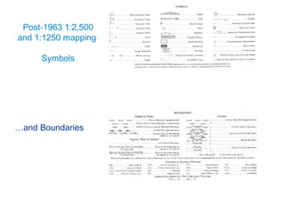
- 68. Post-1963 1:2,500 and 1:1250 mapping Symbols ŌĆ”and Boundaries
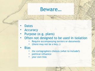
- 70. BewareŌĆ” ŌĆó Dates ŌĆó Accuracy ŌĆó Purpose (e.g. plans) ŌĆó Often not designed to be used in isolation ŌĆó Require accompanying terriers or documents ŌĆó (there may not be a keyŌĆ”) ŌĆó Bias ŌĆó the cartographers choices (what to include?) ŌĆó political influence ŌĆó your own bias
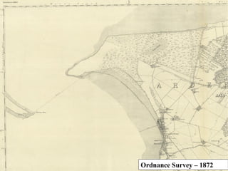
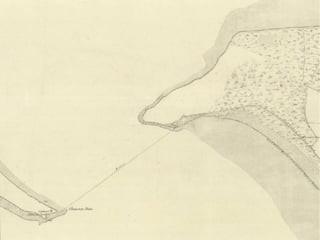
- 71. Ordnance Survey ŌĆō 1872
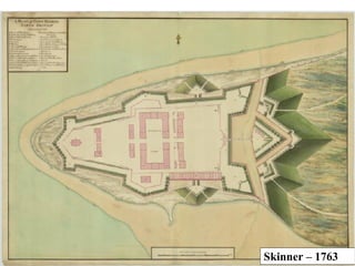
- 73. Skinner ŌĆō 1763
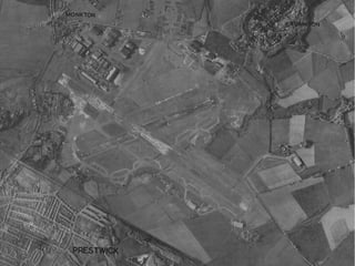
- 74. RAF ŌĆō 1951
- 75. RAF ŌĆō 1948
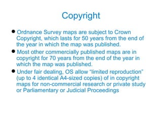
- 76. Copyright ’ü¼Ordnance Survey maps are subject to Crown Copyright, which lasts for 50 years from the end of the year in which the map was published. ’ü¼Most other commercially published maps are in copyright for 70 years from the end of the year in which the map was published. ’ü¼Under fair dealing, OS allow ŌĆ£limited reproductionŌĆØ (up to 4 identical A4-sized copies) of in copyright maps for non-commercial research or private study or Parliamentary or Judicial Proceedings
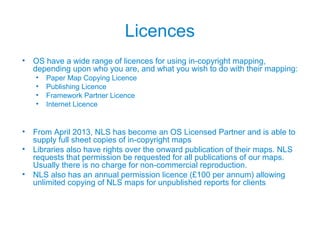
- 77. Licences ŌĆó OS have a wide range of licences for using in-copyright mapping, depending upon who you are, and what you wish to do with their mapping: ŌĆó Paper Map Copying Licence ŌĆó Publishing Licence ŌĆó Framework Partner Licence ŌĆó Internet Licence ŌĆó From April 2013, NLS has become an OS Licensed Partner and is able to supply full sheet copies of in-copyright maps ŌĆó Libraries also have rights over the onward publication of their maps. NLS requests that permission be requested for all publications of our maps. Usually there is no charge for non-commercial reproduction. ŌĆó NLS also has an annual permission licence (┬Ż100 per annum) allowing unlimited copying of NLS maps for unpublished reports for clients
- 78. Contact usŌĆ” Map Library National Library of Scotland 159 Causewayside Edinburgh EH9 1PH 0131 623 3970 maps@nls.uk maps.nls.uk
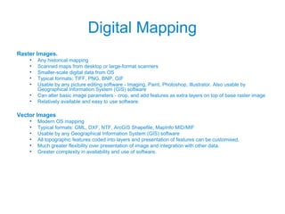
- 80. Digital Mapping Raster Images. ŌĆó Any historical mapping ŌĆó Scanned maps from desktop or large-format scanners ŌĆó Smaller-scale digital data from OS ŌĆó Typical formats: TIFF, PNG, BNP, GIF ŌĆó Usable by any picture editing software - Imaging, Paint, Photoshop, Illustrator. Also usable by Geographical Information System (GIS) software ŌĆó Can alter basic image parameters - crop, and add features as extra layers on top of base raster image ŌĆó Relatively available and easy to use software. Vector Images ŌĆó Modern OS mapping ŌĆó Typical formats: GML, DXF, NTF, ArcGIS Shapefile, MapInfo MID/MIF ŌĆó Usable by any Geographical Information System (GIS) software ŌĆó All topographic features coded into layers and presentation of features can be customised. ŌĆó Much greater flexibility over presentation of image and integration with other data. ŌĆó Greater complexity in availability and use of software.
Editor's Notes
- #3: County maps ŌĆō again really at any detail from about 1770. - and in a more uniform style. Often 1 inch to the mileŌĆ” Land/house owners names regularly appear ŌĆō After this ŌĆō move to the Ordnance Survey a which Chris will talk more about later Following on from estate plans, ’ā╝ some surveyors made the logical leap to making county maps, such as this one of Haddingtonshire by 1799 by William Forrest. These were at least partly funded up front by the collections of subscriptions. Remember that still only a tiny part of the population was educated and could read, and probably even fewer could afford to buy the maps. ’ā╝ This is a particularly fine example ŌĆō and in this extract you can see the quality of the engraving. Remember that these were engraved backwards onto copper plates for engraving! The limited market had to be secured before production. Part of the sales pitch was undoubtedly to promise that the gentlemanŌĆÖs houses would be shown, and they were often issued with an accompanying list of subscribers... There are many examples of proposals for maps which never made it to production for want of the requisite number of subscriptions. It seems probable that the selection of content, or prominence given to particular areas would be determined by who subscribed. The surveyor may have already surveyed their estate in much greater detail and that knowledge could then come through onto the county map. This is a very good example of the type, described by John Thomson 30 years later as: ŌĆ£ The masterly manner in which this map is executed is at once a memorial of industry, skill and enterprise, seldom found in one individual. The noblemen and gentlemenŌĆÖs domains, the towns and villages, with the roads, the parish boundaries, the sea coast, the woods and rivers, are presented on paper as if reflected in a glass. The woods and pleasure grounds of Tyningham, the seat of the Earl of Haddington, may be cited as a specimen of delineation that may be equalled, but not surpassed .ŌĆØ
- #7: John Adair. East Lothian. 1682
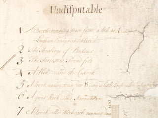
- #15: 'Plan of the Forest of Mamlorn' was surveyed by Colin Foster in 1732. It is drawn in ink with a very faint grey wash to show relief on the hills and pale brown for rivers. It covers an area in Breadalbane, Perthshire, south of Loch Lyon. It related to a land dispute between the Earl of Breadalbane to the south, and the Laird of Culdares to the north. The map was used in an ensuing Court of Session case in 1735 which examined and settled the boundary between two landowners. Ownershuip is shown by being written on the mapŌĆ” Some areas were clearly not for negotiationŌĆ”
- #16: John Geddy. S. Andre sive Andreapolis Scotiae Universitas Metropolitana. [ca1780]
- #55: Ordnance Survey. 1:2500. Ayrshire sheet LV.4 Girvan Parish. Surveyed 1856.
- #60: Ordnance Survey. 1:10,560. Edinburghshire 7, surveyed 1852-3, published 1854.
- #63: Ordnance Survey. 1:63,360. One inch to the mile Scotland. First edition. Sheet 22 Kilmarnock. Surveyed 1852 ŌĆō 5.
- #68: It is worth knowing a little bit about scale because the maps you are most likely to use come at a variety of scales. We are all familiar with the modern OS, and many people have the false impression that equivalent mapping will be available as far back as they can trace their family. Unfortunately this is not the case. For Scotland, the OS really came into being in the 1850ŌĆÖs. So for addresses and places after that there is a good chance of being able to locate an exact house or building. As a rough guide, the more populated an area, the more detailed mapping will be available, and in more editions. In some rural areas of Highlands and Perthshire there can be more than 70 years between editions. Just because you canŌĆÖt find it on the map doesnŌĆÖt mean it didnŌĆÖt exist.
- #71: caveats : ’ā╝ DATES often they do not represent the landscape at the time of publication but several or even 10s of years before. ACCURACY early maps were not measured... they show things which never happened changes happened which were never recorded PURPOSE they were made to show a particular feature so the rest is distorted may only show things related to that purpose... Often not designed to be used in isolation BIAS ALL MAPS ARE BIASED! Mapmakers choice of what to include (impossible to show everything ... 1:1) Their conscious and unconscious political environment Your reading of it is biased by your own views and knowledge All these caveats still hold true to some extent ŌĆō it is impossible for a map to represent everything thatŌĆÖs on the ground.
- #79: Approx 2 million items Whole world ŌĆō not just Scotland Responsibility to collect for the Scottish people ŌĆ”. Website: approx 4,000 maps 6ŌĆØ going up soon work on 1 st ed. Parish ed. 25ŌĆØ just started ŌĆō scanning Catalogue ŌĆō individual maps rather than series (ie no OS) ca. 55,000 ASK!