Openscales Foss4g 2010 presentation
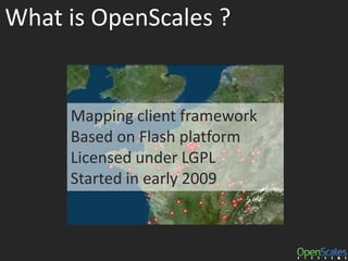
- 2. What is OpenScales ?Mapping client frameworkBased on Flash platformLicensed under LGPLStarted in early 2009
- 3. Community 160 subscribers on the mailing list
- 4. Hosted on BitBucket
- 5. Companies/organizations involved
- 7. French National Geographic Institute
- 8. XoomCode
- 9. Pennsylvania State University
- 10. CyclomediaLetâs talk aboutFlash platform ...
- 11. From designers to developersA few years ago, Flash authoring tools were only for designers.Nowadays, we can develop application writing ActionScript3 and Flex with an Open Source SDKFxEfficient development requires commercial IDE Flash Builder, based on Eclipse.FB
- 12. Flash 10.1Adobe has rewritten Flash Player from scratch in order to be able to run it on all platforms consistently
- 13. Issues and challengesiPhone/iPad do not have Flash for now. Apple has just announced that they will support Flash CS5 feature that convert a Flash application to iPhone application !
- 14. Adobe MUST continue to open the platform
- 15. Flash player for 64 bits operating systems
- 16. Official Flash Builder under Linux
- 17. HTML 5
- 18. A few years to wait for wide deployment
- 19. Innovation comes from competition Quick comparison ...Quite similar to Java few years agoThanks to the community,it has been Open SourcedWhy is not the same with Flash ?
- 20. OpenScales 1.2OpenScales 1.2-beta3 is outFinal release before the end of September
- 22. openscales-proj4as: Proj4 port in ActionScript
- 23. openscales-core: lightweight mapping core
- 24. openscales-fx: Flex 4 support
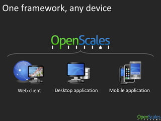
- 27. openscales-air-exampleOne framework, any deviceDesktop applicationWeb clientMobile application
- 28. Flex applicationFx+ Flex 4 support
- 29. OpenScales API is closed to OpenLayersâ one
- 30. Support WMS, WFS, KML, OSM ...
- 31. OpenScales 1.2 displays 75000 points (2500 lines) with a good user experienceCourtesy of AESN, http://www.eau-seine-normandie.fr/
- 32. AIR applicationFx+ Turn your web client in a desktop application
- 33. Full access to thefilesystem
- 35. File association
- 36. Icon on desktopkml-viewer.air
- 37. AIR mobile applicationAS+ Package as a native mobile application
- 38. Support multi-touch, GPS, screen orientation, accelerometer events
- 39. Same speed as Flashplugin on your computerAIR mobile applicationAS+You can test it if you have a smartphone withAndroid 2.2 (Froyo) and AIR 2.5http://openscales.org/downloads/openscales-mobile-tracker-1.2.apk
- 40. OpenScales 2
- 41. OpenScales 2 roadmap (2011)ActionScriptGeoAPI
- 42. Free zoom mode
- 43. Display geometries up to 300000 pts
- 44. WMTS, WFS 2.0, GML 3.2.1 support
- 45. Tiled KML support
- 46. SLD editor (Flex and AIR)
- 48. And ...3D
- 51. Full 3D support in OpenScales 2Flash Player 3D Future sessionat Max 2010 on the 27th of OctoberOur guess/bet : Flash full accelerated3D support to compete with webGL
- 52. How to : Use it http://openscales.org
- 53. Contribute hg clone http://bitbucket.org/gis/openscales
- 54. Contact us sebastien.deleuze@atosorigin.com simon.lopez@atosorigin.com


