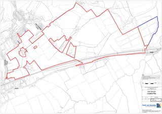
S out 13_1555-location_plan_scale_1_2500-410719
- 1. O ld ge ra ca Vi ne La Thornhill Road A420 NOTE This drawing is for information purposes only and not for use in construction. Do NOT scale from this drawing. All dimensions are to be checked on site and any discrepancies should be immediately reported to the originator of the drawing. All information is copyright protected and may not be used or reproduced without prior permission. 250m 0m N Reproduced by permission of Ordnance Survey on behalf of HMSO. 2010 All rights reserved. Ordnance Survey Licence number 100022533 A420 Title East Swindon Location Plan Date Drawn Designed Scale 21-11-13 --- --- Approved --- 1:2500 @ A0 Drawing Number LHL005 - 144 C DAVID LOCK ASSOCIATES LIMITED 50 NORTH THIRTEENTH STREET, CENTRAL MILTON KEYNES, MK9 3BP TEL: 01908 666276 FAX : 01908 605747 EMAIL: mail@davidlock.com www.davidlock.com

