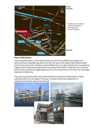
Salforf Quays Map
- 1. Salford University The white arrows indicate a short anti-clockwise 15 minute stroll around The Quays Ordsall Hall Metrolink Map of Salford Quays If you visit Salford Quays, a short walk will take you from the new Media City development (which will house many BBC operations from later this year) to the Imperial War Museum North and The Lowry Arts Centre. Standing in front of Media City, turn right and follow the new pedestrian bridge across the Manchester Ship Canal to the Imperial War Museum. Walk down the canal bank path to another pedestrian bridge taking you over to The Lowry Centre. From there the road bridge leads back to Media City. If you want to go further afield, Old Trafford Football Ground (home of Manchester United), and Ordsall Hall are on the edge of The Quays as shown on the map. Ordsall Hall is a mediaeval hall recently repaired and restored.

