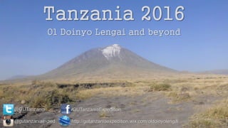
Tanzania Expedition 2016
- 1. Tanzania 2016 Ol Doinyo Lengai and beyond @GUTanzania /GUTanzaniaExpedition http://gutanzaniaexpedition.wix.com/oldoinyolengai@gutanzaniaexped
- 2. GU Tanzania Expedition 2016 âĒ Unique Geological Setting âĒ East African Rift USGS
- 3. Background âĒ Complex interplay of volcanic and tectonic activity âĒ Ol Doinyo Lengai: âThe Mountain of Godâ - Stratovolcano, ~2962 m - First active in 1883, erupting 10 times in 20th century 2015 Team Photos Wiki, March 2008 Eruption
- 4. Background âĒ Previous work: - Mapping by Barry Dawson (1960s) - Re-survey by USGS (2010 onwards) - Mineralogy and geochemistry Barry Dawson: Natrocarbonatite USGS
- 5. Why should we care? âĒ Unique geological setting - Accessible volcano in an active rift zone - Lake Natron Basin - Active volcano-tectonic faulting âĒ Understand the development of rifting âĒ Hazard Mitigation 2015 Team Photos: Local Maasai tribe Ol Doinyo Lengai from Lake Natron USGS
- 6. Why should we care? âĒ Unique opportunity âĒ Limited field studies âĒ Limited knowledge of volcanology âĒ Out of date? âĒ Understand volcanology of carbonatite volcanoes âĒ Hazard Mitigation 2015 Team Photo: Ol Doinyo Lengai Crater
- 7. Logistics: Collaboration âĒ Collaboration with Tanzanian geology students: - University of Dodoma - University of Dar Es Salaam University 2015 Team Photos: University of Dodoma University of Dar Es Salaam
- 8. Logistics: Fieldwork âĒ Transfers, transport and staff provided by Global Adventure Safaris, independent travel operator âĒ Full board lodges and camping âĒ shower, toilets, some electricity âĒ meals and packed lunches âĒ Climbing and camping at the summit of Ol Doinyo Lengai âĒ Physically demanding 2015 Team Photos: Engare Sero Lodge base camp Descending Ol Doinyo Lengai
- 9. Timetable âĒ Early August 2016 (provisional) âĒ 3 weeks (with option of longer duration) âĒ Flying to Dar Es Salaam Airport ï Kilimanjaro Airport âĒ 2 weeks fieldwork and teaching - areas to be finalised by the team âĒ Climbing Ol Doinyo Lengai: 2-3 days camping at summit âĒ Lake Natron, Engare Sero Waterfalls
- 10. Contribution Costs âĒ Preliminary budget: ~ÂĢ1300 per person âĒ Personal contribution: ~ÂĢ750-1000 (hopefully less) Fundraising and Grants âĒ Many grants and bursaries to apply for (VERY IMPORTANT!!!) âĒ Fundraising (events, sponsored challenges, etc.)
- 11. Preparation âĒ Opportunities to learn and practice field skills (field trips, meetings etc.) âĒ Learn skills: GIS, first aid, basic Swahili etc. âĒ Physically demanding, good fitness level, a head for heights!
- 12. Skills âĒ Teaching in advanced geology âĒ volcanology & tectonics âĒ research/project/experiment planning âĒ mapping, logging, T&C mapping, GIS/Digital âĒ Teamwork âĒ UK, Tanzanian students/staff, Maasai âĒ Presenting âĒ filming, video editing, photography âĒ Reporting âĒ writing, editing âĒ GREAT FOR CV, CAREERS 2015 Team photos
- 13. Independent Travel & Add-ons âĒ Option of flying out earlier and/or later to allow for independent travel within Tanzania/Africa âĒ Option of group additional excursions - Lake Manyara, Ngorongoro and Serengeti (ÂĢ430) - Kilimanjaro (ÂĢ890) - Zanzibar âĒ Flexibility 2015 Team member photos: Zanzibar TMB: Kilimanjaro
- 14. Next Steps... âĒ Complete application form and return to Gregory Building Office by 10 am on Wednesday 14th October âĒ Interviews commencing 21st October âĒ Team confirmed by 27th October âĒ COMPULSORY team meeting in week commencing 28th October


