Tools of the geographer
•Download as PPT, PDF•
0 likes•333 views

Maps and globes are tools used by geographers to represent Earth. Maps are 2D representations that show location and distances but inevitably distort the 3D globe when flattened. While lacking detail, globes maintain accuracy but are bulky. There are two main types of maps - reference maps like political and physical maps that show selected environmental details, and thematic maps that illustrate patterns or features through methods like color schemes or dot densities.

Tools of the geographer
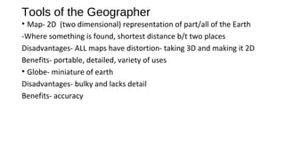
- 1. Tools of the Geographer • Map- 2D (two dimensional) representation of part/all of the Earth -Where something is found, shortest distance b/t two places Disadvantages- ALL maps have distortion- taking 3D and making it 2D Benefits- portable, detailed, variety of uses • Globe- miniature of earth Disadvantages- bulky and lacks detail Benefits- accuracy
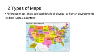
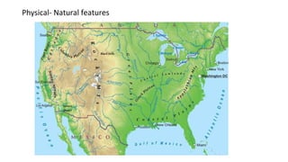
- 2. 2 Types of Maps • Reference maps- show selected details of physical or human environments Political- States, Countries
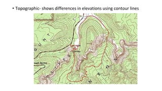
- 4. • Topographic- shows differences in elevations using contour lines
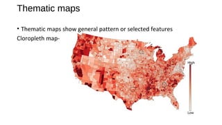
- 5. Thematic maps • Thematic maps show general pattern or selected features Cloropleth map-
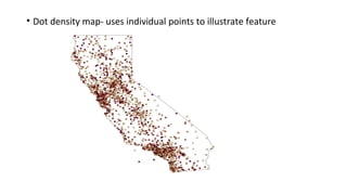
- 6. • Dot density map- uses individual points to illustrate feature