Tuscany inner areas strategy
ŌĆó
0 likesŌĆó202 views

Tuscany inner areas strategy. An history of participation. Method and criteria, needs and opportunity.


Tuscany inner areas strategy
- 1. Edinburgh, 11th April 2018 Alessandra de Renzis Tuscany Regional Government, Italy Tuscany Inner Areas strategy An history of participation
- 2. Inner Areas Strategy: in brief Inner Areas are ŌĆó territories characterized by a NOT adequate offer of/ access to essential services to assure a certain level of citizenship among population. ŌĆó territories substantially far from large and medium-sized urban centres able to supply adequate health, educational and transport services. ŌĆó Inner areas are considered strategically relevant to foster a more sustainable and inclusive national growth. Aims of the strategy ŌĆó Improve the quality of life and wellbeing of local communities ŌĆó Increase local employment and work opportunities ŌĆó Recover un-valorised natural resources and territorial capital ŌĆó Reduce the social cost due to the progressive depopulation trend characterizing these areas ŌĆó Strengthen local development factors Ultimate goal of the strategy Reinforcement of demographic structure 5 main innovations ŌĆó National dimension and multilevel governance (Centres ŌĆō Regions ŌĆōmunicipalities and inter municipalities cooperation) ŌĆó In the project areas ŌĆō at the same time - services improvements (mainly through national policy) and investments in selected development factors (regional policy) ŌĆó Multi-fund attitude (EAFRD, ERDF, ESF and National Funds) ŌĆó Participatory approach to local development ŌĆó Municipalities Associations. 60% of national territory 4.000 municipalities 23% of total population 65% mountain municipalities
- 3. First Draft Preliminary to the Strategy Scouting Inner Areas Strategy: Method and criteria Desk Analysis (Area diagnosis) Pre-selected area is thoroughly analyzed with respect to a series of demographic and socio-economic parameters: e.g. Population losses and demographic structure, Utilized Agricultural Area (UAA) trends, deforestation, hydrological risk, entrepreneurship, tourism and cultural heritage, quality of education, mobility and health services, Digital Divide Field Analysis Local development strategy definition and design Project AreaŌĆÖs Development Strategy
- 4. Population: 3.742.437 inhab Area: 23.000 km┬▓ GDP per capita: Ōé¼ 29.466 GDP composition: 73.4% Services; per sector (2015) 24.3% Industry; 2.3% Agriculture (including Fishery and Forestry) Registered companies: approximately 351.000 (ISTAT- 2015) Around 95% of companies have less than 10 employees (ISTAT- 2015) Manufacturing: over 32% of regional workforce (ISTAT- 2015) Employment rate 69,9% Mountain area represents 25% of the territory Hilly landscape is predominant, representing more than 66% Flatland accounts for about 8% Forests cover about 51% of the landscape and are well distributed in the Region Total agricultural surface is about 8.000 Square Km. Population with higher education: 10% R&D expenditure as a % of GDP: 1,36% (40% from private sector) University size: 150.000 students Tuscany in brief: main features
- 5. Fragile Inner areas Low potential tourist Inner areas Inner areas with potentiality Residential Inner areas ŌĆśSilver - typeŌĆÖ railway station 2nd level DEA hospital Service Centers and Belt areas 1st level DEA hospital Exhaustive range of secondary schools National Classification (re)Defining Tuscany Inner Areas Regional re-Classification
- 6. Selection of project areas: background Tuscany has a long history of participatory processes: the first Regional Law dates back 2007 (L.R. n.69/2007 now repealed with L.R. n.46/2013) a pioneer initiative in the Italian and European context and it can be considered one of the first examples of perennial institutionalized social participation guided by deliberative systems theories. Regional Development Programme 2016-2020 foresees the identification of homogeneous territorial areas where carrying out analysis and collection of local needs, together with local Institutions and economic actors. 2007 Jan 2015 July 2015 2016 The regional Government publishes a call for proposal entrusting the territory to propose a local development strategy based on and able to respond to local population and economic system needs addressing ŌĆ£rightsŌĆØ (i.e. Education, Health-welfare and mobility policies) and ŌĆ£growthŌĆØ (economic development) simultaneously. Size and entity of the participation process are considered as selection criteria. While programming Regional Inner Areas strategy, the regional Government decided that it had to be the territory itself to select, define and promote an aggregation of territories as its strategic area (around a core of weakest areas of the Region identified ŌĆ£ fragileŌĆØ).
- 7. Selection of project areas: outcomes Garfagnana ŌĆō Lunigiana ŌĆō Media Valle del Serchio ŌĆō Appennino Pistoiese Valdarno-Valdisieve, - Mugello - Valbisenzio Casentino -Valtiberina Val di Cecina Amiata Grossetana - Amiata Val d'Orcia - Colline Metallifere - Colline del Fiora - Val di Chiana Senese - Val di Merse Project Area: 17 Municipalities Strategy Area: 22Municipalities Public partners: 12 Private partners: 15 No. meetings: 13 No. participants: 133 Project Area: 11 Municipalities Strategy Area: 28 Municipalities Public partners: 22 Private partners: 37 No. meetings: 7 No. participants: 156 Project Area: 12 Municipalities Strategy Area: 23 Municipalities Public partners: 23 Private partners: 25 No. meetings: 14 No. participants: 135 Project Area: 4 Municipalities Strategy Area: 1 Municipality Public partners: 10 Private partners: - No. meetings: 1 No. participants: 15
- 8. Project areas Development Strategy: Identifying needs and opportunity Desk Analysis (Area diagnosis) RIGHTS NEEDS GROWTH Beware of development bottlenecks and constraints BASIC SERVICES OPPORTUNITY MARKET
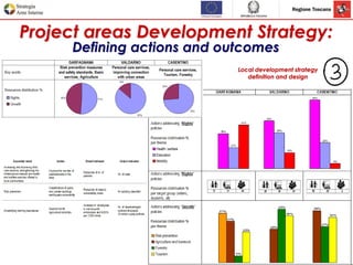
- 9. Project areas Development Strategy: Defining actions and outcomes Local development strategy definition and design
- 10. Project areas Development Strategy: How did we get there?
- 11. MTR RIS3: Territorial proofing How: Analyse the potential application of research and development roadmaps to regional territories: - correlation of the innovation roadmaps to territorial value chains; - analysis of "territorial stocks" enabling roadmaps effectiveness; - feedback from S3 local development mirror group (LAGs, FLAGs, EIP-OGs). Why: The aim is to combine excellence with relevance, supporting excellences while reducing disparities and fostering equal development opportunities: ŌĆ£from rivalry to synergyŌĆØ! What is all about? A synthesis of ŌĆ£Territorial Impact AssessmentŌĆØ (TIA) and ŌĆ£Rural ProofingŌĆØ (RP) together with roadmaps technical validation, provides a place-evidence contribution on the relevance of strategic roadmaps and their expected impacts at territorial level.