STORMTOOLS for Beginners
Download as PPTX, PDF1 like8,743 views

This document provides a tutorial for using STORMTOOLS, a web-based mapping tool for understanding coastal flood risk in Rhode Island. It outlines how to access and use the various features and layers in STORMTOOLS to determine flood depths and impacts under different hurricane and sea level rise scenarios. Key features include zooming and panning the map, adjusting layer transparency, toggling layers on and off, and clicking on locations to view flood depths and identify emergency services. The tutorial is created by a team from the University of Rhode Island and the Rhode Island Coastal Resources Management Council.


More Related Content
More from riseagrant (20)
Recently uploaded (20)


STORMTOOLS for Beginners
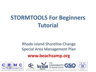
- 1. STORMTOOLS For Beginners Tutorial Rhode Island Shoreline Change Special Area Management Plan www.beachsamp.org
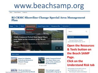
- 2. www.beachsamp.org Open the Resources & Tools button on the Beach SAMP Page. Click on the Understand Risk tab
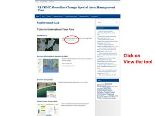
- 3. Click on View the tool
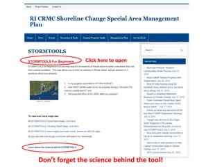
- 4. Donât forget the science behind the tool! Click here to open
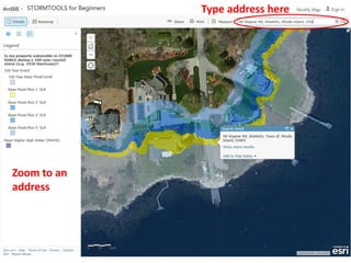
- 6. Zoom to an address Type address here
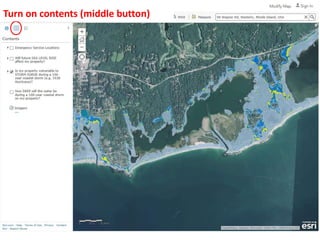
- 8. Turn on contents (middle button)
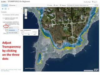
- 9. Adjust Transparency by clicking on the three dots
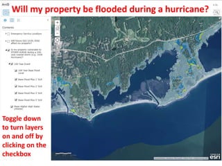
- 10. Toggle down to turn layers on and off by clicking on the checkbox Will my property be flooded during a hurricane?
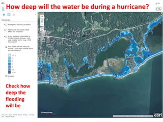
- 11. Check how deep the flooding will be How deep will the water be during a hurricane?
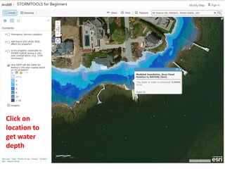
- 12. Click on location to get water depth
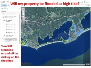
- 13. Turn SLR scenarios on and off by clicking on the checkbox Will my property be flooded at high tide?
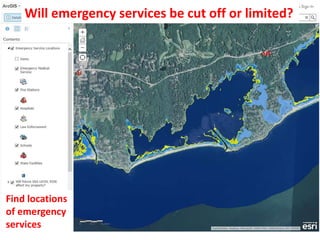
- 14. Find locations of emergency services Will emergency services be cut off or limited?
- 15. STORMTOOLS Team Malcolm Spaulding, Grover Fugate, Teresa Crean, Chris Damon, Annette Grilli, Reza Hashemi, Tatsu Isaji, Alex Shaw, and Lauran Schumbach Ocean Engineering, University of RI, Narragansett, RI Coastal Resources Center, University of RI, Narragansett, RI Environmental Data Center, University of RI, Kingston, RI Coastal Resources Management Council, Wakefield, RI ASA RPS Group, Wakefield, RI