Urbantips
- 1. REVISION TIPS ŌĆō URBAN You should know the main factors that can affect the site of a town or city. You should refer to a case study of a named developed world city Referring to a named city in the developed world you should know how site and location affected its growth You should be able to describe functional zones in a settlement giving map evidence to support your argument You should be able to describe and account for the location of functional zones within a town or city, from the CBD to the suburbs You should be able to identify the CBD of a settlement on an OS map, giving map evidence to support your choice. You should also be able to compare two CBDs, referring to their location and land use You should be able to describe the site and account for the location of particular zones within a town. You should be able to describe and contrast the features of urban zones within a town or city and explain why the environments of particular zones are so different You should be able to map evidence to suggest the likely function of a settlement, e.g. resort or mining towns For a named city in the developed world you should be able to describe and account for the pattern of land uses within the CBD Referring to a named city in the developed world you should describe and account for changes which have occurred both within the CBD and inner city, explaining why they were necessary and comment on their
- 2. REVISION TIPS ŌĆō URBAN You should be able to describe impact of new developments, in particular urban zones and be able to discuss any problems resulting form these changes RBAN: GEOGRAPHICAL METHODS & TECHNIQUES You should be able to describe and analyse land use maps, transects and survey data, e.g. land-use maps from CBD to suburbs, and sphere of influence studies You should be able to annotate field sketches and photographs of urban areas and comment on the accuracy of statements describing urban patterns on maps and diagrams
- 3. REVISION TIPS ŌĆō URBAN 1 You should know the main factors that can affect the site of a town or city. You should refer to a case study of a named developed world city Water supply Flat land Fertile soils Dry firm land Defensive site Route centre / gap Lowest bridging point Mineral resources Access to the sea
- 4. REVISION TIPS ŌĆō URBAN 1 contd. You should know the main factors that can affect the site of a town or city. You should refer to a case study of a named developed world city Identifying site factors from O.S. maps Contour lines to show flatness of site Roads show accessibility of original site Defensive sites ŌĆō within meander / on high ground Mines / quarries indicate past or present mineral wealth
- 5. REVISION TIPS ŌĆō URBAN 2 Referring to a named city in the developed world you should know how site and location affected its growth Specific reasons for the city chosen
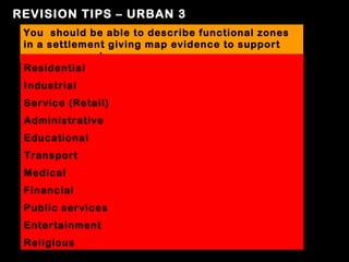
- 6. REVISION TIPS ŌĆō URBAN 3 You should be able to describe functional zones in a settlement giving map evidence to support your argument Residential Industrial Service (Retail) Administrative Educational Transport Medical Financial Public services Entertainment Religious
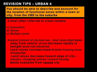
- 7. REVISION TIPS ŌĆō URBAN 4 You should be able to describe and account for the location of functional zones within a town or city, from the CBD to the suburbs 3 most often referred to urban models: c) Concentric d) Sector e) Multiple nuclei Analyse transect of city land use ŌĆō land values decrease away from centre / prices decrease rapidly in twilight zone (old industrial) Land values increase toward better housing areas of suburbs Land values decrease toward edge of city ŌĆō industry / shopping centres / council housing Quote examples from named city
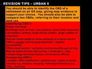
- 8. REVISION TIPS ŌĆō URBAN 5 You should be able to identify the CBD of a settlement on an OS map, giving map evidence to support your choice. You should also be able to compare two CBDs, referring to their location and land use Identifying CBDŌĆÖs Roads converge Buildings such as train / bus stations, town halls museums, information centres, large blocks (malls), large number of churches Narrow street patterns show antiquity of original centre CBD is usually central geographically ŌĆō highest accessibility Often most central / certainly most accessible part of city May be some streets with curves, cul-de-sacs ŌĆō may contain large terraced houses converted to offices Comparing CBDŌĆÖs Location within settlement / general size / types of zones closeby e.g. industry, housing / individual functions e.g. TICs, churches
- 9. REVISION TIPS ŌĆō URBAN 6 You should be able to describe the site and account for the location of particular zones within a town. The Core Area ŌĆō CBD Size / location / accessible / transport links converge / most services here / retail, office, admin. Functions ŌĆō all of which can afford high prices of centre The Industrial Zone Normally on flat ground for accessibility; older areas close to CBD; range of manufacturing ŌĆō look out for name ŌĆśworksŌĆÖ ŌĆō often beside railway tracks. Newer areas on outskirts ŌĆō ŌĆśrural-urban fringeŌĆÖ or in redeveloped inner city ŌĆō both areas have lower land values; must be near routeways; newer industry has smaller units than old; newer industry is ŌĆślightŌĆÖ Low cost housing Close to inner industry zone ŌĆō ŌĆśtenementsŌĆÖ for workers Medium cost housing Further from centre ŌĆō less pollution, congestion; less dense housing pattern ŌĆō often winding roads, cul-de-sacs Area of high-cost housing Further from CBD; low density, high value houses
- 10. REVISION TIPS ŌĆō URBAN 7 You should be able to describe and contrast the features of urban zones within a town or city and explain why the environments of particular zones are so different Housing Identify street patterns ŌĆō Low cost = grid iron, with small narrow streets, close to old industrial areas, unpleasant environment ŌĆō mostly tenements / low cost high density housing, replaced by high rise flats; many people rehoused in schemes on outskirts ŌĆō layout often high density like housing they replaced High cost = ŌĆścurvilinearŌĆÖ streets, cul-de-sacs and gardens ŌĆō low density; more pleasant environment, with wider streets, less traffic, less pollution. Wide range of functions, e.g. small shopping centres, schools, open space
- 11. REVISION TIPS ŌĆō URBAN 8 You should be able to map evidence to suggest the likely function of a settlement, e.g. resort or mining towns Settlement Function For example ŌĆō ŌĆśmining townŌĆÖ, port, resort, university town, cathedral town, market town, dormitory town. Map evidence e.g. Resort would have pier or conference centre, rail and bus terminals, recreational facilities Mining or industrial town ŌĆō look for evidence of disused collieries, mines, large scale ŌĆśworksŌĆÖ or ŌĆśfactoryŌĆÖ, plus railway sidings Dormitory settlements are less obvious but will be adjacent to large cities and may still have a railway station and / or good road links to the city / large settlement in question; they may lack any obvious signs of industry
- 12. REVISION TIPS ŌĆō URBAN 9 For a named city in the developed world you should be able to describe and account for the pattern of land uses within the CBD See notes on Inner City Glasgow
- 13. REVISION TIPS ŌĆō URBAN 10 Referring to a named city in the developed world you should describe and account for changes which have occurred both within the CBD and inner city, explaining why they were necessary and comment on their relative success See notes on Inner City Glasgow
- 14. REVISION TIPS ŌĆō URBAN 11 You should be able to describe impact of new developments, in particular urban zones and be able to discuss any problems resulting form these changes Problems New trading estates rarely employ same number as the industry they replaced Growth of home (tele)working Impacts on residential areas attractiveness Overall loss of population to rural areas - ŌĆśurban-rural driftŌĆÖ Increase in demand for housing in the rural-urban fringe or greenbelt Changes to transport networks around CBD ŌĆō one way systems, bus lanes, parking restrictions etc to ease congestion ŌĆō in some instances this has caused business to lose trade ŌĆō particularly in competition with out of town shopping centres e.g. Gyle Regeneration schemes ŌĆō vastly improved quality of housing but had consequences for older residents and young families (stuck in high-rise flats); families broken up, spread throughout city; loss of community spirit
- 15. RBAN: GEOGRAPHICAL METHODS & TECHNIQUES You should be able to describe and analyse land use maps, transects and survey data, e.g. land-use maps from CBD to suburbs, and sphere of influence studies Ordnance Survey maps Street patterns allow identification of older, inner city industrial & tenement zones as opposed to newer, suburban areas ŌĆō refer to transport patterns, road, rail and water networks to explain location of service areas and industrial areas Land use divided up into R.I.C.E.P.O.T.S (Residential, Industrial, Commercial, Entertainment, Public buildings, Offices and Transport Urban models should help you explain pattern and land uses within certain zones identified on map Sphere of Influence ŌĆō the area around a settlement where its services are found e.g. area within which department store will deliver
- 16. URBAN: GEOGRAPHICAL METHODS & TECHNIQUES cont. You should be able to annotate field sketches and photographs of urban areas and comment on the accuracy of statements describing urban patterns on maps and diagrams Detailed labels pointing out significant features Comparisons of different areas possible Some explanation can be added to your answer by referring to general changes