Uttarakhand tsunami
•Download as PPSX, PDF•
10 likes•7,214 views

This document discusses the 2013 floods in Uttarakhand, India. It notes that heavy rainfall from June 14-17, 2013 caused devastating floods and landslides. The rainfall was over 375% of the benchmark amount. A cloudburst centered over Uttarakhand melted glaciers and caused rivers like the Mandakini to overflow. This natural disaster was exacerbated by man-made factors like deforestation, unchecked construction, and hydropower projects. The floods affected over 300,000 people across several districts, destroyed infrastructure and villages, and caused over 580 deaths. Kedarnath valley was among the worst hit areas.
Uttarakhand tsunami
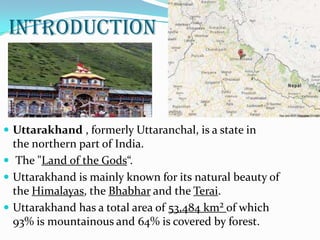
- 2. INTRODUCTION  Uttarakhand , formerly Uttaranchal, is a state in the northern part of India.  The "Land of the Gods“.  Uttarakhand is mainly known for its natural beauty of the Himalayas, the Bhabhar and the Terai.  Uttarakhand has a total area of 53,484 km² of which 93% is mountainous and 64% is covered by forest.
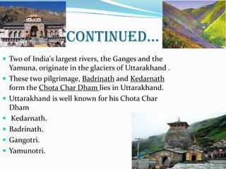
- 3. CONTINUED…  Two of India's largest rivers, the Ganges and the Yamuna, originate in the glaciers of Uttarakhand .  These two pilgrimage, Badrinath and Kedarnath form the Chota Char Dham lies in Uttarakhand.  Uttarakhand is well known for his Chota Char Dham  Kedarnath.  Badrinath.  Gangotri.  Yamunotri. 3
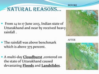
- 5. NATURAL REASONS…  From 14 to 17 June 2013, Indian state of Uttarakhand and near by received heavy rainfall .  The rainfall was above benchmark which is above 375 percent.  A multi-day Cloudburst ,centered on the state of Uttarakhand caused devastating Floods and Landslides. BEFORE AFTER
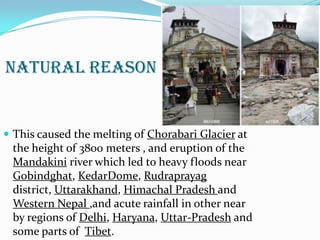
- 6. NATURAL REASON ď‚— This caused the melting of Chorabari Glacier at the height of 3800 meters , and eruption of the Mandakini river which led to heavy floods near Gobindghat, KedarDome, Rudraprayag district, Uttarakhand, Himachal Pradesh and Western Nepal ,and acute rainfall in other near by regions of Delhi, Haryana, Uttar-Pradesh and some parts of Tibet.
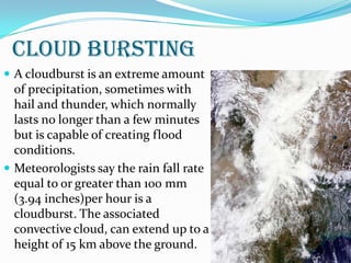
- 7. CLOUD BURSTING ď‚— A cloudburst is an extreme amount of precipitation, sometimes with hail and thunder, which normally lasts no longer than a few minutes but is capable of creating flood conditions. ď‚— Meteorologists say the rain fall rate equal to or greater than 100 mm (3.94 inches)per hour is a cloudburst. The associated convective cloud, can extend up to a height of 15 km above the ground.
- 8. 4/25/2014 8
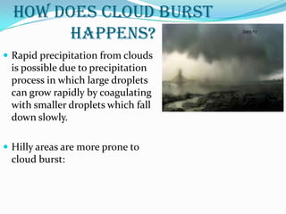
- 9. HOW DOES CLOUD BURST HAPPENS? ď‚— Rapid precipitation from clouds is possible due to precipitation process in which large droplets can grow rapidly by coagulating with smaller droplets which fall down slowly. ď‚— Hilly areas are more prone to cloud burst:
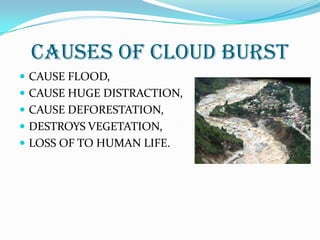
- 10. CAUSES OF CLOUD BURST ď‚— CAUSE FLOOD, ď‚— CAUSE HUGE DISTRACTION, ď‚— CAUSE DEFORESTATION, ď‚— DESTROYS VEGETATION, ď‚— LOSS OF TO HUMAN LIFE.
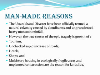
- 11. MAN-MADE REASONS ď‚— The Uttarakhand Disaster have been officially termed a natural calamity caused by cloudbursts and unprecedented heavy monsoon rainfall. ď‚— However, the true causes of the epic tragedy is growth of : ď‚— Tourism, ď‚— Unchecked rapid increase of roads, ď‚— Hotels, ď‚— Shops, and ď‚— Multistory housing in ecologically fragile areas and unplanned construction are the reason for landslide.
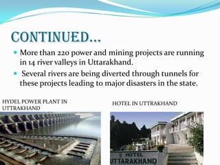
- 12. CONTINUED…  More than 220 power and mining projects are running in 14 river valleys in Uttarakhand.  Several rivers are being diverted through tunnels for these projects leading to major disasters in the state. HYDEL POWER PLANT IN UTTRAKHAND HOTEL IN UTTRAKHAND
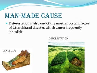
- 13. MAN-MADE CAUSE ď‚— Deforestation is also one of the most important factor of Uttarakhand disaster, which causes frequently landslide. LANDSLIDE DEFORESTATION
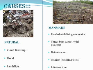
- 14. CAUSES!!! NATURAL MANMADE ď‚— Cloud Bursting. ď‚— Flood. ď‚— Landslide. ď‚— Roads destabilizing mountains. ď‚— Threat from dams (Hydel projects) ď‚— Deforestation. ď‚— Tourism (Resorts, Hotels) ď‚— Infrastructure.
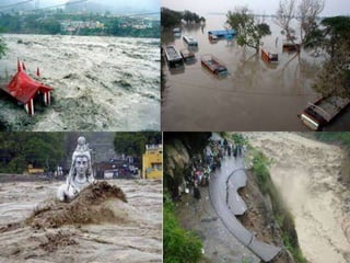
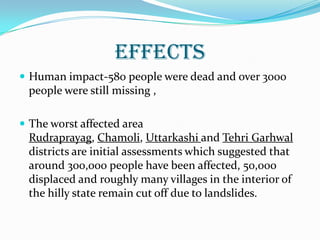
- 15. EFFECTS ď‚— Human impact-580 people were dead and over 3000 people were still missing , ď‚— The worst affected area Rudraprayag, Chamoli, Uttarkashi and Tehri Garhwal districts are initial assessments which suggested that around 300,000 people have been affected, 50,000 displaced and roughly many villages in the interior of the hilly state remain cut off due to landslides.
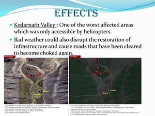
- 16. EFFECTS ď‚— Kedarnath Valley : One of the worst affected areas which was only accessible by helicopters. ď‚— Bad weather could also disrupt the restoration of infrastructure and cause roads that have been cleared to become choked again.
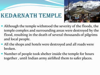
- 17. KEDARNATH TEMPLE ď‚— Although the temple withstood the severity of the floods, the temple complex and surrounding areas were destroyed by the flood, resulting in the death of several thousands of pilgrims and local people. ď‚— All the shops and hotels were destroyed and all roads were broken. ď‚— Number of people took shelter inside the temple for hours together , until Indian army airlifted them to safer places.
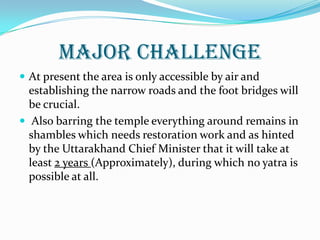
- 18. MAJOR CHALLENGE ď‚— At present the area is only accessible by air and establishing the narrow roads and the foot bridges will be crucial. ď‚— Also barring the temple everything around remains in shambles which needs restoration work and as hinted by the Uttarakhand Chief Minister that it will take at least 2 years (Approximately), during which no yatra is possible at all.
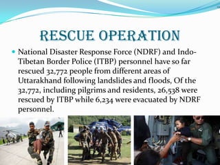
- 19. RESCUE OPERATION ď‚— National Disaster Response Force (NDRF) and Indo- Tibetan Border Police (ITBP) personnel have so far rescued 32,772 people from different areas of Uttarakhand following landslides and floods, Of the 32,772, including pilgrims and residents, 26,538 were rescued by ITBP while 6,234 were evacuated by NDRF personnel. 19