![Introduction
’üĄ Passage planning or voyage planning is a
procedure of developing a complete
description of a vessel's voyage from start to
finish.
’üĄ Production of a passage plan prior to
departure is a legal requirement.
’üĄ The practice of voyage planning has evolved
from drawing lines on nautical charts to a
process of risk management.]](https://image.slidesharecdn.com/voyage-planningppt-230309022321-65615dfe/85/Voyage-Planning-PPT-ppt-7-320.jpg)

![’ü« On the chart [with summary in bridge notebook]
’ü« tracks and courses to steer, where to alter
course/speed
’ü« highlight danger areas ŌĆō wrecks, shallows, etc
’ü« identify electronic aids to navigation that can be
used
’ü« Identify good position fixing objects, e.g.
’ü« lights, transits, clearing bearings, radar/visual
objects
’ü« where the tide is critical, e.g height, or rate
’ü« alternative contingency plans
Planning (contd)](https://image.slidesharecdn.com/voyage-planningppt-230309022321-65615dfe/85/Voyage-Planning-PPT-ppt-25-320.jpg)
![’ü« On the chart [with summary in bridge notebook]
’ü« tracks and courses to steer, where to alter
course/speed
’ü« highlight danger areas ŌĆō wrecks, shallows, etc
’ü« identify electronic aids to navigation that can be
used
’ü« Identify good position fixing objects, e.g.
’ü« lights, transits, clearing bearings, radar/visual
objects
’ü« where the tide is critical, e.g height, or rate
’ü« alternative contingency plans
Planning (contd)](https://image.slidesharecdn.com/voyage-planningppt-230309022321-65615dfe/85/Voyage-Planning-PPT-ppt-26-320.jpg)
Voyage-Planning PPT.ppt
- 1. Voyage Planning Planning the safe & economical passage between two places
- 2. GUIDELINES FOR VOYAGE PLANNING (IMO Resolution A.893(21) Annex 25 of SOLAS V - GUIDELINES FOR VOYAGE PLANNING
- 3. The main elements to ensure safety of life at sea, safety and efficiency of navigation, and protection of the marine environment during the intended voyage or passage; such elements should include, but not be limited to: - Safe speed, having regard to the proximity of navigational hazards along the intended route or track, the manoeuvring characteristics of the vessel and its draught in relation to the available water depth
- 4. Guidelines for Voyage Planning All information must be assembled as the requirement is a plan covering from berth to berth it therefore includes the period a pilot will be on board. Voyage planning, also referred to as passage planning, is the detailed procedure of laying out a vessel's voyage from start to finish.ŌĆ£ Voyage planning be done ŌĆØPrior to sailingŌĆØ
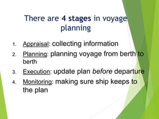
- 5. On the basis of the fullest possible appraisal, a detailed voyage or passage plan should be prepared which should cover the entire voyage or passage from berth to berth,
- 6. 1 Objectives 1.1 The development of a plan for voyage or passage, as well as the close and continuous monitoring of the vessel's progress and position during the execution of such a plan, are of essential importance for safety of life at sea, safety and efficiency of navigation and protection of the marine environment.
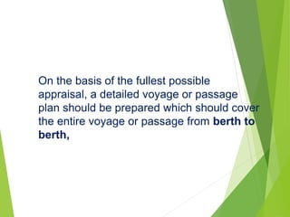
- 7. Introduction ’üĄ Passage planning or voyage planning is a procedure of developing a complete description of a vessel's voyage from start to finish. ’üĄ Production of a passage plan prior to departure is a legal requirement. ’üĄ The practice of voyage planning has evolved from drawing lines on nautical charts to a process of risk management.]
- 8. What to include? The plan should include: leaving the dock and harbor area, the enroute portion of a voyage, approaching the destination, and mooring.
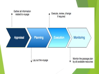
- 9. There are 4 stages in voyage planning 1. Appraisal: collecting information 2. Planning: planning voyage from berth to berth 3. Execution: update plan before departure 4. Monitoring: making sure ship keeps to the plan
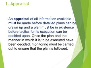
- 11. 1. Appraisal An appraisal of all information available must be made before detailed plans can be drawn up and a plan must be in existence before tactics for its execution can be decided upon. Once the plan and the manner in which it is to be executed have been decided, monitoring must be carried out to ensure that the plan is followed.
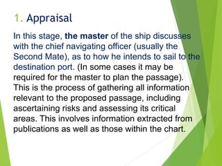
- 12. 1. Appraisal In this stage, the master of the ship discusses with the chief navigating officer (usually the Second Mate), as to how he intends to sail to the destination port. (In some cases it may be required for the master to plan the passage). This is the process of gathering all information relevant to the proposed passage, including ascertaining risks and assessing its critical areas. This involves information extracted from publications as well as those within the chart.
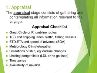
- 13. 1. Appraisal The appraisal stage consists of gathering and contemplating all information relevant to the voyage. Appraisal Checklist ’ü« Great Circle or Rhumbline routes ’ü« TSS and shipping lanes, traffic, fishing vessels ’ü« ETD,ETA and speed of advance (SOA) ’ü« Meteorology Climate/weather ’ü« Limitations of ship, eg loadline changes ’ü« Limiting danger lines (LDL or no go lines) ’ü« Time zones ’ü« Availability of navaids
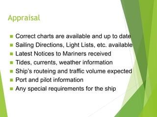
- 14. Appraisal ’ü« Correct charts are available and up to date ’ü« Sailing Directions, Light Lists, etc. available ’ü« Latest Notices to Mariners received ’ü« Tides, currents, weather information ’ü« ShipŌĆÖs routeing and traffic volume expected ’ü« Port and pilot information ’ü« Any special requirements for the ship
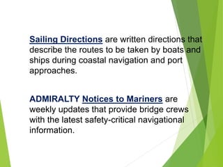
- 15. Sailing Directions are written directions that describe the routes to be taken by boats and ships during coastal navigation and port approaches. ADMIRALTY Notices to Mariners are weekly updates that provide bridge crews with the latest safety-critical navigational information.
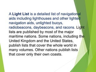
- 16. A Light List is a detailed list of navigational aids including lighthouses and other lighted navigation aids, unlighted buoys, radiobeacons, daybeacons, and racons. Light lists are published by most of the major maritime nations. Some nations, including the United Kingdom and the United States, publish lists that cover the whole world in many volumes. Other nations publish lists that cover only their own coasts.
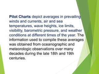
- 17. Pilot Charts depict averages in prevailing winds and currents, air and sea temperatures, wave heights, ice limits, visibility, barometric pressure, and weather conditions at different times of the year. The information used to compile these averages was obtained from oceanographic and meteorologic observations over many decades during the late 18th and 19th centuries.
- 18. The Atlas of Pilot Charts set is comprised of five volumes, each covering a specific geographic region. Each volume is an atlas of twelve pilot charts, each depicting the observed conditions for a particular month of any given year. The charts are intended to aid the navigator in selecting the fastest and safest routes with regards to the expected weather and ocean conditions. The charts are not intended to be used for navigation.
- 19. The Guide to Port Entry 2021 provides accurate and comprehensive information on over 14,700 global commercial ports and terminals. With over 80 port information sections, it ensures that a complete port overview can be obtained before arrival, including pre-arrival information, details of the documentation required by the port, maximum size of vessel permissible and cargo facilities. It also includes reports of actual conditions experienced by other seafarers visiting that port..
- 20. ADMIRALTY List of Radio Signals provides information on all aspects of Maritime Radio Communications, helping bridge crews to manage communications and comply with all reporting regulations throughout a voyage.
- 23. 2. Planning The process involves projecting various future events including landfalls, narrow passages, and course changes expected during the voyage. The mental model becomes the standard by which later on the navigator measures progress toward the goal.
- 24. ’ü« On the basis of the appraisal, a detailed voyage plan is prepared ’ü« from berth to berth (even when a pilot is on board) ’ü« drawn on the chart(s) ’ü« written in a bridge notebook 2. Planning
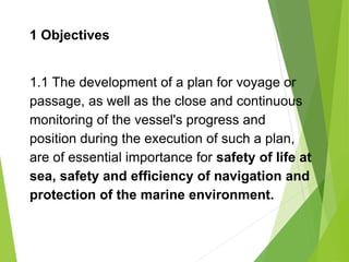
- 25. ’ü« On the chart [with summary in bridge notebook] ’ü« tracks and courses to steer, where to alter course/speed ’ü« highlight danger areas ŌĆō wrecks, shallows, etc ’ü« identify electronic aids to navigation that can be used ’ü« Identify good position fixing objects, e.g. ’ü« lights, transits, clearing bearings, radar/visual objects ’ü« where the tide is critical, e.g height, or rate ’ü« alternative contingency plans Planning (contd)
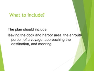
- 26. ’ü« On the chart [with summary in bridge notebook] ’ü« tracks and courses to steer, where to alter course/speed ’ü« highlight danger areas ŌĆō wrecks, shallows, etc ’ü« identify electronic aids to navigation that can be used ’ü« Identify good position fixing objects, e.g. ’ü« lights, transits, clearing bearings, radar/visual objects ’ü« where the tide is critical, e.g height, or rate ’ü« alternative contingency plans Planning (contd)
- 27. Necessary speed alterations en route, e.g., where there may be limitations because of night passage, tidal restrictions, or allowance for the increase of draught due to squat and heel effect when turning;
- 28. Execution In this stage, the navigating officers perform the plan that has been prepared According to international law, a vessel's Master is legally responsible for passage planning, The duty of passage planning is usually delegated to the ship's navigation officer, typically the second officer on merchant ships. Voyage planning be executed only when equipment complies and is operated as approved by the Flag State
- 29. ’ü« When departure time is known, consider: ’ü« ETA at critical points in the plan ’ü« the weather forecast ’ü« traffic conditions ’ü« night or daylight passage ’ü« i.e. does anything need to be changed? ’ü« If the Officer of the watch must deviate from the voyage plan, he should, Inform the Master 3. Execution
- 30. ’ü« Monitor position along planned tracks by frequent fixing of position, incl. echo sounder ’ü« Record key positions & alterations in the bridge logbook ’ü« Check reliability of all navigation equipment at regular intervals 4. Monitoring
- 31. Monitoring Once the voyage has begun the progress of the vessel along its planned route must be monitored. This requires that the ship's position be determined.
- 32. Vessel Positioning Techniques Vessel Positioning ’é¦ By Cross Bearings ’é¦ By Ranges of Two or More Points ’é¦ By Combined Range and Bearing ’é¦ By a Bearing and Sounding ’é¦ By a Line of Soundings ’é¦ By Running Fix Position Fixing: The Most Important Element of Passage Planning
- 33. ’é¦ Doubling the Angle on the Bow ’é¦ The Four Point Bearing ’é¦ The Transit Bearing ’é¦ Danger or Clearing Bearings ’é¦ Vertical Sextant Angle ’é¦ Selection of Suitable Points for Bearings and Radar Ranges ’é¦ Vessel Positioning
- 34. Deviations ’üĄ Results that are different to the planned ones ’üĄ Occur on daily basis
- 35. Deviations It is importnat to determine their source: ’üĄ internal or ’üĄ external reasons. Possible reasons for deviations in maritime tr.: ’üĄ bad weather conditions, ’üĄ delays in ports, ’üĄ route deviations (eg. due to medical condition of crew memeber), ’üĄ fuel price changes, ’üĄ hull or engine condition, ’üĄ poor planning etc.
- 36. Other planning It is not only the navigation that needs to be carefully planned. It is also necessary to plan cargo loading (type of cargo, volume, distribution aboard the etc.) and unloading, port staying, bunker and provisions, shipyard visit etc.