ŽĄžé±ő°ä„»„ß„Ê©`„Ś„ì„Œ„ó
Download as PPTX, PDF4 likes1,770 views

3/9ĄĄŽĄžé±ő°ä„»„ß„Ê©`ĄĄŃÒÆé°k±íŚÊÁÏ


![FOSSÀûÓÀˀą€ż€Ă€Æ€ÎŚąÒâ”ă
? ŸtșϔĄł„č„È€ÎżŒ]
šC ÈË”ÄÙYÔŽ€ÎÓęłÉ”È€â±ŰÒȘ
? FOSS€ËÏȚ€ê€Ț€»€ó€Ź
šC „«„č„ż„Ț„€„ș”È€Ë€â„ł„č„È€Ź€«€«€ë
? „ł„ß„ć„Ë„Æ„Ł€È€ÎévS€ÎșB
šC ·eO”Ä€ËÓ€«€Ê€±€ì€ĐÒâҀϻ€ï€é€Ê€€
? é_°kĄąžÄÁŒĄąÆŐŒ°”ȀǀÎŰÏŚ€â±ŰÒȘ
? ÈŐ±ŸŐZ»Ż€Îî}
šC é_°kÄžÌ怏șŁÍâ€Î€ł€È€Ź¶à€€
? ÓĐÖŸ€ŹĐĐ€Ă€Æ€€€ëŚŽB
44FOSS€òÀûÓĂ€č€ëÀû”ă€ÈŚąÒâ”ă](https://image.slidesharecdn.com/aric-160310000802/85/ARIC-44-320.jpg)


More Related Content
What's hot (20)
Viewers also liked (8)


Similar to ŽĄžé±ő°ä„»„ß„Ê©`„Ś„ì„Œ„ó (20)


More from IWASAKI NOBUSUKE (20)


ŽĄžé±ő°ä„»„ß„Ê©`„Ś„ì„Œ„ó
- 2. œńÈՀΰk±íÄÚÈĘ ? FOSS€Ë€Ä€€€Æ šC oÁÏ„œ„Ő„È€È€Îß`€€ šC évßB€·€Æ„Ș©`„Ś„ó„Ç©`„ż€Ë€Ä€€€Æ ? č«čČČżéT€Ë€Ș€±€ëFOSS€Î»îÓĂÊÂÀę šC čúÄÚÍâŐțžźCév šC čúëHCév šC ”Ű·œŚÔÖÎÌć ? FOSS€òÀûÓĂ€č€ëÀû”ă ? €Ț€È€á 2Agenda
- 3. œńÈՀΰk±íÄÚÈĘ ? FOSS€Ë€Ä€€€Æ šC oÁÏ„œ„Ő„È€È€Îß`€€ šC évßB€·€Æ„Ș©`„Ś„ó„Ç©`„ż€Ë€Ä€€€Æ ? č«čČČżéT€Ë€Ș€±€ëFOSS€Î»îÓĂÊÂÀę šC čúÄÚÍâŐțžźCév šC čúëHCév šC ”Ű·œŚÔÖÎÌć ? FOSS€òÀûÓĂ€č€ëÀû”ă€ÈŚąÒâ”ă ? €Ț€È€á 3Agenda
- 4. °k±íŐ߀ˀĀ€€Æ ? ÂÔs šC |Ÿ©¶ŒÁąŽó”ŰÀíżÆŁšŃ§ČżŁ© šC |Ÿ©č€IŽóѧŁšĐȚÊż?Č©ÊżŁ© šC ȚrIhŸłŒŒĐgŃĐŸżËù ? ÉúBÏ”ÓyŃĐŸżîIÓò šC 4Ô€«€é€ÏȚrŃĐC€ËœyșÏ ? ŃĐŸż„Æ©`„Ț šC ȚrŽć”ŰÓò€Ë€Ș€±€ësÊ·”ÄÍÁ”ŰÀû ÓĂ仯€ÎœâĂś šC FOSS4G€òÀûÓĂ€·€ż”ŰÀíżŐégÇéó €ÎÀû»îÓĂÊÖ·š€ÎÊÓ ? »îÓ šC OSGeoŰâÈŐ±ŸÖ§Čż 4ŚÔŒșœBœé
- 6. FOSS€Ë€Ä€€€Æ ? Free and Open Source Software€ÎÂÔ šC ŚÔÓÉ€ËÀûÓÀǀ€ë„œ„Ő„È„Š„§„ą€Î€ł€È šC ĄžFLOSSĄč€Èșô€Ö€ł€È€â€ą€ê€Ț€č šC ÔOÓí€Ç€ą€ë„œ©`„č„ł©`„É€Źč«é_€”€ì€Æ€€€ë 6What's FOSS?
- 7. oÁπ΄œ„Ő„È€È€Ïß`€Š€Î€«Łż ? Ąž„Ő„ê©`„œ„Ő„ÈĄč€ÏÓĐĂû€Ç€č šC €ż€È€š€ĐAdobe Acrobat Reader 7What's FOSS?
- 9. FOSS€ÎÌŰŐ ? ŚÔÓɀ˥ąÈëÊÖ?ĐȚŐę?ÔÙĆäČŒ€Ç€Ąą€É€Î €ÊÄż”ĀǀâÊ耚€ë€ł€È šC oÁπǀπʀŻŚÔÓÉ€ŹÖŰÒȘ€Ç€č ? http://www.opensource.org/docs/osd 9What's FOSS?
- 10. FOSS4G€Ë€Ä€€€Æ ? FOSS€ËĄžfor GeospatialĄč€Ź€Ä€€€ż€Î€ŹFOSS4G šC ŽóÚæÊĐÁąŽóѧ„Ù„ó„«„Æ„Ł„Ă„·„ć?„é„Ź„ï„óœÌÊÚ€ÎÌáłȘ ? ŹFOSGeo Foundation President ? 2012Äê€Î„œ„ë?„«„Ă„ÄÙp (Sol Katz Award for Geospatial Free and Open Source Software) €òÊÜÙp šC €Ê€Ë€ï€Î„€„ó„ÉÈËŁĄ 10What's FOSS?
- 11. „Ș©`„Ś„ó„Ç©`„ż€Ë€Ä€€€Æ ? ÍŹ€ËŚÔÓÉ€ËÊ耚€ë„Ç©`„ż€ŹĄž„Ș©`„Ś„ó „Ç©`„żĄč€Ç€č šC ÈŐ±ŸŐțžź€âÈĄ€êœM€ó€Ç€€€Ț€č 11What's FOSS? http://www.kantei.go.jp/jp/singi/it2/densi/jichibukai/dai1/siryou3.pdf
- 13. €ł€ÎÙYÁÏ€â„Ș©`„Ś„ó„Ç©`„ż€Ç€č ? „Ż„ê„š„€„Æ„Ł„Ö?„ł„â„ó„ș ±íÊŸ 4.0 čúëH 13What's FOSS? „Ș©`„Ś„ó„Ç©`„żÁśÍšÍÆßM„ł„󄜩`„·„ą„à€ÎÈĄœM€ÈÌáŃÔ http://www.kantei.go.jp/jp/singi/it2/densi/dai3/siryou3.pdf
- 14. oÁπǎóŐÉ·òŁż ? oÁÏ€À€«€éĄž°Č€«€í€Š€«€í€ŠĄč€Ç€ÏŁż šC șŁÍâ€Ç€â€è€Ż€€€ï€ì€Ț€č ? „Ș©`„Ś„󄜩`„č„œ„Ő„È€Ë€Ä€€€Æ€Î10€ÎĂÔĐĆ šC gëH€ÎÀûÓÀˀĀ€€Æ€ŽœBœé€·€Ț€č 14What's FOSS?
- 16. FOSS€Ë€ÏĄ©€Ê„œ„Ő„È„Š„§„ą€Ź€ą€ê€Ț€č ? „”©`„ĐĄąWeb„ą„Ś„ê šC „€„ó„ż©`„Í„Ă„È„”©`„Đ©`€ÇÓŚś ? OSĄą„Ç„č„Ż„È„Ă„Ś„ą„Ś„ê šC PC€ÇÓŚś ? „é„€„Ö„é„ê©`Ąą„Ś„é„°„€„ó šC Ëû€Î„œ„Ő„È€ÈÒ»Ÿw€ËÊ耊 16č«čČCév€Ë€Ș€±€ëFOSS€Î»îÓĂÊÂÀę „”©`„ĐĄąWeb„ą„Ś„ê „€„ó„ż©`„Í„Ă„È „Ç„č„Ż„È„Ă„Ś „Ç„č„Ż„È„Ă„Ś Ł«„Ś„é„°„€„ó „Ç„č„Ż„È„Ă„Ś „é„€„Ö„é„ê©` „é„€„Ö„é„ê©` „é„€„Ö„é„ê©`
- 19. DATA.GO.JP ? CKAN€È€€€Š„Ç©`„ż„«„ż„í„°€òÊčÓĂ šC Óąčú?Open Knowledge€Źé_°k 19č«čČCév€Ë€Ș€±€ëFOSS€Î»îÓĂÊÂÀę http://ckan.org
- 20. CKANńÓĂ„”„€„È ? čúÍÁ”ŰÀíÔș ”ŰÀíżŐégÇéó„Ż„ê„ą„ê„ó„°„Ï„Š„č ? ȚrIhŸłŒŒĐgŃĐŸżËù ȚrIhŸłÇéó„«„ż„í„°„”„€„ÈNIAES VIC 20č«čČCév€Ë€Ș€±€ëFOSS€Î»îÓĂÊÂÀę
- 25. GżŐég„Ś„é„Ă„È„Ő„©©`„à€ÇÊčÓĂ€”€ì€ëFOSS ? FOSS€ÇłÉ€”€ì€Æ€€€Ț€č šC CKAN Ąú „Ç©`„ż„«„ż„í„°„”„€„È šC Drupal Ąú Web„”„€„ÈčÜÀí šC Apache Solr Ąú È«ÎÄÊËś„·„č„Æ„à šC REDMINE Ąú „ż„č„ŻčÜÀí šC GeoServer, PostGIS, MapProxy Ąú ”Űí„Ç©`„żčÜÀí šC Cesium, leaflet Ąú ”Űí„Ç©`„ż±íÊŸ 25č«čČCév€Ë€Ș€±€ëFOSS€Î»îÓĂÊÂÀę
- 27. Drupal€ÎÀûÓĂCév ? the WHITE HOUSE šC ÀûÓĂ€č€ë€À€±€Ç€Ê€ŻžÄÁŒ€Ë€âŰÏŚ 27č«čČCév€Ë€Ș€±€ëFOSS€Î»îÓĂÊÂÀę
- 29. ÈŐ±ŸčúÄڀǀÎDrupal€ÎÀûÓĂ ? ŐțžźCIO„Ę©`„ż„ë šC CIO€È€ÏŚîžßÇéóŰÈÎŐ߀΀ł€È ? ŐțžźÇéó»ŻœyÀšŰÈÎČżéT 29č«čČCév€Ë€Ș€±€ëFOSS€Î»îÓĂÊÂÀę
- 31. ”ŰÀíÔș”Űí€Ș€è€Ó”ŰÀíÔș”Űí3ŁÄ ? ”ŰÀíÔș”Űí Ąú leaflet ? ”ŰÀíÔș”Űí3D Ąú three.js 31č«čČCév€Ë€Ș€±€ëFOSS€Î»îÓĂÊÂÀę
- 33. leaflet ? ”Űí€ò±íÊŸ€č€ë€ż€á€Î„é„€„Ö„é„ê šC „č„Ț„ۀαíÊŸ€Ë€âê 33č«čČCév€Ë€Ș€±€ëFOSS€Î»îÓĂÊÂÀę
- 35. €œ€ÎËû€Î„é„€„Ö„é„ê©` ? D3.js šC „Ç©`„żżÉÒ»Ż€Î€ż€á€Î„é„€„Ö„é„ê©` 35č«čČCév€Ë€Ș€±€ëFOSS€Î»îÓĂÊÂÀę
- 40. GRASS GIS ? ·ÖÎöCÄÜ€Ë€ì€żGIS šC ”ŰÇò”Űí€ÎŚśłÉ€ËÊčÓĂ 40č«čČCév€Ë€Ș€±€ëFOSS€Î»îÓĂÊÂÀę http://www1.gsi.go.jp/geowww/globalmap-gsi/download/gmrd/manual/GMRD_manual_jp.pdf
- 42. č«”ÄCév€ŹFOSS€ò§Èë€č€ëÀû”ă ? „ł„č„ÈÏśp šC §Èë€è€ê€âĆäČŒżÉÄÜ€Ê”ă€ŹÓĐÀû ? łÖŸA”Äß\ÓĂ šC „Ș©`„Ś„ó„č„ż„ó„À©`„É€ÎńÓĂ šC IŐ€ÎÒęŸ@€ŹÈĘÒŚ ? IՀοÂÊ»Ż šC „é„€„»„ó„ččÜÀ퀏±ŰÒȘ€Ê€€ šC „Ù„ó„À©`„í„Ă„Ż„€„ó€ò»Ű±Ü šC ĐĄ€”€ÊžÄĐȚ€ÏŚÔ·Ö€ÇêżÉÄÜ 42FOSS€òÀûÓĂ€č€ëÀû”ă€ÈŚąÒâ”ă
- 43. ”ŰÀíżŐégÇéó€Ëév€č€ëœńáᣚ5Ą«10ÄêŁ©€ÎÒÍš€· ? FOSS€ÎÀû”ă€ÈŚąÒâ”』֞ŐȘ€”€ì€Æ€€€ë šC ŚśłÉ€ÏÓąčúê”ŰyÁżČżŁšOrdinance SurveyŁ© 43FOSS€òÀûÓĂ€č€ëÀû”ă€ÈŚąÒâ”ă http://ggim.un.org/docs/Future%20Trends%20JPN_rev.pdf
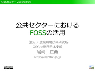
- 44. FOSSÀûÓÀˀą€ż€Ă€Æ€ÎŚąÒâ”ă ? ŸtșϔĄł„č„È€ÎżŒ] šC ÈË”ÄÙYÔŽ€ÎÓęłÉ”È€â±ŰÒȘ ? FOSS€ËÏȚ€ê€Ț€»€ó€Ź šC „«„č„ż„Ț„€„ș”È€Ë€â„ł„č„È€Ź€«€«€ë ? „ł„ß„ć„Ë„Æ„Ł€È€ÎévS€ÎșB šC ·eO”Ä€ËÓ€«€Ê€±€ì€ĐÒâҀϻ€ï€é€Ê€€ ? é_°kĄąžÄÁŒĄąÆŐŒ°”ȀǀÎŰÏŚ€â±ŰÒȘ ? ÈŐ±ŸŐZ»Ż€Îî} šC é_°kÄžÌ怏șŁÍâ€Î€ł€È€Ź¶à€€ ? ÓĐÖŸ€ŹĐĐ€Ă€Æ€€€ëŚŽB 44FOSS€òÀûÓĂ€č€ëÀû”ă€ÈŚąÒâ”ă
- 46. č«čČ„»„Ż„ż©`€Ë€Ș€±€ëFOSS€Î»îÓĂ ? FOSS€È€Ï šC oÁπǀπʀŻĄąŚÔÓÉ€ËÊ耚€ë„œ„Ő„È„Š„§„ą ? FOSS€ÎÀûÓĂgż šC ÈŐ±ŸčúŐțžźĄąșŁÍâŐțžź€äčúëHCévĄą”Ű·œč«čČ âÌ楹ŃĐŸżCév”ȀǻîÓĂ€”€ì€Æ€€€ë ? ĐĆîmĐÔ€Ź€ą€ë€È€€€š€ë ? FOSS§Èë€ÎÀû”ă€ÈŚąÒâ”ă šC „ł„č„ÈÏśpĄąłÖŸA”Äß\ÓĂĄąIՀοÂÊ»Ż šC ŸtșϔĄł„č„ÈĄą„ł„ß„ć„Ë„Æ„Ł€Ű€ÎévÓ륹ÈŐ±Ÿ ŐZ»Ż 46€Ț€È€á