

蚕骋滨厂を使った土地利用/被覆のモデル化とシミュレーション:进捗状况(アジア航测株式会社?骋颈蝉尘辞苍诲颈様)
- 1. QGIS を使った土地利用 / 被覆変化 のモデル化とシミュレーション : 進捗状況 Modelling and simulating land use/cover changes using QGIS: Current Progress Presented by Matteo Gismondi Asia Air Survey Co., Ltd.
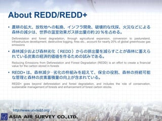
- 2. About REDD/REDD+ ● 農耕の拡大、放牧地への転換、インフラ開発、破壊的な伐採、火災などによる 森林の減少は、世界の温室効果ガス排出量の約 20 %を占める。 Deforestation and forest degradation, through agricultural expansion, conversion to pastureland, infrastructure development, destructive logging, fires etc., account for nearly 20% of global greenhouse gas emissions ● 森林減少および森林劣化( REDD )からの排出量を減らすことが森林に蓄えら れている炭素の経済的価値を作るための試みである。 Reducing Emissions from Deforestation and Forest Degradation (REDD) is an effort to create a financial value for the carbon stored in forests ● REDD+ は、森林減少 · 劣化の枠組みを超えて、保全の役割、森林の持続可能 な管理と森林の炭素蓄積量の向上が含まれている。 REDD+ goes beyond deforestation and forest degradation, and includes the role of conservation, sustainable management of forests and enhancement of forest carbon stocks. http://www.un-redd.org/ 2
- 3. Why FOSS for REDD? ● 土地利用変化の解析のための既存ツールの改善 Improve existing tools for land use change analysis ● コストの削減 Lower the costs ● 政府開発援助( ODA )プロジェクトの終了後でも、発展途上国 で使用することができる費用対効果の高いツールを提供 Provide cost-effective tools that can be used in developing countries even after the end of the ODA-sponsored project ● 常に更新され、自由に配布されるソフトウェア Have the security of a freely distributed software, which is always updated ● Open is better!! 3
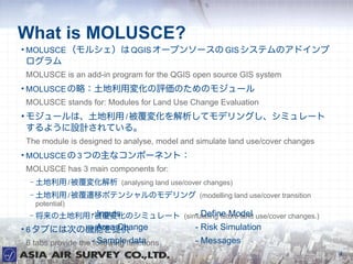
- 4. What is MOLUSCE? ● MOLUSCE (モルシェ)は QGIS オープンソースの GIS システムのアドインプ ログラム MOLUSCE is an add-in program for the QGIS open source GIS system ● MOLUSCE の略:土地利用変化の評価のためのモジュール MOLUSCE stands for: Modules for Land Use Change Evaluation ● モジュールは、土地利用 / 被覆変化を解析してモデリングし、シミュレート するように設計されている。 The module is designed to analyse, model and simulate land use/cover changes ● MOLUSCE の 3 つの主なコンポーネント: MOLUSCE has 3 main components for: – 土地利用 / 被覆変化解析 (analysing land use/cover changes) – 土地利用 / 被覆遷移ポテンシャルのモデリング (modelling land use/cover transition potential) – 将来の土地利用 -被覆変化のシミュレート (simulating future land use/cover changes.) / Inputs - Define Model ● 6 タブには次の機能を提供 - Area Change - Risk Simulation 6 tabs provide the -following functions Sample data - Messages 4
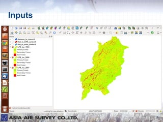
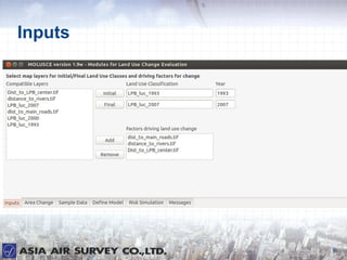
- 5. Inputs 5
- 6. Inputs 6
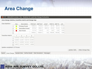
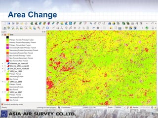
- 7. Area Change 7
- 8. Area Change 8
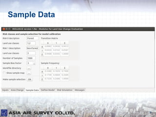
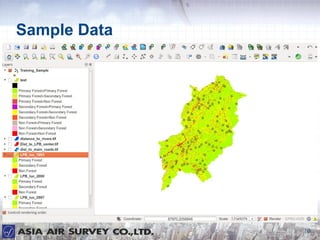
- 9. Sample Data 9
- 10. Sample Data 10
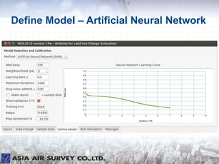
- 11. Define Model – Artificial Neural Network 11
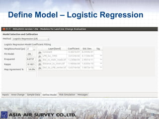
- 12. Define Model – Logistic Regression 12
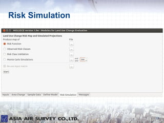
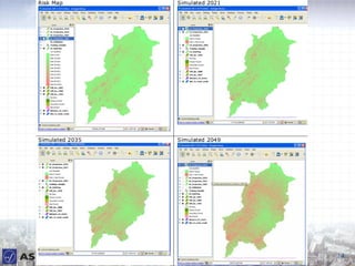
- 13. Risk Simulation 13
- 14. 14
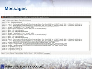
- 15. Messages 15
- 16. Summary ● モデリング遷移の可能性のために提案された方法 : Proposed method for modelling transition potential: – 人工ニューラルネットワーク( ANN ) Artificial Neural Network (ANN) – ロジスティック回帰( LR ) Logistic Regression (LR) – 証拠の重み( WoE ) Weights of Evidence (WoE) – 多基準評価( MCE ) Multi-Criteria Evaluation (MCE) ● 半自動工程 Semi-automated process ● 高速データ処理 Fast data processing ● 必要に応じ、更なる試験 Further testing required ● Quantum GIS は完全にプロの作業環境で使用できるようになった。 Quantum GIS is ready to be used in a fully professional working environment 16
- 17. Thank you for your attention ● 連絡先 Contact information MATTEO GISMONDI Email mto.gismondi@ajiko.co.jp Company Website http://www.ajiko.co.jp/ Overseas Operations Division +81-44-969-7510 17