


More Related Content
Similar to geoSDI-Overview-092009 (20)
Recently uploaded (20)


geoSDI-Overview-092009
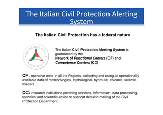
- 1. ░š│¾▒ŌĆ®I│┘▓╣▒¶Š▒▓╣▓įŌĆ®CŠ▒▒╣Š▒▒¶ŌĆ®P░∙┤Ū│┘▒│”1┤Ū▓įŌĆ®A▒¶▒░∙1▓į▓ĄŌĆ® SystemŌĆ® The Italian Civil Protection has a federal nature The Italian Civil Protection Alerting System is guaranteed by the Network of Functional Centers (CF) and Competence Centers (CC) CF: operative units in all the Regions, collecting and using all operationally available data of meteorological, hydrological, hydraulic, volcanic, seismic matters CC: research institutions providing services, information, data processing, technical and scientific advice to support decision making of the Civil Protection Department
- 2. ░š░∙▓╣╗ÕŠ▒1┤Ū▓į▓╣▒¶ŌĆ®w▓╣▓ŌŌĆ®t┤ŪŌĆ®m▓╣▓į▓╣▓Ą▒ŌĆ®d▓╣│┘▓╣ŌĆ® Storage / Database YouŌĆ®canŌĆ®workŌĆ®withŌĆ®dataŌĆ®onlyŌĆ®byŌĆ®(local/remote)ŌĆ®ŌĆ® DIRECTŌĆ®ACCESSŌĆ®TOŌĆ®FILEŌĆ® Hundreds of mimetypes (DXF, TIFF, ECW, JPG, PNG, DEM, CSV, SHP, KML ŌĆ”)
- 3. ░š│¾▒ŌĆ®n▒Ę╔ŌĆ®S│┘▓╣▓į╗Õ▓╣░∙╗ÕŌĆ® The Open Geospatial Consortium, Inc.┬« (OGC) is a non-profit, international, voluntary consensus standards organization that is leading the development of standards for geospatial and location based services. WMSŌĆ® OGC Open Web Services allow web clients to (WebŌĆ®MapŌĆ®Service)ŌĆ® WCSŌĆ® Query and Receive geographic (WebŌĆ®CoverageŌĆ®Service)ŌĆ® WFSŌĆ® information (WebŌĆ®FeatureŌĆ®Service)ŌĆ® ŌĆ”ŌĆ® in the form of image, vector, or coverage data.
- 4. ░┐▒Ķ▒▓įŌĆ®W▒▓·ŌĆ®S▒░∙▒╣Š▒│”▒▓§ŌĆ® WithŌĆ®OGCŌĆ®webŌĆ®servicesŌĆ®youŌĆ®canŌĆ® WMSŌĆ® WCSŌĆ® WFSŌĆ® QueryŌĆ®andŌĆ®ReceiveŌĆ®geographicŌĆ® CSWŌĆ® informa1onŌĆ® VIAŌĆ®INTERNETŌĆ® usingŌĆ®standardsŌĆ® DesktopŌĆ®ClientsŌĆ®/ŌĆ®WebŌĆ®ClientsŌĆ®
- 6. TheŌĆ®▓Ą▒┤Ū│¦Č┘▒§ŌĆ®ProgrammeŌĆ® geoSDI is a Programme coordinated by the Italian Civil Protection Department ŌĆóŌĆł For implemeting the Civil Protection National Spatial Data Infrastructure ŌĆóŌĆł According to the provisions of the INSPIRE Directive ŌĆóŌĆł Using open source software applications. http://www.geosdi.org It is developed by the Institute for the Methodologies of Environmental Analysis (IMAA) of the Italian National Research Council (CNR) with the collaboration of most of the national civil and military institutions concerned.
- 7. TheŌĆ®▓Ą▒┤Ū│¦Č┘▒§ŌĆ®ProjectŌĆ® geoSDI is also the name of a complete solution for: ŌĆóŌĆł Pre-processing data for creating geoSpatial DataStores ŌĆóŌĆł Managing and providing OGC Web Services (Server Side Components) ŌĆóŌĆł Use OGC Web Services (Client Side Components)
- 8. DataŌĆ®WorkŌĆ®FlowŌĆ® ŌĆóŌĆłŌĆ®CivilŌĆ®andŌĆ®MilitaryŌĆ®Ins1tu1onsŌĆ®collectŌĆ®dataŌĆ®withŌĆ® ŌĆ® theirŌĆ®ownŌĆ®sensorsŌĆ®andŌĆ®elaborateŌĆ®themŌĆ®toŌĆ®haveŌĆ® geospa1alŌĆ®productsŌĆ® ŌĆóŌĆłŌĆ®Geospa1alŌĆ®dataŌĆ®andŌĆ®productsŌĆ®areŌĆ®storedŌĆ®withŌĆ® ŌĆ® backŌĆÉendŌĆ®▓Ą▒┤Ū│¦Č┘▒§ŌĆ®componentsŌĆ®forŌĆ®crea1ngŌĆ®OWSŌĆ® servicesŌĆ®inŌĆ®eachŌĆ®nodeŌĆ®ofŌĆ®theŌĆ®federateŌĆ®networkŌĆ® ŌĆóŌĆłŌĆ®OWSŌĆ®servicesŌĆ®areŌĆ®basedŌĆ®onŌĆ®theŌĆ®storedŌĆ®dataŌĆ®andŌĆ® ŌĆ® productsŌĆ® ŌĆóŌĆłŌĆ®TheŌĆ®C.P.Dept.ŌĆ®andŌĆ®theŌĆ®otherŌĆ®involvedŌĆ®ins1tu1onsŌĆ® ŌĆ® canŌĆ®requestŌĆ®andŌĆ®workŌĆ®withŌĆ®theŌĆ®wholeŌĆ®poolŌĆ®ofŌĆ®OWSŌĆ® availableŌĆ®ŌĆ®ŌĆ®ŌĆ®ŌĆ® QuantumŌĆ®GisŌĆ® uDigŌĆ® GoogleŌĆ®EarthŌĆ® gvSIGŌĆ®
- 9. ▓Ą▒┤Ū│¦Č┘▒§ŌĆ®forŌĆ®theŌĆ®C.P.Dept.ŌĆ® The Network of CF and CC share geographic information using geoSDI Na1onal,ŌĆ®RegionalŌĆ® ▓Ą▒┤Ū│¦Č┘▒§ŌĆ®ERAŌĆ® andŌĆ®LocalŌĆ®authori1esŌĆ® FrontŌĆÉEndŌĆ® OGC (ClientŌĆ®Side)ŌĆ® Data Production Web Services Providing ▓Ą▒┤Ū│¦Č┘▒§ŌĆ® BackŌĆÉEndŌĆ® (ServerŌĆ®Side)ŌĆ® AnyŌĆ®OGCŌĆ®compliantŌĆ® ClientŌĆ® Quantum Gis uDig Google Earth gvSIG AnyŌĆ®authorityŌĆ®canŌĆ®useŌĆ®geospa1alŌĆ®servicesŌĆ®fromŌĆ® AnyŌĆ®authorityŌĆ®isŌĆ®aŌĆ®geospa1alŌĆ®dataŌĆ®providerŌĆ® theŌĆ®wholeŌĆ®federa1onŌĆ®throughŌĆ®▓Ą▒┤Ū│¦Č┘▒§ŌĆ®ERAŌĆ®orŌĆ® usingŌĆ®theŌĆ®▓Ą▒┤Ū│¦Č┘▒§ŌĆ®backŌĆÉendŌĆ® otherŌĆ®applica1onsŌĆ®
- 10. RecentŌĆ®▓Ą▒┤Ū│¦Č┘▒§ŌĆ®cases: ŌĆ® theŌĆ®AbruzzoŌĆ®EarthquakeŌĆ® C.P.DeptŌĆ®PartnersŌĆ®produceŌĆ®dataŌĆ® rela1veŌĆ®toŌĆ®theŌĆ®earthquakeŌĆ® AndŌĆ®shareŌĆ®themŌĆ®asŌĆ® OGCŌĆ®WebŌĆ®ServicesŌĆ® UsingŌĆ®theŌĆ®▓Ą▒┤Ū│¦Č┘▒§ŌĆ®BackŌĆÉEndŌĆ® ŌĆóŌĆłŌĆ®OrthophotoŌĆ® ŌĆ® ŌĆóŌĆłŌĆ®SatelliteŌĆ®imagesŌĆ® ŌĆ® ŌĆóŌĆłŌĆ®MeteorologicalŌĆ®productsŌĆ® ŌĆ® ŌĆóŌĆłŌĆ®InterferometryŌĆ®imagesŌĆ® ŌĆ® ŌĆóŌĆłŌĆ®SeismicŌĆ®sensorsŌĆ® ŌĆ® TheŌĆ®▓Ą▒┤Ū│¦Č┘▒§ŌĆ®ERAŌĆ®webGISŌĆ®applicaConŌĆ®allowsŌĆ®toŌĆ® ŌĆóŌĆłŌĆ®DamageŌĆ®assessmentŌĆ® ŌĆ® workŌĆ®withŌĆ®allŌĆ®theŌĆ®geographicŌĆ®infrma1onŌĆ®sharedŌĆ® ŌĆóŌĆłŌĆ®ŌĆ”ŌĆ® ŌĆ® betweenŌĆ®theŌĆ®FederateŌĆ®Organiza1onsŌĆ®
- 11. RecentŌĆ®▓Ą▒┤Ū│¦Č┘▒§ŌĆ®cases: ŌĆ® GeoSpa2alŌĆ®SupportŌĆ®forŌĆ®theŌĆ®G8ŌĆ® ItalianŌĆ®CivilŌĆ®andŌĆ®MilitaryŌĆ® ins1tu1onsŌĆ®usedŌĆ®▓Ą▒┤Ū│¦Č┘▒§ŌĆ® componentsŌĆ®toŌĆ®shareŌĆ®geospa1alŌĆ® servicesŌĆ®concerningŌĆ®theŌĆ®G8ŌĆ® SummitŌĆ®AreaŌĆ®
- 12. │¦┤Ū│Š▒ŌĆ®S│”░∙▒▒▓į▓§│¾┤Ū│┘ ŌĆ® AbruzzoŌĆ®EarthquakeŌĆ®areaŌĆ®ofŌĆ®interestŌĆ®andŌĆ®CivilŌĆ®Protec1onŌĆ®structuresŌĆ®
- 13. │¦┤Ū│Š▒ŌĆ®S│”░∙▒▒▓į▓§│¾┤Ū│┘ ŌĆ® OrthophotoŌĆ®postŌĆÉearthquakeŌĆ®(lookŌĆ®atŌĆ®theŌĆ®tends!!)ŌĆ®andŌĆ®regionalŌĆ®technicalŌĆ®MapŌĆ®
- 14. │¦┤Ū│Š▒ŌĆ®S│”░∙▒▒▓į▓§│¾┤Ū│┘ ŌĆ® DataŌĆ®fromŌĆ®seismicŌĆ®sensorsŌĆ®
- 15. │¦┤Ū│Š▒ŌĆ®S│”░∙▒▒▓į▓§│¾┤Ū│┘ ŌĆ® DataŌĆ®fromŌĆ®seismicŌĆ®sensorsŌĆ®(WFSŌĆ®relatedŌĆ®infoŌĆ®request)ŌĆ®
- 16. │¦┤Ū│Š▒ŌĆ®S│”░∙▒▒▓į▓§│¾┤Ū│┘ ŌĆ® DataŌĆ®fromŌĆ®seismicŌĆ®sensorsŌĆ®(WFSŌĆ®relatedŌĆ®infoŌĆ®request)ŌĆ®
- 17. │¦┤Ū│Š▒ŌĆ®S│”░∙▒▒▓į▓§│¾┤Ū│┘ ŌĆ® LandslideŌĆ®phenomenaŌĆ®
- 18. │¦┤Ū│Š▒ŌĆ®S│”░∙▒▒▓į▓§│¾┤Ū│┘ ŌĆ® DamagedŌĆ®BuildingsŌĆ®
- 19. │¦┤Ū│Š▒ŌĆ®S│”░∙▒▒▓į▓§│¾┤Ū│┘ ŌĆ® SeismicŌĆ®sensorŌĆ®andŌĆ®terrainŌĆ®deforma1onŌĆ®fromŌĆ®satelliteŌĆ®imageŌĆ®processingŌĆ®
- 20. │¦┤Ū│Š▒ŌĆ®S│”░∙▒▒▓į▓§│¾┤Ū│┘ ŌĆ® MapŌĆ®ofŌĆ®theŌĆ®HydrogeologicalŌĆ®riskŌĆ®inŌĆ®theŌĆ®G8ŌĆ®AreaŌĆ®