Critical facility mapping
Download as PPT, PDF1 like1,350 views

This document discusses critical facilities and the importance of critical facilities mapping (CFM). It defines critical facilities as man-made structures that could cause harm if damaged or disrupted. CFMs show the location and characteristics of vital systems like water and transportation. Mapping critical facilities and combining it with hazard maps improves development planning decisions by identifying vulnerable areas and infrastructure. The document outlines key considerations for identifying and reducing vulnerabilities of critical facilities.


More Related Content
What's hot (20)
Similar to Critical facility mapping (20)


More from Amirul Faiz Amil Azman (9)


Critical facility mapping
- 1. PRESENTER : ALICE TABITHA PHUA KIA XIN REGINA TAN YUN RU PRISCILLA CHIENG
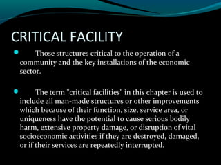
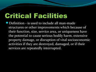
- 2. CRITICAL FACILITY ÔÇó Those structures critical to the operation of a community and the key installations of the economic sector. ÔÇó The term "critical facilities" in this chapter is used to include all man-made structures or other improvements which because of their function, size, service area, or uniqueness have the potential to cause serious bodily harm, extensive property damage, or disruption of vital socioeconomic activities if they are destroyed, damaged, or if their services are repeatedly interrupted.
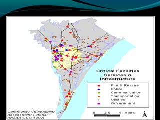
- 3. CRITICAL FACILITY MAPPING ÔÇóCritical facilities maps (CFM) are a graphical reference which includes information on the location and characteristics of these vital systems.
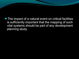
- 6. ÔÇóThe impact of a natural event on critical facilities is sufficiently important that the mapping of such vital systems should be part of any development planning study.
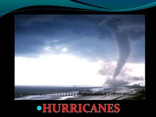
- 7. EXAMPLES OF NATURAL PHENOMENA WHICH MAY BE HAZARDOUS
- 12. ÔÇóMapping critical facilities, comparing or combining that information with a multiple hazard map and integrating both into project preparation improve decisions during the different stages of the development planning process. The use of the maps ranges from location decisions to criteria for developing construction standards.
- 13. ÔÇóThe term "lifelines" has been variously defined as: ÔÇó Systems vital to the support of any community (Earthquake Engineering Research Institute, 1977). ÔÇóFacilities which are required to transport people, things, energy, and information, necessary "for a community in a modern industrial society to survive and prosper," and "indispensable... to other facilities and services that are critical in a disaster setting such as hospitals, fire fighting, and emergency operation centers" (Schiff, 1984).
- 14. ÔÇó(1) water, transportation, and communications facilities necessary for the survival of a community ÔÇó(2) systems that provide essential services to a community ÔÇó(3) services that are important in our daily lives and that, if interrupted, could cause widespread social and economic inconvenience or loss
- 15. KEY CONSIDERATIONS WHEN IDENTIFYING CRITICAL FACILITIES WITHIN A DEVELOPMENT PLANNING PROCESS ÔÇóUnique or large structures whose failure might be catastrophic. ÔÇóEmergency facilities whose operation is crucial immediately before, during, or after a disaster. ÔÇóHigh-density occupancy structures whose failure would result in numerous deaths and injuries. ÔÇóFacilities required for public safety and security.
- 16. Critical Facilities ÔÇóDefinition - is used to include all man-made structures or other improvements which because of their function, size, service area, or uniqueness have the potential to cause serious bodily harm, extensive property damage, or disruption of vital socioeconomic activities if they are destroyed, damaged, or if their services are repeatedly interrupted.
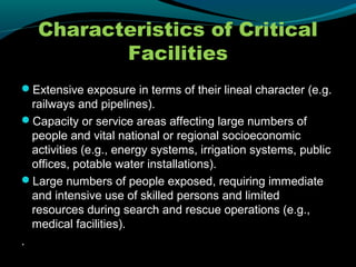
- 17. Characteristics of Critical Facilities ÔÇóExtensive exposure in terms of their lineal character (e.g. railways and pipelines). ÔÇóCapacity or service areas affecting large numbers of people and vital national or regional socioeconomic activities (e.g., energy systems, irrigation systems, public offices, potable water installations). ÔÇóLarge numbers of people exposed, requiring immediate and intensive use of skilled persons and limited resources during search and rescue operations (e.g., medical facilities). .
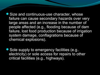
- 18. ÔÇóSize and continuous-use character, whose failure can cause secondary hazards over very large areas and an increase in the number of people affected (e.g., flooding because of dam failure, lost food production because of irrigation system damage, conflagrations because of chemical explosions). ÔÇóSole supply to emergency facilities (e.g.. electricity) or sole access for repairs to other critical facilities (e.g., highways).
- 19. ÔÇóVital for everyday emergencies, easily overloaded during a disaster, and no substitutes available if damaged (e.g., hospitals and emergency management centers). ÔÇóOperation necessary for effective response and recovery activities during and after an emergency (e.g., airports, power generators).
- 20. Benefits in Using Critical Facilities Maps
- 21. Maps are the most effective way to convey actual and relative location of critical facilities. A CFM is a prerequisite to addressing and reducing natural hazards that may affect new or existing critical facilities.
- 24. Critical Facility Information Display -SYMBOLS-
- 25. LOCATION TYPE CAPACITY SERVICE AREA IMPACT
- 27. CAPACITY
- 28. IMPACT
- 29. GENERAL CRITERIA FOR DATA COLLECTION WHEN COMPILING CFM ÔÇóCollecting base maps and appropriate facilities information from the sources identified. ÔÇóEvaluating the uniformity and completeness of such information-areal coverage, detail, content, information needed (location, number, type, size or capacity, and service area), format, and symbols.
- 30. ÔÇóSelecting the most appropriate base map (and scale) to be used, facilities to be shown, and symbols to portray those facilities. ÔÇóCombining or integrating the selected facilities information into the CFM in an accurate, clear, and convenient way.
- 31. KEY CONSIDERATIONS FOR REDUCING VULNERABILITY IN CRITICAL FACILITIES ÔÇóUpdating of hazard information and maps by scientists and engineers. ÔÇóContinuous updating of facilities information and maps by facilities managers and designers. ÔÇóAccurate site investigations by qualified geologists or geotechnical engineers.
- 32. ÔÇóCareful evaluations of facilities by architects, engineers, and safety specialists. ÔÇóPrompt adherence to facility emergency procedures by operators and managers. ÔÇóConscientious administration of regulations by building and zoning inspectors and consistent enforcement by government officials.
- 33. ÔÇóSustained support of inspection and enforcement officials by political leaders. ÔÇóSkillful advocacy by public officials and informed interpretation by the courts, if the techniques are challenged. ÔÇóConcern for individual, family, and community health, safety, and welfare by developers, investors, donors, and insurers.