


More Related Content
What's hot (20)
Similar to さわったことありますか、 FOSS4G&QGIS? (20)


More from IWASAKI NOBUSUKE (20)


さわったことありますか、 FOSS4G&QGIS?
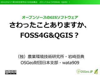
- 1. 2012/03/17 第59回生態学会大会自由集会 さわってみようFOSS4G(QGIS)! オープンソースのGISソフトウェア さわったことありますか、 FOSS4G&QGIS? (独)農業環境技術研究所?岩崎亘典 OSGeo財団日本支部?wata909
- 2. 2012/03/17 第59回生態学会大会自由集会 さわってみようFOSS4G(QGIS)! ご来場ありがとう ございます m(_ _)m
- 3. 2012/03/17 第59回生態学会大会自由集会 さわってみようFOSS4G(QGIS)! 骋滨厂ってなに?
- 4. 2012/03/17 第59回生態学会大会自由集会 さわってみようFOSS4G(QGIS)! いわゆる、”GIS”の定義 ● 地理情報システム(Geographic Information System)の頭文字をとったもの ● デジタル化した「地理空間情報」を扱うソフト ● 昔は「システム」でした ● 主な機能は、 ● 「地理空間情報」の表示、編集、解析、公開機能を 持っている – 「地図」ではありません
- 5. 2012/03/17 第59回生態学会大会自由集会 さわってみようFOSS4G(QGIS)! GISで何ができる? ● たぶん皆さんの聞きたいこと ● GISってどんなことが出来る? ● どんなふうに使ったらいいの? ● 私にもつかえるの? ● たとえば、こんな感じ? ● http://prezi.com/kcdaw-uidtez/present/? auth_key=vgw9mb8&follow=eneuorlocdsw
- 6. 2012/03/17 第59回生態学会大会自由集会 さわってみようFOSS4G(QGIS)! GIS利用の問題点 ● ソフトが高い ● 操作が難しい 以上の二点が大きなハードル ● そんなあなたにFOSS4G!!!
- 7. 2012/03/17 第59回生態学会大会自由集会 さわってみようFOSS4G(QGIS)! FOSS4Gとは? ● Free and Open Source Software for Geospatial と呼ばれるソフトウェア、略してFOSS4G ● 「自由」に利用できるGISソフトウェアのこと – 自由に入手?改良?再配布ができます。 – コピーして渡してもいい – 機能が足りない場合は改良してもよい ● いわゆる「無料」のソフトはできない ● デスクトップ、Webサーバー、データベース、い ろいろあります
- 8. 2012/03/17 第59回生態学会大会自由集会 さわってみようFOSS4G(QGIS)! Quantum GISについて ● 「Quantum GIS」(略してQGIS)もFOSS4G の一つ(http://www.qgis.org/)
- 9. 2012/03/17 第59回生態学会大会自由集会 さわってみようFOSS4G(QGIS)! QGISの特徴 ● グラフィカルなユーザーインターフェイス(GUI)
- 10. 2012/03/17 第59回生態学会大会自由集会 さわってみようFOSS4G(QGIS)! QGISの特徴 ● マルチプラットフォーム ● Windows, Mac, Linux
- 11. 2012/03/17 第59回生態学会大会自由集会 さわってみようFOSS4G(QGIS)! 多彩な機能 ● GRASSとの連携 ● プラグインによる機能強化
- 12. 2012/03/17 第59回生態学会大会自由集会 さわってみようFOSS4G(QGIS)! 活発な開発 ● Ver. 0.1 'Moroz' 2004/02/24 ● Version 0.2 ‘Pumpkin’ 2004/04/25 Version 0.3 ‘Madison’ 2004/05/25 Version 0.4 ‘Baby’ 2004/07/01 ● Version 0.5 'Bandit' 2004/10/02 Version 0.6 'Simon' 2004/12/19 Version 0.7 'Seamus' 2005/09/01 ● Version 0.8 'Joesephine' 2006/12/29 Version 0.9 'Ganymede' 2007/10/26 Version 0.10 'Io' 2008/04/25 ● Version 0.11 'Metis' 2008/07/22 ● Ver. 1.0 'Kore' 2009/01/24 ● Version 1.1 'Pan' 2009/05/13 Version 1.2 'Daphnis' 2009/09/03 ● Version 1.3 'Mimas' 2009/09/20 Version 1.4 'Enceladus' 2010/01/11 ● Version 1.5.0 'Tethy' 2010/07/19 ● Ver. 1.6.0 "Copiapó" 2010/11/27 ● Ver. 1.7.0 "Wroc?aw" 2011/06/19 ● 最新版は1.7.4 ● しかし、いささか不安定 ● 開発版は1.9
- 13. 2012/03/17 第59回生態学会大会自由集会 さわってみようFOSS4G(QGIS)! ユーザーによる情報発信 ● 日本でも多くのユーザーが利用 ● それぞれが独自に情報発信されている QGIS学習ノート http://na-mii.com/gis/qgis02/ GIS自習室(2) QGISを使い倒そう http://na-mii.com/gis/qgis02/
- 14. 2012/03/17 第59回生態学会大会自由集会 さわってみようFOSS4G(QGIS)! 中級者向け 森林土木memo http://www5.hp-ez.com/hp/koutochas/gis-gps QGIS1.6 マニュアル http://d.hatena.ne.jp/Geo80k/20110531/1306673808
- 15. 2012/03/17 第59回生態学会大会自由集会 さわってみようFOSS4G(QGIS)! 上級者向け QGISとか http://d.hatena.ne.jp/waigani/20101229#1291163366 月の杜工房?QGIS豆知識 http://mf-atelier.sakura.ne.jp/mf-atelier/modules/tips/index.php/software/qgis/
- 16. 2012/03/17 第59回生態学会大会自由集会 さわってみようFOSS4G(QGIS)! QGIS日本語化プロジェクト ● GUIの日本語化はほぼ完了 ● 文部科学省のプロジェクトと しても実施 – FOSS4Gを活用した衛星 データ利用のためのオープ ン?リソースの構築 – マニュアル等も日本語化し ています ● http://www.osgeo.jp/user_guide /user_guide.html
- 17. 2012/03/17 第59回生態学会大会自由集会 さわってみようFOSS4G(QGIS)! ぜひ使って下さい! ● まずは使ってみましょう! ● 一人で難しければ、仲間を見つけましょう ● 自分の経験を共有しよう! ● blogとか勉強会とか。悩んでるのはみんな同じ! ● FOSS4Gはコミュニティーが命です! ● みんなで使って、みんなで意見交換して、みんなで 良くしていく! ● この自由集会が切っ掛けになればうれしいです!
- 18. 2012/03/17 第59回生態学会大会自由集会 さわってみようFOSS4G(QGIS)! ありがとうございます E-mail: niwasaki@affrc.go.jp Twitter: @wata909
- 20. 2012/03/17 第59回生態学会大会自由集会 さわってみようFOSS4G(QGIS)! FOSS4Gの利用促進と普及 ● 普及と利用の促進を目的として、OSGeoという組 織があります ● http://www.osgeo.org ● OSGeo.JPという日本支部もあります。 ● http://www.osgeo.jp
- 21. 2012/03/17 第59回生態学会大会自由集会 さわってみようFOSS4G(QGIS)! OSGeo.JPについて ● メーリングリストによる広報や意見交換 ● OSGeoJapan-announce – http://lists.osgeo.org/mailman/listinfo/osgeojapan-announce ● OSGeoJapan-discuss – http://lists.osgeo.org/mailman/listinfo/osgeojapan-discuss ● 質問などはこちらにどうぞ ● 会員も募集しています ● http://www.osgeo.jp/about/support/ ● FOSS4G Tokyo/Osakaイベントの開催 ● 11月2~4日(Tokyo)を予定