


More Related Content
What's hot (20)
Similar to GLOBE AND MAPES (20)


Recently uploaded (20)


GLOBE AND MAPES
- 1. Globe And Maps PREPARED BY Ahmed Ali UNIVERSITY OF SARGODHA
- 2. What is a globe
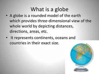
- 3. What is a globe • A globe is a rounded model of the earth which provides three-dimensional view of the whole world by depicting distances, directions, areas, etc. • It represents continents, oceans and countries in their exact size.
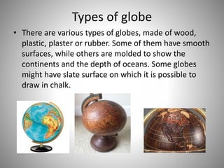
- 4. Types of globe • There are various types of globes, made of wood, plastic, plaster or rubber. Some of them have smooth surfaces, while others are molded to show the continents and the depth of oceans. Some globes might have slate surface on which it is possible to draw in chalk.
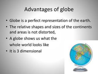
- 5. Advantages of globe • Globe is a perfect representation of the earth. • The relative shapes and sizes of the continents and areas is not distorted, • A globe shows us what the whole world looks like • It is 3 dimensional
- 6. Disadvantages • Difficult to carry around because it is bulky and heavy • It does not provides the detailed information about a specific place
- 7. Maps
- 8. What is a map • A diagrammatic representation of an area of land or sea showing physical features, cities, roads, etc in a two dimensional form is known as map • Maps are pictures of the Earth's surface. They show how places are related to each other by distance, direction, and size. • Maps are a way of showing a part of the Earth's surface on a flat piece of paper
- 9. Uses of maps • To understand roads and subways at new places. • To calculate distance between two places. • To know whether there are two or more paths to the same place and which is the shortest. • We can get information about mountains, rivers, valleys or any other thing, which may come on the way, and we can prepare for that. • We can get the information like height of the place or ups and downs on the road.
- 10. Uses of maps • Boundaries of the land to define ownership. • Places like houses, farmhouses, mines can be shown on the map. • We can also mark crops, weather reports, direction of wind, rainfall on the maps. • Government needs the map to keep the record of the owners
- 11. Advantages of Map: • Map is a conventional representation of the earth, whole or part of it, on a flat surface, drawn to scale. • Different features and details can be shown on maps. • Maps are easy to carry and maintain. • Maps can show small areas in great detail. • Different types of maps are bound into an atlas. • Different colors and symbols are used to show different features and other details.
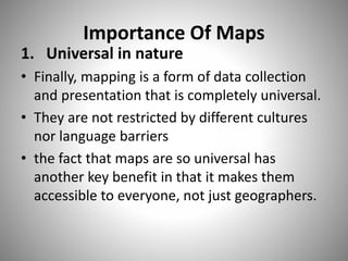
- 12. Importance Of Maps 1. Universal in nature • Finally, mapping is a form of data collection and presentation that is completely universal. • They are not restricted by different cultures nor language barriers • the fact that maps are so universal has another key benefit in that it makes them accessible to everyone, not just geographers.
- 13. Cont… 2. Change • Another explanation for the importance of mapping is how maps can easily and concretely show change through time. By looking at maps of the same area over many different time periods human geographers can easily investigate changes in infrastructure, economy and settlement which are all very important facets of population change and development.
- 14. Cont… 3. Versatility • The versatility of maps is reason why they are so important. Maps such as resource maps showing natural resources and secondary outputs are extremely useful within economic geography and likewise political maps focusing on boundaries and borders are useful to politicians and anyone interested in international relations.
- 15. Types of maps There are different types of maps to show different type of information. Some of them are as follow • Physical maps • Political maps • Special purpose or Thematic maps
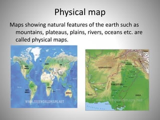
- 16. Physical map Maps showing natural features of the earth such as mountains, plateaus, plains, rivers, oceans etc. are called physical maps.
- 17. Political maps Maps showing cities, towns and villages, and different countries and states of the world with their boundaries are called political maps.
- 18. Special purpose/Thematic maps • Thematic maps can represent a variety of information including things like climate, precipitation, vegetation, elevation, population, life expectancy, etc.
- 19. Thank You All