


![<script
OpenLayers
src=/slideshow/foss4g-10758056/10758056/&
<script?src="../lib/OpenLayers.js"></script>
<script?type="text/javascript">
var?map;
function?init()?{
map?=?new?OpenLayers.Map('map');
map.addControl(new?OpenLayers.Control.LayerSwitcher());
var?gphy?=?new?OpenLayers.Layer.Google("Google?Physical",???{type:?
G_PHYSICAL_MAP}??);
var?gmap?=?new?OpenLayers.Layer.Google("Google?Streets"?//?the?default);
var?ghyb?=?new?OpenLayers.Layer.Google(??"Google?Hybrid",?{type:?
G_HYBRID_MAP});
var?gsat?=?new?OpenLayers.Layer.Google(?"Google?Satellite",?{type:?
G_SATELLITE_MAP}?);
map.addLayers([gphy,?gmap,?ghyb,?gsat]);
map.setCenter(new?OpenLayers.LonLat(10.2,?48.9),?5);???}
</script>
</head>
<body?onload="init()">
<div?id="map"?class="smallmap"></div>](https://image.slidesharecdn.com/3lt-120101223146-phpapp01/85/FOSS4G-41-320.jpg)


More Related Content
Similar to ŹĄ½ē¤ņ¤«¤Ø¤Į¤ć¤Ć¤æ¤«¤ā¤·¤ģ¤Ź¤¤¹ó°æ³§³§4³Ņ (20)
More from Yoichi Kayama (20)


Recently uploaded (15)


ŹĄ½ē¤ņ¤«¤Ø¤Į¤ć¤Ć¤æ¤«¤ā¤·¤ģ¤Ź¤¤¹ó°æ³§³§4³Ņ
- 1. ŹĄ½ē¤ņä¤Ø¤Į¤ć¤Ć¤æ ¤«¤ā¤·¤ģ¤Ź¤¤ FOSS4G OSGeo.jp???¼ĪɽźŅ»
- 2. FOSS4G¤Ć¤Ę£æ Free and Open Source Software for 4 Geospatial
- 3. OSGeo.jp OSGeoŲāČÕ±¾Ö§²æ FOSS4G¤Ėév¤¹¤ėŹĄ½ēµÄ„³„ß„å„Ė„Ę„£©`¤ĪČÕ±¾Ö§²æ æÕégĒéó¤Ėév¤¹¤ė Open Source Software Open Standard Open Data Contents é_°kÕß „ę©`„¶ ¤½¤ĪĖūÅdĪ¶¤¢¤ėČĖ¤Ź¤éČĖ¤Ē¤ā·ØČĖ¤Ē¤āŻŻX¤Ė ²Ī¼ÓæÉÄÜ
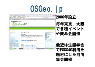
- 4. OSGeo.jp 2006ÄźŌOĮ¢ °Äź|¾©”¢“óŚę ¤Ēø÷·N„¤„Ł„ó„Č ¤äļ¤ß»įé_“ß ×ī½ü¤ĻÉśBѧ»į ¤ĒFOSS4GĄūÓƤņ ī}²Ä¤Ė¤·¤æ×ŌÓÉ ¼Æ»įé_“ß
- 5. OSGeo.org 2006ÄźŌOĮ¢ 2006 „ķ©`„¶„ó„Ģ 2007 „ō„£„Æ„Č„ź„¢ 2008 „±©`„ׄ愦„ó „«„ó„Õ„”„ģ„ó„¹é_“ß 2009 „·„É„Ė©` 2010 „Š„ė„»„ķ„Ź
- 6. ±¾ČÕ¤ĪÖ÷ FOSS4G TOKYO OSAKA fŁm¤¢¤ź¤¬¤Č¤¦¤“¤¶¤¤ ¤Ž¤·¤æ ĶüÄź»į¤ā±ć\¤µ¤» ¤Ę¤¤¤æ¤Ą¤¤Ž¤·¤æ £Øŗ¹£»
- 11. Ē°¤Õ¤ź¤Ļ¤³¤³¤Ž ¤Ē¤Ē
- 12. FOSS4G2008 OSAKA
- 14. FOSS4G2008 OSAKA
- 15. FOSS4G2008 OSAKA
- 22. Christopher?Schmidt¤µ¤ó¤Ļ ObamaŹĻ¤Ī“ó½yīIßxµ±ßx¤ņĻ²¤ó¤Ē Åd^¤·¤Ę¤¤¤æ¤Ī¤Ē¤·¤ē¤¦¤«£æ ¶ą·Ö¤½¤¦¤Ą¤±¤É”¢ ¤½¤ģ¤Ą¤±¤ø¤ć¤Ź¤¤¤ČĖ¼¤¦
- 26. Obama£” Obama£”Obama£” ObamaŹĻµ±ßx¤Ė¤Ä¤¤¤Ę¤ĪĻ²¤Ó £« OpenLayers¤ņ¶ą¤Æ¤ĪČĖ¤¬Ź¹¤Ć¤æ ¤³¤Č¤ĪĻ²¤Ó ¤³¤Ī¤č¤¦¤ĖĶĘy¤·¤Ž¤¹
- 34. „·„¹„Ę„ą¤ņ¤É¤¦¤ä¤Ć¤Ę×÷¤Ć¤Ę¤¤ ¤ė¤Ī¤«ĻėĻń¤·¤Ž¤¹
- 36. °æ²ś²¹³¾²¹ÕóÓŃ”¤ŌĖ¶Æ¤Ē¤ĪµŲķĄūÓĆ PostGIS æÕégĒéó„Ē©`„æ„Ł©`„¹ UMN Mapserver µŲķévßBCGI ¤³¤ģ¤é¤Ļ OpenLayersFOSS4G¤Ī µŲķ²Ł×÷JavaScript ¤ā¤·¤«¤¹¤ė¤Č R „ׄķ„Ą„Æ„Č¤Ē¤¹ ½yÓ½āĪö„Ń„Ć„±©`„ø TileCache „愤„ėµŲķ„µ©`„Š FeatureServer µŲĪļµŲķ„µ©`„Š
- 37. ¤³¤ó¤Ź„·„¹„Ę„ą¤«¤ā¤·¤ģ¤Ž¤»¤ó Amazon EC2 ÓŠŲÕßĒéó ß\ÓTĒéó ŠŠÕž½ē Ubuntu Linux Yahoo ßx¤Ēų µŲķ¤Č ŹōŠŌĒéó (µŲķ) PostGIS UMN Google Mapserver (µŲķ) Apache2 PostgreSQL Feature Server Browser TileCache R OpenLayers Client
- 41. <script OpenLayers src=/slideshow/foss4g-10758056/10758056/& <script?src="../lib/OpenLayers.js"></script> <script?type="text/javascript"> var?map; function?init()?{ map?=?new?OpenLayers.Map('map'); map.addControl(new?OpenLayers.Control.LayerSwitcher()); var?gphy?=?new?OpenLayers.Layer.Google("Google?Physical",???{type:? G_PHYSICAL_MAP}??); var?gmap?=?new?OpenLayers.Layer.Google("Google?Streets"?//?the?default); var?ghyb?=?new?OpenLayers.Layer.Google(??"Google?Hybrid",?{type:? G_HYBRID_MAP}); var?gsat?=?new?OpenLayers.Layer.Google(?"Google?Satellite",?{type:? G_SATELLITE_MAP}?); map.addLayers([gphy,?gmap,?ghyb,?gsat]); map.setCenter(new?OpenLayers.LonLat(10.2,?48.9),?5);???} </script> </head> <body?onload="init()"> <div?id="map"?class="smallmap"></div>
- 44. ¤µ¤é¤Ė¤¤¤ķ¤¤¤ķŹ¹¤Ø¤ė¤ā¤Ī¤ā Amazon EC2 Ubuntu Linux Yahoo (µŲķ) Geoserver PostGIS UMN Google Mapserver (µŲķ) Mapguide Apache2 PostgreSQL Feature Server GRASS Browser TileCache R QGIS UDig gv OpenLayers Client
- 47. °æ³§³§¤Ī°kÕ¹¤Ī¤æ¤į¤Ė¤Ļ „³„ß„å„Ė„Ę„£¤ĪĮ¦¤¬±ŲŅŖ Linux BSD Apache Mozilla PostgreSQL Ruby Seasear Android
- 50. OSGeo.org¤ĻFOSS4G¤Ė¤Ä¤¤¤Ę¤Ī ¤¤¤ķ¤¤¤ķ¤Ź„³„ß„å„Ė„Ę„£¤Ī¼ÆŗĻĢå ¤Ē¤¹ ”©¤ŹFOSS4G„ׄķ„Ą„Æ„Č¤Ė¤Ä¤¤ ¤Ę¤Ī„³„ß„å„Ė„Ę„£¤äµŲÓņ”¢ĄūÓĆ ŃŌÕZe„³„ß„å„Ė„Ę„£¤Ī¼ÆŗĻĢ唣 FOSS4G¤Īé_°kÕߤäŗ£Ķā¤ĪĄūÓĆÕß¤Č Ēéó¹²ÓŠ
- 52. ½YÕ FOSS4G 2009 Sydney 10ŌĀ20-23ČÕ FOSS4G 2009 Tokyo 11ŌĀ2ČÕ¤“¤ķ FOSS4G 2009 Osaka 11ŌĀ6ČÕ-7ČÕ „¤„Ł„ó„ȤŲ¤Ī¤“²Ī¼Ó¤ņ¤Ŗ“ż¤Į¤·¤Ę¤¤ ¤Ž¤¹
- 53. ¤µ¤é¤Ė FOSS4G 2009 Sydney 10ŌĀ20-23ČÕ FOSS4G 2009 Tokyo 11ŌĀ2ČÕ¤“¤ķ FOSS4G 2009 Osaka 11ŌĀ6ČÕ-7ČÕ ¤³¤ĪĒļ¤Ļ„¤„Ł„ó„ČÄæ°×Ńŗ¤·¤Ē¤¹¤¬ 10ŌĀ15-16ČÕGISѧ»į ŠĀ
- 54. ¤³¤Ī„Ś©`„ø¤Ž¤Ē¤³¤ģ¤ė¤«¤Ź£æ ¤“ĒåĀ¤¢¤ź¤¬¤Č¤¦¤“¤¶¤¤¤Ž¤·¤æ http://www.osgeo.org/ http://www.osgeo.jp/